- Červený Kláštor
-
Červený Kláštor Village  Červený Kláštor (Monastery)
Country Slovakia Region Prešov District Kežmarok Coordinates 49°24′N 20°25′E / 49.4°N 20.417°E Population 222 (2004-12-31) Postal code 059 06 Car plate KK 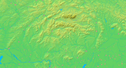

 Location of Červený Kláštor in Slovakia
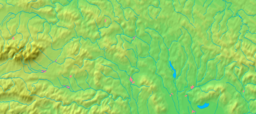
 Location of Červený Kláštor in the Prešov Region
Wikimedia Commons: Červený Kláštor Statistics: MOŠ/MIS This is an article about the Slovakian village. For the monastery see, Červený Kláštor (Monastery)
Červený Kláštor (Hungarian: Vöröskolostor) is a small village and municipality in the far north Kežmarok District in the Prešov Region of northern Slovakia, near the Polish border in the Zamagurie region.
History
A Camaldolese Monastery was established on this location, than part of the Habsburg-ruled Kingdom of Hungary, in 1710.
In 1782 it was secularized as part of Emperor Joseph II's campaign against monastic orders that in his view didn't pursue useful activities. The monastery building still exists, however (see photo).
The present village was founded in 1828.
Geography
The municipality lies at an altitude of 465 metres and covers an area of 3.043 km². It has a population of about 222 people. It lies 8 km east of the centre of Zamagurie region, Spišská Stará Ves. The governing body of the Pieniny national park is located in the village. Dunajec river, which makes border with Poland, flows near the village. It is used for tourist purposes for rafting. Other attractions in or near the village include the Červený kláštor (spelled with a lower-case "k"; literally Red Monastery) or walking in the surrounding mountains of Pieniny. Since 2006, there is a new bridge for pedestrians in operation, connecting Červený Kláštor and Sromowce Niżne.
External links
 View of the village from the Polish Trzy Korony hill
 Wooden pedestrian bridge between Červený Kláštor and the village of Sromowce Niżne
Kežmarok · Spišská Belá · Spišská Stará Ves
Abrahámovce · Bušovce · Červený Kláštor · Havka · Holumnica · Hradisko · Huncovce · Ihľany · Javorina · Jezersko · Jurské · Krížová Ves · Lechnica · Lendak · Ľubica · Majere · Malá Franková · Malý Slavkov · Matiašovce · Mlynčeky · Osturňa · Podhorany · Rakúsy · Reľov · Slovenská Ves · Spišské Hanušovce · Stará Lesná · Stráne pod Tatrami · Toporec · Tvarožná · Veľká Franková · Veľká Lomnica · Vlková · Vlkovce · Vojňany · Vrbov · Výborná · Zálesie · Žakovce Categories:
- Villages and municipalities in Kežmarok District
- Prešov Region geography stubs


Wikimedia Foundation. 2010.