Dubník

Dubník
Dubník
Csúz
Village
Country Slovakia
Region Nitra
District Nové Zámky
Elevation 146 m (479 ft)
Coordinates 47°57′N 18°25′E / 47.95°N 18.417°E / 47.95; 18.417
Area 41.006 km2 (15.83 sq mi)
Population 1,762 (2004-12-31)
Density 43 / km2 (111 / sq mi)
First mentioned 1236
Postal code 941 35
Area code +421-35
Car plate NZ
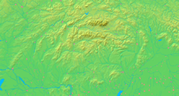
Location of Dubník in Slovakia
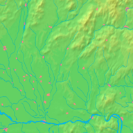
Location of Dubník in the Nitra Region
Statistics: MOŠ/MIS

Dubník (Hungarian: Csúz) is a municipality and village in the Nové Zámky District in the Nitra Region of south-west Slovakia.

Contents

History

In historical records the village was first mentioned in 1236.

Geography

The village lies at an altitude of 146 metres and covers an area of 41.006 km². It has a population of about 1,765 people.

Ethnicity

The population is about 65% Hungarian and 35% Slovak.

Facilities

The village has a public library and a football pitch.

External links


Wikimedia Foundation. 2010.

Игры ⚽ Нужен реферат?

Look at other dictionaries:

  • Dubnik — Dubník ist der Name: mehrerer Orte in der Slowakei: Gemeinde im Okres Nové Zámky, siehe Dubník (Gemeinde) Gemeindeteil der Gemeinde Červenica, siehe Dubník (Červenica) Siedlung als Teil der Stadt Vranov nad Topľou, siehe Dubník (Vranov nad… …   Deutsch Wikipedia

  • Dubník — (Village) Administration Pays …   Wikipédia en Français

  • Dubník — ist der Name: mehrerer Orte in der Slowakei: Gemeinde im Okres Nové Zámky, siehe Dubník (Gemeinde) Gemeindeteil der Gemeinde Červenica, siehe Dubník (Červenica) Siedlung als Teil der Stadt Vranov nad Topľou, siehe Dubník (Vranov nad Topľou)… …   Deutsch Wikipedia

  • Dubnik Transmitter — is a facility for FM /TV broadcasting near Dubnik in Slovakia at 21°27 45 E 48°55 26 N. It uses as antenna tower a guyed tubular steel mast, which is similar to that of Suchá Hora transmitter and 318 metres tall and one of the tallest towers in… …   Wikipedia

  • Dubník (Červenica) — Dubník ist eine Ortschaft in der Slowakei. Sie ist Teil der Gemeinde Červenica nördlich des Hauptortes in den Bergen. In der Nähe von Dubník befindet sich bei 21°27 45 E 48°55 26 N ein über 300 Meter hoher abgespannter Stahlrohrendemast zur… …   Deutsch Wikipedia

  • Battle of Gorni Dubnik — Infobox Military Conflict conflict=Battle of Gorni Dubnik colour scheme=background:#eeddbb caption= partof=the Russo Turkish War, 1877–78 date=24 October, 1877 place=near Pleven, Bulgaria result=Russian victory combatant1=flag|Russian Empire|1858 …   Wikipedia

  • Dolni Dubnik — Original name in latin Dolni Dbnik Name in other language Diubnik, Dolni Dabnik, Dolni Dibnik, Dolni Dobnik, Dolni Dubnik, Dolni Dbnik, Dolni Dbnik, Dolni Dbnik, Dolni Debnik, Dolni Dubnjak, Долни Дъбник State code BG Continent/City Europe/Sofia… …   Cities with a population over 1000 database

  • Dolni Dŭbnik — Sp Dòlni Debnikas Ap Долни Дъбник/Dolni Dŭbnik L Š Bulgarija …   Pasaulio vietovardžiai. Internetinė duomenų bazė

  • Gorni Dŭbnik — Sp Gòrni Debnikas Ap Горни Дъбник/Gorni Dŭbnik L Š Bulgarija …   Pasaulio vietovardžiai. Internetinė duomenų bazė

  • Obshtina Dolni Dubnik — Admin ASC 2 Code Orig. name Obshtina Dolni Dŭbnik Country and Admin Code BG.50.PVN11 BG …   World countries Adminstrative division ASC I-II

Share the article and excerpts

Direct link
Do a right-click on the link above
and select “Copy Link”