- Mount Grafton
-
Mount Grafton White Pine County, Nevada, USA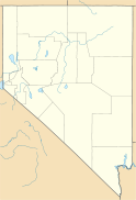

Elevation 10,997 ft (3,352 m) NAVD 88[1] Prominence 3,257 ft (993 m) [2] Location Range Schell Creek Range Coordinates 38°41′32″N 114°44′33″W / 38.692189247°N 114.742404681°WCoordinates: 38°41′32″N 114°44′33″W / 38.692189247°N 114.742404681°W[1] Topo map USGS Mount Grafton Mount Grafton is the high point of the southern section of the Schell Creek Range in southern White Pine County, in eastern Nevada in the western United States. The summit is located 39 miles (63 km) south of the community of Ely.
References
- ^ a b "Mount Grafton". NGS data sheet. U.S. National Geodetic Survey. http://www.ngs.noaa.gov/cgi-bin/ds_mark.prl?PidBox=JP0380. Retrieved 2008-11-22.
- ^ "Mount Grafton". Peakbagger.com. http://www.peakbagger.com/peak.aspx?pid=3565. Retrieved 2011-05-19.
External links
- "Mount Grafton". Geographic Names Information System, U.S. Geological Survey. http://geonames.usgs.gov/pls/gnispublic/f?p=gnispq:3:::NO::P3_FID:845483. Retrieved 2008-11-22.
- "Mount Grafton". SummitPost.org. http://www.summitpost.org/page/153194. Retrieved 2011-05-07.
Categories:- Mountains of Nevada
- Landforms of White Pine County, Nevada
- Nevada geography stubs

Wikimedia Foundation. 2010.