- Deer Flat National Wildlife Refuge
-
Deer Flat National Wildlife Refuge IUCN Category IV (Habitat/Species Management Area)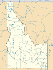

Location Southwestern Idaho and eastern Oregon, (USA) Nearest city Nampa, Idaho Coordinates 43°33′N 116°40′W / 43.55°N 116.667°WCoordinates: 43°33′N 116°40′W / 43.55°N 116.667°W Area 10,548 acres (16.481 sq mi; 42.69 km2)[1] Established February 25, 1909 Governing body U.S. Fish and Wildlife Service Official website The Deer Flat National Wildlife Refuge is an important breeding area for mammals, birds, and other animals. The National Wildlife Refuge is located on land surrounding Lake Lowell, just outside Nampa, Idaho. It serves as a resting and wintering area for birds, including mallards and Canada geese, along the Pacific Flyway and was named a "Globally Important Bird Area" by the American Bird Conservancy.[2]
The refuge consists of two sections which contains open water, edge wetlands, grasslands and riparian and forest habitats. The largest portion of the refuge consists of Lake Lowell and its environs, located in Canyon County, just west of Nampa, while the second comprises the Snake River islands located in non-contiguous localities along the river in Canyon, Owyhee, Payette, and Washington counties (Idaho) and Malheur and Baker counties (Oregon).
There is a visitor's center at the Lake Lowell site, which is the hub of activity for visitors and those volunteers who donate their time and services to wildlife conservation projects.
Contents
Wildlife and Habitat
Wildlife has dynamic and unique needs that require a variety of habitats for food, shelter, and raising young. Deer Flat National Wildlife Refuge is managed to improve and maintain wildlife habitat. Habitats at Deer Flat include wetlands, riparian forests, uplands, and croplands at the Lake Lowell sector, as well as the 101 Snake River Islands.
History
President Theodore Roosevelt created a national bird refuge at Deer Flat Reservoir, now Lake Lowell, with his February 25, 1909, executive order.[3] The refuge was one of 17 federal reclamation projects referenced in the order, each of which used manmade aquifers to provide safe havens for migratory birds. The effort to include the Canyon County site was spearheaded by James H. Lowell, then-president of the Payette-Boise Water Users Association.
- 1902 Reclamation Act authorizes establishment of U.S. Reclamation Service, now the Bureau of Reclamation, to irrigate western lands. Survey for location of Deer Flat Reservoir conducted.
- 1905 James H. Lowell, begins securing contracts to purchase the lands that would become the Deer Flat Reservoir, now Lake Lowell.
- 1906 Work begins on the upper and lower embankments.
- 1907 Caldwell Interurban Railroad begins public route to Lower Dam
- 1908 Lower Embankment completed in January. Equalization trench in Deer Flat Reservoir excavated with steam shovel No. 1 from Upper Embankment. Earthwork at Upper Embankment completed.
- 1909 Outlet channel at Lower Embankment completed and water turned in to Lake Lowell from New York canal. Roosevelt signs Executive Order 1032 on February 25.
- 1913 Sebree Dance Pavilion completed at Lower Dam Recreation Area.
- 1926 Nampa-Meridian Irrigation District signs agreement with federal government stipulating that Board of Control is now in charge of the project.
- 1928 Sebree Dance Pavilion dismantled and moved to Caldwell.
- 1930 First Lake Lowell Boat Races held at Upper Dam.
- 1935 Civilian Conservation Corps BR-24 Co. 2506 charged with restoring dams eroded by waves and ice.
- 1937 President Franklin D. Roosevelt creates the Snake River Islands Refuge by executive order. Thomas Horn assigned as first refuge manager.
- 1938 Works Progress Administration workers help build refuge infrastructure (roads and buildings).
- 1939 WPA workers complete observation tower.
- 1943 Youth Aid Farm Camp for girls housed in Civilian Conservation Corps barracks at Lower Dam.
- 1948 Deer Flat Reservoir renamed Lake Lowell in honor of J.H. Lowell.
- 1957 Special-use permit issued to Canyon County for sanitary landfill on refuge property.
- 1963 Snake River Islands Refuge consolidated with Deer Flat National Wildlife Refuge.
- 1967 Last of CCC barracks removed from Lower Dam Recreation Area.
- 1970 Environmental Education building constructed at the Lower Dam.
- 1971 Landfill closed. Marsing Job Corps starts construction of Visitor Center.
- 1975 Visitor Center completed and First Youth Conservation Corps formed.
- 1976 Bureau of Reclamation nominates embankments to National Register of Historic Places.
- 1979 Special-use permit issued to Clint Eastwood to film part of Bronco Billy at Upper Embankment.
- 2006 Friends of Deer Flat Wildlife Refuge formed.
- 2009 Centennial Trail installed across historic upper dam.
Notes
- ^ "Annual Report of Lands as of September 30, 2009". U.S. Fish and Wildlife Service. http://www.fws.gov/refuges/realty/archives/pdf/2009_Annual_Report_of_Lands.pdf.
- ^ "Deer Flat National Wildlife Refuge". U.S. Fish and Wildlife Service. http://www.fws.gov/deerflat/.
- ^ Dooley, Bryan. "Deer Flat Refuge celebrates 100 years." Idaho Press-Tribune. 31 May 2009. Main 8, 9.
External links
- "Deer Flat National Wildlife Refuge Overview". U.S. Fish and Wildlife Service. http://www.fws.gov/refuges/profiles/index.cfm?id=14560.
- "Deer Flat National Wildlife Refuge". Recreation.gov. http://www.recreation.gov/recAreaDetails.do?contractCode=NRSO&recAreaId=1372&agencyCode=127.
- "Deer Flat National Wildlife Refuge". Idaho Department of Commerce. http://www.visitidaho.org/thingstodo/wildlife/deer-flat-national-wildlife-refuge.aspx.
Federal National ParksNational MonumentsNational ForestsBitterroot • Boise • Caribou-Targhee • Clearwater • Coeur d'Alene • Idaho Panhandle • Kaniksu • Kootenai • Nez Perce • Payette • Salmon-Challis • Sawtooth • St. Joe • Wallowa–Whitman • Wasatch-CacheNational Wildlife RefugesBear Lake • Camas • Deer Flat • Grays Lake • Kootenai • Minidoka • Oxford Slough Waterfowl Production AreaBig Jacks Creek • Bruneau-Jarbidge Rivers • Craters of the Moon • Frank Church-River of No Return • Gospel Hump • Hells Canyon • Little Jacks Creek • North Fork Owyhee • Owyhee River • Pole Creek • Selway-Bitterroot • SawtoothState Bear Lake • Bruneau Dunes • Castle Rocks • City of Rocks • Coeur d'Alene Parkway • Dworshak • Eagle Island • Farragut • Harriman • Hells Gate • Henrys Lake • Heyburn • Lake Cascade • Lake Walcott • Land of the Yankee Fork • Lucky Peak • Massacre Rocks • McCroskey • Old Mission • Ponderosa • Priest Lake • Round Lake • Thousand Springs • Three Island Crossing • Trail of the Coeur d'Alenes • Winchester Lake •Idaho Department of Parks & Recreation (website) Protected Areas of Oregon Federal State Arcadia Beach • Bob Straub • Bradley • Cape Kiwanda • Cape Lookout • Cape Meares • Clay Myers at Whalen Island • Del Rey Beach • Ecola • Elmer Feldenheimer • Fishing Rock • Fort Stevens • Gearhart Ocean • Haystack Hill • Hug Point • John Yeon • Manhattan Beach • Munson Creek Falls • Neahkahnie–Manzanita • Nehalem Bay • Oceanside Beach • Oswald West • Rockaway Beach • Sunset Beach • Sunset Highway Forest • Symons • Tolovana Beach • Tolovana Beach • Twin Rocks • Wilson River Highway Forest
Agate Beach • Alsea Bay • Beachside • Beaver Creek • Beverly Beach • Boiler Bay • Carl G. Washburne • Collins Creek • D River • Darlingtonia • Devils Lake • Devils Punch Bowl • Driftwood Beach • Ellmaker • Fogarty Creek • Gleneden Beach • Governor Patterson • H.B. Van Duzer • Heceta Head Lighthouse • Jessie M. Honeyman • Joaquin Miller Forest • L. Presley & Vera C. Gill • Lost Creek • Muriel O. Ponsler • Neptune • Neskowin Beach • Ona Beach • Otter Crest • Pritchard • Roads End • Rocky Creek • San Marine • Seal Rock • Smelt Sands • South Beach • Stonefield Beach • Tokatee Klootchman • W. B. Nelson • Whale Watching • Yachats • Yachats Ocean Road • Yaquina Bay
Albert H. Powers • Alfred A. Loeb • Arizona Beach • Bandon • Bolon Island Tideways • Bullards Beach • Cape Arago • Cape Blanco • Cape Sebastian • Conde B. McCullough • Coquille Myrtle Grove • Crissey Field • Elk Creek Tunnel Forest • Face Rock • Floras Lake • Geisel Monument • Golden and Silver Falls • Harris Beach • Hoffman • Humbug Mountain • Hutchinson • Maria C. Jackson • McVay Rock • Ophir • Otter Point • Paradise Point • Pistol River • Port Orford Cedar Forest • Port Orford Heads • Samuel H. Boardman • Seven Devils • Shore Acres • Sisters Rock • Sunset Bay • Sweet Myrtle • Umpqua • Umpqua Lighthouse • Umpqua Myrtle • William M. Tugman • Winchuck • Yoakam Point
Banks–Vernonia • Bonnie Lure • Government Island • L. L. "Stub" Stewart • Mary S. Young • Milo McIver • Tryon Creek • Willamette Stone
Ainsworth • Benson • Bonneville • Bridal Veil Falls • Crown Point • Dabney • Dalton Point • George W. Joseph • Guy W. Talbot • Historic Columbia River Highway • John B. Yeon • Koberg Beach • Lang Forest • Lewis and Clark • Lindsey Creek • Mayer • McLoughlin • Memaloose • Multnomah Falls • Portland Women's Forum • Rocky Butte • Rooster Rock • Seneca Fouts • Shepperd's Dell • Sheridan • Starvation Creek • Viento • Vinzenz Lausmann • Wyeth • Wygant
Alderwood • Bald Peak • Blachly Mountain Forest • Bowers Rock • Cascadia • Champoeg • Detroit Lake • Dexter • Elijah Bristow • Erratic Rock • Fall Creek • Fort Yamhill • Holman • Jasper • Lowell • Luckiamute • Maples • Maud Williamson • Molalla River • North Santiam • Sarah Helmick • Silver Falls • State Capitol • Thompson's Mills • Washburne • Willamette Mission
Ben Hur Lampman • Canyon Creek Forest • Casey • Collier Memorial • Illinois River Forks • Jackson F. Kimball • Joseph H. Stewart • Klamath Falls – Lakeview Forest • OC&E Woods Line • Prospect • Rough and Ready Forest • Stage Coach Forest • TouVelle • Tub Springs • Valley of the Rogue • Wolf Creek Inn
Cline Falls • Deschutes River • Dyer • Elliott Corbett • La Pine • Ochoco • Peter Skene Ogden • Pilot Butte • Prineville Reservoir • Redmond–Bend Juniper • Sisters • Smith Rock • The Cove Palisades • Tumalo • White River Falls
Bates • Battle Mountain Forest • Blue Mountain Forest • Booth • Catherine Creek • Chandler • Clyde Holliday • Crooked Creek • Deadman's Pass • Emigrant Springs • Farewell Bend • Fort Rock • Fort Rock Cave • Frenchglen Hotel • Goose Lake • Hat Rock • Hilgard Junction • Kam Wah Chung • Lake Owyhee • Minam • Ontario • Pete French Round Barn • Red Bridge • Succor Creek • Sumpter Valley Dredge • Ukiah–Dale Forest • Unity Forest • Unity Lake • Wallowa Lake • Wallowa Lake Highway Forest • Wallowa River
Bridge Creek • Dean Creek • Denman • E.E. Wilson • Elkhorn • Fern Ridge • Irrigon • Jewell Meadows • Klamath • Ladd Marsh • Lower Deschutes • Phillip W. Schneider • Prineville • Riverside • Sauvie Island • Snake River Islands • Summer Lake • Wenaha • White River • Willow Creek
Regions Portland metroBlue Lake • Cooper Mountain • Glendoveer • Howell • Oregon Zoo • Oxbow • Smith and Bybee • Mount Talbert
Cities PortlandForest Park • Washington Park
Heritage registers: National Register of Historic Places • National Historic Landmarks • National Natural Landmarks • World Network of Biosphere Reserves Categories:- IUCN Category IV
- Protected areas of Baker County, Oregon
- Protected areas of Canyon County, Idaho
- Protected areas of Malheur County, Oregon
- Protected areas of Owyhee County, Idaho
- Protected areas of Payette County, Idaho
- Protected areas of Washington County, Idaho
- Conservation in the United States
- Important Bird Areas of the United States
- National Wildlife Refuges in Idaho
- National Wildlife Refuges in Oregon
- Snake River
- Civilian Conservation Corps in Idaho
- Works Progress Administration in Idaho
- Protected areas established in 1909

Wikimedia Foundation. 2010.