- Coychurch
-
Coychurch (Welsh: Llangrallo) is a small village that sits between Pencoed and Bridgend in Wales, bordering with Bridgend Industrial Estate.
It has a longstanding religious association, with an early Christian church having been built there possibly as long ago as the 8th century CE. The current church of St. Crallo was built in the 13th century.
One local legend claims that after his death in battle near Ogmore Castle, King Arthur was secretly laid to rest in a cave in Coed-y-Mwstwr Forest, just behind the village of Coychurch, for fear that the news of his death might split the nation. When his son came of age to replace him at the throne, Arthur's death was announced, and his body moved to a grave at Cor Emrys church close to Pencoed.
External links
- Birdgend.gov.uk, Bridgend tourism guide
- Geograph.co.uk, photos of Coychurch and surrounding area
Coordinates: 51°30′21″N 3°31′48″W / 51.50583°N 3.53°W
Bridgend County Borough Bridgend County Borough Council Communities Brackla · Bridgend · Cefn Cribwr · Coity · Coychurch Higher · Coychurch Lower · Cornelly · Garw Valley · Laleston · Llangynwyd Lower · Llangynwyd Middle · Maesteg · Merthyr Mawr · Newcastle Higher · Ogmore Vale · Pencoed · Porthcawl · Pyle · St Bride's Minor · Ynysawdre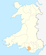
Towns and villages Aberkenfig · Bettws · Blackmill · Bridgend · Bryncethin · Brynmenyn · Bryntirion · Caerau · Cefn Cross · Cornelly · Coychurch · Cwmfelin · Danygraig · Garth · Heol-y-Cyw · Kenfig · Kenfig Hill · Litchard · Llangan · Llangeinor · Llangwynydd · Llangynwyd · Maudlam · Maesteg · Merthyr Mawr · Nantymoel · Newton · North Cornelly · Nottage · Pantygog · Pantyrawel · Pen-y-Fai · Pencoed · Pontycymer · Porthcawl · Price Town · Pyle · Sarn · South Cornelly · Tondu · Tythegston · Wild Mill · WyndhamCastles Rivers Categories:- Villages in Bridgend county borough
- M4 corridor
- Glamorgan geography stubs

Wikimedia Foundation. 2010.