- Nemrut (volcano)
-
- Turkey also has a mountain called Nemrut
Nemrut Dağı 
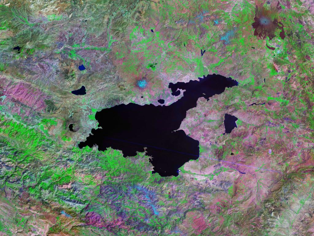
Satellite view from 2001Elevation 2,948 m (9,672 ft) Location Location Turkey Coordinates 38°39′N 42°14′E / 38.65°N 42.23°E Geology Type Stratovolcano Last eruption 1597 Nemrut (Turkish: Nemrut Dağı, Armenian: Սարակն Sarakn, "Mountain spring", Armenian pronunciation: [sɑɾɑkn], Kurdish: Çiyayê Nemrud) is a dormant volcano in Eastern Turkey, close to Lake Van, at 38°37′10″N 42°14′28″E / 38.61944°N 42.24111°E. The volcano is named after King Nimrod who is said to have ruled this area in about 2100 BC.
Contents
Description
Mt. Nemrut is near Tatvan, a small town in the eastern Anatolian province of Bitlis. The mountain rises from the southwestern shore of Lake Van, and enters the district of Ahlat to the north.
It is 3,050 m (10,007 ft) high and its elliptic caldera has a diameter of about 7 by 8 km (4 by 5 mi). The western part of the caldera contains a large coldwater crater lake about 155 m (509 ft) deep. There is also a small warm lake whose temperature reaches 60 °C (140 °F), providing evidence of continuing volcanic activity.
Geological history and eruptions
Mt. Nemrut is the most southern and youngest of the chain of volcanoes in eastern Anatolia. It is a stratovolcano, and began erupting during the Quaternary and continued to be active until 1597 A.D.[1] As a result of the volcanic eruptions of Mt. Nemrut, the single Van — Mus river basin was divided into two separate basins. The eruption of Nemrut volcano also led the formation of Lake Van, the largest lake in Turkey.
Visiting and climbing Mt. Nemrut
The city of Tatvan lies to the southeast of Mt. Nemrut and is a good starting point from which to climb the volcano. One can reach the south-eastern edge of the crater after four to five hours' easy hike from Tatvan. This vantage point gives good views over the crater and lake, and also views over Lake Van. The mountain has oak and birch trees on the southern slopes, but is otherwise bare.
June to September is the best time to climb the mountain. As an alternative to walking, it is possible to reach the summit by four-wheel drive vehicle from Ahlat or Tatvan.[2]
See also
- Lake Nemrut
- List of volcanoes in Turkey
Footnotes
- ^ E. Aydar et al. / Journal of Volcanology and Geothermal Research 306 123 (2003) 301—312
- ^ "Ataman Hotel — Mountaineering in Turkey". Ataman Hotel, Cappadocia, Turkey. http://www.atamanhotel.com/mountaineering.html. Retrieved 2006-05-13.
References
External links
Islands - Kuş Island
- Adır Island
- Akdamar Island
- Çarpanak Island

Cities Water resources near Lake Van Lake Nemrut (Nemrut Gölü) - Lake Nazik (Nazik Gölü) - Lake Erçek (Erçek Gölü) - Lake Sodalı (Sodalı Gölü) - Koçköprü Dam (Koçköprü Barajı) Mountains of Turkey
Two main ranges Mountains Acıgöl • Akdağ • Aktaş • Ağrı (Ararat) • Babadağ • Beşparmak (Latmus) • Davraz • Dilek (Mycale) • Erciyes • Erek • Göllü • Hasan • Honaz • Kaçkar • Kadifekale • Karacadağ • Karadag • Karagöl • Kaz (Ida) • Kula • Küçük Ağrı • Madur • Mahya • Nemrut • Nemrut (volcano) • Nif • Palandöken • Spil • Sultan • Süphan • Şaphane • Tendürek • Topçambaba • Uludağ • Yamanlar • ZurbahanCategories:- Stratovolcanoes
- Volcanic calderas
- Crater lakes
- Volcanoes of Turkey
- Mountains of Turkey

Wikimedia Foundation. 2010.