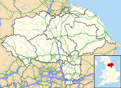
Middlethorpe, North Yorkshire
- Middlethorpe, North Yorkshire
-
Categories:
- Villages and areas in the City of York
- York geography stubs
Wikimedia Foundation.
2010.
Look at other dictionaries:
Middlethorpe — is the name of three settlements in England: Middlethorpe, North Yorkshire, a village near the city of York Middlethorpe Hall, historic house Middlethorpe, East Riding of Yorkshire, a hamlet in the East Riding of Yorkshire Middlethorpe,… … Wikipedia
Middlethorpe Hall — is a historic house currently used as a hotel in Middlethorpe, York, North Yorkshire, England. It is a perfectly symmetrical red brick and stone house built in 1699 and since 2008 has been owned by The National Trust. In 1980 it was rescued from… … Wikipedia
Middlethorpe, East Riding of Yorkshire — Coordinates: 53°53′55″N 0°38′40″W / 53.898640°N 0.644437°W / 53.898640; 0.644437 … Wikipedia
List of places in Yorkshire — This is a list of cities, towns and villages in the historic English county of Yorkshire. See the list of places in England for places in other counties.See:List of civil parishes in the East Riding of Yorkshire, :List of civil parishes in North… … Wikipedia
List of schools in Yorkshire and the Humber — The following is a partial list of currently operating schools in the Yorkshire and the Humber region of England. You may also find of use to find a particular school. See also the List of the oldest schools in the United Kingdom.Listed by local… … Wikipedia
York — Para otros usos de este término, véase York (desambiguación). York Escudo … Wikipedia Español
List of National Trust properties in England — This is a list of National Trust Properties in England, including any stately home, historic house, castle, abbey, museum or other property in the care of the National Trust in England. Contents 1 Bedfordshire … Wikipedia
List of York sites of interest — A list of prominent tourist attractions in York.City centre* All Saints Church, North Street *Assembly Rooms, a grand Palladian public space designed by Lord Burlington, 1731–32, lies behind a rebuilt 19th century facade. *Bar Convent Museum… … Wikipedia
Cleethorpes — For the constituency of this name, see Cleethorpes (UK Parliament constituency). Coordinates: 53°33′12″N 0°01′18″W / 53.5533°N 0.02155°W / … Wikipedia
Londesborough — infobox UK place country = England latitude = 53.898491 longitude = 0.679446 official name = Londesborough population = 183 (2001 census) civil parish = Londesborough unitary england = East Riding of Yorkshire region = Yorkshire and the Humber… … Wikipedia
 Middlethorpe