- Drayton Valley Industrial Airport
-
Drayton Valley Industrial Airport IATA: none – ICAO: none – TC LID: CER3 Summary Airport type Public Operator Town of Drayton Valley Location Brazeau County, near Drayton Valley, Alberta Elevation AMSL 2,776 ft / 846 m Coordinates 53°15′57″N 114°57′37″W / 53.26583°N 114.96028°WCoordinates: 53°15′57″N 114°57′37″W / 53.26583°N 114.96028°W Map Location in Alberta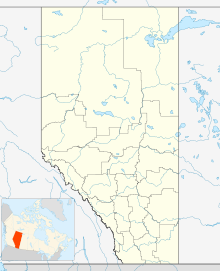
 CER3
CER3Runways Direction Length Surface ft m 14/32 5,066 1,544 Asphalt Source: Canada Flight Supplement[1] Drayton Valley Industrial Airport, (TC LID: CER3), is located 2.5 NM (4.6 km; 2.9 mi) northeast of Drayton Valley, Alberta, Canada.[1]
References
- ^ a b Canada Flight Supplement. Effective 0901Z 20 October 2011 to 0901Z 15 December 2011
External links
- Drayton Valley Industrial Airport on COPA's Places to Fly airport directory
- Accident history for YDC: Drayton Valley-Industrial Airport at Aviation Safety Network
Airports in Canada By name A–B · C–D · E–G · H–K · L–M · N–Q · R–S · T–ZBy location indicator CA · CB · CC · CD · CE · CF · CG · CH · CI · CJ · CK · CL · CM · CN · CO · CP · CR · CS · CT · CV · CW · CY · CZBy province/territory National Airports System Calgary · Charlottetown · Edmonton · Fredericton · Gander · Halifax · Iqaluit · Kelowna · London · Moncton · Montréal-Mirabel · Montréal-Trudeau · Ottawa · Prince George · Québec · Regina · Saint John · St. John's · Saskatoon · Thunder Bay · Toronto · Vancouver · Victoria · Whitehorse · Winnipeg · YellowknifeRelated List of airports by ICAO code: C · List of defunct airports in Canada · List of heliports in Canada · List of international airports in Canada · National Airports System · Operation Yellow RibbonCategories:- Airports in Alberta
- Brazeau County, Alberta
- Alberta airport stubs

Wikimedia Foundation. 2010.