- Columbia Trail
-
Columbia Trail 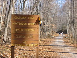
Columbia Trail in Clinton Township, New Jersey Length 16.2 miles (26.1 km) Location Hunterdon County Trailheads Main Street in High Bridge, Schooley's Mountain Road in Long Valley Use Hiking, Cycling Trail difficulty Easy Season Year round Surface Stone dust ROW Central Railroad of New Jersey The Columbia Trail is a rail trail in rural northwestern New Jersey. It was created from portions of the former Central Railroad of New Jersey High Bridge Branch and stretches from High Bridge, in Hunterdon County, to Flanders, in Morris County for a total of 16.2 miles (26.1 km). The trail surface is relatively flat and consists mostly of fine crushed stone.
Contents
History
Built in 1876, the railroad branch line was used for passenger and freight traffic. The type of freight most commonly moved was iron ore from mines in Morris County to be used in the foundries at High Bridge or Wharton. In 1976, the branch was deemed redundant by its new owner, Conrail, and the rails were dismantled in 1980. Since then, it has been a recreational trail serving the surrounding communities. In the mid-1990s, Columbia Gas Company bought the trail right-of-way and laid an underground gas pipeline under the right-of-way along the length of the trail. The trail and bridges were resurfaced in 2004. The Hunterdon County Department of Parks and Recreation and Morris County Department of Parks and Recreation now operate and maintain the trail[1] under lease, although ownership of the right-of-way remains with the Columbia Gas Company. Lewis H Taylor a member of the trustees of the Central Jersey Railroad brought the railroad in to High Bridge originally to bring coal to fuel the Taylor Wharton Iron and Steel Company , the oldest foundry in United States History. This connects to the Taylor Steelworkers Historic Greenway.
The Columbia Trail owes its name to a train wreck that occurred on the trestle on April 18, 1885, when an iron ore train led by the Columbia Engine derailed and crashed on the trestle and into the river below.[dubious ] IRON MINE RAILROAD OF NORTHERN NEW JERSEY, by Larry Lowenthal, indicates this was engine 112 and does not indicate it had a name. The trail is, instead, most likely named for the Columbia Gas Pipeline.[citation needed]
 Falls on the south branch of the Raritan River along the Columbia Trail.
Route
The Columbia Trail in Morris County is quite scenic, as the meandering and scenic South Branch of the Raritan River parallels the trail along most of its route through the county. Near the northern terminus of the trail in Morris County is Long Valley, New Jersey, where the trail crosses a road near a small commercial district. Just north of Long Valley, Patriots' Path provides links east towards County Route 513 and west towards Schooley's Mountain Park.
Beyond the northern end of the trail at Flanders, an active rail line is still in service and operated by the Morristown and Erie Railway to Wharton. The trail connects to the New Jersey Transit Raritan Valley Line at High Bridge and connects to Patriots Path in Long Valley.
 The south branch of the Raritan River seen from the Ken Lockwood trestle.
A notable portion of the Columbia Trail is the Ken Lockwood Gorge, between Califon and High Bridge (2½ miles north of High Bridge). The South Branch of the Raritan River parallels the trail through the gorge, and is a scenic fast-flowing small river with recreational activities, especially fly fishing. A 60-foot (18 m) trestle carries the trail over the river in the gorge.
 View from the road that follows the South Branch Raritan River through Ken Lockwood Gorge.
There are few remnants of the former rail line along the trail, except for the occasional rotting railroad cross ties along the trail. There is a small section of track preserved in Califon and a small and rarely open museum dedicated to the rail line history is located in the preserved train station in the town center.
Trail access
The southern trail head is located in High Bridge, New Jersey, not far from the intersection of Main Street and Van Syckle Place. Although several sources instruct trail users to turn left onto Van Syckle Place to enter the municipal parking lot and access the trail, the municipal lot is actually one block north of Van Syckle on the east side of Main Street and the trail head is directly across Main Street from the parking area.
The Long Valley trailhead is located on County Route 517 (Schooleys Mountain Road) between West Maple and Fairview Avenues and offers a public parking area.
A brochure with a map of the Patriot Path trail indicates that the Columbia trail may continue north beyond Long Valley for another 4 to 5 miles where it terminates at Bartley road, this section however can not be verified from satellite images on Google Earth[2][dead link].
References
- ^ Official website
- ^ "Patriot Path Trail". Morris County. http://www.morrisparks.net/maps/iviewer/patriotspath2.asp. Retrieved 2011-07-26.
External links
- Official website
- Columbia Trail mountain biking
- Rails to Trails Conservancy Trail Information Page
- NY-NJTC: Columbia Trail Details and Info
- Photo Gallery
Coordinates: 40°34′48″N 74°51′41″W / 40.57988°N 74.86148°W
Rail trails in New Jersey Asphalt Capital to Coast Trail · Henry Hudson Trail · Edgar Felix Bikeway · Atlantic County Bikeway · Barnegat Branch Trail · Traction Line Recreation Trail · Monroe Township Bikepath · Somers Point Bike Path · Middlesex GreenwayStone Dust D&R Canal Trail · Pemberton Rail-Trail · West Essex Trail · Columbia Trail · Union Transportation TrailBallast/dirt/natural Paulinskill Valley Trail · Patriots' Path · Sussex Branch TrailCategories:- Rail trails in New Jersey
- Protected areas of Hunterdon County, New Jersey
- Transportation in Morris County, New Jersey
- Protected areas of Morris County, New Jersey
- Transportation in Hunterdon County, New Jersey


Wikimedia Foundation. 2010.