- Marvyn, Alabama
-
 Location of Marvyn in Lee County.
 Marvyn's abandoned service station located at the intersection of Alabama Highway 51 and U.S. Highway 80.
Marvyn is an unincorporated community southerly located in Lee County, Alabama, United States. It sits at the crossroads of Alabama Highway 51 and U.S. Highway 80, and in the Lee County "panhandle" between Russell County and Macon County. It is part of the Columbus, Georgia-Alabama Metropolitan Area.
History
Marvyn was originally located in Russell County, but was granted to Lee County in 1923 in exchange for Phenix City.
References
- Barnes, Margaret Anne (1998). The Tragedy and the Triumph of Phenix City, Alabama. Macon, Ga., Mercer University Press. ISBN 0-86554-613-4
Municipalities and communities of Lee County, Alabama County seat: Opelika Cities Auburn | Opelika | Phenix City‡ | Smiths Station

Towns Loachapoka | Notasulga‡ | Waverly‡
Unincorporated
communitiesBeauregard | Beulah | Gold Hill | Hopewell | Marvyn | Roxana | Salem
Footnotes ‡This populated place also has portions in an adjacent county or counties
Greater Columbus, Georgia Central cities/Largest cities 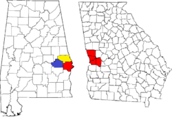 Location of the Columbus, Georgia-Auburn, Alabama CSA and its counties:Columbus, Georgia Metropolitan Statistical AreaAuburn, Alabama Metropolitan Statistical AreaTuskegee, Alabama Micropolitan Statistical Area
Cities in Georgia Bibb City · Buena Vista · Cataula · Columbus · Cusseta · Custer Terrace · Fort Benning South · Fortson · Hamilton · Hopewell · Juniper · Midland · Mountain Hill · Mulberry Grove · Pine Mountain · Rehobeth · Ridgeway · Shiloh · Upatoi · Waverly Hall · West Point · WhitesvilleCities in Alabama Beauregard · Bee Hive · Beulah · Creek Stand · Fort Mitchell · Franklin · Glenville · Gold Hill · Holy Trinity · Hurtsboro · Ladonia · Loachapoka · Marvyn · Notasulga · Opelika · Phenix City · Roxana · Salem · Seale · Shorter · Smiths Station · The Bottle · Tuskegee · WaverlyCounties in Georgia Counties in Alabama
Coordinates: 32°26′21″N 85°21′51″W / 32.43917°N 85.36417°WCategories:- Unincorporated communities in Alabama
- Populated places in Lee County, Alabama
- Columbus, Georgia metropolitan area


Wikimedia Foundation. 2010.