- Old Seminole Heights
-
Old Seminole Heights — Neighborhood — Seminole Heights Garden Center in Old Seminole Heights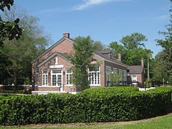 Location within the state of Florida
 Old Seminole Heights
Coordinates: 28°0′19″N 82°27′8″W / 28.00528°N 82.45222°WCoordinates: 28°0′19″N 82°27′8″W / 28.00528°N 82.45222°W Country  United States
State  Florida
County Hillsborough City  Tampa
TampaPopulation (2000) – Total 15,564 Time zone Eastern (EST) (UTC-5) – Summer (DST) EDT (UTC-4) ZIP codes 33603, 33604, and 33610 Area code(s) 813 Old Seminole Heights is a neighborhood within the city limits of Tampa, in the U.S. state of Florida. The neighborhood is one of three which comprise the greater Seminole Heights district within the city. As of the 2000 census the neighborhood had a population of 15,564. The ZIP Codes serving the area are 33603, 33604, and 33610.[1]
Contents
Geography
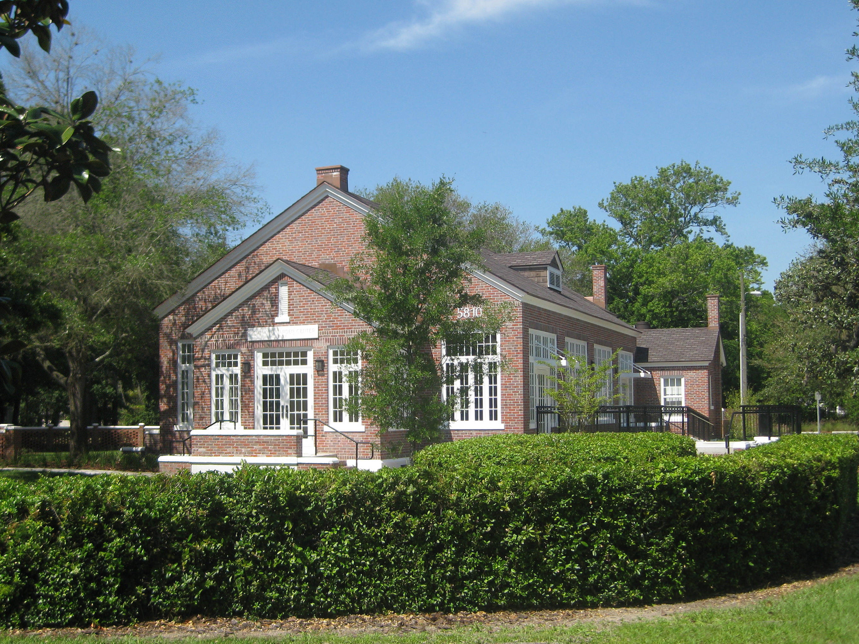
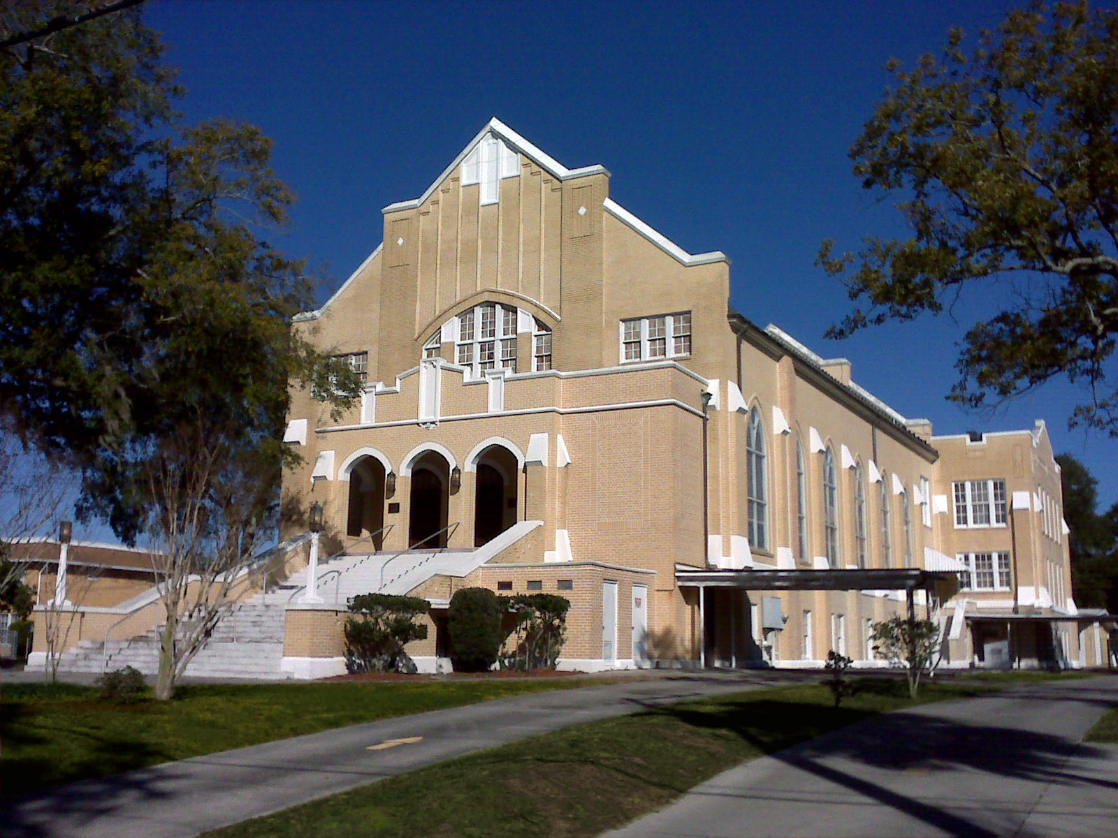
 Seminole Heights Methodist Church
is a prominent landmark in the Old Seminole Heights neighborhood.Old Seminole Heights' boundaries are Live Oaks Square to the east, Hillsborough River to the west and north, Sulphur Springs to the north, and Hillsborough Avenue to the south, with the exception of the area between Florida Avenue and I-275, where a rectangular section extends the southern boundary south of Hillsborough Avenue to Dr. Martin Luther King Jr. Boulevard.[2]
The neighborhood is located in the northern edge of the area within Tampa known as Seminole Heights. Old Seminole Heights is the largest of the three distinct city of Tampa neighborhoods within the Seminole Heights district, the other two being South Seminole Heights and Southeast Seminole Heights.[3]
Prominent neighborhood landmarks within Old Seminole Heights include Hillsborough High School, Memorial Middle School, Seminole Heights Elementary School, Seminole Heights United Methodist Church, St. Paul's Lutheran Church, and the Seminole Heights Garden Center, a city of Tampa park[4].
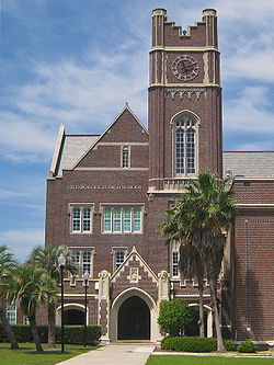 The campus for Hillsborough High School
is located within Old Seminole Heights.Demographics
Source: Hillsborough Community Atlas
As of the census[5] of 2000, there were 15,564 people and 6,391 households residing in the neighborhood. The population density was 4,422/mi². The racial makeup of the neighborhood was 71% White, 21% African American, less than 1% Native American, less than 1% Asian, 4% from other races, and 3% from two or more races. Hispanic or Latino of any race were about 17% of the population.
There were 6,391 households out of which 28% had children under the age of 18 living with them, 37% were married couples living together, 16% had a female householder with no husband present, and 12% non-families. 30% of all households were made up of individuals.
In the neighborhood the population was spread out with 25% under the age of 18, 23% from 18 to 34, 27% from 35 to 49, 14% from 50 to 64, and 12% who were 65 years of age or older. For every 100 females there were 98.6 males.
The per capita income for the neighborhood was $16,641. About 16% of the population were below the poverty line.
Historic Districts
Old Seminole Heights contains two areas designated as U.S. Historic Districts and listed with the National Register of Historic Places. They are the Seminole Heights Residential District and Hampton Terrace Historic District[6].
Seminole Heights Residential District is also designated as a Local Historic District by the city of Tampa[7].
See also
- Seminole Heights
- Neighborhoods in Tampa, Florida
- Seminole Heights Residential District
- Hampton Terrace Historic District
References
- ^ Hillsborough Community Atlas : Old Seminole Heights Civic Association : General Information
- ^ Hillsborough Community Atlas
- ^ "Neighborhood Registry", February 13, 2010. TampaGov. Retrieved February 13, 2010.
- ^ Steele, Kathy. (April 24, 2010) "Garden center returns to its original roots". The Tampa Tribune Retrieved April 24, 2010.
- ^ "American FactFinder". United States Census Bureau. http://factfinder.census.gov. Retrieved 2008-01-31.
- ^ "Florida - Hillsborough County - - Historic Districts" National Register of Historic Places. Retrieved February 13, 2010.
- ^ "Historic Preservation and Urban Design". TampaGov. Retrieved February 13, 2010.
External links
- Old Seminole Heights Neighborhood Association official site
- Old Seminole Heights Neighborhood Association at Hillsborough Community Atlas
- Old Seminole Heights on Wikimapia
Regions North Tampa | South Tampa | New Tampa
Historic Districts Hampton Terrace | Hyde Park | Seminole Heights | Tampa Heights | West Tampa | Ybor City
Central Business Districts Downtown Tampa | Uptown Tampa |
Westshore Business DistrictResidential Neighborhoods Armenia Gardens Estates | Audubon Park | Ballast Point | Bayshore Beautiful | Bayshore Gardens | Bayside West | Beach Park | Beach Park Isles | Beasley | Bel Mar Shores | Belmont Heights | Bowman Heights | Bon Air | Carver City-Lincoln Gardens | Channel District | College Hill | Courier City-Oscawana | Cory Lake Isles | Culbreath Bayou | Culbreath Isles | Davis Islands | Dixie Farms | Drew Park | Eastern Heights | East Tampa | East Ybor | Fair Oaks-Manhattan Manor | Fern Cliff | Florence Villa | Forest Hills | Gandy-Sun Bay South | Golf View | Grant Park | Gray Gables | Harbour Island | Harvey Heights | Highland Pines | Historic Hyde Park North | Hunters Green | Interbay | Jackson Heights | Live Oaks Square | Lowry Park | Lowry Park North | MacDill Air Force Base | Macfarlane Park | Marina Club | Maryland Manor | New Suburb Beautiful | North Bon Air | Northeast Community | Northeast Macfarlane | North Hyde Park | North Tampa | Northview Hills | Oakford Park | Oak Park | Old Seminole Heights | Old West Tampa | Palma Ceia | Palma Ceia West | Palmetto Beach | Parkland Estates | Port Tampa | Rattlesnake | Rembrandt Gardens | Ridgewood Park | Riverbend | Rivercrest | River Grove | Riverside Heights | Robles Park | South Seminole Heights | Southeast Seminole Heights | Southern Pines | South Nebraska | South Westshore | Stoney Point | Sulphur Springs | Sunset Park | Swann Estates | Tampa Overlook | Tampa Palms | Temple Crest | Terrace Park | University Square | V.M. Ybor | Virginia Park | Wellswood | West Meadows | Westshore Palms | West Hyde Park | West Riverfront | West Tampa | Woodland Terrace
Industrial areas Garrison Channel | Gary | Uceta Yard
Other areas Rocky Point | Soho District
Categories:


Wikimedia Foundation. 2010.