- North Bridgton, Maine
-
North Bridgton is a village in the town of Bridgton in Cumberland County, Maine, United States. It is located just west of Long Lake, and just south of the town of Harrison. It is home to Bridgton Academy, an all-boys college-preparatory school. The Zip Code for North Bridgton is 04057.
Coordinates: 44°05′55″N 70°41′55″W / 44.09861°N 70.69861°W
Municipalities and communities of Cumberland County, Maine Cities 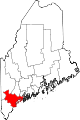
Towns Baldwin | Bridgton | Brunswick | Cape Elizabeth | Casco | Chebeague Island | Cumberland | Falmouth | Freeport | Frye Island | Gorham | Gray | Harpswell | Harrison | Long Island | Naples | New Gloucester | North Yarmouth | Pownal | Raymond | Scarborough | Sebago | Standish | Windham | Yarmouth
CDPs Other
villageNorth Bridgton
Categories:- Villages in Maine
- Populated places in Cumberland County, Maine
- Bridgton, Maine
- Maine geography stubs

Wikimedia Foundation. 2010.