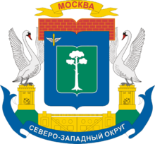
- North-Western Administrative Okrug
-
For other entities called "North-Western District" or "Severo-Zapadny District", see Severo-Zapadny (disambiguation).
Coordinates: 55°49′N 37°26′E / 55.817°N 37.433°E
North-Western Administrative Okrug, or Severo-Zapadny Administrative Okrug (Russian: Се́веро-За́падный администрати́вный о́круг, Severo-Zapadny administrativny okrug), is one of the ten administrative okrugs of Moscow, Russia. It was founded in 1991 and has an area of 107 square kilometers (41 sq mi). Population: 924,419 (2010 Census preliminary results);[1] 779,965 (2002 Census).[2]
Its borders with Northern and Central Administrative Okrugs in the east and passes by the Khimki Reservoir and the Moscow District Railway. In the south, it borders with Western Administrative Okrug and the bed of the Moskva River.
Contents
History
The North-Western Administrative Okrug was formed in 1991 from Tushinsky and Khoroshevsky Districts of Moscow. The okrug is sometimes referred to as "the lungs of the capital", as it is surrounded by the Khimki Reservoir, the Moskva River, and the Moscow Canal, and about 46% of its territory is covered by natural features.
Until the beginning of the 20th century, what is now the administrative okrug's territory was home to peasant settlements in the nearest Moscow suburbs: Spas, Tushino, Strogino, Streshnevo, Khoroshevo, Shchukino, and others, which were incorporated into the boundaries of the city over the last fifty years. Many historical and cultural monuments reside within the okrug, such as Trinity Church (in Khoroshyovo), as well as the stone church of the Vladimir Icon of the Mother of God, which was built in 1672 and has been preserved to this day.[3]
Districts
The okrug encompasses eight districts:
- Kurkino
- Mitino
- Pokrovskoye-Streshnevo
- Severnoye Tushino
- Strogino
- Shchukino
- Khoroshyovo-Mnyovniki
- Yuzhnoye Tushino
References
- ^ Федеральная служба государственной статистики (Federal State Statistics Service) (2011). "Предварительные итоги Всероссийской переписи населения 2010 года (Preliminary results of the 2010 All-Russian Population Census)" (in Russian). Всероссийская перепись населения 2010 года (All-Russia Population Census of 2010). Federal State Statistics Service. http://www.perepis-2010.ru/results_of_the_census/results-inform.php. Retrieved 2011-04-25.
- ^ Федеральная служба государственной статистики (Federal State Statistics Service) (2004-05-21). "Численность населения России, субъектов Российской Федерации в составе федеральных округов, районов, городских поселений, сельских населённых пунктов – районных центров и сельских населённых пунктов с населением 3 тысячи и более человек (Population of Russia, its federal districts, federal subjects, districts, urban localities, rural localities—administrative centers, and rural localities with population of over 3,000)" (in Russian). Всероссийская перепись населения 2002 года (All-Russia Population Census of 2002). Federal State Statistics Service. http://www.perepis2002.ru/ct/doc/1_TOM_01_04.xls. Retrieved 2010-03-23.
- ^ (Russian)History of the North-Western Administrative Okrug Retrieved on October 30, 2009
External links
- Official website (Russian)
Administrative divisions of Moscow Zelenogradsky Administrative Okrug Northern Administrative Okrug Aeroport ·Begovoy · Beskudnikovsky · Dmitrovsky · Golovinsky · Khoroshyovsky · Khovrino · Koptevo · Levoberezhny · Molzhaninovsky · Savyolovsky · Sokol · Timiryazevsky · Vostochnoye Degunino · Voykovsky · Zapadnoye Degunino
North-Eastern Administrative Okrug Alexeyevsky ·Altufyevsky · Babushkinsky · Bibirevo · Butyrsky · Lianozovo · Losinoostrovsky · Marfino · Maryina roshcha · Ostankinsky · Otradnoye · Rostokino · Severnoye Medvedkovo · Severny · Sviblovo · Yaroslavsky · Yuzhnoye Medvedkovo
North-Western Administrative Okrug Central Administrative Okrug Arbat ·Basmanny · Khamovniki · Krasnoselsky · Meshchansky · Presnensky · Tagansky · Tverskoy · Yakimanka · Zamoskvorechye
Eastern Administrative Okrug Bogorodskoye ·Golyanovo · Ivanovskoye · Izmaylovo · Kosino-Ukhtomsky · Metrogorodok · Novogireyevo · Novokosino · Perovo · Preobrazhenskoye · Severnoye Izmaylovo · Sokolinaya gora · Sokolniki · Veshnyaki · Vostochnoye Izmaylovo · Vostochny
Western Administrative Okrug Dorogomilovo ·Filyovsky park · Fili-Davydkovo · Krylatskoye · Kuntsevo · Mozhaysky · Novo-Peredelkino · Ochakovo-Matveyevskoye · Prospekt Vernadskogo · Ramenki · Solntsevo · Troparyovo-Nikulino · Vnukovo
Southern Administrative Okrug Biryulyovo Vostochnoye ·Biryulyovo Zapadnoye · Brateyevo · Chertanovo Severnoye · Chertanovo Tsentralnoye · Chertanovo Yuzhnoye · Danilovsky · Donskoy · Moskvorechye-Saburovo · Nagatino-Sadovniki · Nagatinsky Zaton · Nagorny · Orekhovo-Borisovo Severnoye · Orekhovo-Borisovo Yuzhnoye · Tsaritsyno · Zyablikovo
South-Eastern Administrative Okrug Kapotnya ·Kuzminki · Lefortovo · Lyublino · Maryino · Nekrasovka · Nizhegorodsky · Pechatniki · Ryazansky · Tekstilshchiki · Vykhino-Zhulebino · Yuzhnoportovy
South-Western Administrative Okrug Akademichesky ·Cheryomushki · Gagarinsky · Konkovo · Kotlovka · Lomonosovsky · Obruchevsky · Severnoye Butovo · Tyoply Stan · Yasenevo · Yuzhnoye Butovo · Zyuzino
Categories:- Administrative okrugs of Moscow
Wikimedia Foundation. 2010.


