- National Register of Historic Places listings in Davidson County, Tennessee
-
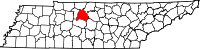 Location of Davidson County in Tennessee
This is a list of the National Register of Historic Places listings in Davidson County, Tennessee.
This is intended to be a complete list of the properties and districts on the National Register of Historic Places in Davidson County, Tennessee, United States. Latitude and longitude coordinates are provided for many National Register properties and districts; these locations may be seen together in a Google map.[1]
There are 180 properties and districts listed on the National Register in the county, including 6 National Historic Landmarks.
Contents: Counties in Tennessee Anderson – Bedford – Benton – Bledsoe – Blount – Bradley – Campbell – Cannon – Carroll – Carter – Cheatham – Chester – Claiborne – Clay – Cocke – Coffee – Crockett – Cumberland – Davidson – Decatur – DeKalb – Dickson – Dyer – Fayette – Fentress – Franklin – Gibson – Giles – Grainger – Greene – Grundy – Hamblen – Hamilton – Hancock – Hardeman – Hardin – Hawkins – Haywood – Henderson – Henry – Hickman – Houston – Humphreys – Jackson – Jefferson – Johnson – Knox – Lake – Lauderdale – Lawrence – Lewis – Lincoln – Loudon – Macon – Madison – Marion – Marshall – Maury – McMinn – McNairy – Meigs – Monroe – Montgomery – Moore – Morgan – Obion – Overton – Perry – Pickett – Polk – Putnam – Rhea – Roane – Robertson – Rutherford – Scott – Sequatchie – Sevier – Shelby – Smith – Stewart – Sullivan – Sumner – Tipton – Trousdale – Unicoi – Union – Van Buren – Warren – Washington – Wayne – Weakley – White – Williamson – Wilson -
- This National Park Service list is complete through NPS recent listings posted November 10, 2011.[2]
Current listings
[3] Landmark name [4] Image Date listed Location City or town Summary 1 Acme Farm Supply Building 
April 2, 1998 101 Broadway
36°09′43″N 86°46′28″W / 36.161944°N 86.774444°WNashville 2 Airdrie September 15, 2005 3210 Avenal Ave.
36°06′18″N 86°43′54″W / 36.105°N 86.731667°WNashville 3 Alumni Memorial Hall, Vanderbilt University July 6, 2011 2205 West End Ave.
36°08′53″N 86°48′12″W / 36.148056°N 86.803333°WNashville 4 Archeological Site No. 40DV35 December 16, 1992 Address Restricted Nashville 5 Beech Grove November 8, 2007 8423 Old Harding Pike
36°01′22″N 87°01′31″W / 36.022817°N 87.025306°WNashville 6 Belair 
May 6, 1971 2250 Lebanon Rd.
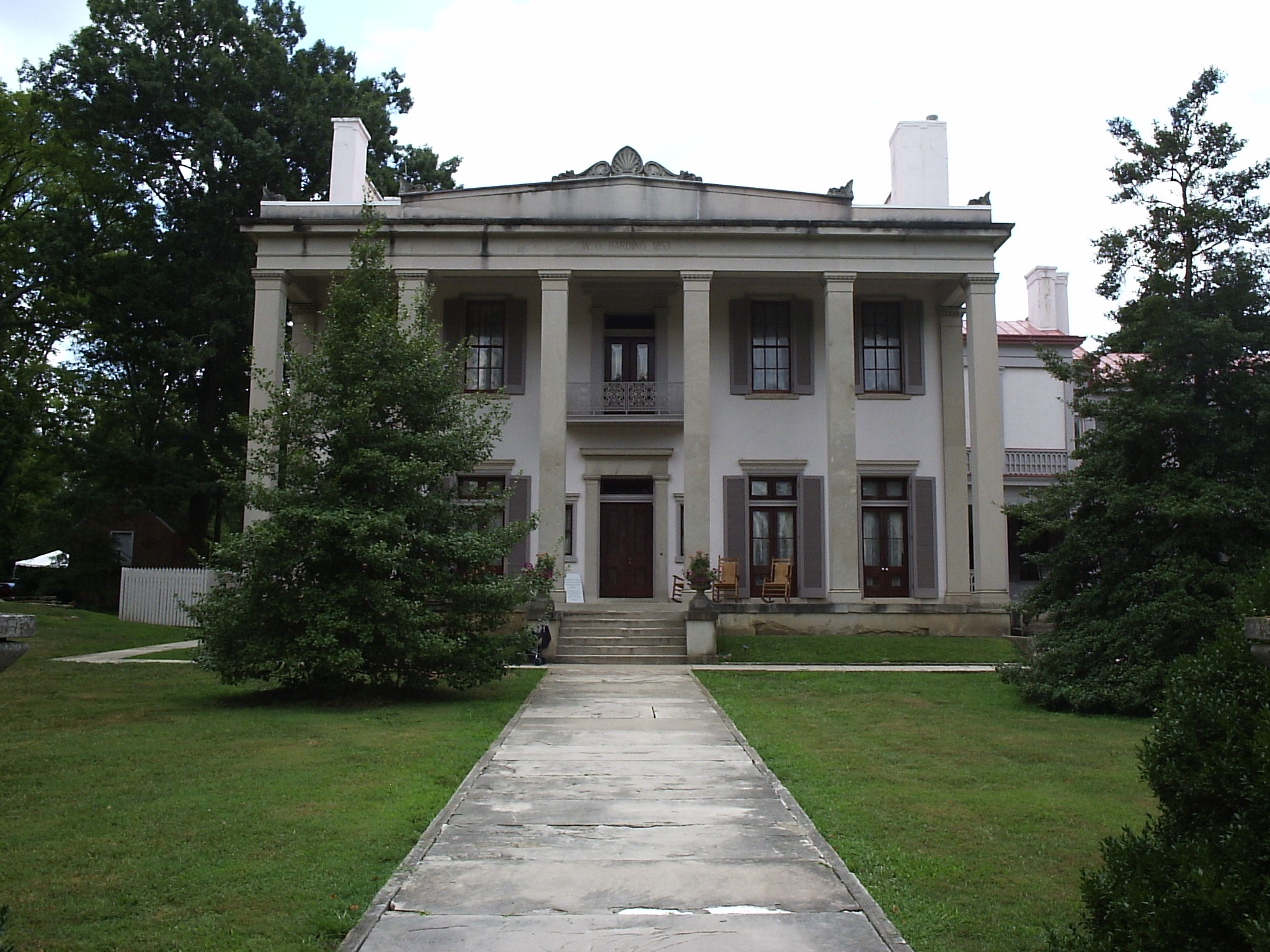
36°10′09″N 86°41′15″W / 36.169167°N 86.6875°WNashville 7 Belle Meade 
December 30, 1969 Harding Rd. at Leake Ave.
36°06′20″N 86°51′52″W / 36.105556°N 86.864444°WNashville 8 Belle Meade Apartments April 19, 1984 715 Belle Meade Boulevard
36°05′47″N 86°51′28″W / 36.096389°N 86.857778°WNashville 9 Belle Meade Golf Links Subdivision Historic District July 7, 2004 Roughly bounded by Windsor Dr., Blackburn and Pembroke Aves., Westover Dr., and Harding Pl.
36°06′07″N 86°51′48″W / 36.101944°N 86.863333°WNashville 10 Belle Vue October 25, 1973 Old Harding Rd., off U.S. Route 70S
36°03′58″N 86°56′16″W / 36.066111°N 86.937778°WBellevue 11 Belmont 
May 6, 1971 Belmont Boulevard
36°08′09″N 86°47′41″W / 36.135833°N 86.794722°WNashville 12 Belmont-Hillsboro Historic District May 1, 1980 Roughly bounded by Primrose and 20th Aves. and Magnolia and Belmont Boulevards
36°07′38″N 86°47′53″W / 36.127222°N 86.798056°WNashville 13 Bennie-Dillon Building 
August 16, 1984 702 Church St.
36°09′44″N 86°46′59″W / 36.162222°N 86.783056°WNashville 14 Berger Building 
November 8, 1984 164 N. 8th Ave.
36°09′40″N 86°46′59″W / 36.161111°N 86.783056°WNashville 15 Brick Church Mound and Village Site May 7, 1973
36°14′51″N 86°46′32″W / 36.247469°N 86.775689°WNashville A multi-mound Mississippian culture site, leveled in the 1970s and 80s for a residential neighborhood 16 Broadway Historic District 
July 18, 1980 Broadway between 2nd and 5th Aves.
36°09′40″N 86°46′38″W / 36.161111°N 86.777222°WNashville 17 James Buchanan House March 29, 1984 2910 Elm Hill Pike
36°08′41″N 86°39′26″W / 36.144722°N 86.657222°WNashville 18 Buena Vista Historic District 
April 24, 1980 Bounded by Interstate 65 and U.S. Route 41
36°10′34″N 86°47′50″W / 36.176111°N 86.797222°WNashville 19 Bush-Herbert Building 
March 25, 1982 174 3rd. Ave., N.
36°09′49″N 86°46′38″W / 36.163611°N 86.777222°WNashville 20 Cameron School 
March 15, 2005 1034 1st Ave., S.
36°08′55″N 86°45′51″W / 36.148611°N 86.764167°WNashville 21 Cane Ridge Cumberland Presbyterian Church December 12, 1976 Southeast of Antioch on Old Hickory Boulevard
36°00′06″N 86°38′02″W / 36.001667°N 86.633889°WAntioch 22 Capers C.M.E. Church 
January 2, 1985 319 15th Ave., N.
36°09′34″N 86°47′43″W / 36.159444°N 86.795278°WNashville 23 Carnegie Library 
January 2, 1985 17th Ave. N. on the Fisk University campus
36°10′05″N 86°48′18″W / 36.168056°N 86.805°WNashville 24 Cartwright-Moss House August 1, 1979 Old Dickerson Pike
36°18′13″N 86°43′22″W / 36.303611°N 86.722778°WGoodlettsville 25 Castner-Knott Building 
August 20, 1999 616-618 Church St.
36°09′45″N 86°46′56″W / 36.1625°N 86.782222°WNashville 26 Centennial Park 
July 15, 2008 West End Ave. at its junction with 25th Ave. N.
36°08′59″N 86°48′47″W / 36.149589°N 86.812936°WNashville 27 Robert Chadwell House November 13, 1989 712 Neeleys Bend Rd.
36°15′09″N 86°41′48″W / 36.2525°N 86.696667°WMadison 28 Cheatham Building 
February 21, 1980 301-309 Church St.
36°09′50″N 86°46′39″W / 36.163889°N 86.7775°WNashville 29 Cheekwood 
August 23, 2000 1200 Forrest Park Dr.
36°05′11″N 86°52′26″W / 36.086339°N 86.873961°WNashville 30 Christ Church 
November 14, 1978 900 Broadway
36°09′32″N 86°47′00″W / 36.158889°N 86.783333°WNashville 31 Church of the Assumption 
August 22, 1977 1227 7th Ave., N.
36°10′31″N 86°47′30″W / 36.175278°N 86.791667°WNashville 32 Cleveland Hall April 16, 1971 4041 Old Hickory Boulevard
36°13′46″N 86°37′38″W / 36.229444°N 86.627222°WOld Hickory 33 Clover Bottom Mansion April 3, 1975 2930 Lebanon Rd.
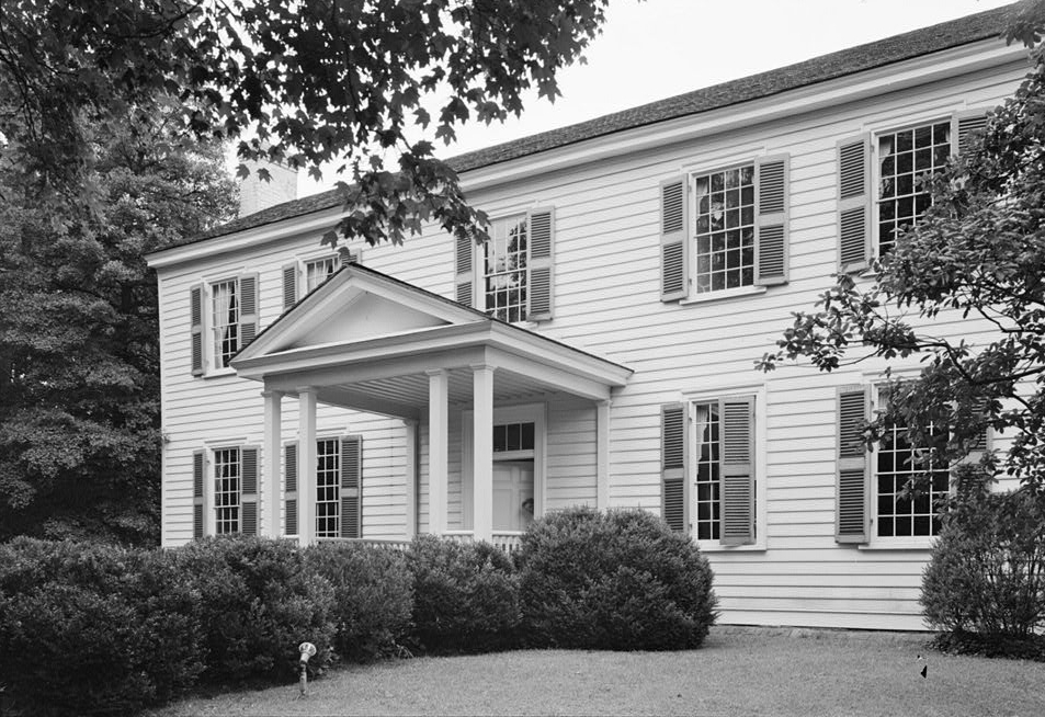
36°10′11″N 86°38′58″W / 36.169722°N 86.649444°WDonelson 34 Cole House 
December 27, 1974 2001 Lebanon Rd.
36°09′24″N 86°42′28″W / 36.156667°N 86.707778°WNashville 35 Anna Russell Cole Auditorium April 17, 1980 Tennessee Preparatory School campus
36°07′56″N 86°44′28″W / 36.132222°N 86.741111°WNashville 36 Mrs. Edward B. Craig House October 27, 2003 1418 Chickering Rd.
36°04′18″N 86°52′03″W / 36.071667°N 86.8675°WForest Hills 37 Cummins Station 
November 17, 1983 Demonbreun and 10th Ave., S.
36°09′19″N 86°46′58″W / 36.155278°N 86.782778°WNashville 38 Davidson County Courthouse 
March 23, 1987 Public Sq.
36°10′02″N 86°46′43″W / 36.167222°N 86.778611°WNashville 39 Demonbreun's Cave February 7, 1980 1700 Omohumdro Dr.
36°09′55″N 86°42′57″W / 36.165278°N 86.715833°WNashville 40 Devon Farm August 28, 1974 South of Nashville on State Route 100
36°03′28″N 86°55′11″W / 36.057778°N 86.919722°WNashville 41 Doctor's Building 
July 25, 1985 706 Church St.
36°09′44″N 86°46′59″W / 36.162222°N 86.783056°WNashville 42 Dozier Farm November 1, 1990 8451 River Rd. Pike
36°12′16″N 86°58′36″W / 36.204444°N 86.976667°WNashville 43 Dubuisson-Neuhoff House October 27, 2003 1407 Chickering Rd.
36°04′24″N 86°52′01″W / 36.073333°N 86.866944°WForest Hills 44 Guildfor Dudley, Sr. and Anne Dallas House October 23, 2003 5401 Hillsboro Pike
36°05′07″N 86°50′04″W / 36.085278°N 86.834444°WForest Hills 45 Arthur J. Dyer Observatory March 6, 2009 1000 Oman Dr.
36°03′08″N 86°48′17″W / 36.05213°N 86.80481°WBrentwood 46 East Nashville High and Junior High Schools 
January 25, 2002 110 and 112 Gallatin Rd.
36°10′52″N 86°45′10″W / 36.181111°N 86.752778°WNashville 47 East Nashville Historic District 
April 15, 1982 Roughly bounded by Gallatin Pike, Edgewood Pl., N. 16th St., and Russell Sts.
36°10′39″N 86°44′42″W / 36.1775°N 86.745°WNashville 48 Edgefield Historic District 
July 13, 1977 Roughly bounded by Woodland, S. 10th and S. 5th Sts., and Shelby Ave.
36°10′22″N 86°45′28″W / 36.172778°N 86.757778°WNashville 49 Eighth Avenue South Reservoir 
March 30, 1978 8th Ave., S.
36°08′21″N 86°46′49″W / 36.139167°N 86.780278°WNashville 50 Ellis Service Station Garage April 15, 1991 2000 Old Murfreesboro Rd.
36°05′50″N 86°39′13″W / 36.097222°N 86.653611°WNashville 51 Elm Street Methodist Church 
May 15, 1984 616 5th Ave., S.
36°09′11″N 86°46′24″W / 36.153056°N 86.773333°WNashville 52 Alexander Ewing House November 25, 1980 5101 Buena Vista Pike
36°14′03″N 86°49′38″W / 36.234167°N 86.827222°WNashville 53 Fall School 
December 19, 1979 1116 S. 8th Ave.
36°08′32″N 86°46′43″W / 36.142222°N 86.778611°WNashville 54 Federal Office Building 
December 26, 1972 Broadway
36°09′31″N 86°46′53″W / 36.158611°N 86.781389°WNashville 55 Federal Reserve Bank of Atlanta 
October 10, 1984 226 N. 3rd Ave.
36°09′58″N 86°46′45″W / 36.166111°N 86.779167°WNashville 56 Fifth Avenue Historic District 
December 5, 1983 Roughly bounded by Church and Union Sts. and 4th, 5th, and 6th Aves.
36°09′50″N 86°46′50″W / 36.163889°N 86.780556°WNashville 57 Fire Hall No. 1 
July 23, 2008 1312 3rd Ave., N.
36°10′43″N 86°47′12″W / 36.178553°N 86.786603°WNashville 58 First Baptist Church East Nashville 
July 27, 2005 601 Main St.
36°10′33″N 86°45′46″W / 36.175833°N 86.762778°WNashville 59 First Presbyterian Church 
July 8, 1970 154 5th Ave., N.
36°09′46″N 86°46′47″W / 36.162778°N 86.779722°WNashville 60 Fisk University Historic District 
February 9, 1978 Roughly bounded by 16th and 18th Aves. and Hermosa, Herman and Jefferson Sts.
36°10′04″N 86°48′17″W / 36.167778°N 86.804722°WNashville 61 Fort Nashborough July 13, 2011 Riverfront Park on 1st Ave.
36°09′51″N 86°46′32″W / 36.164167°N 86.775556°WNashville 62 Fort Negley 
April 21, 1975 Ridley Boulevard and Chestnut St.
36°08′42″N 86°46′28″W / 36.145°N 86.774444°WNashville 63 Frost Building 
November 25, 1980 161 8th Ave., N.
36°09′38″N 86°47′00″W / 36.160556°N 86.783333°WNashville 64 James Geddes Engine Company No. 6 
January 9, 1978 629 2nd Ave., S.
36°09′16″N 86°46′14″W / 36.154444°N 86.770556°WNashville 65 John Geist and Sons Blacksmith Shop and House 
April 29, 1980 309, 311, and 313 Jefferson St.
36°10′28″N 86°47′06″W / 36.174444°N 86.785°WNashville 66 Germantown Historic District 
August 1, 1979 Bounded by Jefferson, Hume, Rosa Parks, and Third[5]
36°10′36″N 86°47′25″W / 36.176667°N 86.790278°WNashville 67 Gilbert Mansion 
March 28, 1979 1906 West End Ave.
36°09′08″N 86°47′54″W / 36.152222°N 86.798333°WNashville 68 Gladstone Apartments June 16, 1983 3803 West End Ave.
36°07′54″N 86°49′54″W / 36.131667°N 86.831667°WNashville 69 Glen Oak November 17, 1983 2012 25th Ave., S.
36°07′57″N 86°48′25″W / 36.1325°N 86.806944°WNashville 70 Grassmere July 19, 1984 Nolensville Rd.
36°05′16″N 86°44′26″W / 36.087778°N 86.740556°WNashville 71 Benajah Gray Log House July 11, 1985 446 Battle Rd.
35°59′36″N 86°37′31″W / 35.993333°N 86.625278°WAntioch 72 Gymnasium, Vanderbilt University 
February 23, 1972 West End and 23rd Aves.
36°08′54″N 86°48′18″W / 36.148333°N 86.805°WNashville 73 Hall-Harding-McCampbell House March 23, 2010 305 Kent Rd.
36°09′32″N 86°39′43″W / 36.158881°N 86.661942°WNashville 74 Hays-Kiser House September 10, 1974 834 Reeves Rd.
36°03′55″N 86°40′20″W / 36.065278°N 86.672222°WAntioch 75 Hermitage Hotel 
July 24, 1975 231 6th Ave., N.
36°09′47″N 86°47′01″W / 36.163056°N 86.783611°WNashville 76 The Hermitage 
October 15, 1966 12 miles east of Nashville on U.S. Route 70N
36°12′54″N 86°36′42″W / 36.215°N 86.611667°WNashville 77 The Hibbettage October 30, 1998 2160 Old Hickory Boulevard
36°03′04″N 86°51′55″W / 36.051111°N 86.865278°WNashville 78 Hillsboro-West End Historic District December 23, 1993 Roughly bounded by West End, 31st, Blakemore, and 21st Aves. and Interstate 440
36°07′56″N 86°48′18″W / 36.132222°N 86.805°WNashville 79 Holly Street Fire Hall 
August 26, 1982 1600 Holly St.
36°10′30″N 86°44′30″W / 36.175°N 86.741667°WNashville 80 Holy Trinity Church 
April 14, 1972 615 6th Ave., S.
36°09′10″N 86°46′33″W / 36.152778°N 86.775833°WNashville 81 Home for Aged Masons November 19, 2008 Ben Allen Rd. and R.S. Gass Boulevard
36°13′03″N 86°44′36″W / 36.217467°N 86.743367°WNashville 82 P. D. Houston, Jr., House October 27, 2003 5617 Hillsboro Pike
36°04′57″N 86°50′06″W / 36.0825°N 86.835°WForest Hills 83 Hows-Madden House November 23, 1984 U.S. Route 70
36°05′32″N 86°59′02″W / 36.092222°N 86.983889°WNashville 84 Hubbard House 
August 14, 1973 1109 1st Ave., S.
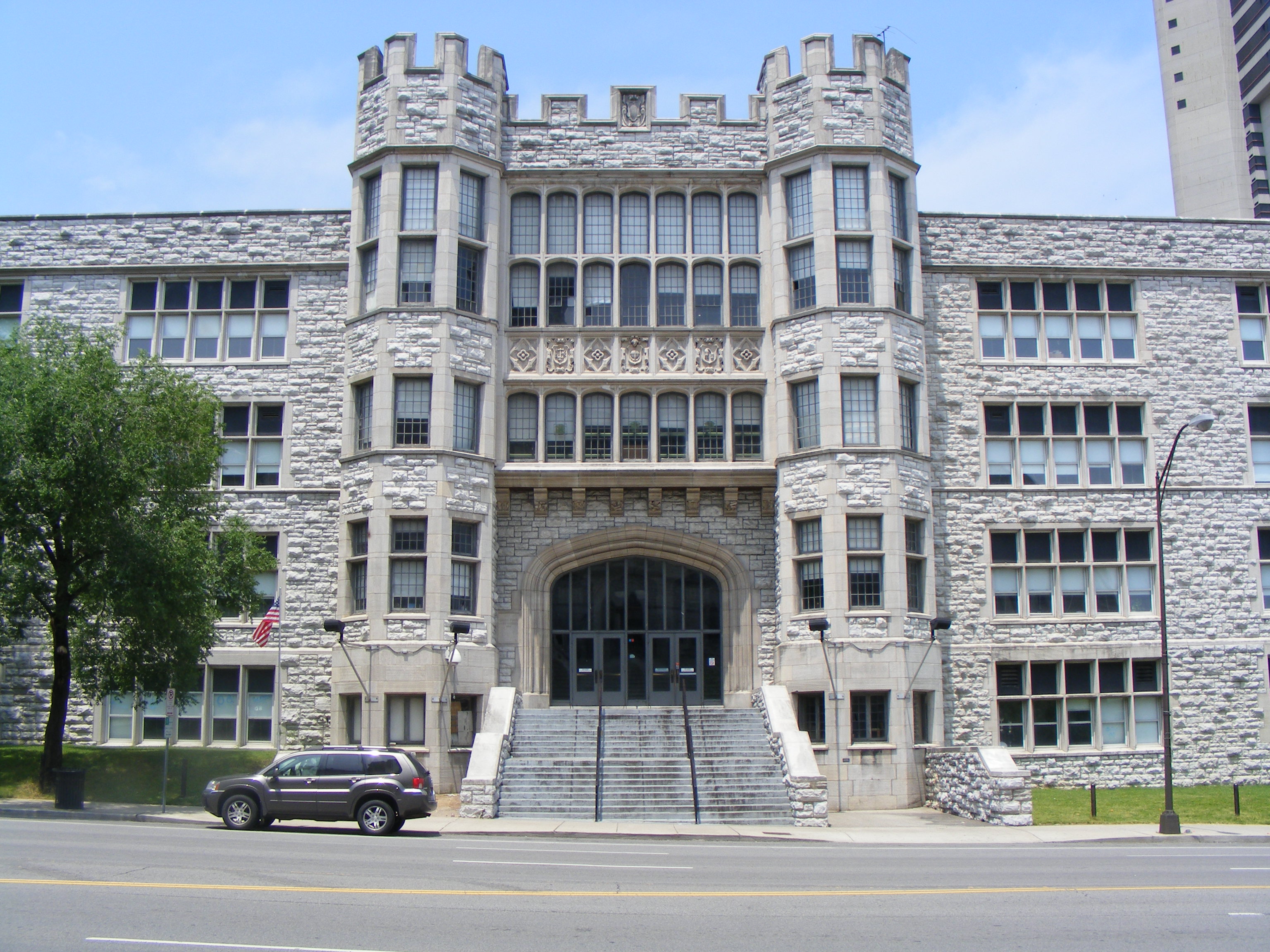
36°08′48″N 86°45′50″W / 36.146667°N 86.763889°WNashville 85 Hume-Fogg High School 
October 16, 1974 700 Broad St.
36°09′34″N 86°46′55″W / 36.159444°N 86.781944°WNashville 86 Jubilee Hall, Fisk University 
December 9, 1971 17th Ave., N.
36°10′08″N 86°48′17″W / 36.168889°N 86.804722°WNashville 87 Thomas P. Kennedy, Jr., House October 27, 2003 6231 Hillsboro Pike
36°03′21″N 86°51′31″W / 36.055833°N 86.858611°WForest Hills 88 Lakewood Commercial District May 24, 1985 Roughly bounded by 22nd St. and Old Hickory Boulevard
36°14′55″N 86°38′32″W / 36.248611°N 86.642222°WLakewood 89 Lebanon Road Stone Arch Bridge 
May 13, 1987 Over Brown's Creek at Lebanon Rd.
36°09′16″N 86°44′33″W / 36.154444°N 86.7425°WNashville 90 Lindsley Avenue Church of Christ 
May 15, 1984 3 Lindsley Ave.
36°09′08″N 86°46′07″W / 36.152222°N 86.768611°WNashville 91 Litterer Laboratory 
January 9, 1978 631 2nd Ave., S.
36°09′15″N 86°46′13″W / 36.154167°N 86.770278°WNashville 92 Little Sisters of the Poor Home for the Aged July 25, 1985 1400 18th Ave., S.
36°08′27″N 86°47′44″W / 36.140833°N 86.795556°WNashville 93 Longleat February 16, 1984 5819 Hillsboro Rd.
36°04′37″N 86°50′27″W / 36.076944°N 86.840833°WNashville 94 Longview January 12, 1983 811 Caldwell Lane
36°06′10″N 86°46′19″W / 36.102778°N 86.771944°WNashville 95 Hulda Margaret Lyttle Hall of Meharry Medical College 
July 27, 1998 1005 Dr. D. B. Todd, Jr., Boulevard
36°10′02″N 86°48′18″W / 36.167222°N 86.805°WNashville 96 Marathon Motor Works 
January 4, 1996 1200–1310 and 1305 Clinton St.
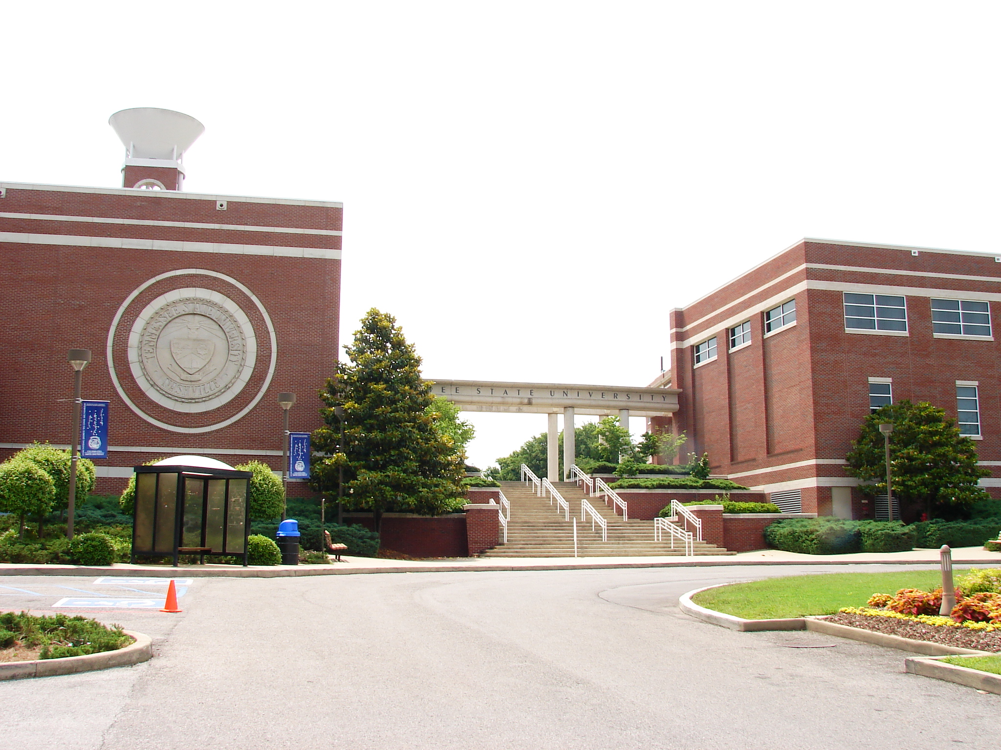
36°09′53″N 86°47′44″W / 36.164722°N 86.795556°WNashville 97 Dr. Richard and Mrs Margaret Martin House March 22, 2007 825 Kendall Dr.
36°08′02″N 86°51′53″W / 36.133889°N 86.864722°WNashville 98 Richard E. Martin House October 27, 2003 30 Castlewood Court
36°04′22″N 86°50′43″W / 36.072778°N 86.845278°WForest Hills 99 McCrory-Mayfield House December 27, 1982 1280 Hickory Boulevard
36°02′31″N 86°49′41″W / 36.041944°N 86.828056°WBrentwood 100 McGavock-Gatewood-Webb House July 11, 2007 908 Meridian St.
36°11′15″N 86°46′07″W / 36.1875°N 86.768611°WNashville 101 Mechanical Engineering Hall, Vanderbilt University December 13, 1978 Grand Ave. and 21st Ave., S.
36°08′50″N 86°48′00″W / 36.147222°N 86.8°WNashville 102 Miles House 
January 8, 1979 631 Woodland St.
36°10′25″N 86°45′38″W / 36.173611°N 86.760556°WNashville 103 Dr. Cleo Miller House August 25, 1995 1431 Shelton Ave.
36°12′37″N 86°43′14″W / 36.210258°N 86.720442°WNashville 104 Morris Memorial Building 
January 2, 1985 330 Charlotte Ave.
36°10′01″N 86°46′49″W / 36.166944°N 86.780278°WNashville 105 Mount Olivet Cemetery 
November 25, 2005 1101 Lebanon Pike
36°09′02″N 86°43′58″W / 36.150556°N 86.732778°WNashville 106 Municipal Public Works Garage Industrial District November 29, 2010 33 Peabody St.
36°09′27″N 86°46′06″W / 36.1575°N 86.768333°WNashville 107 Nashville Arcade 
May 22, 1973 Between 4th and 5th Aves.
36°09′51″N 86°46′48″W / 36.164167°N 86.78°WNashville 108 Nashville Children's Museum 
May 6, 1971 724 2nd Ave., S.
36°09′15″N 86°46′05″W / 36.154167°N 86.768056°WNashville 109 Nashville Christian Institute Gymnasium 
March 10, 2005 2420 Batavia St.
36°09′40″N 86°48′47″W / 36.161111°N 86.813056°WNashville 110 Nashville City Cemetery 
October 18, 1972 1001 S. 4th Ave.
36°08′51″N 86°46′12″W / 36.1475°N 86.77°WNashville 111 Nashville Financial Historic District 
March 20, 2002 3rd Ave., N. and Union St.
36°09′56″N 86°46′42″W / 36.165556°N 86.778333°WNashville 112 Nashville National Cemetery 
December 20, 1996 1420 Gallatin Rd., S
36°14′28″N 86°43′35″W / 36.241111°N 86.726389°WNashville 113 Nashville Union Station and Trainshed 
December 30, 1969 Broadway and 10th Ave.
36°09′24″N 86°47′04″W / 36.156667°N 86.784444°WNashville 114 Newsom's Mill September 13, 1976 West of Nashville on the Big Harpeth River
36°04′49″N 86°59′47″W / 36.080278°N 86.996389°WNashville 115 Noel Hotel 
October 10, 1984 200-204 N. 4th Ave.
36°09′50″N 86°46′46″W / 36.163889°N 86.779444°WNashville 116 Oglesby School November 15, 2002 5724 Edmondson Pike
36°02′15″N 86°44′34″W / 36.0375°N 86.742778°WNashville 117 Old Hickory Historic District May 24, 1985 Bordered by Hadley Ave., Jones St., 8th St., Riverside Dr. and 15th Ave.
36°15′32″N 86°38′42″W / 36.258889°N 86.645°WOld Hickory 118 Old Hickory Methodist Church May 24, 1985 1216 Hadley Ave.
36°15′28″N 86°38′52″W / 36.257778°N 86.647778°WOld Hickory 119 Old Natchez Trace May 30, 1975 From the Alabama/Tennessee border to State Route 100 in Davidson County Nashville Extends into Hickman, Lawrence, Lewis, Maury, Wayne, and Williamson counties 120 Omohundro Water Filtration Complex District 
May 13, 1987 Northeast of Omohundro Dr.
36°09′43″N 86°43′23″W / 36.161944°N 86.723056°WNashville 121 Overbrook March 29, 1984 4218 Harding Rd.
36°07′55″N 86°50′35″W / 36.131944°N 86.843056°WNashville 122 Overton Lane July 17, 1980 Kirkman Lane
36°05′12″N 86°48′01″W / 36.086667°N 86.800278°WOak Hill 123 The Parthenon 
February 23, 1972 Centennial Park
36°08′59″N 86°48′49″W / 36.149722°N 86.813611°WNashville 124 Peabody College for Teachers 
October 15, 1966 21st Ave., S. and Edgehill Ave.
36°08′30″N 86°47′55″W / 36.141667°N 86.798611°WNashville 125 Pearl High School 
August 2, 2002 613 17th Ave., N.
36°09′43″N 86°48′01″W / 36.161944°N 86.800278°WNashville 126 Thomas W. Phillips Memorial November 9, 2006 1101 19th Ave., S.
36°08′50″N 86°47′52″W / 36.147222°N 86.797778°WNashville 127 Dr. Cobb Pilcher House October 27, 2003 5335 Stanford Dr.
36°04′55″N 86°49′37″W / 36.081944°N 86.826944°WForest Hills 128 Primitive Baptist Church 
May 15, 1984 627-629 3rd Ave., S.
36°09′15″N 86°46′19″W / 36.154167°N 86.771944°WNashville 129 Printers Alley Historic District 
August 26, 1982 Roughly bounded by 3rd and 4th Aves., Bank Alley, and both sides of Church St.
36°09′51″N 86°46′43″W / 36.164167°N 86.778611°WNashville 130 Rich-Schwartz Building 
October 10, 1984 202-204 N. 6th Ave.
36°09′47″N 86°46′56″W / 36.163056°N 86.782222°WNashville 131 Richland Hall September 1, 1983 4822 Charlotte Ave.
36°09′08″N 86°50′45″W / 36.152222°N 86.845833°WNashville 132 Richland-West End Historic District April 16, 1979 Roughly bounded by railroad tracks, Murphy Rd., and Park Circle, Wilson, and Richland Aves.
36°08′13″N 86°49′44″W / 36.136944°N 86.828889°WNashville 133 Riverwood 
July 20, 1977 1833 Welcome Lane
36°12′N 86°43′W / 36.2°N 86.71°WNashville 134 James Robertson Hotel 
October 10, 1984 118 N. 7th Ave.
36°09′37″N 86°46′54″W / 36.160278°N 86.781667°WNashville 135 Robincroft July 10, 1978 746 Benton Ave.
36°07′57″N 86°46′39″W / 36.1325°N 86.7775°WNashville 136 Rutledge Hill Historic District 
July 8, 1980 Roughly bounded by Middleton, 2nd, Lea, and Hermitage Aves.
36°09′19″N 86°46′09″W / 36.155278°N 86.769167°WNashville 137 Ryman Auditorium 
May 6, 1971 116 5th Ave., N.
36°09′39″N 86°46′44″W / 36.160833°N 86.778889°WNashville 138 St. Ann's Episcopal Church 
November 18, 1983 419 Woodland St.
36°10′18″N 86°45′56″W / 36.171667°N 86.765556°WNashville 139 St. Cecilia Academy 
December 12, 1976 8th Ave. and Clay St.
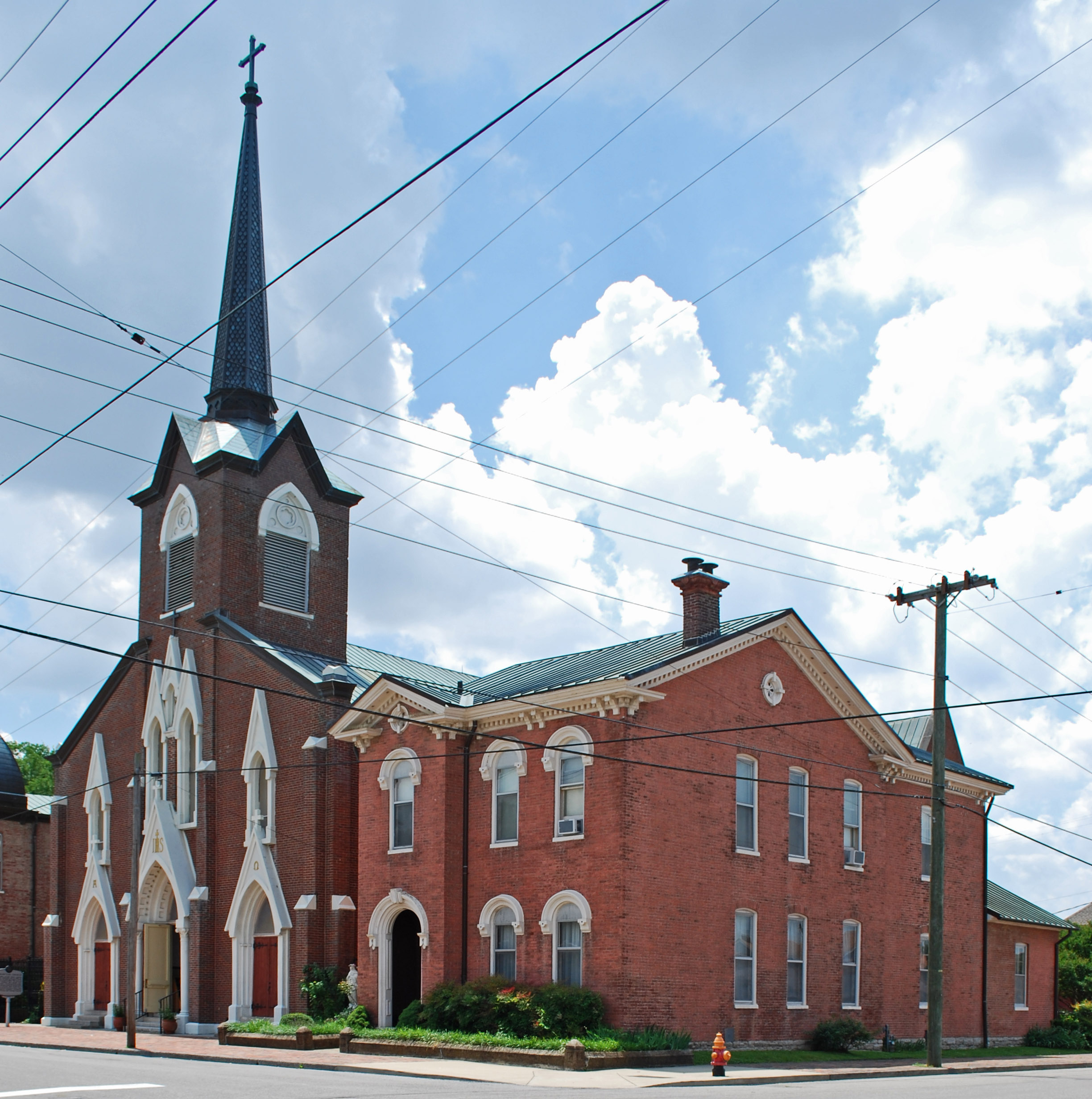
36°11′13″N 86°48′04″W / 36.186944°N 86.801111°WNashville 140 St. Mary's Catholic Church 
July 8, 1970 330 5th Ave., N.
36°09′57″N 86°46′53″W / 36.165833°N 86.781389°WNashville 141 St. Patrick's Catholic Church and Rectory 
May 15, 1984 1219 2nd Ave., S.
36°08′39″N 86°45′51″W / 36.144167°N 86.764167°WNashville 142 Sandbar Village July 22, 1994 Address Restricted Nashville 143 Savage House 
January 11, 1983 167 8th Ave., N.
36°09′39″N 86°47′01″W / 36.160833°N 86.783611°WNashville 144 Scarritt College Historic District August 26, 1982 19th Ave., S.
36°08′46″N 86°47′48″W / 36.146111°N 86.796667°WNashville 145 Second Avenue Commercial District 
February 23, 1972 2nd Ave. between Brandon St. and Broadway
36°09′50″N 86°46′35″W / 36.163889°N 86.776389°WNashville 146 Abner T. Shaw House March 28, 1985 4866 Brick Church Pike
36°18′53″N 86°46′38″W / 36.314722°N 86.777222°WGoodlettsville 147 Shelby Street Bridge 
November 20, 1986 Over the Cumberland River at Shelby St.
36°09′43″N 86°46′19″W / 36.161944°N 86.771944°WNashville 148 Smith Farmhouse November 17, 1983 State Route 100; also 8600 State Route 100, north and west of the original boundaries
36°02′09″N 86°58′54″W / 36.035833°N 86.981667°WPasquo 8600 State Route 100 represents a boundary increase of June 24, 1991 149 Southern Methodist Publishing House 
September 13, 1984 810 Broadway
36°09′31″N 86°46′57″W / 36.158611°N 86.7825°WNashville 150 Stone Hall November 17, 2010 1014 Stones River Rd.
36°11′16″N 86°37′58″W / 36.187778°N 86.632778°WNashville 151 Frederick Stump House April 2, 1973 4949 Buena Vista Pike
36°13′22″N 86°49′31″W / 36.222778°N 86.825278°WNashville 152 Sunnyside October 1, 1974 3000 Granny White Pike
36°07′09″N 86°47′20″W / 36.119167°N 86.788889°WNashville 153 Tanglewood Historic District July 20, 1998 4907, 4909, and 4911 Tanglewood Dr.; also 4905 Tanglewood Dr.
36°14′07″N 86°43′02″W / 36.2354°N 86.717233°WNashville 4905 Tanglewood represents a boundary increase of March 19, 1999 154 Temple Cemetery 
May 12, 2004 2001 15th Ave. N
36°11′09″N 86°48′41″W / 36.185833°N 86.811389°WNashville 155 Tennessee Manufacturing Company 
June 25, 1999 1400 8th Ave., N.
36°10′43″N 86°47′32″W / 36.178611°N 86.792222°WNashville 156 Tennessee State Capitol 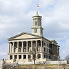
July 8, 1970 Capitol Hill
36°09′57″N 86°47′03″W / 36.165833°N 86.784167°WNashville 157 Tennessee State Library and Archives 
November 17, 2003 403 7th Ave., N.
36°09′56″N 86°47′07″W / 36.165556°N 86.785278°WNashville 158 Tennessee State Office Building July 13, 2011 6th Ave., N. & Charlotte Ave.
36°09′58″N 86°46′57″W / 36.166111°N 86.7825°WNashville 159 Tennessee State University Historic District 
June 14, 1996 3500 John A. Merritt Boulevard
36°10′00″N 86°49′48″W / 36.166667°N 86.83°WNashville 160 Third Baptist Church 
October 31, 1979 906 and 908 Monroe St.
36°10′30″N 86°47′43″W / 36.175°N 86.795278°WNashville 161 Travellers' Rest 
December 30, 1969 Franklin Rd.
36°04′15″N 86°46′05″W / 36.070833°N 86.768056°WNashville 162 Tulip Grove 
February 26, 1970 Lebanon Rd.
36°12′45″N 86°36′21″W / 36.2125°N 86.605833°WHermitage 163 Two Rivers February 23, 1972 3130 McGavock Pike
36°11′23″N 86°40′39″W / 36.189722°N 86.6775°WNashville 164 US Post Office 
November 15, 1984 901 Broadway
36°09′28″N 86°47′02″W / 36.157778°N 86.783889°WNashville 165 U.S. Naval Reserve Training Center July 6, 2011 1515 Davidson St.
36°09′52″N 86°44′27″W / 36.164444°N 86.740833°WNashville 166 US Post Office-Old Hickory August 6, 1985 1010 Donelson Ave.
36°15′49″N 86°39′02″W / 36.263611°N 86.650556°WOld Hickory 167 Utopia Hotel March 26, 1979 206 4th Ave., N.
36°09′51″N 86°46′43″W / 36.164167°N 86.778611°WNashville 168 Warner Park Historic Park January 20, 1984 Roughly bounded by the Little Harpeth River, Belle Meade Boulevard, State Route 100, and Chickering Rd.
36°03′47″N 86°53′30″W / 36.063056°N 86.891667°WNashville Extends into Williamson County 169 Waverly Place Historic District March 28, 1985 Roughly bounded by Beech, Douglas, and Bradford Aves., 10th Ave., S., and Acklen Ave.
36°07′51″N 86°46′56″W / 36.130833°N 86.782222°WNashville 170 Weakley-Truett-Clark House April 13, 1989 415 Rosebank Ave.
36°11′15″N 86°43′14″W / 36.1875°N 86.720556°WNashville 171 West End High School August 1, 2003 3529 West End Ave.
36°07′54″N 86°49′26″W / 36.131667°N 86.823889°WNashville 172 West Meade March 4, 1975 Old Harding Pike
36°06′02″N 86°52′40″W / 36.100556°N 86.877778°WNashville 173 Whites Creek Historic District August 16, 1984 Whites Creek Pike and Old Hickory Boulevard
36°15′32″N 86°49′43″W / 36.258889°N 86.828611°WWhites Creek 174 Whitland Area Neighborhood July 24, 2007 Roughly bounded by Whitland Ave., Bowling Ave., S. Wilson Boulevard, and a tributary of Richland Creek.
36°07′41″N 86°49′46″W / 36.128033°N 86.829367°WNashville 175 Wilkinson House November 29, 2006 7663 Wilkinson Rd.
36°20′58″N 86°51′14″W / 36.349444°N 86.853889°WJoelton 176 Woman's Club of Nashville (J.B. Daniel House) July 19, 2010 3206 Hillsboro Pike
36°07′05″N 86°48′33″W / 36.118056°N 86.809167°WNashville 177 Woodland in Waverly Historic District March 25, 1982 Roughly bounded by Interstate 65, 8th, Bradford and Wedgewood Aves.
36°07′54″N 86°46′38″W / 36.131667°N 86.777222°WNashville 178 Woodlawn November 21, 1978 127 Woodmont Boulevard
36°07′22″N 86°50′46″W / 36.122778°N 86.846111°WNashville 179 Woodmont Terrace Apartments April 21, 2003 920 Woodmont Blvd.
36°06′41″N 86°47′00″W / 36.11135°N 86.783431°WNashville 180 Young Women's Christian Association Building December 16, 1982 211 7th Ave., N.
36°09′47″N 86°47′01″W / 36.163056°N 86.783611°WNashville See also
- List of National Historic Landmarks in Tennessee
- National Register of Historic Places listings in Tennessee
References
- ^ The latitude and longitude information provided in this table was derived originally from the National Register Information System, which has been found to be fairly accurate for about 99% of listings. For about 1% of NRIS original coordinates, experience has shown that one or both coordinates are typos or otherwise extremely far off; some corrections may have been made. A more subtle problem causes many locations to be off by up to 150 yards, depending on location in the country: most NRIS coordinates were derived from tracing out latitude and longitudes off of USGS topographical quadrant maps created under the North American Datum of 1927, which differs from the current, highly accurate WGS84 GPS system used by Google maps. Chicago is about right, but NRIS longitudes in Washington are higher by about 4.5 seconds, and are lower by about 2.0 seconds in Maine. Latitudes differ by about 1.0 second in Florida. Some locations in this table may have been corrected to current GPS standards.
- ^ "National Register of Historic Places: Weekly List Actions". National Park Service, United States Department of the Interior. Retrieved on November 10, 2011.
- ^ Numbers represent an ordering by significant words. Various colorings, defined here, differentiate National Historic Landmark sites and National Register of Historic Places Districts from other NRHP buildings, structures, sites or objects.
- ^ "National Register Information System". National Register of Historic Places. National Park Service. . http://nrhp.focus.nps.gov/natreg/docs/All_Data.html.
- ^ Per the Historic Germantown website. NRIS gives location as "Off Interstate 40 and U.S. Route 41"
U.S. National Register of Historic Places Topics Lists by states Alabama • Alaska • Arizona • Arkansas • California • Colorado • Connecticut • Delaware • Florida • Georgia • Hawaii • Idaho • Illinois • Indiana • Iowa • Kansas • Kentucky • Louisiana • Maine • Maryland • Massachusetts • Michigan • Minnesota • Mississippi • Missouri • Montana • Nebraska • Nevada • New Hampshire • New Jersey • New Mexico • New York • North Carolina • North Dakota • Ohio • Oklahoma • Oregon • Pennsylvania • Rhode Island • South Carolina • South Dakota • Tennessee • Texas • Utah • Vermont • Virginia • Washington • West Virginia • Wisconsin • WyomingLists by territories Lists by associated states Other Municipalities and communities of Davidson County, Tennessee Cities Belle Meade | Berry Hill | Forest Hills | Goodlettsville‡ | Lakewood | Nashville (balance) | Oak Hill | Ridgetop‡

Unincorporated
communityHopewell | Joelton | Old Hickory | Pasquo | Whites Creek
Footnotes ‡This populated place also has portions in an adjacent county or counties
Categories:- National Register of Historic Places in Tennessee by county
- Davidson County, Tennessee
- Buildings and structures in Davidson County, Tennessee
-


Wikimedia Foundation. 2010.