- Mount Savage Historic District
-
Mount Savage Historic District
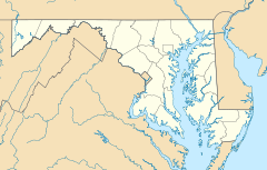

Location: Roughly bounded by Foundry Row, Jennings Run, New School Rd., Yellow Row, Cherry St., and Columbia Ave., Mount Savage, Maryland Coordinates: 39°41′47″N 78°52′49″W / 39.69639°N 78.88028°WCoordinates: 39°41′47″N 78°52′49″W / 39.69639°N 78.88028°W Built: 1830 Architectural style: Bungalow/Craftsman, Queen Anne, Other Governing body: Local NRHP Reference#: 83004213
[1]Added to NRHP: September 08, 1983 The Mount Savage Historic District is a national historic district in Mount Savage, Allegany County, Maryland. It comprises 189 19th and 20th century buildings, structures, and sites within this industrial community northwest of Cumberland. The structures reflect the community's development as a center of the iron, coal, brick, and railroad industries from the 1830s to the early 20th century. Included are a set of vertical-board duplexes on Old Row built about 1840, and possibly the earliest examples of workers' housing remaining in the region.[2]
It was listed on the National Register of Historic Places in 1983.[1]
See also
References
- ^ a b "National Register Information System". National Register of Historic Places. National Park Service. 2008-04-15. http://nrhp.focus.nps.gov/natreg/docs/All_Data.html.
- ^ "Maryland Historical Trust". Mount Savage Historic District. Maryland Historical Trust. 2008-06-14. http://www.mht.maryland.gov/nr/NRDetail.aspx?HDID=762&COUNTY=Allegany&FROM=NRCountyList.aspx?COUNTY=Allegany.
External links
- Mount Savage Historic District, Allegany County, including photo in 2002, at Maryland Historical Trust
- Boundary Map of the Mount Savage Historic District, Allegany County, at Maryland Historical Trust
U.S. National Register of Historic Places in Maryland Lists by county Allegany • Anne Arundel • Baltimore County • Calvert • Caroline • Carroll • Cecil • Charles • Dorchester • Frederick • Garrett • Harford • Howard • Kent • Montgomery • Prince George's • Queen Anne's • Somerset • St. Mary's • Talbot • Washington • Wicomico • Worcester
Lists by city Other lists Categories:- Historic districts in Maryland
- Historic districts in Allegany County, Maryland
- National Register of Historic Places in Maryland
- Maryland Registered Historic Place stubs


Wikimedia Foundation. 2010.