- Monterville, West Virginia
-
Monterville, West Virginia — Unincorporated community — 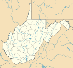
 Monterville, West Virginia
Coordinates: 38°33′32″N 80°06′18″W / 38.55889°N 80.105°WCoordinates: 38°33′32″N 80°06′18″W / 38.55889°N 80.105°W Country United States State West Virginia County Randolph Elevation 3,271 ft (997 m) Time zone Eastern (EST) (UTC-5) - Summer (DST) EDT (UTC-4) ZIP code 26282 Area code(s) 304 & 681 GNIS feature ID 1555153[1] Monterville is an unincorporated community in Randolph County, West Virginia, United States. Monterville is 12.5 miles (20.1 km) southwest of Huttonsville. Monterville has a post office with ZIP code 26282.[2]
References
- ^ "US Board on Geographic Names". United States Geological Survey. 2007-10-25. http://geonames.usgs.gov. Retrieved 2008-01-31.
- ^ ZIP Code Lookup
Municipalities and communities of Randolph County, West Virginia County seat: Elkins City 
Towns CDPs Bowden | Dailey | East Dailey | Helvetia | Pickens | Valley Bend | Valley Head
Unincorporated
communitiesFootnotes ‡This populated place also has portions in an adjacent county or counties
Categories:- Populated places in Randolph County, West Virginia
- Unincorporated communities in West Virginia
- Potomac Highlands geography stubs


Wikimedia Foundation. 2010.