- Meat Camp, North Carolina
-
Meat Camp — Unincorporated — Location within the state of North Carolina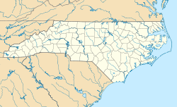
 Meat Camp
Coordinates: 36°17′58″N 81°40′35″W / 36.29944°N 81.67639°WCoordinates: 36°17′58″N 81°40′35″W / 36.29944°N 81.67639°W Country United States State North Carolina County Watauga County Elevation 3,402 ft (1,037 m) Time zone Eastern (EST) (UTC-5) - Summer (DST) EDT (UTC-4) ZIP code 28607 Area code(s) 828 GNIS feature ID 1021403[1] Meat Camp is an unincorporated community located in Watauga County, North Carolina, United States. It is supposedly named after a primitive packing house used by hunters since before the Revolutionary War.[2] The community is located on Meat Camp Road (via NC 194), north of Boone.
History
Situated along the Old Buffalo Trail and established before the Revolutionary War, Meat Camp was the location where hunters stored their dressed animal carcasses until they were ready to return to their homes in the lowlands. Between 1790-1800 a road was established through the area, connecting the Yadkin River Valley (near Wilkesboro) to Trade, Tennessee. In 1851, the Meat Camp Baptist Church was organized, establishing a permanent population in the area to this day.[2]
See also
References
- ^ "Meat Camp, North Carolina". Geographic Names Information System, U.S. Geological Survey. http://geonames.usgs.gov/pls/gnispublic/f?p=gnispq:3:::NO::P3_FID:1021403. Retrieved 2011-09-10.
- ^ a b Sakowski, Carolyn (2011). Touring the Western North Carolina Backroads. John F. Blair. ISBN 9780895875594.
Municipalities and communities of Watauga County, North Carolina County seat: Boone Towns Beech Mountain‡ | Blowing Rock‡ | Boone | Seven Devils‡

Unincorporated
communitiesAho | Deep Gap | Foscoe | Meat Camp | Sugar Grove | Valle Crucis | Vilas | Zionville
Footnotes ‡This populated place also has portions in an adjacent county or counties
Categories:- Populated places in Watauga County, North Carolina
- Unincorporated communities in North Carolina


Wikimedia Foundation. 2010.