- Maryland Route 244
-
Maryland Route 244

Route information Maintained by MDSHA Length: 10.48 mi[1] (16.87 km) Major junctions West end:  MD 5 near Leonardtown
East end:  MD 249 in Valley Lee
Location Counties: St. Mary's Highway system Maryland highway system
Interstate • US • State • Minor • Former • Turnpikes←  MD 243
MD 245  →
→Maryland Route 244 (MD 244) is a state highway in the U.S. state of Maryland. Known for most of its length as Medleys Neck Road, the state highway runs 10.48 miles (16.87 km) from MD 5 near Leonardtown east to MD 249 in Valley Lee. MD 244 parallels MD 5 in central St. Mary's County, serving several communities on Medleys Neck between Breton Bay and the St. Mary's River, including Beauvue. The state highway was constructed as part of three different state highways—MD 244 from Leonardtown, MD 250 from Valley Lee, and MD 251 through Drayden—between the late 1920s and late 1930s. MD 244 assumed the courses of MD 250 and MD 251 in the mid 1940s. The portion of MD 244 east of MD 249 was removed from the state highway system in the mid 1980s.
Contents
Route description
MD 244 begins at an intersection with MD 5 adjacent to Leonardtown High School, Leonardtown Middle School, and the St. Mary's County Fairgrounds. The state highway heads south from the Leonardtown area as two-lane road Medleys Neck Road through a forested area. After crossing Moldier Run, MD 244 passes by Foxes Point Lane, which leads to the Indian Village Archaeological Park. In the hamlet of Beauvue, the state highway intersects Breton Beach Road, which leads to a series of small beach resorts on Breton Bay and the Potomac River. MD 244 curves to the southeast and passes White Beach Beach Road, which leads to the namesake community. The state highway continues east, crossing Poplar Hill Creek before passing Mulberry Fields Road, which serves the namesake historic home. At Chingville Road, MD 244 curves to the south toward Valley Lee. In Valley Lee, the state highway turns east onto Blake Creek Road. MD 244 passes St. George's Episcopal Church before reaching its eastern terminus at MD 249 (Piney Point Road). A former section of MD 244, Drayden Road, heads east from MD 249 a short distance south of the MD 244 intersection. The county highway heads east through the hamlet of Drayden and the historic homes Porto Bello and West St. Mary's Manor on the St. Mary's River.[1][2]
History
MD 244 was constructed as part of three highways: MD 244 from the Leonardtown end, MD 250 from the Valley Lee end, and MD 251 along Drayden Road.[3] MD 244 was constructed from MD 5 to Beauvue in 1925 and 1926.[4][5] The state highway was extended east in 1-mile (1.6 km) segments in 1930, 1933, and 1934.[6][7][8][9] MD 244 was completed to near Chingville Road in 1939.[3][10] The first section of MD 250 was Blake Creek Road from MD 249 to the present right-angle turn onto Medleys Neck Road.[4][5] MD 250 was extended to near Chingville Road in two sections beginning in 1930 and completed in 1935.[6][7][8][9] MD 251 was constructed from MD 249 east to Cherryfield Road in Drayden in 1928 and east to Porto Bello in 1930.[6][11][12] The gap between MD 244 and MD 250 centered on Chingville Road was closed with the construction of 1.6 miles (2.6 km) of connecting highway around 1942.[13] By 1946, MD 244 was extended east over the lengths of MD 250 and MD 251.[14] MD 244 was reduced to its current length when the Drayden Road portion of the state highway was transferred to county maintenance around 1987.[15]
Junction list
The entire route is in St. Mary's County.
Location Mile[1] Destinations Notes Leonardtown 0.00 MD 5 (Point Lookout Road) – Leonardtown, St. Mary's CityWestern terminus Valley Lee 9.92 Blake Creek Road west MD 244 turns east onto Blake Creek Road 10.48 MD 249 (Piney Point Road) – St. George Island, CallawayEastern terminus 1.000 mi = 1.609 km; 1.000 km = 0.621 mi References
- ^ a b c "Highway Location Reference: St. Mary's County" (PDF). Maryland State Highway Administration. 2009. http://www.marylandroads.com/Location/2009_SAINTMARYS.pdf. Retrieved 2010-12-13.
- ^ Google, Inc. Google Maps – Maryland Route 244 (Map). Cartography by Google, Inc. http://maps.google.com/maps?f=d&source=s_d&saddr=MD-244%2FMedleys+Neck+Rd&daddr=MD-244%2FMedleys+Neck+Rd+to:MD-244%2FBlake+Creek+Rd&hl=en&geocode=FQoLSAIdUP9u-w%3BFSBpRwIdCjFv-w%3BFS7KRgIdTn1w-w&mra=ls&sll=38.197821,-76.52338&sspn=0.01548,0.038581&ie=UTF8&t=h&z=12. Retrieved 2010-12-13.
- ^ a b Maryland State Roads Commission. General Highway Map: State of Maryland (Map) (1939 ed.).
- ^ a b Report of the State Roads Commission of Maryland. 1924-1926. Baltimore: Maryland State Roads Commission. January 1927. pp. 36, 65. http://www.archive.org/details/annualreportsofs1924mary. Retrieved 2010-12-13.
- ^ a b Maryland Geological Survey. Map of Maryland: Showing State Road System and State Aid Roads (Map) (1927 ed.).
- ^ a b c Report of the State Roads Commission of Maryland. 1927-1930. Baltimore: Maryland State Roads Commission. 1930-10-01. pp. 226–227. http://www.archive.org/details/reportofstateroa1927mary. Retrieved 2010-12-13.
- ^ a b Maryland Geological Survey. Map of Maryland Showing State Road System: State Aid Roads and Improved County Road Connections (Map) (1933 ed.).
- ^ a b Report of the State Roads Commission of Maryland. 1931-1934. Baltimore: Maryland State Roads Commission. 1934-12-28. p. 353. http://www.archive.org/details/reportofstateroa1931mary. Retrieved 2010-12-13.
- ^ a b Maryland Geological Survey. Map of Maryland Showing State Road System: State Aid Roads and Improved County Road Connections (Map) (1935 ed.).
- ^ Report of the State Roads Commission of Maryland. 1939-1940. Baltimore: Maryland State Roads Commission. 1941-03-15. p. 114. http://www.archive.org/details/reportofstateroa1939mary. Retrieved 2010-12-13.
- ^ Maryland Geological Survey. Map of Maryland: Showing State Road System and State Aid Roads (Map) (1928 ed.).
- ^ Maryland Geological Survey. Map of Maryland Showing State Road System: State Aid Roads and Improved County Road Connections (Map) (1930 ed.).
- ^ Report of the State Roads Commission of Maryland. 1941-1942. Baltimore: Maryland State Roads Commission. 1943-03-15. p. 95. http://www.archive.org/details/reportofstateroa1941mary. Retrieved 2010-12-13.
- ^ Maryland State Roads Commission. Maryland: Official Highway Map (Map) (1946-47 ed.).
- ^ Maryland State Highway Administration. Maryland: Official Highway Map (Map) (1987 ed.).
External links
Roads in St. Mary's County, Maryland State highways 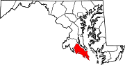 Categories:
- State highways in Maryland
- Roads in St. Mary's County, Maryland


Wikimedia Foundation. 2010.