- Maryland Route 243
-
Maryland Route 243
Newtowne Neck Road 
Map of Southern Maryland with MD 243 highlighted in redRoute information Maintained by MDSHA Length: 4.66 mi[1] (7.50 km) Major junctions South end: St. Francis Xavier Church near Compton North end:  MD 5 in Leonardtown
Location Counties: St. Mary's Highway system Maryland highway system
Interstate • US • State • Minor • Former • Turnpikes←  MD 242
MD 244  →
→Maryland Route 243 (MD 243) is a state highway in the U.S. state of Maryland. Known as Newtowne Neck Road, the state highway runs 4.66 miles (7.50 km) from St. Francis Xavier Church near Compton north to MD 5 in Leonardtown. MD 243 serves communities on the Newtowne Neck peninsula between St. Clements Bay to the west and Breton Bay to the east in central St. Mary's County. The state highway was constructed between the early 1920s and early 1930s. MD 243 was relocated at its northern terminus in the 1970s.
Contents
Route description
MD 243 begins at a dead end adjacent to St. Francis Xavier Church within the St. Francis Xavier Church and Newtown Manor House Historic District. The state highway heads west through the postage-stamp historic district and curves to the north, meeting Newtowne Neck Road on a tangent. That county-maintained portion of Newtowne Neck Road heads south to the end of the Newtowne Neck peninsula. MD 243 heads north through a mix of farmland and forest to the hamlet of Compton, where the highway intersects Bayside Road, which leads to the waterfront community of St. Clement Shores. The state highway veers northeast and intersects Bull Road, which leads to the Society Hill neighborhood and Breton Bay Country Club. MD 243 continues north, crossing Nelson Run and briefly entering the town of Leonardtown before the highway reaches its northern terminus at MD 5 (Point Lookout Road).[1][2]
History
MD 243 was constructed as a gravel road in four sections between the early 1920s and early 1930s. The highway was built from MD 5 to Wathen Road around 1923.[3] MD 243 was extended south to Rosebank Road in Compton in 1924.[4][5] The state highway was extended slightly south to Bayside Road in 1930.[6][7] Finally, MD 243 was extended south to its present terminus at St. Francis Xavier Church in 1932.[8][9] MD 243's original northern terminus was adjacent to McIntosh Run, to the east of its present terminus.[10] MD 243's intersection with MD 5 was relocated to form a four-way intersection with Maypole Road by 1978; the segment of old alignment between MD 243 and MD 5 was designated MD 943.[11] MD 943, which is now assigned to Warren Road in Cockeysville in Baltimore County, was removed from the state highway system in 1999.[12]
Junction list
The entire route is in St. Mary's County.
Location Mile[1] Destinations Notes Compton 0.00 St. Francis Xavier Church Southern terminus Leonardtown 4.66 MD 5 (Point Lookout Road) / Maypole Road north – St. Mary's County, WaldorfNorthern terminus 1.000 mi = 1.609 km; 1.000 km = 0.621 mi References
- ^ a b c "Highway Location Reference: St. Mary's County" (PDF). Maryland State Highway Administration. 2009. http://www.marylandroads.com/Location/2009_SAINTMARYS.pdf. Retrieved 2010-12-09.
- ^ Google, Inc. Google Maps – Maryland Route 243 (Map). Cartography by Google, Inc. http://maps.google.com/maps?f=d&source=s_d&saddr=MD-243+N%2FNewtowne+Neck+Rd&daddr=Compton+Rd%2FNewtowne+Neck+Rd&hl=en&geocode=Fc29RwIdOqJt-w%3BFTx-SAIdxkhu-w&mra=ls&sll=38.304857,-76.658628&sspn=0.001932,0.004823&ie=UTF8&t=h&z=13. Retrieved 2010-12-09.
- ^ Maryland Geological Survey. Map of Maryland: Showing State Road System and State Aid Roads (Map) (1923 ed.).
- ^ Report of the State Roads Commission of Maryland. 1924-1926. Baltimore: Maryland State Roads Commission. January 1927. pp. 36, 65. http://www.archive.org/details/annualreportsofs1924mary. Retrieved 2010-12-09.
- ^ Maryland Geological Survey. Map of Maryland: Showing State Road System and State Aid Roads (Map) (1927 ed.).
- ^ Report of the State Roads Commission of Maryland. 1927-1930. Baltimore: Maryland State Roads Commission. 1930-10-01. p. 226. http://www.archive.org/details/reportofstateroa1927mary. Retrieved 2010-12-09.
- ^ Maryland Geological Survey. Map of Maryland Showing State Road System: State Aid Roads and Improved County Road Connections (Map) (1930 ed.).
- ^ Report of the State Roads Commission of Maryland. 1931-1934. Baltimore: Maryland State Roads Commission. 1934-12-28. p. 352. http://www.archive.org/details/reportofstateroa1931mary. Retrieved 2010-12-09.
- ^ Maryland Geological Survey. Map of Maryland Showing State Road System: State Aid Roads and Improved County Road Connections (Map) (1933 ed.).
- ^ United States Geological Survey. Leonardtown, MD quadrangle (Map). 1:48,000. 15 Minute Series (Topographic) (1939 ed.). http://historical.mytopo.com/quad.cfm?quadname=Leonardtown&state=MD&series=15. Retrieved 2010-12-02.
- ^ Maryland State Highway Administration. Maryland: Official Highway Map (Map) (1978 ed.).
- ^ "Highway Location Reference: St. Mary's County" (PDF). Maryland State Highway Administration. 1999. http://www.marylandroads.com/Location/1999_SAINTMARYS.pdf. Retrieved 2010-12-09.
External links
Roads in St. Mary's County, Maryland State highways 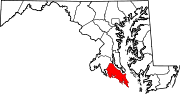 Categories:
- State highways in Maryland
- Roads in St. Mary's County, Maryland


Wikimedia Foundation. 2010.