- Dhungesaghu
-
Dhungesaghu — Village development committee — Location in Nepal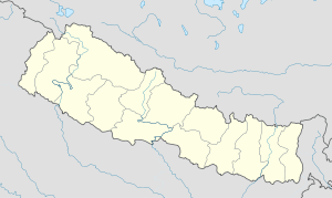
 Dhungesaghu
Coordinates: 27°21′N 87°34′E / 27.35°N 87.57°ECoordinates: 27°21′N 87°34′E / 27.35°N 87.57°E Country  Nepal
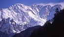
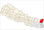
NepalZone Mechi Zone District Taplejung District Population (1991) – Total 4,203 Time zone Nepal Time (UTC+5:45) Dhungesaghu is a village development committee in the Himalayas of Taplejung District in the Mechi Zone of north-eastern Nepal. At the time of the 1991 Nepal census it had a population of 4203 people living in 750 individual households.[1]
References
- ^ "Nepal Census 2001". Nepal's Village Development Committees. Digital Himalaya. http://www.digitalhimalaya.com/collections/nepalcensus/form.php?selection=1. Retrieved 19 November 2008.
External links
Ambegudin · Ankhop · Chaksibote · Change · Dhungesaghu · Dokhu · Dummrise · Ekhabu · Hangdeva · Hangpang · Kalikhola · Khamlung · Khejenim · Khewang · Khokling · Lelep · Limbudin · Lingtep · Linkhim · Liwang · Mamangkhe · Nalbu · Nankholyang · Nidhuradin · Olangchung Gola · Paidang · Papung · Pedang · Phakumba · Phawakhola · Phulbari · Phungling · Phurumbu · Sadewa · Sangu · Santhakra · Sawa · Sawadin · Sawalakhu · Sikaicha · Sinam · Surumakhim · Tapethok · Tellok · Thechambu · Thinglabu · Thukima · Thumbedin · Tiringe · Yamfudin
 Categories:
- Populated places in Taplejung District
- Mechi Zone geography stubs


Wikimedia Foundation. 2010.