- Daphnedale Park, California
-
Daphnedale Park — census-designated place — Location in California
 Daphnedale Park
Coordinates: 41°30′33″N 120°32′42″W / 41.50917°N 120.545°WCoordinates: 41°30′33″N 120°32′42″W / 41.50917°N 120.545°W Country  United States
State  California
County Modoc Area[1] – Total 1.333 sq mi (3.451 km2) – Land 1.331 sq mi (3.447 km2) – Water 0.002 sq mi (0.005 km2) 0.13% Elevation[2] 4,449 ft (1,356 m) Population (2010) – Total 184 – Density 138.1/sq mi (53.3/km2) Time zone Pacific (PST) (UTC-8) – Summer (DST) PDT (UTC-7) ZIP Code Area code(s) 530 GNIS feature IDs 1658375; 2582990 U.S. Geological Survey Geographic Names Information System: Daphnedale Park, California; U.S. Geological Survey Geographic Names Information System: Daphnedale Park, California Daphnedale Park is a census-designated place[3] in Modoc County, California.[2] It is located 1.5 miles (2.4 km) north of Alturas,[4] at an elevation of 4449 feet (1356 m).[2] The population was 184 at the 2010 census.
Geography
Two parallel primary streets, Saralane and Lucilane, access the Daphnedale subdivision from the northern boundary of the city of Alturas at W. 19th St.[5]
According to the United States Census Bureau, the CDP covers an area of 1.3 square miles (3.5 km²), 99.87% of it land, and 0.13% of it water.
Demographics
The 2010 United States Census[6] reported that Daphnedale Park had a population of 184. The population density was 138.1 people per square mile (53.3/km²). The racial makeup of Daphnedale Park was 166 (90.2%) White, 2 (1.1%) African American, 6 (3.3%) Native American, 0 (0.0%) Asian, 4 (2.2%) Pacific Islander, 2 (1.1%) from other races, and 4 (2.2%) from two or more races. Hispanic or Latino of any race were 18 persons (9.8%).
The Census reported that 184 people (100% of the population) lived in households, 0 (0%) lived in non-institutionalized group quarters, and 0 (0%) were institutionalized.
There were 76 households, out of which 23 (30.3%) had children under the age of 18 living in them, 37 (48.7%) were opposite-sex married couples living together, 7 (9.2%) had a female householder with no husband present, 2 (2.6%) had a male householder with no wife present. There were 4 (5.3%) unmarried opposite-sex partnerships, and 0 (0%) same-sex married couples or partnerships. 23 households (30.3%) were made up of individuals and 8 (10.5%) had someone living alone who was 65 years of age or older. The average household size was 2.42. There were 46 families (60.5% of all households); the average family size was 3.09.
The population was spread out with 40 people (21.7%) under the age of 18, 15 people (8.2%) aged 18 to 24, 34 people (18.5%) aged 25 to 44, 72 people (39.1%) aged 45 to 64, and 23 people (12.5%) who were 65 years of age or older. The median age was 45.8 years. For every 100 females there were 121.7 males. For every 100 females age 18 and over, there were 97.3 males.
There were 83 housing units at an average density of 62.3 per square mile (24.0/km²), of which 55 (72.4%) were owner-occupied, and 21 (27.6%) were occupied by renters. The homeowner vacancy rate was 1.8%; the rental vacancy rate was 4.5%. 130 people (70.7% of the population) lived in owner-occupied housing units and 54 people (29.3%) lived in rental housing units.
References
- ^ U.S. Census
- ^ a b c U.S. Geological Survey Geographic Names Information System: Daphnedale Park, California
- ^ U.S. Geological Survey Geographic Names Information System: Daphnedale Park, California
- ^ Durham, David L. (1998). California's Geographic Names: A Gazetteer of Historic and Modern Names of the State. Quill Driver Books. p. 370. ISBN 9781884995149.
- ^ "Daphnedale Park, a Populated Place in Modoc County, California". CA HomeTownLocator. 2007-12-06. http://california.hometownlocator.com/maps/bigmap,n,daphnedale%20park,fid,1658375.cfm. Retrieved 2010-02-11.
- ^ All data are derived from the United States Census Bureau reports from the 2010 United States Census, and are accessible on-line here. The data on unmarried partnerships and same-sex married couples are from the Census report DEC_10_SF1_PCT15. All other housing and population data are from Census report DEC_10_DP_DPDP1. Both reports are viewable online or downloadable in a zip file containing a comma-delimited data file. The area data, from which densities are calculated, are available on-line here. Percentage totals may not add to 100% due to rounding. The Census Bureau defines families as a household containing one or more people related to the householder by birth, opposite-sex marriage, or adoption. People living in group quarters are tabulated by the Census Bureau as neither owners nor renters. For further details, see the text files accompanying the data files containing the Census reports mentioned above.
Municipalities and communities of Modoc County, California City 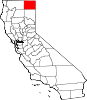
CDPs Adin | California Pines | Canby | Cedarville | Daphnedale Park | Eagleville | Fort Bidwell | Lake City | Likely | Lookout | New Pine Creek | Newell
Unincorporated
communitiesAmbrose | Boles | Bormister | Brooks Mill | Campbell | Cantrall Mill | Christensen | Copic | Cornell | D Flourney | Dalton | Davis Creek | Day | Demuth | Derner | Dibble Place | Fairport | Fletcher Place | Flourney | Grizzlie Place | Hackamore | Hannchen | Harper | Homestead | Juniper | K Flourney | Kalina | Kandra | Kauffman | Kephart | Lakeview Junction | Liskey | Lookout Junction | Mammoth | McArthur | McGarva | Meares | Menlo Baths | Mulkey Place | Old Hulbert Place | Perez | R Flourney | Ramsey | Scarface | Staley | Stronghold | Surprise Station | Tionesta | Tuber | Vestil | White Horse | Williams | Willow Ranch
Indian
reservationsAlturas Indian Rancheria | Fort Bidwell Reservation | XL Rancheria
Former
settlementsCategories:- Census-designated places in Modoc County, California
- Unincorporated communities in California


Wikimedia Foundation. 2010.