- Cedarville, California
-
Cedarville — census-designated place — Satellite Imagery of Cedarville, CA. Taken on September 29, 1999 Location in California
 Cedarville
Coordinates: 41°31′45″N 120°10′24″W / 41.52917°N 120.17333°WCoordinates: 41°31′45″N 120°10′24″W / 41.52917°N 120.17333°W Country  United States
State  California
County Modoc Area[1] – Total 5.445 sq mi (14.104 km2) – Land 5.441 sq mi (14.093 km2) – Water 0.004 sq mi (0.011 km2) 0.08% Elevation[2] 4,652 ft (1,418 m) Population (2010) – Total 514 – Density 94.4/sq mi (36.4/km2) Time zone Pacific (PST) (UTC-8) – Summer (DST) PDT (UTC-7) ZIP Code 96104 Area code(s) 530 GNIS feature ID 220805; 2582971 U.S. Geological Survey Geographic Names Information System: Cedarville, California; U.S. Geological Survey Geographic Names Information System: Cedarville, California Cedarville (formerly, Surprise Valley and Deep Creek)[3] is a census-designated place[4] in Modoc County, California.[2] It is located 20 miles (32 km) east of Alturas,[3] at an elevation of 4652 feet (1418 m).[2]
By 1880 Cedarville was the largest town in the valley, with a population of around 220.[5] The town has grown little in the following hundred years; however, as of the 2010 census, the population was 514.
The ZIP code for Cedarville is 96104. Wired telephone numbers in Cedarville follow the format (530) 279-2xxx or 279-6xxx. Wired telephone service is provided by Frontier Communications. Cedarville Hospital, operated by the Surprise Valley Hospital District, is located on Main Street at Washington. Cedarville Airport is located along Surprise Valley Road 1.5 miles (2.4 km) north of State Route 299.
The town hosts an annual Last Frontier Fair. Tourist services, such as bed and breakfast accommodations, are available in the community. An area attraction is the Warner Mountains, most of which are inside Modoc National Forest.
Surprise Valley offers hiking, fishing, birding, skiing, hunting, petroglyphs, photography, pioneer history and scenery.
Contents
Geography
Cedarville is located at 41°31' North, 120°10' West (41.31, -120.17).
According to the United States Census Bureau, the CDP covers an area of 5.4 square miles (14.1 km²), 99.92% of it land, and 0.08% of it water.
The town is the largest in Surprise Valley, and is located on the alluvial apron at the mouth of Cedar Canyon, at the eastern base of the Warner Mountains, near the western shore of Middle Alkali Lake.[6]
History
The first post office opened in 1869.[3] The current name is from Cedarville, Ohio.[3] The inventor of aerogel, Steven Kistler, was born in the town in 1900.[7] A 1913 book described Cedarville as being on Middle Alkali Lake and having a population of about 500.[8]
Originally known as Deep Creek, Cedarville was founded in about 1864 as a stopping place for wagon trains. In 1867 a trading post was being run by William Cressler and John Bonner, who later also built the first road over Cedar Pass, connecting Surprise Valley to Alturas and the rest of Modoc County. The Laxague Lumber Company mill was located in Cedarville, and employed from 18 to 60 residents.[6]
As branch county seat of Siskiyou County, nearby Lake City was the dominant population center of Surprise Valley until Modoc County formed in 1874. However, by 1880 Cedarville was the largest in the valley, with a population of around 220,[5] and once Fort Bidwell, 20 miles (32 km) to the north was demilitarized, Cedarville's central location and access to Cedar Pass made it the natural population and business center of the valley.[9] However, Cedarville has grown little in the following hundred years.
Demographics
2010
The 2010 United States Census[10] reported that Cedarville had a population of 514. The population density was 94.4 people per square mile (36.4/km²). The racial makeup of Cedarville was 422 (82.1%) White, 1 (0.2%) African American, 15 (2.9%) Native American, 0 (0.0%) Asian, 0 (0.0%) Pacific Islander, 59 (11.5%) from other races, and 17 (3.3%) from two or more races. Hispanic or Latino of any race were 86 persons (16.7%).
The Census reported that 490 people (95.3% of the population) lived in households, 2 (0.4%) lived in non-institutionalized group quarters, and 22 (4.3%) were institutionalized.
There were 237 households, out of which 55 (23.2%) had children under the age of 18 living in them, 98 (41.4%) were opposite-sex married couples living together, 21 (8.9%) had a female householder with no husband present, 13 (5.5%) had a male householder with no wife present. There were 19 (8.0%) unmarried opposite-sex partnerships, and 1 (0.4%) same-sex married couples or partnerships. 92 households (38.8%) were made up of individuals and 51 (21.5%) had someone living alone who was 65 years of age or older. The average household size was 2.07. There were 132 families (55.7% of all households); the average family size was 2.71.
The population was spread out with 94 people (18.3%) under the age of 18, 31 people (6.0%) aged 18 to 24, 104 people (20.2%) aged 25 to 44, 149 people (29.0%) aged 45 to 64, and 136 people (26.5%) who were 65 years of age or older. The median age was 49.5 years. For every 100 females there were 89.0 males. For every 100 females age 18 and over, there were 94.4 males.
There were 294 housing units at an average density of 54.0 per square mile (20.8/km²), of which 146 (61.6%) were owner-occupied, and 91 (38.4%) were occupied by renters. The homeowner vacancy rate was 1.3%; the rental vacancy rate was 12.5%. 296 people (57.6% of the population) lived in owner-occupied housing units and 194 people (37.7%) lived in rental housing units.
2000
At the 2000 census, the United States didnot define a census-designated place called Cedarville, but it did define a Zip Code Tabulation Area (ZCTA), 96104. Because Cedarville is contained within this ZCTA, it is possible to obtain Census data from the United States 2000 Census for the area even though data for "Cedarville" is unavailable.
As of the census of 2000, there were 849 people, 381 households, and 249 families residing in the ZCTA of 96104. The population density was 3.2 per sq mi. There were 457 housing units at an average density of 1.6 per square mile. The racial makeup of the city was 92.8% White, 0.0% African American, 3.4% Native American, 1.3% Asian, 0.0% Pacific Islander, 1.1% from other races, and 1.4% from two or more races. 6.8% of the population were Hispanic or Latino of any race.
There were 381 households out of which 22.3% had children under the age of 18 living with them, 53.3% were married couples living together, 2.4% had a female householder with no husband present, and 34.6% were non-families. 29.9% of all households were made up of individuals. The average household size was 2.17.
In the town the population was spread out with 21.6% under the age of 18, 5.1% from 18 to 24, 19.7% from 25 to 44, 29.9% from 45 to 64, and 23.7% who are 65 years of age or older. For every 100 females there are 98.4 males.
The median income for a household in the town was $32,159, and the median income for a family was $36,938. Males had a median income of $37,136 versus $19,083 for females. The per capita income for the town was $20,412. 18.5% of the population and 14.1% of families were below the poverty line.
Politics
In the state legislature Cedarville is located in the 1st Senate District, represented by Republican Dave Cox, and in the 2nd Assembly District, represented by Republican Jim Nielsen. Federally, Cedarville is located in California's 4th congressional district, which has a Cook PVI of R +11[11] and is represented by Republican Tom McClintock.
References
- ^ U.S. Census
- ^ a b c U.S. Geological Survey Geographic Names Information System: Cedarville, California
- ^ a b c d Durham, David L. (1998). California's Geographic Names: A Gazetteer of Historic and Modern Names of the State. Quill Driver Books. p. 363. ISBN 9781884995149.
- ^ U.S. Geological Survey Geographic Names Information System: Cedarville, California
- ^ a b "Cedarville". Greater Surprise Valley Chamber of Commerce. Archived from the original on 2006-02-07. http://web.archive.org/web/20060207060933/http://hoover.hdo.net/~svcoc/cedarville.html. Retrieved 2010-04-04.
- ^ a b Pease, Robert W. (1965). Modoc County; University of California Publications in Geography, Volume 17. Berkeley and Los Angeles: University of California Press. pp. 276.
- ^ Ayers, Michael (2000-05). "From the High Desert". The Pioneer: Samuel Kistler. E.O. Lawrence Berkeley National Laboratory. http://eetd.lbl.gov/ECS/aerogels/kistler-desert.html. Retrieved 2010-04-04.
- ^ Drury, Wells; Drury, Aubrey (1913). California tourist guide and handbook: authentic description of routes of travel and points of interest in California. Western guidebook company. p. 249. http://books.google.com/books?id=yQtFAAAAIAAJ. Retrieved 2009-06-16.
- ^ Pease, Robert W. (1965). Modoc County; University of California Publications in Geography, Volume 17. Berkeley and Los Angeles: University of California Press. pp. 82,96,97,136.
- ^ All data are derived from the United States Census Bureau reports from the 2010 United States Census, and are accessible on-line here. The data on unmarried partnerships and same-sex married couples are from the Census report DEC_10_SF1_PCT15. All other housing and population data are from Census report DEC_10_DP_DPDP1. Both reports are viewable online or downloadable in a zip file containing a comma-delimited data file. The area data, from which densities are calculated, are available on-line here. Percentage totals may not add to 100% due to rounding. The Census Bureau defines families as a household containing one or more people related to the householder by birth, opposite-sex marriage, or adoption. People living in group quarters are tabulated by the Census Bureau as neither owners nor renters. For further details, see the text files accompanying the data files containing the Census reports mentioned above.
- ^ "Will Gerrymandered Districts Stem the Wave of Voter Unrest?". Campaign Legal Center Blog. http://www.clcblog.org/blog_item-85.html. Retrieved 2007-10-20.
Municipalities and communities of Modoc County, California City 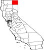
CDPs Adin | California Pines | Canby | Cedarville | Daphnedale Park | Eagleville | Fort Bidwell | Lake City | Likely | Lookout | New Pine Creek | Newell
Unincorporated
communitiesAmbrose | Boles | Bormister | Brooks Mill | Campbell | Cantrall Mill | Christensen | Copic | Cornell | D Flourney | Dalton | Davis Creek | Day | Demuth | Derner | Dibble Place | Fairport | Fletcher Place | Flourney | Grizzlie Place | Hackamore | Hannchen | Harper | Homestead | Juniper | K Flourney | Kalina | Kandra | Kauffman | Kephart | Lakeview Junction | Liskey | Lookout Junction | Mammoth | McArthur | McGarva | Meares | Menlo Baths | Mulkey Place | Old Hulbert Place | Perez | R Flourney | Ramsey | Scarface | Staley | Stronghold | Surprise Station | Tionesta | Tuber | Vestil | White Horse | Williams | Willow Ranch
Indian
reservationsAlturas Indian Rancheria | Fort Bidwell Reservation | XL Rancheria
Former
settlementsCategories:- Census-designated places in Modoc County, California
- Unincorporated communities in California


Wikimedia Foundation. 2010.