- Dangbang
-
Dangbang
दाङबाङ— Village Development Committee — Location in Nepal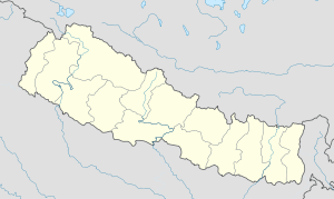
 Dangbang
Coordinates: 27°57′N 82°59′E / 27.95°N 82.98°ECoordinates: 27°57′N 82°59′E / 27.95°N 82.98°E Country  Nepal
NepalRegion Mid-Western Zone Rapti Zone District Pyuthan District VDC Dangbang Wards Population (2001 Census[1]) - Total 3,719 608 households Time zone Nepal Time (UTC+5:45) Dangbang is a town and Village Development Committee in Pyuthan, a Middle Hills district of Rapti Zone, western Nepal.
Villages in VDC[2]
Ward Lat. Lon Elev. Airabati ऐराबती 27°56'N 82°57'E 470m Amili अमिली 4 27°57'N 82°58'E 1,410 Angri अङग्री 27°59'N 82°59'E 550 Baji Pokhari बाजी पोखरी 27°57'N 82°59'E 1,370 Batchaur बाटचौर 27°57'N 83°00'E 1,370 Belbot बेलबोट 4 27°56'N 82°58'E 830 Besi बेसी 27°56'N 82°58'E 410 Bukeni बुकेनी 27°58'N 82°58'E 890 Chaklaghat चाक्लाघाट 27°58'N 83°00'E 530 Chendhara चेनधारा 27°58'N 82°59'E 1,213 Chheda छेडा 27°56'N 83°01'E 483 Dabar डाबर 27°56'N 82°59'E 430 Dangbang दाङबाङ 27°59'N 82°58'E 1,190 Deurali देउराली 27°58'N 82°58'E 1,236 Dhanbot धानबोट 27°58'N 82°58'E 1,410 Ghakse घाक्से 27°57'N 82°57'E 1,210 Juda जुडा 27°59'N 83°00'E 550 Khalneta खल्नेटा 27°58'N 82°58'E 1,470 Kolbot कोलबोट 6 27°57'N 83°00'E 1,336 Kudule कुडुले 27°56'N 82°58'E 410 Majhi Damar माझी दमार 27°56'N 82°59'E 490 Majhkhanda माझखण्ड 27°55'N 83°01'E 520 Mandre मान्द्रे 27°58'N 83°00'E 1,213 Mandrechaur मान्द्रेचौर 27°57'N 83°00'E 1,013 Pateri पतेरी 27°58'N 83°00'E 570 Rengra रेङ्गरा 27°59'N 82°58'E 590 Sajbot साजबोट 27°59'N 82°59'E 590 Sallekot सल्लेकोट 3 27°56'N 82°57'E 910 Sarwas सर्वास 27°57'N 82°58'E 1,310 Simpani सिमपानी 27°56'N 83°01'E 530 Sirsini सिर्सिनी 5 27°58'N 82°58'E 1,450 Takura टाकुरा 27°58'N 82°59'E 1,050 References
- ^ "Nepal Census 2001". Nepal's Village Development Committees. Digital Himalaya. http://www.digitalhimalaya.com/collections/nepalcensus/form.php?selection=1. Retrieved 21 September 2008.
- ^ "Index of Geographical Names of Nepal, Volume IV: Mid Western Development Region, List of Settlements, Pyuthan". Government of Nepal, National Geographic Information Infrastructure Program. http://www.ngiip.gov.np/pdf/vol4pyuthan.pdf. Retrieved 2011-03-12.
External links
Arkha, Badikot, Bangesal, Baraula, Barjiwang, Belwaspur, Bhingri, Bijaya Nagar, Bijubar, Bijuli, Chuja, Dakhakuwadi Salghari, Damri, Dangwang, Dharamawati, Dharampani, Dhobaghat, Dhuwang, Dungegadi, Gothiwang, Hansapur, Jumrikanda, Khaira, Khawang, Khung, Kochiwang, Ligha, Liwang, Lung, Majhakot, Maranthana, Markawang, Narikot, Naya Gaun, Okharkot, Pakala,
Phopli, Puja, Rajbara, Ramdi, Ruspur Kot, Sari, Swargadwarikhal, Syauliwang, Tarwang, Tiram, Tusara, Wangemarkot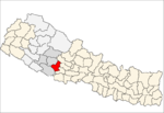 Categories:
- Populated places in Pyuthan District
- Rapti Zone geography stubs


Wikimedia Foundation. 2010.