Cullingworth railway station

Cullingworth railway station
Cullingworth
Location
Place Cullingworth
Area City of Bradford
Coordinates 53°49′35″N 1°54′12″W / 53.826260°N 1.903420°W / 53.826260; -1.903420Coordinates: 53°49′35″N 1°54′12″W / 53.826260°N 1.903420°W / 53.826260; -1.903420
Grid reference SE064366
Operations
Original company Great Northern Railway
Pre-grouping Great Northern Railway
Post-grouping London and North Eastern Railway
Platforms 2
History
7 April 1884 (1884-04-07) Station opened
23 May 1955 (1955-05-23) Station closed
Disused railway stations in the United Kingdom
Closed railway stations in Britain
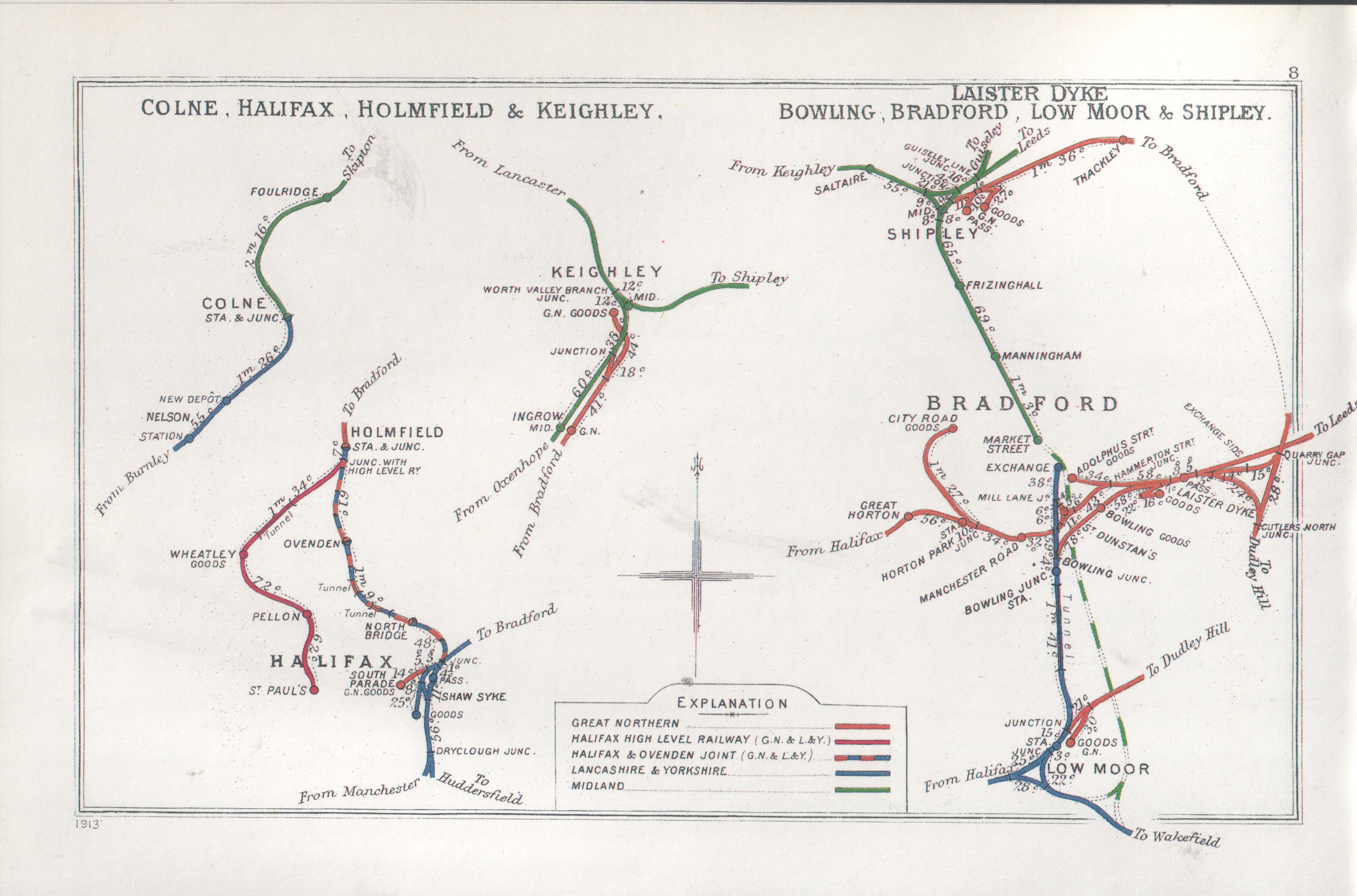
A B C D–F G H–J K–L M–O P–R S T–V W–Z
Portal icon UK Railways portal
Railway clearing house map showing lines south of Keighley in 1913


Cullingworth railway station was a station on the Queensbury Lines which ran between Keighley, Bradford and Halifax. The station served the village of Cullingworth, West Yorkshire, England. It opened for passengers in 1884 and closed in 1955

The station was about 1.5 miles (2.4 km) from Wilsden railway station and was near to the 150-yard (140 m) long 9 arch Cullingworth Viaduct which exists to this day.

External links

Preceding station Disused railways Following station
Wilsden   GN
The Queensbury Lines
  Ingrow (East)


Wikimedia Foundation. 2010.

Игры ⚽ Нужно решить контрольную?

Look at other dictionaries:

  • Manchester Road railway station (Bradford) — Manchester Road Location Place Bradford Area City of Bradford Coordinates …   Wikipedia

  • Dudley Hill railway station — Dudley Hill Location Place Dudley Hill Area City of Bradford Coordinates …   Wikipedia

  • Cullingworth — Coordinates: 53°49′29″N 1°54′10″W / 53.824730°N 1.902738°W / 53.824730; 1.902738 …   Wikipedia

  • Keighley — For the constituency of the same name, see Keighley (UK Parliament constituency). Coordinates: 53°52′01″N 1°54′40″W / 53.867°N 1.911°W / …   Wikipedia

  • City of Bradford —   City Metropolitan borough   View of Bradford city centre …   Wikipedia

  • Denholme — Coordinates: 53°48′07″N 1°53′38″W / 53.802°N 1.894°W / 53.802; 1.894 …   Wikipedia

  • Bingley — Infobox UK place official name=Bingley country=England region=Yorkshire and the Humber static static image caption= population=28,817 [Census, 2001] os grid reference=SE108389 latitude=53.84656 longitude= 1.83647 post town=BINGLEY postcode… …   Wikipedia

  • Bradford — For the larger local government district, see City of Bradford. For other uses, see Bradford (disambiguation). Coordinates …   Wikipedia

  • Oxenhope — Not to be confused with Oxenholme. Coordinates: 53°48′43″N 1°57′07″W / 53.812°N 1.952°W / 53.812; 1.952 …   Wikipedia

  • City Road Goods Branch — Not a lot left now... Location Place Bradford …   Wikipedia

Share the article and excerpts

Direct link
Do a right-click on the link above
and select “Copy Link”