Conondale, Queensland

Conondale, Queensland
Conondale
Queensland
ConondaleGeneralStore.JPG
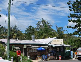
Conondale General store
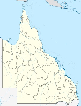
Conondale is located in Queensland
{{{alt}}}
Conondale
Population: 766[1]
Postcode: 4552
Location:
  • 114 km (71 mi) N of Brisbane
  • 54 km (34 mi) W of Caloundra
  • 20 km (12 mi) W of Maleny
LGA: Sunshine Coast Region
State District: Glass House
Federal Division: Fisher

Conondale is a town in the Sunshine Coast, Queensland hinterland region of Queensland, Australia. The town is located in the Sunshine Coast Region local government area and on the banks of the upper Mary River, 114 kilometres (71 mi) north of the state capital, Brisbane. At the 2006 census, Conondale and the surrounding area had a population of 766.[1]

See also

References

External links

Coordinates: 26°44′S 152°43′E / 26.733°S 152.717°E / -26.733; 152.717


Wikimedia Foundation. 2010.

Игры ⚽ Нужен реферат?

Look at other dictionaries:

  • Conondale Range — Country Australia State Queensland …   Wikipedia

  • Conondale National Park — IUCN Category II (National Park) Coordinates 26°39′47″S 152°38′44″E /  …   Wikipedia

  • Protected areas of Queensland — Queensland is the second largest state in Australia. It contains 470 separate Protected Areas with a total land area of 69,388 km² (4.02% of the state’s area). 223 of these are National parks, which is the highest number of any Australian… …   Wikipedia

  • Zonas protegidas de Queensland — Queensland es el segundo más grande de los estados continentales de Australia. Contiene 470 áreas protegidas separadas que cubren un total de 69.388 km² (4,02% del territorio del estado). 216 de ellos son parques nacionales, que representa el más …   Wikipedia Español

  • Parque Nacional Conondale — Conondale es un parque nacional en Queensland (Australia), ubicado a 98 km al noroeste de Brisbane …   Enciclopedia Universal

  • Parque Nacional Conondale — Saltar a navegación, búsqueda Conondale es un parque nacional en Queensland (Australia), ubicado a 98 km al noroeste de Brisbane. Datos Área: 68,00 km² Coordenadas: 26°39′47″S …   Wikipedia Español

  • Mary River (Queensland) — Mary (Moocooboola) Wide Bay River …   Wikipedia

  • Mary River (Queensland) — 26°35′06.3″S 152°44′01.2″E / 26.585083, 152.733667 …   Wikipédia en Français

  • Crystal Waters, Queensland — Crystal Waters Queensland Population: 250 [1] Established: 1989 …   Wikipedia

  • Kilcoy, Queensland — Infobox Australian Place | type = town name = Kilcoy state = qld caption = lga = Somerset Regional Council postcode = 4515 pop = 1,500 pop footnotes= stategov = Nanango fedgov = Fisher dist1 = 98 dir1 = NW location1= Brisbane dist2 = 50 dir2 = NW …   Wikipedia

Share the article and excerpts

Direct link
Do a right-click on the link above
and select “Copy Link”