- Compeer, Alberta
-
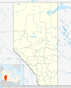
 Location of Compeer in Alberta
Compeer is a hamlet in east-central Alberta, Canada within Special Area No. 4.[1][2] It is located on an abandoned track of the Railink Central Western railway, north of Highway 12 and west of the Alberta–Saskatchewan border. It is approximately 14 kilometres (8.7 mi) east of Altario.
Compeer was founded in 1901. Compeer was a spot Aboriginals used to camp. Its literal meaning is camp here. When explorers came to Compeer, natives told them to camp here. Due to a misinterpretation, explorers thought the area was called Compeer.[citation needed]
Compeer is a small community with few services. It has a bar, an outfitting store and an indoor skating rink.
See also
- List of communities in Alberta
- List of hamlets in Alberta
References
- ^ Alberta Municipal Affairs (2010-04-01). "Specialized and Rural Municipalities and Their Communities". http://municipalaffairs.gov.ab.ca/documents/msb/2010-ruralmun.pdf. Retrieved 2010-07-11.
- ^ Statistics Canada (2010-03-05). "Standard Geographical Classification 2006 – Special Area No. 4, geographical codes and localities, 2006". http://stds.statcan.gc.ca/sgc-cgt/2006/sgcsl-cgtrl-fin-eng.asp?criteria=4804020. Retrieved 2010-07-11.
 Subdivisions of Alberta
Subdivisions Regions · Census divisions · Municipal districts (counties) · Specialized municipalities · School districts · Regional health authoritiesCommunities Cities · Towns · Villages · Summer villages · Hamlets · Indian reserves · Métis settlements · Ghost towns · Designated placesCities and Urban
Service AreasAirdrie · Brooks · Calgary · Camrose · Cold Lake · Edmonton (capital) · Fort McMurray · Fort Saskatchewan · Grande Prairie · Lacombe · Leduc · Lethbridge · Lloydminster · Medicine Hat · Red Deer · Sherwood Park · Spruce Grove · St. Albert · Wetaskiwin Category ·
  Portal ·
  WikiProject
Coordinates: 51°51′34″N 110°00′47″W / 51.85944°N 110.01306°W
Categories:- Hamlets in Alberta
- Former municipalities in Alberta
- Special Area No. 4, Alberta
- Central Alberta geography stubs

Wikimedia Foundation. 2010.