- Cluny, Alberta
-
Hamlet of Cluny — Hamlet — Location of Cluny in Alberta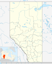

Coordinates: 50°50′11″N 112°52′00″W / 50.83649°N 112.86667°WCoordinates: 50°50′11″N 112°52′00″W / 50.83649°N 112.86667°W Country  Canada
Province  Alberta
Census division No. 5 Municipal district Wheatland County Government - Type Unincorporated - Reeve Glenn Koester - Governing body Wheatland County Council- Ben Armstrong
- Berniece Bland
- Alice Booth
- Brenda Knight
- Glenn Koester
- Ken Sauve
- Donald Vander Velde
Area[1] - Total 0.58 km2 (0.2 sq mi) Elevation 570 m (1,870 ft) Population (2006)[1] - Total 60 - Density 102.9/km2 (266.5/sq mi) - Dwellings 29 Time zone MST (UTC-7) Cluny is a hamlet in Alberta, Canada within Wheatland County.[2] It is located on {{km to mi}3}} south of Highway 1 on a Canadian Pacific Railway line and Highway 843, approximately 87 kilometres (54 mi) southeast of Calgary. It has an elevation of 570 metres (1,870 ft).
The hamlet is located in census division No. 5 and in the federal riding of Crowfoot.
Demographics
As of 2006, Cluny had a total population of 60 living in 29 dwellings. With a land area of 0.58 km2 (0.22 sq mi), it has a population density of 102.9 /km2 (267 /sq mi).[1]
Industry Canada shows that Cluny's greater rural area had a total population of 471 living in 155 dwellings in 2001. With a land area of 513.2 km2 (198.1 sq mi), its greater rural area has a population density of 5.0 /km2 (13 /sq mi).[3]
See also
- List of communities in Alberta
- List of hamlets in Alberta
References
- ^ a b c Statistics Canada (2007). "Population and dwelling counts, for Canada, provinces and territories, and designated places, 2006 and 2001 censuses". http://www12.statcan.ca/english/census06/data/popdwell/Table.cfm?T=1302&SR=1&S=1&O=A&RPP=9999&PR=48&CMA=0. Retrieved 2010-01-29.
- ^ Alberta Municipal Affairs (2010-04-01). "Specialized and Rural Municipalities and Their Communities". http://municipalaffairs.gov.ab.ca/documents/msb/2010-ruralmun.pdf. Retrieved 2010-07-08.
- ^ Industry Canada/Web Archive (2006-11-04). "Cluny - Community demographics (2001 census)". http://www.collectionscanada.gc.ca/webarchives/20061104084225/http://broadband.gc.ca/maps/province.html?prov=48. Retrieved 2010-02-07.

Strathmore Chancellor Hussar Gleichen 
Bassano  Cluny
Cluny 

Arrowwood Milo Bow River  Subdivisions of Alberta
Subdivisions Regions · Census divisions · Municipal districts (counties) · Specialized municipalities · School districts · Regional health authoritiesCommunities Cities · Towns · Villages · Summer villages · Hamlets · Indian reserves · Métis settlements · Ghost towns · Designated placesCities and Urban
Service AreasAirdrie · Brooks · Calgary · Camrose · Cold Lake · Edmonton (capital) · Fort McMurray · Fort Saskatchewan · Grande Prairie · Lacombe · Leduc · Lethbridge · Lloydminster · Medicine Hat · Red Deer · Sherwood Park · Spruce Grove · St. Albert · Wetaskiwin Category ·
  Portal ·
  WikiProjectCategories:
- Hamlets in Alberta
- Former municipalities in Alberta
- Designated places in Alberta
- Wheatland County, Alberta
- Southern Alberta geography stubs

Wikimedia Foundation. 2010.