- Mendocino Woodlands State Park
-
Mendocino Woodlands State Park

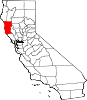
Nearest city: 39350 Little Lake Road, Mendocino, California Coordinates: 39°19′43″N 123°41′54″W / 39.32861°N 123.69833°WCoordinates: 39°19′43″N 123°41′54″W / 39.32861°N 123.69833°W Area: 700 acres (2.8 km2) Built: 1934 Architect: Daniel R. Hull, Raymond E. Floyd Architectural style: Bungalow, Craftsman Governing body: State NRHP Reference#: 97001262[1] Added to NRHP: September 25, 1997[2] The Mendocino Woodlands State Park is a group camping facility located at 39350 Little Lake Road, Mendocino County, California, seven miles (11 km) inland from the town of Mendocino. It was built as a Recreational Demonstration Area by the Civilian Conservation Corps. Mendocino Woodlands consists of approximately 700 acres (2.8 km2) of land along the Little North Fork of the Big River, and is surrounded to the north, east, and west by the 50,000 acre (200 km²) Jackson Demonstration State Forest. To the south, the park abuts the Big River State Park. It was declared a National Historic Landmark on September 25, 1997.[2]
Contents
History
Mendocino Woodlands was one of forty-six campgrounds (including Camp David) created by the Works Progress Administration and the Civilian Conservation Corps in the 1930s. Its rustic wood-and-stone buildings, built by the WPA are surrounded by second-growth redwood forest. Like the other campgrounds, Mendocino Woodlands was originally planned as a site for youth summer camps in which the participants would be introduced to the wonders of nature. However, Mendocino Woodlands is the only one of the campgrounds that has been continuously used for public camping.
As originally formed, the campsite occupied a property of 5,425 acres (22 km2). However, when the campsite was conveyed to the California State Park system by Senate Bill 1063 in 1976, the size of the property was reduced to approximately 700 acres (2.8 km2), with the remaining area left in the control of the California Department of Forestry. In 1997, the Mendocino Woodlands Recreation Demonstration Area was designated as a National Historic Landmark.
Management
The Mendocino Woodlands State Park is managed by Mendocino Woodlands Camp Association, a nonprofit corporation that has operated and maintained the facilities at the park since 1949.
See also
- Lark Camp
References
- ^ "National Register Information System". National Register of Historic Places. National Park Service. 2007-01-23. http://nrhp.focus.nps.gov/natreg/docs/All_Data.html.
- ^ a b NHL Summary
External links
- California State Parks official web page for Mendocino Woodlands
- Mendocino Woodlands Camp Association
- Wildernet: Mendocino Woodlands State Park
- Mendocino Woodlands Recreation Demonstration Area, National Historic Landmarks official page
U.S. National Register of Historic Places Topics Lists by states Alabama • Alaska • Arizona • Arkansas • California • Colorado • Connecticut • Delaware • Florida • Georgia • Hawaii • Idaho • Illinois • Indiana • Iowa • Kansas • Kentucky • Louisiana • Maine • Maryland • Massachusetts • Michigan • Minnesota • Mississippi • Missouri • Montana • Nebraska • Nevada • New Hampshire • New Jersey • New Mexico • New York • North Carolina • North Dakota • Ohio • Oklahoma • Oregon • Pennsylvania • Rhode Island • South Carolina • South Dakota • Tennessee • Texas • Utah • Vermont • Virginia • Washington • West Virginia • Wisconsin • WyomingLists by territories Lists by associated states Other Municipalities and communities of Mendocino County, California Cities Fort Bragg | Point Arena | Ukiah | Willits
CDPs Albion | Anchor Bay | Boonville | Brooktrails | Calpella | Caspar | Cleone | Comptche | Covelo | Hopland | Laytonville | Leggett | Little River | Manchester | Mendocino | Philo | Potter Valley | Redwood Valley | Talmage
Unincorporated
communitiesAlpine | Andersonia | Arnold | Asylum | Bell Springs | Bowman Place | Branscomb | Bredehoft Place | Burbeck | Cameron | Cape Horn | Card Place | Carpenter Place | Clare Mill | Cooks Valley | Crowley | Cubbler Place | Cummings | Dawes | DeCamp | DeHaven | Delmonico Place | Dos Rios | Duncan Springs | Dunlap Place | El Roble | Elk | Fair Oaks | Farley | Fish Rock | Flumeville | Four Pines | Gallaway | Glenblair | Grove | Gualala | Hales Grove | Hardy | Hardy Place | Hays Place | Hearst | Heath Place | Heeser Addition | Hendy Grove | Indian Springs | Inglenook | Ingram | Irmulco | Jim Leggett Place | Kibesillah | Largo | Laughlin | Little Penny | Longvale | Marble Place | Marks Place | McClure Place | Melbourne | Mina | Montgomery | Nacomis Indian Rancheria | Nashmead | Navarro | Newport | Northspur | Noyo | Oasis | Old Bailey Place | Old Hopland | Old Ornbaun Hot Springs | Old Red Rock Place | O'Neil Place | Orrs Springs | Philbrick Mill | Piercy | Pieta | Pine Grove | Pomo | Pratt Place | Presswood | Ralph Leggett Place | Ramsey | Redwood Lodge | Reeves Place | Regina Heights | Reilly Heights | Reyes Place | Ridge | Ridgewood Park | Riverdale | Shake City | Simerson | Soda Springs (Boonville) | Soda Springs (Burbeck) | South Fork | South Leggett | Spyrock | Stronetta | Tan Oak Park | Tatu | The Forks | The Oaks | Twin Rocks | Ukiah Rancheria | Underwood Park | Union Landing | Upp | Vichy Springs | Wanhala | Westport | Whiskey Springs | Whitesboro | Woodman | Yorkville
Indian
reservationsCoyote Valley Reservation | Guidiville Rancheria | Hopland Rancheria | Iverson Indian Rancheria | Manchester-Point Arena Rancheria | Pinoleville Rancheria | Potter Valley Rancheria | Sherwood Valley Rancheria | Redwood Valley Rancheria | Round Valley Indian Reservation
Former
settlementsAnderson | Arthur | Bentley | Bokea | Bucknell | Buldam | Cahto | Carbon | Carey | Chomchadila | Christine | Christine Junction | Clearbrook | Comfort | Crittendon | Dapishul | Dellavan | Duffey | Dunlap | Echo | Empire | En Cimo | Fairbanks | Fountain | Gracy | Half Way | Hardin | Hermitage | Iverson | Junction | Kenny | Lane Redwood Flat | Lema | Masut | Melborne Camp | Moiya | Muir Springs | North Fork House | Northwestern | Noyo Lodge | Ornbaun | Poonkiny | Rankin | Redwine | Reynolds | River Garden | Rockport | Rodgers | Rowes | Salmon Creek | Salsig | Sawyers | Sherburns | Shiegho | Signal Port | Sunnyside | Sylvandale | Tilly | Tolson | Tomki | Tomkiah | Ubakhea | Ulco | Usal | Wendling | Wheeler | Whitehall
Protected areas of California National Park System National Parks National Preserves National Monuments Cabrillo · Devils Postpile · Lava Beds · Muir Woods · Pinnacles · World War II Valor in the Pacific National MonumentNational Seashores National Historical Parks National Historic Sites National Memorials Port Chicago Naval MagazineNational Recreation Areas National Forests National Forests Angeles · Cleveland · Eldorado · Inyo · Klamath · Lassen · Los Padres · Mendocino · Modoc · Plumas · San Bernardino · Sequoia · Shasta-Trinity · Sierra · Six Rivers · Stanislaus · TahoeNational Wilderness
Preservation SystemAgua Tibia · Ansel Adams · Bucks Lake · Caribou · Carson-Iceberg · Castle Crags · Cucamonga · Desolation · Dick Smith · Dinkey Lakes · Emigrant · Golden Trout · Hoover · Inyo Mountains · Ishi · Jennie Lakes · John Muir · Kaiser · Marble Mountain · Mokelumne · Mount Shasta Wilderness · North Fork · San Gabriel · Sanhedrin · San Jacinto · San Rafael · Sespe · Siskiyou · Snow Mountain · South Fork Eel River · South Sierra · South Warner · Thousand Lakes · Trinity Alps · Ventana · Yolla Bolly-Middle Eel · YukiOther State Forests Boggs Mountain Demonstration · Ellen Pickett · Jackson Demonstration · Las Posadas · LaTour Demonstration · Mount Zion · Mountain Home Demonstration · Soquel Demonstration
National Wildlife Refuges Antioch Dunes · Bitter Creek · Blue Ridge · Butte Sink · Castle Rock · Clear Lake · Coachella Valley · Colusa · Delevan · Don Edwards San Francisco Bay · Ellicott Slough · Farallon · Guadalupe-Nipomo Dunes · Hopper Mountain · Humboldt Bay · Kern · Lower Klamath · Marin Islands · Merced · Modoc · Pixley · Sacramento · Sacramento River · Salinas River · San Diego Bay · San Diego · San Joaquin River · San Luis · San Pablo Bay · Seal Beach · Sonny Bono Salton Sea · Stone Lakes · Sutter · Tijuana Slough · Tule LakeState Wildlife Areas Wildlife Areas Antelope Valley · Ash Creek · Bass Hill · Battle Creek · Big Lagoon · Big Sandy · Biscar · Butte Valley · Buttermilk Country · Cache Creek · Camp Cady · Cantara/Ney Springs · Cedar Roughs · Cinder Flats · Collins Eddy · Colusa Bypass · Coon Hollow · Cottonwood Creek · Crescent City Marsh · Crocker Meadows · Daugherty Hill · Decker Island · Doyle · Dutch Flat · Eastlker River · Eel River · Elk Creek Wetlands · Elk River · Fay Slough · Feather River · Fitzhugh Creek · Fremont Weir · Grass Lake · Gray Lodge · Green Creek · Grizzly Island · Hallelujah Junction · Heenan Lake · Hill Slough · Hollenbeck Canyon · Honey Lake · Hope Valley · Horseshoe Ranch · Imperial · Indian Valley · Kelso Peak and Old Dad Mountains · Kinsman Flat · Knoxville · Laguna · Lake Berryessa · Lake Earl · Lake Sonoma · Little Panoche Reservoir · Los Banos · Lower Sherman Island · Mad River Slough · Marble Mountains · Mendota · Merrill's Landing · Miner Slough · Monache Meadows · Morro Bay · Moss Landing · Mouth of Cottonwood Creek · Napa-Sonoma Marshes · North Grasslands · O'Neill Forebay · Oroville · Petaluma Marsh · Pickel Meadow · Pine Creek · Point Edith · Putah Creek · Rector Reservoir · Red Lake · Rhode Island · Sacramento River · San Felipe Valley · San Jacinto · San Luis Obispo · San Luis Reservoir · San Pablo Bay · Santa Rosa · Shasta Valley · Silver Creek · Slinkard/Little Antelope · Smithneck Creek · South Fork · Spenceville · Surprise Valley · Sutter Bypass · Tehama · Truckee River · Upper Butte Basin · Volta · Warner Valley · Waukell Creek · West Hilmar · Westlker River · White Slough · Willow Creek · Yolo BypassEcological Reserves Albany Mudflats · Alkali Sink · Allensworth · Atascadero Creek Marsh · Bair Island · Baldwin Lake · Batiquitos Lagoon · Blue Sky · Boden Canyon · Boggs Lake · Bolsa Chica · Bonny Doon · Buena Vista Lagoon · Butler Slough · Butte Creek Canyon · Butte Creek House · Buttonwillow · By Day Creek · Calhoun Cut · Canebrake · Carlsbad Highlands · Carmel Bay · Carrizo Canyon · Carrizo Plains · China Point · Clover Creek · Coachella Valley · Coal Canyon · Corte Madera Marsh · Crestridge · Dairy Mart Ponds · Dales Lake · Del Mar Landing · Eden Landing · Elkhorn Slough · Estelle Mountain · Fall River Mills · Fish Slough · Fremont Valley · Goleta Slough · Indian Joe Spring · Kaweah · Kerman · King Clone · Laguna Laurel · Loch Lomond Vernal Pool · Lokern · Magnesia Spring · Marin Islands · Mattole River · McGinty Mountain · Morro Dunes · Morro Rock · Napa River · North Table Mountain · Oasis Spring · Panoche Hills · Peytonia Slough · Pine Hill · Piute Creek · Pleasant Valley · Point Lobos · Rancho Jamul · Redwood Shores · River Springs Lakes · Saline Valley · San Dieguito Lagoon · San Elijo Lagoon · San Felipe Creek · San Joaquin River · Santa Rosa Plateau · Springville · Stone Corral · Sycamore Canyon · Sycuan Peak · Thomes Creek · Tomales Bay · Upper Newport Bay · Watsonville Slough · West Mojave Desert · Woodbridge · YaudanchiMarine Protected Areas Abalone Cove · Agua Hedionda Lagoon · Albany Mudflats · Anacapa · Anacapa · Año Nuevo · Asilomar · Atascadero Beach · Bair Island · Batiquitos Lagoon · Big Creek · Big Creek · Big Sycamore Canyon · Bodega · Bolsa Chica · Buena Vista Lagoon · Cambria · Cardiff and San Elijo · Carmel Bay · Carmel Pinnacles · Carrington Point · Catalina Marine Science Center · Corte Madera Marsh · Crystal Cove · Dana Point · Del Mar Landing · Doheny · Doheny · Duxbury Reef · Edward F. Ricketts · Elkhorn Slough · Elkhorn Slough · Encinitas · Estero de Limantour · Fagan Marsh · Farallon Islands · Farnsworth Bank · Fort Ross · Gerstle Cove · Goleta Slough · Greyhound Rock · Gull Island · Harris Point · Heisler Park · Hopkins · Irvine Coast · James V. Fitzgerald · Judith Rock · Julia Pfeiffer Burns · La Jolla · Laguna Beach · Lovers Cove (Catalina Island) · Lovers Point · MacKerricher · Manchester and Arena Rock · Marin Islands · Mia J. Tegner · Moro Cojo Slough · Morro Bay · Morro Bay · Morro Beach · Natural Bridges · Niguel · Pacific Grove Marine Gardens · Painted Cave · Peytonia Slough · Piedras Blancas · Piedras Blancas · Pismo · Pismo-Oceano Beach · Point Buchon · Point Buchon · Point Cabrillo · Point Fermin · Point Lobos · Point Reyes Headlands · Point Sur · Point Sur · Portuguese Ledge · Punta Gorda · Redwood Shores · Refugio · Richardson Rock · Robert E. Badham · Robert W. Crown · Russian Gulch · Russian River · Salt Point · San Diego-Scripps · San Dieguito Lagoon · San Elijo Lagoon · Santa Barbara Island · Scorpion · Skunk Point · Sonoma Coast · Soquel Canyon · South Laguna Beach · South Point · Tomales Bay · Upper Newport Bay · Van Damme · Vandenberg · White Rock (Cambria)National Landscape Conservation System National Monuments National Conservation Areas California Desert · King RangeWilderness Areas Argus Range · Big Maria Mountains · Bigelow Cholla Garden · Bighorn Mountain · Black Mountain · Bright Star · Bristol Mountains · Cadiz Dunes · Carrizo Gorge · Chemehuevi Mountains · Chimney Peak · Chuckwalla Mountains · Chumash · Cleghorn Lakes · Clipper Mountain · Coso Range · Coyote Mountains · Darwin Falls · Dead Mountains · Dick Smith · El Paso Mountains · Fish Creek Mountains · Funeral Mountains · Golden Valley · Grass Valley · Headwaters Forest Reserve · Hollow Hills · Ibex · Indian Pass · Inyo Mountains · Jacumba · Kelso Dunes · Kiavah · Kingston Range · Little Chuckwalla Mountains · Little Picacho · Machesna Mountain · Matilija · Malpais Mesa · Manly Peak · Mecca Hills · Mesquite · Newberry Mountains · Nopah Range · North Algodones Dunes · North Mesquite Mountains · Old Woman Mountains · Orocopia Mountains · Otay Mountain · Owens Peak · Pahrump Valley · Palen/McCoy · Palo Verde Mountains · Picacho Peak · Piper Mountain · Piute Mountains · Red Buttes · Resting Spring Range · Rice Valley · Riverside Mountains · Rodman Mountains · Sacatar Trail · Saddle Peak Hills · San Gorgonio · Santa Lucia · Santa Rosa · Sawtooth Mountains · Sespe · Sheephole Valley · South Nopah Range · Stateline · Stepladder Mountains · Surprise Canyon · Sylvania Mountains · Trilobite · Turtle Mountains · Whipple Mountains ·National Marine Sanctuaries National Estuarine Research Reserves Elkhorn Slough · San Francisco Bay · Tijuana River Estuary
University of California Natural Reserve System Año Nuevo Island · Bodega Marine · Box Springs · Boyd Deep Canyon Desert Research Center · Burns Piñon Ridge · Carpinteria Salt Marsh · Chickering American River · Coal Oil Point · Dawson Los Monos Canyon · Eagle Lake Field Station · Elliott Chaparral · Emerson Oaks · Fort Ord · Hastings · James San Jacinto Mountains · Jenny Pygmy Forest · Jepson Prairie · Kendall-Frost Mission Bay Marsh · Kenneth S. Norris Rancho Marino · Landels-Hill Big Creek · McLaughlin · Motte Rimrock · Quail Ridge · Sagehen Creek Field Station · San Joaquin Freshwater Marsh · Santa Cruz Island · Scripps Coastal · Sedgwick · Stebbins Cold Canyon · Steele Burnand Anza-Borrego · Stunt Ranch Santa Monica Mountains · Sweeney Granite Mountains Desert Research Center · Valentine Eastern Sierra · Younger LagoonHeritage registers: World Heritage Sites · World Network of Biosphere Reserves · National Register of Historic Places · National Historic Landmarks · National Natural Landmarks · California Historical Landmarks · California Points of Historical Interest · California Register of Historical Resources
Categories:- California state parks
- Parks in Mendocino County, California
- National Historic Landmarks in California
- Civilian Conservation Corps in California
- Works Progress Administration in California
- Protected areas established in 1934


Wikimedia Foundation. 2010.