- Minnesota Lake, Minnesota
-
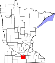
Minnesota Lake, Minnesota — City — Location of Minnesota Lake, Minnesota
Coordinates: 43°50′33″N 93°49′54″W / 43.8425°N 93.83167°W Country United States State Minnesota Counties Faribault, Blue Earth Government – Type Mayor - Council – Mayor Jerry Klein Area – Total 2.1 sq mi (5.4 km2) – Land 1.6 sq mi (4.1 km2) – Water 0.5 sq mi (1.3 km2) Elevation 1,043 ft (318 m) Population (2010)[1] – Total 687 – Density 431.6/sq mi (166.7/km2) Time zone Central (CST) (UTC-6) – Summer (DST) CDT (UTC-5) ZIP code 56068 Area code(s) 507 FIPS code 27-43198[2] GNIS feature ID 0647940[3] Website www.minnesotalake.com Minnesota Lake is a city in Blue Earth and Faribault counties in the U.S. state of Minnesota. The population was 687 at the 2010 census.[1] The bulk of the city is in Faribault County; only a small part extends into Blue Earth County. Minnesota Lake was first called Marples in 1858 after an early settler of the area. It was later changed to Minnesota Lake in 1866.
The small Blue Earth County portion of Minnesota Lake is part of the Mankato–Metropolitan Statistical Area.
Contents
Geography
According to the United States Census Bureau, the city has a total area of 2.1 square miles (5.4 km²), of which, 1.6 square miles (4.1 km²) of it is land and 0.5 square miles (1.3 km²) of it (23.67%) is water.
Minnesota State Highway 22 serves as a main route in the community.
Demographics
Historical populations Census Pop. %± 1880 208 — 1890 340 63.5% 1900 518 52.4% 1910 445 −14.1% 1920 450 1.1% 1930 435 −3.3% 1940 526 20.9% 1950 609 15.8% 1960 697 14.4% 1970 711 2.0% 1980 744 4.6% 1990 681 −8.5% 2000 681 0% 2010 687 0.9% U.S. Decennial Census As of the census[2] of 2000, there were 681 people, 297 households, and 196 families residing in the city. The population density was 431.6 people per square mile (166.4/km²). There were 316 housing units at an average density of 200.3 per square mile (77.2/km²). The racial makeup of the city was 99.56% White, 0.15% Native American, and 0.29% from two or more races. Hispanic or Latino of any race were 0.59% of the population.
There were 297 households out of which 29.3% had children under the age of 18 living with them, 58.6% were married couples living together, 3.7% had a female householder with no husband present, and 33.7% were non-families. 31.0% of all households were made up of individuals and 20.2% had someone living alone who was 65 years of age or older. The average household size was 2.29 and the average family size was 2.86.
In the city the population was spread out with 24.2% under the age of 18, 7.6% from 18 to 24, 26.9% from 25 to 44, 21.6% from 45 to 64, and 19.7% who were 65 years of age or older. The median age was 40 years. For every 100 females there were 105.1 males. For every 100 females age 18 and over, there were 100.8 males.
The median income for a household in the city was $34,896, and the median income for a family was $44,091. Males had a median income of $32,105 versus $19,844 for females. The per capita income for the city was $18,609. About 2.0% of families and 4.3% of the population were below the poverty line, including 3.3% of those under age 18 and 7.1% of those age 65 or over.
References
- ^ a b "2010 Census Redistricting Data (Public Law 94-171) Summary File". American FactFinder. United States Census Bureau. http://factfinder2.census.gov/faces/tableservices/jsf/pages/productview.xhtml?pid=DEC_10_PL_GCTPL2.ST13&prodType=table. Retrieved 27 April 2011.
- ^ a b "American FactFinder". United States Census Bureau. http://factfinder.census.gov. Retrieved 2008-01-31.
- ^ "US Board on Geographic Names". United States Geological Survey. 2007-10-25. http://geonames.usgs.gov. Retrieved 2008-01-31.
External links
Municipalities and communities of Blue Earth County, Minnesota Cities Amboy | Eagle Lake | Good Thunder | Lake Crystal | Madison Lake | Mankato‡ | Mapleton | Minnesota Lake‡ | North Mankato‡ | Pemberton | Skyline | St. Clair | Vernon Center
Townships Beauford | Butternut Valley | Cambria | Ceresco | Danville | Decoria | Garden City | Jamestown | Judson | Le Ray | Lime | Lincoln | Lyra | Mankato | Mapleton | McPherson | Medo | Pleasant Mound | Rapidan | Shelby | South Bend | Sterling | Vernon Center
Footnotes ‡This populated place also has portions in an adjacent county or counties
Municipalities and communities of Faribault County, Minnesota Cities 
Townships Barber | Blue Earth City | Brush Creek | Clark | Delavan | Dunbar | Elmore | Emerald | Foster | Jo Daviess | Kiester | Lura | Minnesota Lake | Pilot Grove | Prescott | Rome | Seely | Verona | Walnut Lake | Winnebago City
Unincorporated
communityHuntley
Ghost towns Footnotes ‡This populated place also has portions in an adjacent county or counties
Coordinates: 43°50′31″N 93°49′55″W / 43.84194°N 93.83194°W
Categories:- Cities in Minnesota
- Populated places in Faribault County, Minnesota
- Populated places in Blue Earth County, Minnesota
- Mankato – North Mankato metropolitan area


Wikimedia Foundation. 2010.