- Conham
-
Coordinates: 51°26′N 2°32′W / 51.44°N 2.53°W
Conham 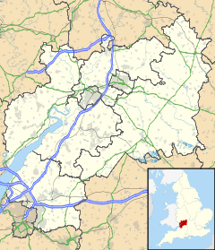
 Conham
Conham shown within GloucestershireOS grid reference ST6372 Unitary authority South Gloucestershire Ceremonial county Gloucestershire Region South West Country England Sovereign state United Kingdom Police Avon and Somerset Fire Avon Ambulance Great Western EU Parliament South West England UK Parliament Kingswood List of places: UK • England • Gloucestershire Conham is a suburb of the city of Bristol in England. It lies near Hanham on the north bank of the River Avon just outside the city boundaries in South Gloucestershire.
The Conham Ferry is a small passenger ferry which operates across the river from Conham to Broomhill.[1]
The Conham River Park lies in a loop of the River Avon, and forms part of the Avon Valley Woodlands.[2]
References
External links
Subdivisions of Bristol Constituencies Wards Ashley · Avonmouth · Bedminster · Bishopston · Bishopsworth · Brislington East · Brislington West · Cabot · Clifton · Clifton East · Cotham · Easton · Eastville · Filwood · Frome Vale · Hartcliffe · Henbury · Hengrove · Henleaze · Hillfields · Horfield · Kingsweston · Knowle · Lawrence Hill · Lockleaze · Redland · Southmead · Southville · St George East · St George West · Stockwood · Stoke Bishop · Westbury-on-Trym · Whitchurch Park · Windmill HillNeighbourhoods City centre · Arnos Vale · Ashley Down · Ashton Gate · Ashton Vale · Avonmouth · Baptist Mills · Barton Hill · Bedminster · Bedminster Down · Bishopston · Bishopsworth · Blaise Hamlet · Bower Ashton · Brentry · Brislington · Broadmead · Broomhill near Brislington · Broomhill near Stapleton · Canon's Marsh · Chester Park · Chittening · Clifton · Cliftonwood · Coombe Dingle · Cotham · Crew's Hole · Crofts End · Easton · Eastville · Filwood Park · Fishponds · Golden Hill · Greenbank · Hartcliffe · Headley Park · Henbury · Hengrove · Henleaze · Hillfields · Horfield · Hotwells · Kensington Park · Kingsdown · Knowle · Knowle West · Lawrence Hill · Lawrence Weston · Lockleaze · Lodge Hill · Mayfield Park · Monks Park · Montpelier · Old City · Redcliffe · Redfield · Redland · Sea Mills · Shirehampton · Sneyd Park · Southmead · Southville · Speedwell · Spike Island · St Andrews · St Annes · St George · St Jude's · St Pauls · St Philips Marsh · St Werburghs · Stapleton · Stockwood · Stoke Bishop · Stokes Croft · Totterdown · Tyndalls Park · Upper Knowle · Westbury-on-Trym · Westbury Park · Whitchurch · Whitehall · Windmill Hill · WithywoodThe following suburbs are in the same urban area but lie in South Gloucestershire
Bradley Stoke · Conham · Downend · Emersons Green · Filton · Frenchay · Hambrook · Hanham · Little Stoke · Kingswood · Mangotsfield · Patchway · Soundwell · Staple Hill · Stoke Gifford · WinterbourneOther Notable Areas Bristol Harbour · Buildings · Churches · Cribbs Causeway · Places of interest · Stokes Croft
Categories:- Villages in South Gloucestershire
- Districts of Bristol
- South Gloucestershire geography stubs

Wikimedia Foundation. 2010.