- Spanaway, Washington
Infobox Settlement
official_name = Spanaway, Washington
settlement_type = CDP
nickname =
motto =
imagesize =
image_caption =
image_
imagesize =
image_caption =
image_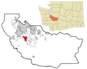
mapsize = 250x200px
map_caption = Location of Spanaway, Washington
mapsize1 =
map_caption1 =subdivision_type = Country
subdivision_name =United States
subdivision_type1 = State
subdivision_name1 =Washington
subdivision_type2 = County
subdivision_name2 = Piercegovernment_footnotes =
government_type =
leader_title =
leader_name =
leader_title1 =
leader_name1 =
established_title =
established_date =unit_pref = Imperial
area_footnotes =area_magnitude =
area_total_km2 = 22.5
area_land_km2 = 21.6
area_water_km2 = 1.0
area_total_sq_mi = 8.7
area_land_sq_mi = 8.3
area_water_sq_mi = 0.4population_as_of = 2000
population_footnotes =
population_total = 21588
population_density_km2 = 1000.8
population_density_sq_mi = 2592.0timezone = Pacific (PST)
utc_offset = -8
timezone_DST = PDT
utc_offset_DST = -7
elevation_footnotes =
elevation_m = 116
elevation_ft = 381
latd = 47 |latm = 5 |lats = 52 |latNS = N
longd = 122 |longm = 25 |longs = 26 |longEW = Wpostal_code_type =
ZIP code
postal_code = 98387
area_code = 253
blank_name = FIPS code
blank_info = 53-66255GR|2
blank1_name = GNIS feature ID
blank1_info = 1512680GR|3
website =
footnotes =Spanaway is a
census-designated place (CDP) in Pierce County,Washington ,United States . The population was 21,588 at the 2000 census. Spanaway is an unincorporated suburb of Tacoma, and is often identified together with the more urban, less wealthy Parkland.In
1890 the area was originally named "Lake Park" as a planned community by the Lake Park Land, Railway and Improvement Company which bought all the nearby land east of the lake. The development company built a rail line that ended at what is now 162nd and Park Avenue. Tourists would take the train, a run of about ten miles (ten miles being one "span", in rail slang) fromTacoma , while traveling to Mount Rainier. By the founding ofMount Rainier National Park in 1899, the tourist reference that the last train depot was a "span away" from Tacoma, stuck as the name of the area.Alternate etymologies include one from
Hudson's Bay Company records that refer to a place known to theNisqually tribe as "Spanuch"/"Spanueh" in 1849, but it is unclear where that actually referred to. The Hudson's Bay Company did have sheep ranches in this area in the 1840s. Another alternative eymology, published by theTacoma News Tribune in 1956 (July 15 edition) claimed that "yawanaps" was a "local Indian word" meaning "beautiful waters."Spanaway Lake was originally named Bushalier Lake after Henry de la Bushalier, who owned all the property to the north of the lake.The song "The Needle Has Landed" from the Tacoma native
Neko Case 's CD "Fox Confessor Brings the Flood " mentions Spanaway in passing. Tacoma alternative pop/rock band Seaweed also released an album entitled "Spanaway". Long Island, NY bandThe Movielife also has a song called "Spanaway".Geography
Spanaway is located at coor dms|47|5|52|N|122|25|26|W|city (47.097887, -122.424016)GR|1.
According to the
United States Census Bureau , the CDP has a total area of 8.7square mile s (22.6km² ), of which, 8.3 square miles (21.6 km²) of it is land and 0.4 square miles (1.0 km²) of it (4.25%) is water.Demographics
As of the
census GR|2 of 2000, there were 21,588 people, 7,659 households, and 5,820 families residing in the CDP. Thepopulation density was 2,592.0 people per square mile (1,000.6/km²). There were 7,963 housing units at an average density of 956.1/sq mi (369.1/km²). The racial makeup of the CDP was 71.13% White, 9.11% African American, 1.61% Native American, 6.34% Asian, 2.12% Pacific Islander, 2.15% from other races, and 7.55% from two or more races. Hispanic or Latino of any race were 5.49% of the population.There were 7,659 households out of which 40.4% had children under the age of 18 living with them, 57.1% were married couples living together, 13.6% had a female householder with no husband present, and 24.0% were non-families. 18.2% of all households were made up of individuals and 4.8% had someone living alone who was 65 years of age or older. The average household size was 2.82 and the average family size was 3.17.
In the CDP the population was spread out with 30.0% under the age of 18, 8.4% from 18 to 24, 32.7% from 25 to 44, 21.5% from 45 to 64, and 7.3% who were 65 years of age or older. The median age was 33 years. For every 100 females there were 99.3 males. For every 100 females age 18 and over, there were 96.2 males.
The median income for a household in the CDP was $46,210, and the median income for a family was $50,076. Males had a median income of $35,525 versus $26,758 for females. The
per capita income for the CDP was $17,928. About 7.8% of families and 10.8% of the population were below thepoverty line , including 15.5% of those under age 18 and 7.3% of those age 65 or over.Famous residents
*
Derrike Cope ,NASCAR driver
*Mike Blowers ,MLB baseball player
*Aimee Wright,America's Next Top Model, Cycle 10 contestant who came in 9th place
*Jerry Cantrell ,Alice In Chains guitaristReferences
External links
Wikimedia Foundation. 2010.