- Darby, Pennsylvania
-
Not to be confused with Darby Township, Delaware County, Pennsylvania or Upper Darby Township, Delaware County, Pennsylvania.
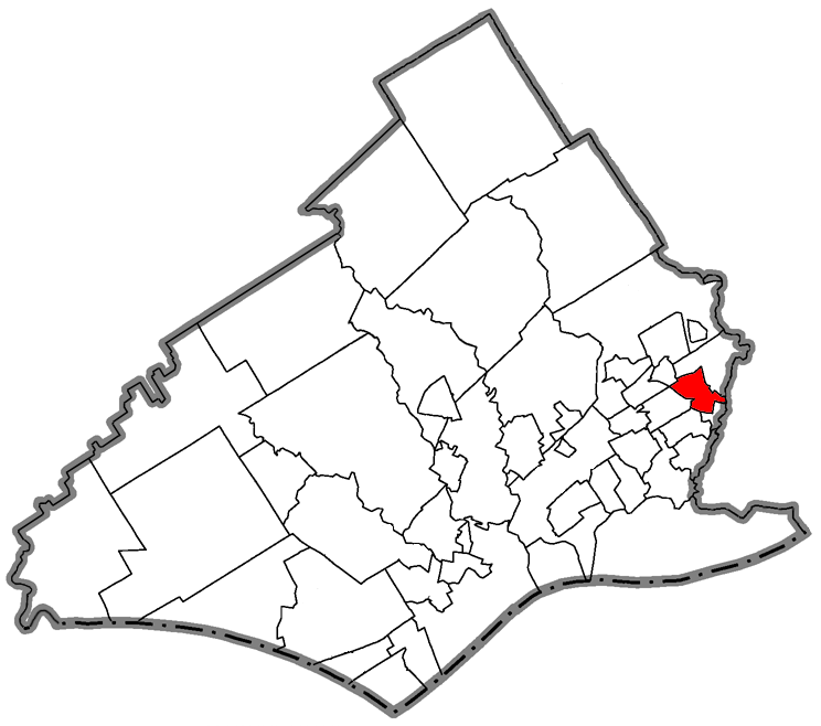
Borough of Darby Borough Country United States State Pennsylvania County Delaware Elevation 79 ft (24.1 m) Coordinates 39°55′06″N 75°15′30″W / 39.91833°N 75.25833°W Area 0.8 sq mi (2.1 km2) - land 0.8 sq mi (2 km2) - water 0.0 sq mi (0 km2), 0% Population 10,229 (2000) Density 12,624.5 / sq mi (4,874.3 / km2) Timezone EST (UTC-5) - summer (DST) EDT (UTC-4) Area code 610  Location of Darby in Delaware County
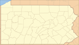
 Location of Darby in Pennsylvania
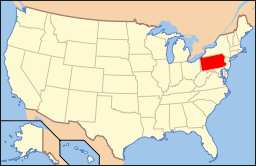 Location of Pennsylvania in the United States
Website: http://www.darbyborough.com Darby is a borough in Delaware County, Pennsylvania, United States, along Darby Creek 5 miles (8.0 km) southwest of downtown Philadelphia. It has a public library founded in 1743 and a cemetery more than 300 years old. The Quakers lived there early in the colonial era. Darby was settled about 1660 and was incorporated on March 3, 1852. In 1900, 3,429 people made their homes there, in 1910, 6,305, and in 1940, 10,334 residents of Darby existed. The population was 10,299 at the 2000 census. There is speculation, according to local historians, that the name "Darby" is related to "Derby" derived from the English town of Derby, in the county of Derbyshire. One explanation states that the Darby Creek closely resembled the English River Derwent, the main body of water that flows through Derby. British immigrants named the town in the new world thus.
Birthplace of comedian and actor, W.C. Fields, born in 1880 at the Buttonwood Hotel, then located at 9th and Main Streets.
Darby Borough is a distinct municipality from the similarly named, nearby municipality of Darby Township.
Contents
History
It was a New Sweden settlement.
Geography
 Darby Friends Meeting House, built 1805
Darby is located at 39°55′6″N 75°15′30″W / 39.91833°N 75.25833°W (39.918312, -75.258360)[1].
According to the United States Census Bureau, the borough has a total area of 0.8 square miles (2.1 km2), all of it land.
Demographics
Historical populations Census Pop. %± 1930 9,899 — 1940 10,334 4.4% 1950 13,154 27.3% 1960 14,059 6.9% 1970 13,729 −2.3% 1980 11,513 −16.1% 1990 11,140 −3.2% 2000 10,299 −7.5% www.dvrpc.org/data/databull/rdb/db82/appedixa.xls As of the census[2] of 2000, there were 10,299 people, 3,405 households, and 2,393 families residing in the borough. The population density was 12,624.5 people per square mile (4,849.3/km²). There were 3,999 housing units at an average density of 4,902.0 per square mile (1,883.0/km²). The racial makeup of the borough was 36.37% White, 60.00% African American, 0.14% Native American, 0.87% Asian, 0.07% Pacific Islander, 0.51% from other races, and 2.04% from two or more races. Hispanic or Latino of any race were 0.95% of the population.
There were 3,405 households out of which 41.3% had children under the age of 18 living with them, 34.1% were married couples living together, 30.0% had a female householder with no husband present, and 29.7% were non-families. 25.6% of all households were made up of individuals and 9.0% had someone living alone who was 65 years of age or older. The average household size was 2.88 and the average family size was 3.45.
In the borough the population was spread out with 33.4% under the age of 18, 7.7% from 18 to 24, 28.2% from 25 to 44, 17.1% from 45 to 64, and 13.6% who were 65 years of age or older. The median age was 32 years. For every 100 females there were 85.7 males. For every 100 females age 18 and over, there were 75.3 males.
The median income for a household in the borough was $36,938, and the median income for a family was $30,065. Males had a median income of $35,507 versus $22,451 for females. The per capita income for the borough was $16,990. About 35.5% of families and 20.6% of the population were below the poverty line, including 27.6% of those under age 18 and 11.1% of those age 65 or over.
Education
William Penn School District serves Darby.
- Park Lane Elementary School (K-6)
- Walnut Street Elementary School (K-6)
- Penn Wood Middle School (7-8)
- Penn Wood High School, Cypress Street Campus (9-10) (Yeadon)
- Penn Wood High School, Green Ave Campus (11-12) (Lansdowne)
In addition to these public institutions, there is in Darby the school known as Blessed Virgin Mary (BVM), a parochial school affiliated with the Roman Catholic Church.
Notable natives and residents
- Actress Monica Horan is from Darby, Pennsylvania. She is best known for her role as Amy MacDougall on Everybody Loves Raymond.
- 19th Century House of Representative John James Pearson was born at or near Darby.
- Early American Botanist John Bartram, the father of the even more famous traveler and botanist William Bartram, was born in Darby. He was also buried in Darby at the Friends Cemetery at 13th and Main Street. His botanical garden exists nearby and is considered the oldest surviving botanical garden in the US.[citation needed]
- Entertainer W.C. Fields was born in Darby.
- Sports Broadcaster Chris Wheeler.
- John Patrick Cardinal Foley, former Grand Master of the Equestrian Order of the Holy Sepulchre of Jerusalem and former President of the Pontifical Council for Social Communications, lives in retirement at the Villa St. Joseph in Darby, a home for retired, infirm, and convalescent priests of the Roman Catholic Archdiocese of Philadelphia.
- George Basile, native, Ward Melville senior high school varsity baseball player.
References
- ^ "US Gazetteer files: 2010, 2000, and 1990". United States Census Bureau. 2011-02-12. http://www.census.gov/geo/www/gazetteer/gazette.html. Retrieved 2011-04-23.
- ^ "American FactFinder". United States Census Bureau. http://factfinder.census.gov. Retrieved 2008-01-31.
 Commonwealth of Pennsylvania
Topics - Cities
- Politics
- Government
- Delegations
- History
- Geography
- Geology
- Pennsylvanians
- State parks
- Symbols
- Visitor attractions
Metro areas Cities Largest
municipalities- Baldwin
- Berwick
- Bethel Park
- Brentwood
- Carlisle
- Chambersburg
- Columbia
- Darby
- Dunmore
- Elizabethtown
- Emmaus
- Ephrata
- Franklin Park
- Hanover
- Indiana
- Kingston
- Lansdale
- Lansdowne
- Monroeville
- Munhall
- Murrysville
- Norristown
- Penn Hills
- Phoenixville
- Plum
- Pottstown
- State College
- West Chester
- West Mifflin
- Whitehall
- Wilkinsburg
- Wyomissing
- Yeadon
Regions - Allegheny Mountains
- Allegheny National Forest
- Allegheny Plateau
- Atlantic Coastal Plain
- Blue Ridge
- Coal Region
- Cumberland Valley
- Delaware Valley
- Dutch Country
- Endless Mountains
- Happy Valley
- Laurel Highlands
- Lehigh Valley
- Main Line
- Northeast
- Northern Tier
- Northwestern
- Oil Region
- Pennsylvania Highlands
- Piedmont
- The Poconos
- Ridge and Valley
- South Central
- Susquehanna Valley
- Western
- Wyoming Valley
Counties - Adams
- Allegheny
- Armstrong
- Beaver
- Bedford
- Berks
- Blair
- Bradford
- Bucks
- Butler
- Cambria
- Cameron
- Carbon
- Centre
- Chester
- Clarion
- Clearfield
- Clinton
- Columbia
- Crawford
- Cumberland
- Dauphin
- Delaware
- Elk
- Erie
- Fayette
- Forest
- Franklin
- Fulton
- Greene
- Huntingdon
- Indiana
- Jefferson
- Juniata
- Lackawanna
- Lancaster
- Lawrence
- Lebanon
- Lehigh
- Luzerne
- Lycoming
- McKean
- Mercer
- Mifflin
- Monroe
- Montgomery
- Montour
- Northampton
- Northumberland
- Perry
- Philadelphia
- Pike
- Potter
- Schuylkill
- Snyder
- Somerset
- Sullivan
- Susquehanna
- Tioga
- Union
- Venango
- Warren
- Washington
- Wayne
- Westmoreland
- Wyoming
- York
Categories:- Populated places in Pennsylvania with African American majority populations
- Populated places established in 1698
- Boroughs in Delaware County, Pennsylvania


Wikimedia Foundation. 2010.