- Minatare, Nebraska
-
Minatare, Nebraska — City — Location of Minatare, Nebraska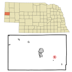
Coordinates: 41°48′40″N 103°30′10″W / 41.81111°N 103.50278°WCoordinates: 41°48′40″N 103°30′10″W / 41.81111°N 103.50278°W Country United States State Nebraska County Scotts Bluff Area – Total 0.4 sq mi (1.0 km2) – Land 0.4 sq mi (1.0 km2) – Water 0.0 sq mi (0.0 km2) Elevation 3,825 ft (1,166 m) Population (2000) – Total 810 – Density 2,127.6/sq mi (821.5/km2) Time zone Mountain (MST) (UTC-7) – Summer (DST) MDT (UTC-6) ZIP code 69356 Area code(s) 308 FIPS code 31-32305[1] GNIS feature ID 0831336[2] Minatare is a city in Scotts Bluff County, Nebraska, United States. It is part of the Scottsbluff, Nebraska Micropolitan Statistical Area. The population was 810 at the 2000 census.
Contents
Geography
Minatare is located at 41°48′40″N 103°30′10″W / 41.81111°N 103.50278°W (41.810992, -103.502728)[3].
According to the United States Census Bureau, the city has a total area of 0.4 square miles (1.0 km2), all of it land.
Demographics
As of the census[1] of 2000, there were 810 people, 326 households, and 237 families residing in the city. The population density was 2,127.6 people per square mile (823.0/km²). There were 356 housing units at an average density of 935.1 per square mile (361.7/km²). The racial makeup of the city was 84.81% White, 0.25% African American, 1.23% Native American, 10.37% from other races, and 3.33% from two or more races. Hispanic or Latino of any race were 22.22% of the population.
There were 326 households out of which 35.9% had children under the age of 18 living with them, 54.6% were married couples living together, 12.3% had a female householder with no husband present, and 27.3% were non-families. 24.5% of all households were made up of individuals and 10.7% had someone living alone who was 65 years of age or older. The average household size was 2.48 and the average family size was 2.92.
In the city the population was spread out with 26.9% under the age of 18, 9.0% from 18 to 24, 26.9% from 25 to 44, 22.5% from 45 to 64, and 14.7% who were 65 years of age or older. The median age was 36 years. For every 100 females there were 100.0 males. For every 100 females age 18 and over, there were 96.7 males.
The median income for a household in the city was $23,365, and the median income for a family was $30,156. Males had a median income of $21,823 versus $17,569 for females. The per capita income for the city was $11,977. About 18.4% of families and 18.6% of the population were below the poverty line, including 24.8% of those under age 18 and 11.6% of those age 65 or over.
Notable native
- John A. Nerud - Thoroughbred horse trainer and owner inducted into the National Museum of Racing and Hall of Fame in 1972.
References
- ^ a b "American FactFinder". United States Census Bureau. http://factfinder.census.gov. Retrieved 2008-01-31.
- ^ "US Board on Geographic Names". United States Geological Survey. 2007-10-25. http://geonames.usgs.gov. Retrieved 2008-01-31.
- ^ "US Gazetteer files: 2010, 2000, and 1990". United States Census Bureau. 2011-02-12. http://www.census.gov/geo/www/gazetteer/gazette.html. Retrieved 2011-04-23.
External links
Municipalities and communities of Scotts Bluff County, Nebraska Cities Gering | Minatare | Mitchell | Scottsbluff
Villages Categories:- Cities in Nebraska
- Populated places in Scotts Bluff County, Nebraska
- Scottsbluff micropolitan area

Wikimedia Foundation. 2010.