- Oberelz
-
Oberelz 

 OberelzLocation of Oberelz within Vulkaneifel district
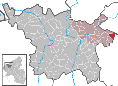
Coordinates 50°15′58″N 7°3′2″E / 50.26611°N 7.05056°ECoordinates: 50°15′58″N 7°3′2″E / 50.26611°N 7.05056°E Administration Country Germany State Rhineland-Palatinate District Vulkaneifel Municipal assoc. Kelberg Mayor Franz Breitbach Basic statistics Area 5.55 km2 (2.14 sq mi) Elevation 380 m (1247 ft) Population 119 (31 December 2010)[1] - Density 21 /km2 (56 /sq mi) Other information Time zone CET/CEST (UTC+1/+2) Licence plate DAU Postal code 56767 Area code 02657 Website www.oberelz.de Oberelz is an Ortsgemeinde – a municipality belonging to a Verbandsgemeinde, a kind of collective municipality – in the Vulkaneifel district in Rhineland-Palatinate, Germany. It belongs to the Verbandsgemeinde of Kelberg, whose seat is in the like-named municipality.
Contents
Geography
Location
The municipality lies in the Vulkaneifel, a part of the Eifel known for its volcanic history, geographical and geological features, and even ongoing activity today, including gases that sometimes well up from the earth.
History
The village was mentioned in 1336 as Eltze. The name comes from the municipality’s location in the headwaters of the river Elzbach, which empties into the Moselle near Moselkern. In feudal times, Oberelz belonged to the County of Virneburg. Under Prussian administration it was a municipality in the Bürgermeisterei (“Mayoralty”) of Kelberg in the Adenau district. In the course of administrative restructuring in Rhineland-Palatinate in 1970, the municipality, along with the others in the Amt of Kelberg, was assigned to the Daun district, which has since been given the name Vulkaneifel[2][3].
Politics
Municipal council
The council is made up of 6 council members, who were elected by majority vote at the municipal election held on 7 June 2009, and the honorary mayor as chairman.
Mayor
Oberelz’s mayor is Franz Breitbach, and his deputy is Albert Grohnert[4].
Coat of arms
The German blazon reads: Von Gold vor Rot durch Wellenschnitt geteilt, vorn 7 (4:3) zu 2 Balken aneinandergereihte rote Rauten, hinten 3 (1:1:1) goldene Kugeln.
The municipality’s arms might in English heraldic language be described thus: Per bend sinister wavy, Or seven lozenges gules, four and three, and gules three bezants, two in bend sinister and one in base sinister.
The former mediaeval lord’s arms are seen as a charge on the dexter (armsbearer’s right, viewer’s left) side. The seven lozenges were borne by the Counts of Virneburg; their arms can also be seen locally at the chapel, on the vault’s keystone. The three bezants (golden disks, or in this case balls or orbs, as the German blazon has it) are Saint Nicholas’s attribute, thus representing the municipality’s and the church’s patron saint. The line of partition, “per bend sinister wavy”, represents the river Elzbach[5].
Culture and sightseeing
Buildings
- Saint Nicholas’s Catholic Church (branch church; Filialkirche St. Nikolaus), Hauptstraße – aisleless church 1750.
- Wayside chapel, west of the village in the woods at the “Beutelstälchen” municipal limit – plastered building, partly timber-frame, from 1823[6].
References
- ^ "Bevölkerung der Gemeinden am 31.12.2010" (in German). Statistisches Landesamt Rheinland-Pfalz. 31 December 2010. http://www.statistik.rlp.de/fileadmin/dokumente/berichte/A1033_201022_hj_G.pdf.
- ^ Oberelz’s history
- ^ Oberelz’s history
- ^ Oberelz’s council
- ^ Description and explanation of Oberelz’s arms
- ^ Directory of Cultural Monuments in Vulkaneifel district
External links
- Municipality’s official webpage (German)
- Oberelz in the collective municipality’s Web pages (German)
- This article incorporates information from the German Wikipedia.
Categories:- Municipalities in Rhineland-Palatinate
- Vulkaneifel geography stubs


Wikimedia Foundation. 2010.