- Oathlaw
-
Coordinates: 56°41′44″N 2°51′32″W / 56.695459°N 2.858838°W
Oathlaw 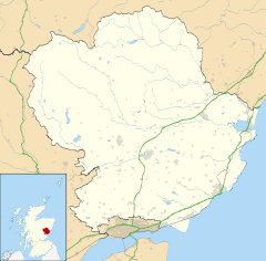
 Oathlaw
Oathlaw shown within AngusOS grid reference NO475563 Council area Angus Country Scotland Sovereign state United Kingdom Police Tayside Fire Tayside Ambulance Scottish EU Parliament Scotland List of places: UK • Scotland • Oathlaw is a village in Angus, Scotland, north of Forfar.[1]
 Oathlaw Kirk
References
- ^ "Dundee and Montrose, Forfar and Arbroath", Ordnance Survey Landranger Map, 2007, ISBN 0319229807
Angus Principal towns Other towns
and villagesAberlemno · Airlie · Arbirlot · Ardovie · Ascreavie · Auchnacree · Auchmithie · Auchinleish · Auchterhouse · Balgray · Balintore · Balkeerie · Balmirmer · Balnaboth · Barry · Birkhill · Boddin · Boysack · Brewlands Bridge · Bridgend of Lintrathen · Bridgefoot · Bridge of Craigisla · Bucklerheads · Burnside of Duntrune · Caldhame · Camuston † · Careston · Carlungie · Carlogie · Carmyllie · Castleton · Charleston · Clayholes · Clova · Colliston · Cortachy · Cottown of Guthrie · Craichie · Craigo · Craigton · Douglastown · Dronley · Drumsturdy · Dubton · Dun · Dunnichen · Dykehead · Eassie · East Haven · Edzell · Elliot · Farnell · Folda · Friockheim · Gardynebourg † · Gateside · Glamis · Greystone · Guthrie · Hillside · Hunter's Town † · Inveraldie · Inverarity · Inverkeilor · Inverpeffer † · Kellas · Kingennie · Kingsmuir · Kirkbuddo · Kirkinch · Kirkton of Glenisla · Kirkton of Kingoldrum · Letham · Liff · Little Brechin · Little Forter · Lucknow · Lunan · Lundie · Marywell · Memus · Menmuir · Milden · Milton of Finavon · Milton of Ogilvie · Monikie · Muirdrum · Murroes · Newbigging · Newtyle · Northmuir · Oathlaw · Old Balkello · Panbride · Redford · Ruthven · Salmond's Muir · St Vigeans · Stracathro · Strathmartine · Tannadice · Tarfside · Tealing · Trinity · Unthank · Upper Victoria · Wellbank · Wester Denoon · Whigstreet · WoodhillCategories:- Villages in Angus
- Angus geography stubs


Wikimedia Foundation. 2010.