- Clayholes
-
Coordinates: 56°30′34″N 2°43′40″W / 56.509424°N 2.727888°W
Clayholes 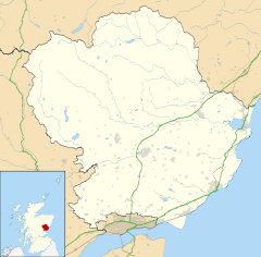
 Clayholes
Clayholes shown within AngusOS grid reference NO553355 Council area Angus Lieutenancy area Angus Country Scotland Sovereign state United Kingdom Post town CARNOUSTIE Postcode district DD7 Dialling code 01241 Police Tayside Fire Tayside Ambulance Scottish EU Parliament Scotland UK Parliament Dundee East Scottish Parliament Angus North East Scotland List of places: UK • Scotland • Clayholes is a small hamlet in Angus, Scotland. It lies approximately 0.5 kilometres (0.31 mi) north of Carnoustie on the unclassified Balmachie road, that connects the A930 road in Carnoustie with the A92 road at Balmachie.[1]
The settlement is not present on the earliest detailed maps available for the area, but can be seen for example on Ainslie's map of 1794.[2] The site, however, appears to have been settled in pre-modern times, as evidenced by archaeology found in the immediate vicinity.[3]
 Clayholes
References
- ^ "Dundee and Montrose, Forfar and Arbroath", Ordnance Survey Landranger Map, 2007, ISBN 0319229807
- ^ Ainslie, J (1794), Map of the county of Forfar or Shire of Angus, http://www.nls.uk/maps/joins/577.html, retrieved April 26, 2011
- ^ "Clayholes: cropmarks, enclosures, rig and furrow", Royal Commission on the Ancient and Historical Monuments of Scotland, Canmore database, http://canmore.rcahms.gov.uk/en/site/34526/details/clayholes/, retrieved April 26, 2011
See also
Angus Principal towns Other towns
and villagesAberlemno · Airlie · Arbirlot · Ardovie · Ascreavie · Auchnacree · Auchmithie · Auchinleish · Auchterhouse · Balgray · Balintore · Balkeerie · Balmirmer · Balnaboth · Barry · Birkhill · Boddin · Boysack · Brewlands Bridge · Bridgend of Lintrathen · Bridgefoot · Bridge of Craigisla · Bucklerheads · Burnside of Duntrune · Caldhame · Camuston † · Careston · Carlungie · Carlogie · Carmyllie · Castleton · Charleston · Clayholes · Clova · Colliston · Cortachy · Cottown of Guthrie · Craichie · Craigo · Craigton · Douglastown · Dronley · Drumsturdy · Dubton · Dun · Dunnichen · Dykehead · Eassie · East Haven · Edzell · Elliot · Farnell · Folda · Friockheim · Gardynebourg † · Gateside · Glamis · Greystone · Guthrie · Hillside · Hunter's Town † · Inveraldie · Inverarity · Inverkeilor · Inverpeffer † · Kellas · Kingennie · Kingsmuir · Kirkbuddo · Kirkinch · Kirkton of Glenisla · Kirkton of Kingoldrum · Letham · Liff · Little Brechin · Little Forter · Lucknow · Lunan · Lundie · Marywell · Memus · Menmuir · Milden · Milton of Finavon · Milton of Ogilvie · Monikie · Muirdrum · Murroes · Newbigging · Newtyle · Northmuir · Oathlaw · Old Balkello · Panbride · Redford · Ruthven · Salmond's Muir · St Vigeans · Stracathro · Strathmartine · Tannadice · Tarfside · Tealing · Trinity · Unthank · Upper Victoria · Wellbank · Wester Denoon · Whigstreet · WoodhillCategories:- Angus geography stubs
- Villages in Angus


Wikimedia Foundation. 2010.