- Metroad 10
-
Metroad 10
Route information Length: 23 km (14 mi) Existed: December 1998 – present Major junctions Northeast end:  Mona Vale Road in Mona Vale
Wakehurst Parkway in North Narrabeen
Sydney Road in Seaforth
 Warringah Road in Dee Why
Southeast end:  Warringah Freeway in North Sydney
Location Major cities: Collaroy, Dee Why, Manly Vale, Cremorne, Neutral Bay Highway system Highways in Australia
National Highway • Freeways in Australia
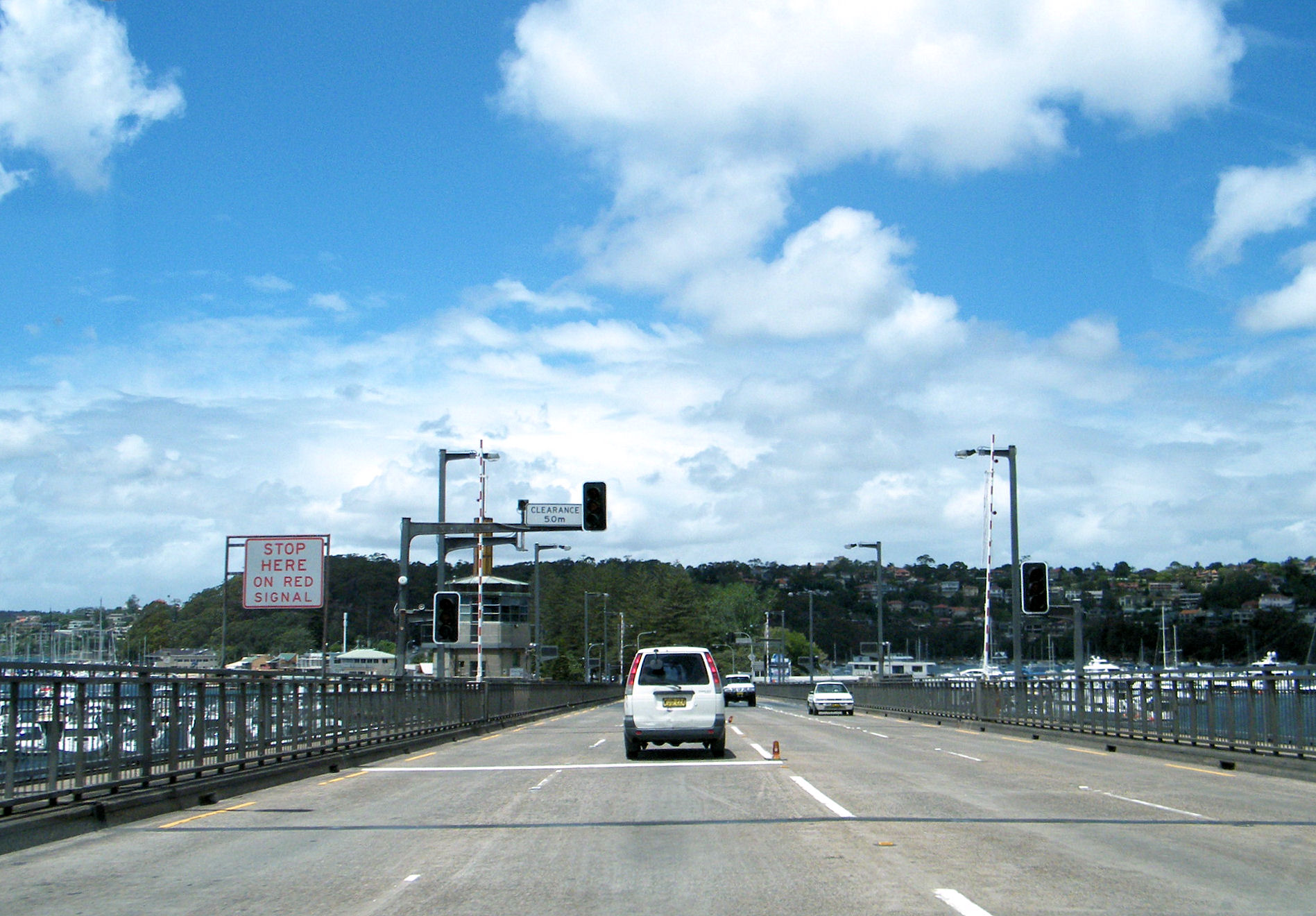
Highways in New South Wales Driving southbound on Metroad 10 over the Spit Bridge
Metroad 10 is one of Sydney, Australia's Metroads. It replaced State Route 14 in December 1998[citation needed]. It travels from the Warringah Freeway (Metroad 1) at North Sydney to Metroad 3 at Mona Vale.
Metroad 10 changes names several times as it passes through the city. Its names from North Sydney to Mona Vale are (bold are motorway grade): Falcon Street; Military Road; Spit Road; Manly Road; Burnt Bridge Creek Deviation; Condamine Street; Pittwater Road.
The Metroad 10 is the main transport link to and through the Northern Beaches district of Sydney. Its crossing of Middle Harbour on the Spit Bridge has become infamous as one of the most congested road links in the city, made worse by the regular opening of the bridge to allow boats to pass by.
Major intersections
Here are the major intersections from north to south:
- Pittwater Road
- Mona Vale Road (Metroad 3)
- Wakehurst Parkway
- Warringah Road (State Route 29)
- Condamine Street
- Pittwater Road
- Burnt Bridge Creek Deviation
- Sydney Road
- Manly Road
- Spit Road
- Military Road
- Falcon Street
Change to A8
It has been revealed that upon the introduction of alphanumeric route marking in NSW, Metroad 10 will become known as route A8.[1]
References
Sydney Metroads Road infrastructure in Sydney Motorways / Tollways Freeways / Expressways Cahill Expressway • Gore Hill Freeway • Southern Cross Drive • Southern Freeway • M5 East • Sydney–Newcastle Freeway • Warringah Freeway • Western Distributor • General Holmes DriveMetroads Bridges and Tunnels Vehicle Ferries Conceptual Plans Sydney Orbital Network • Sydney Bypasses (past, present and proposed)Other M4 East (proposed) • Marrickville Tunnel (proposed) • North Western Expressway (abandoned) • F3 to Sydney Orbital (proposed) • F6 to Marrickville Tunnel (proposed)Categories Streets in Sydney • Highways in SydneyOperators Transport in Sydney Categories:- Sydney Metroads
- Pittwater Road


Wikimedia Foundation. 2010.