- Maspeth, Queens
-
Maspeth — Neighborhoods of New York City — Maspeth Savings Bank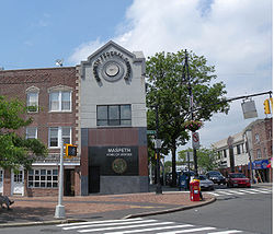
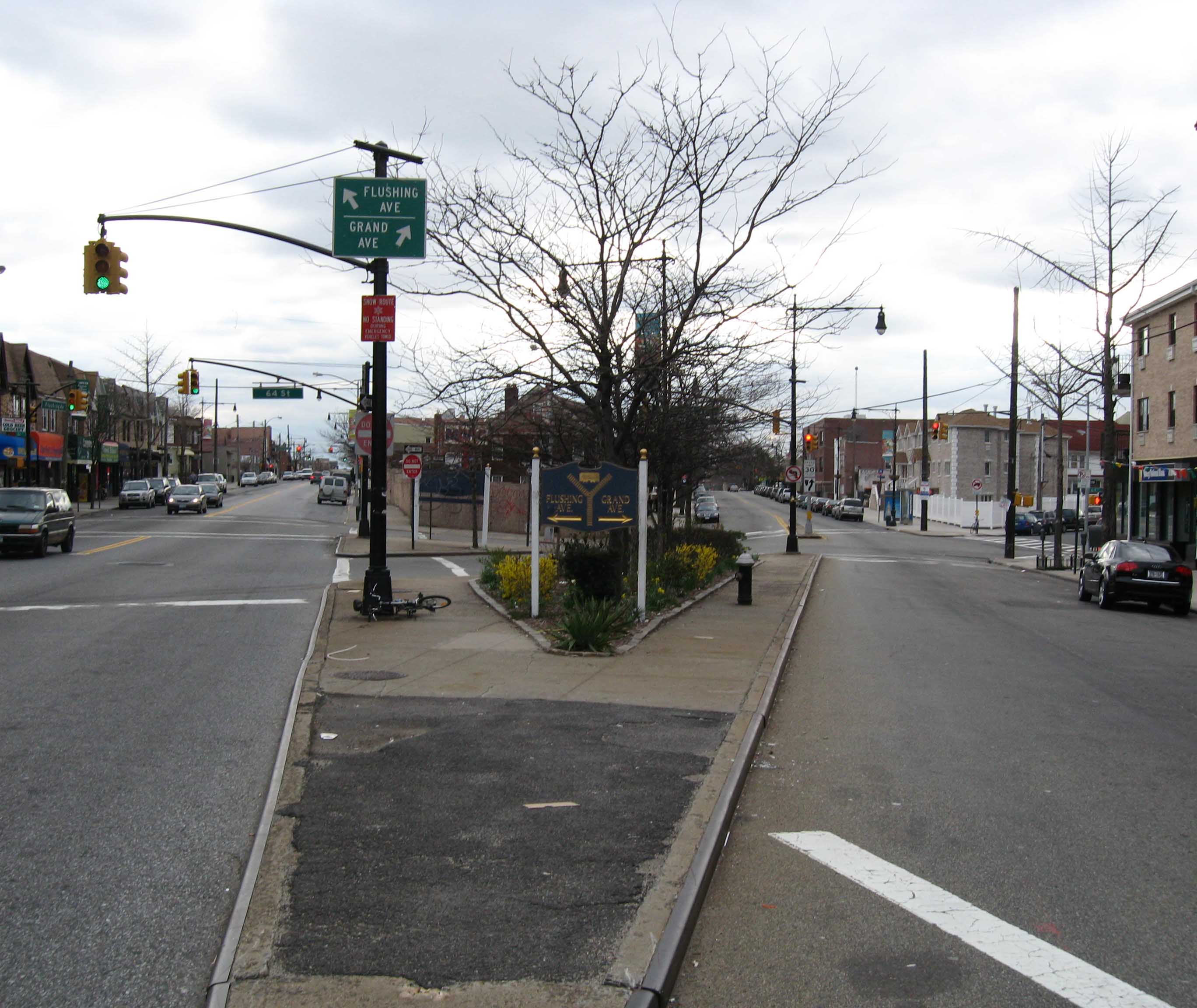
Country United States State New York County Queens Population (2000) - Total 34,053 Ethnicity - White 81.9% - Black 0.7% - Hispanic 19.1% - Asian 6.1% - Other 8.0% Economics - Median income $83,107 ZIP code 11378 Area code(s) 718, 347, 917 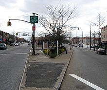 Flushing Avenue and Grand Avenue in Maspeth, Queens NY
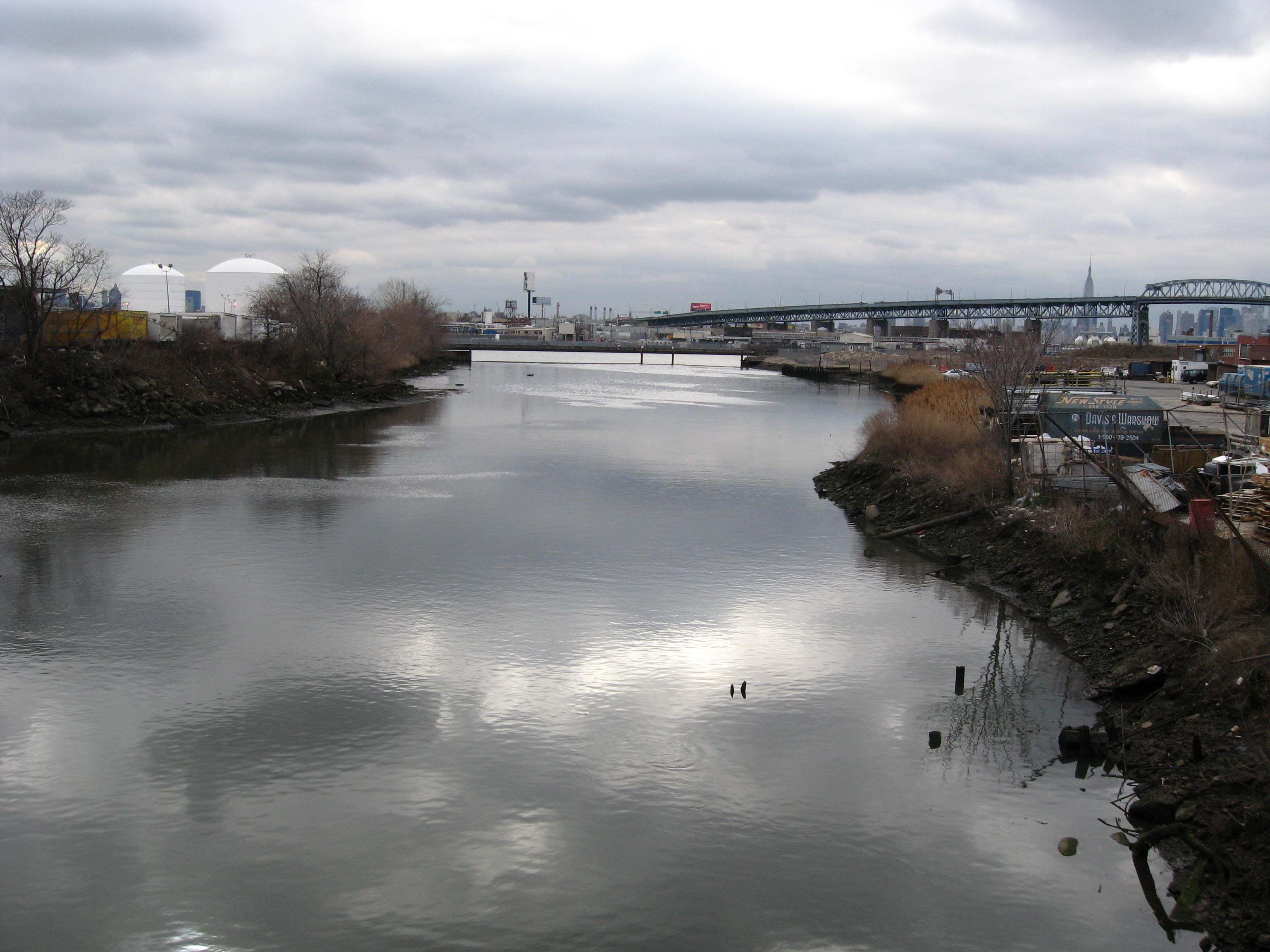
 Maspeth Creek, looking west towards Newtown Creek
Maspeth is a small community in the borough of Queens in New York City. Neighborhoods sharing borders with Maspeth are Woodside and Sunnyside to the north, Long Island City to the northwest, Greenpoint to the west, East Williamsburg to the southwest, Fresh Pond and Ridgewood to the south, and Middle Village and Elmhurst to the east.
Contents
History
The area known today as Maspeth was chartered by Dutch and English settlers in the mid-17th century. The Dutch had purchased land in the area known today as Queens in 1635, and within a few years began chartering towns. In 1642 they settled Maspat, under a charter granted to Rev. Francis Doughty.[1] Maspat became the first European settlement in Queens.[2] The settlement was leveled the following year in an attack by Native Indians, and the surviving settlers returned to Manhattan. It wasn't until nine years later, in 1652, that settlers ventured back to the area, settling an area slightly inland from the previous Maspat location. This new area was called Middleburg, and eventually developed into what is now the town of Elmhurst, bordering Maspeth. Following the immigration waves of the 19th century, Maspeth was home to a shanty town of Boyash (Ludar) Gypsies between 1925 and 1939, though this was eventually bulldozed.[3]
The name "Maspeth" is derived from the name of Mespeatches Indians, one of the 13 main Indian tribes that inhabited Long Island. It is translated to mean "at the bad waterplace" relating to the many stagnant swamps that existed in the area.[4]
Columbusville
Columbusville was the name formerly applied to a section of Maspeth. It was a development of Edward Dunn that took place on 69th Place (Originally known as Firth Avenue) between Grand Avenue and Caldwell Avenue during 1854-55, and was subsequently absorbed into Maspeth. The name fell into disuse in the 1890s.[5]
Community
The Metropolitan Avenue Bridge carries Grand Street (Brooklyn) eastward across English Kills from Williamsburg where it becomes Grand Avenue, Maspeth's main street for dining and business. Grand Avenue continues eastward to end in Elmhurst. Cemeteries take up a large part of this small neighborhood although they are separated from residential areas for the most part. Single home houses and multiple dwelling homes make up most of Maspeth and there are hardly any apartment buildings, except for the co-ops on 65th Place, also known as The Plateau.
Forty-Third Street through 58th Street, including the former Furman Island, is industrial lowlands, and from 60th Street to 72nd Street is residential. The Phelps Dodge Corporation was present from 1920–1983. The Phelps Dodge mining company heavily contaminated Newtown Creek, which separates northern Brooklyn from western Queens and serves barge traffic. Other freight moves on the Long Island Railroad Montauk Branch and the lightly used Bushwick Branch. A new West Maspeth rail freight station has been proposed in connection with a Cross-Harbor Rail Tunnel to diminish truck traffic across New York City. It is opposed by residents who don't want more trucks in Maspeth.
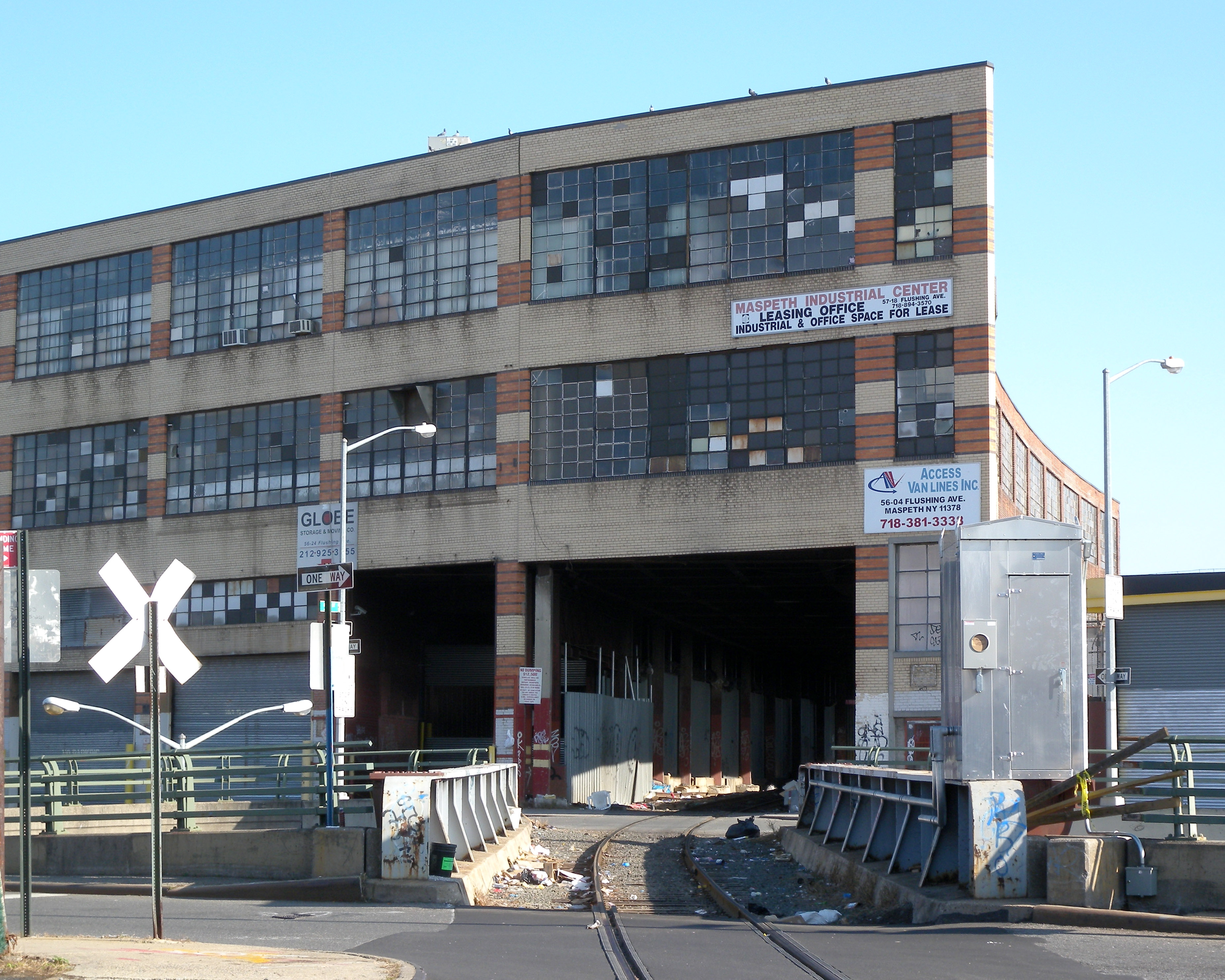
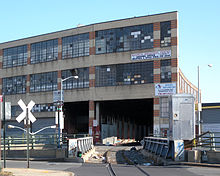 Maspeth Industrial Center and Bushwick Branch
There is access to the Brooklyn-Queens Expressway and the Long Island Expressway. The former road crosses Newtown Creek on the Kosciuszko Bridge. These expressways are accessible at 69th and Grand Street, and also at 48th Street, where the two expressways cross.
For many years a well known landmark in Maspeth was a pair of cylindrical natural gas tanks. These tanks were considered "sister tanks" to similar (but differently operating) gas holders at the Newtown Holder Station in Elmhurst (Queens) NY. There were many similarities: both were visible from major roadways, both were painted in an FAA-required red/white checkered color scheme, and both pairs of tanks have since been demolished. However, The Maspeth holders were fixed above-ground structures, whereas the Elmhurst ones were rising/falling gasometers.
Maspeth was the first English settlement in Queens County. However, conflicts with the Mespet tribe forced many settlers to move to what is now Elmhurst in 1643.
Most people who live in Maspeth are of Polish, Slavic, Italian, Irish, German, Hispanic or Chinese descent. Holy Cross R.C. Church, is the focal point of the three parishes in Maspeth. It has weekly masses, in English and Polish. It also conducts the yearly Stations of the Cross, which the procession on the streets every Good Friday, starts from Holy Cross, go to St. Stans., and than finally ends at Transfiguration. These three parishes are only 2 blocks apart from each other. The Polish go to Holy Cross, the Irish & Spanish go to St. Stans., and Lithuanians go to Transfiguration. Only the parish of St. Stans is currently running a Catholic school for the city of Maspeth. The Catholic school for Holy Cross, has closed its doors in June of 2005, as to a lack of funding. But, Holy Cross still runs its weekend Polish School along with CCD classes.
Maspeth is also home to the Metropolitan Oval.
The "unofficial" mayor of Maspeth is Queens resident and local Stop and Shop manager Joe Kilcoyne, a favorite amongst the residents in the area.
Education
 PS 58
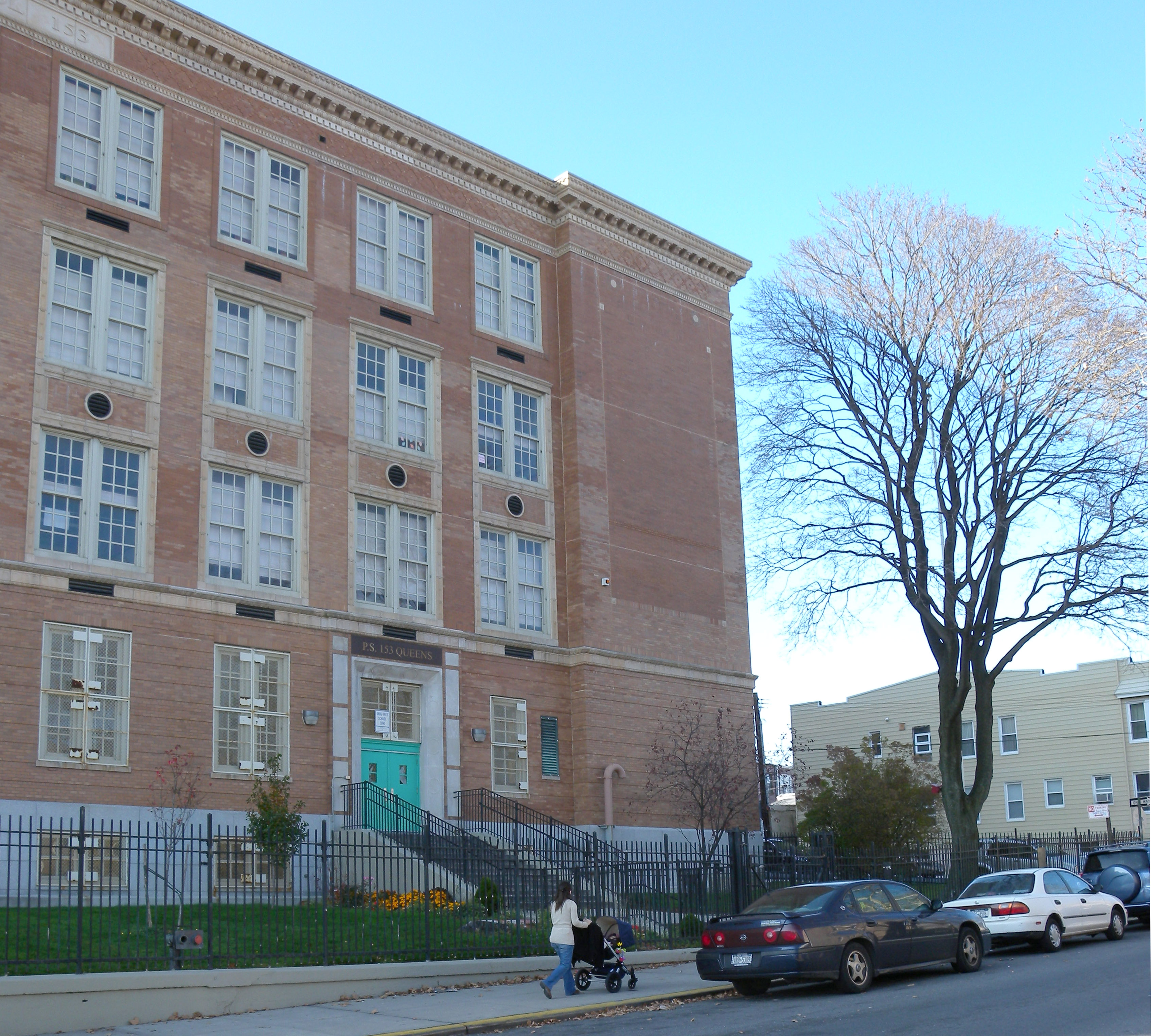
PS 58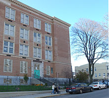 PS 153
Schools in the area include:
- Holy Cross R.C. Church - Maspeth : Polish School and CCD classes on the weekends.
- IS 73 The Frank Sansivieri Intermediate School in Maspeth is where most of the community's children attend grades 6 through 8.
- PS 58, The School of Heroes, was dedicated in 2002 in honor of the 9/11 victims on Grand Avenue at the site of the original Finast supermarket.It is named one of the best schools in the Maspeth community.
- PS 153, Maspeth Elementary School
- Saint Stanislaus Kostka School (Nursery - 8 Catholic School under the auspices of the Roman Catholic Diocese of Brooklyn)
- Martin Luther High School (9-12 private school)
- Maspeth High School (Temporarily located at the campus of Metropolitan High School) is the first public high school in Maspeth. It is expected to open on September 2012.
Transport
Although there is no subway station in Maspeth, several bus routes make subway connections, including:
- B57 to Flushing Avenue (J M Z trains), Flushing Avenue (G train), Jay Street – MetroTech (A C F N R trains)
- Q18 bus to Woodside – 61st Street (7 <7> trains), Northern Boulevard (E M R trains), or 30th Avenue (N Q trains)
- Q39 bus to Forest Avenue (M train), Queensboro Plaza (7 <7> N Q trains) or Court Square (7 <7> E G M trains)
- Q47 bus to 69th Street or 74th Street – Broadway (7 train), Jackson Heights – Roosevelt Avenue (E F M R trains), or LaGuardia Airport
- Q58 bus to Grand Avenue – Newtown (E M R trains), Flushing – Main Street (7 <7> trains), Fresh Pond Road (M train), Forest Avenue (M train), Myrtle–Wyckoff Avenues (L M trains)
- Q59 bus to Grand Avenue – Newtown (E M R trains), Woodhaven Boulevard (E M R trains), 63rd Drive – Rego Park (E M R trains), or Grand Street (L train)
- Q67 bus to Middle Village – Metropolitan Avenue (M train), Hunters Point Avenue (7 <7> trains), 21st Street – Van Alst (G train), Queensboro Plaza (7 <7> N Q trains), Queens Plaza (E M R trains) or Court Square (7 <7> E G M trains)
References
- ^ http://www.nnp.org/vtour/regions/Long_Island/mespath.html
- ^ http://www.rootsweb.com/~nyqueen2/Maspeth/
- ^ http://www.smithsonianeducation.org/migrations/gyp/lud.html
- ^ http://www.queensnewyork.com/maspeth/chamberof/history.html
- ^ Jackson, Kenneth T. (1995). The Encyclopedia of New York City. New York, New York: The New York Historical Society and Yale University Press. pp. 261. ISBN 0-300-05536-6.
External links
Categories:- Neighborhoods in Queens


Wikimedia Foundation. 2010.