- Drovers Cave National Park
-
Drovers Cave National Park IUCN Category II (National Park)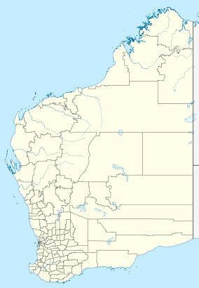

Nearest city Jurien Bay Coordinates 30°14′04″S 115°05′16″E / 30.23444°S 115.08778°ECoordinates: 30°14′04″S 115°05′16″E / 30.23444°S 115.08778°E Area 2,681 ha (6,620 acres)[1] Established 1972 Governing body Department of Environment and Conservation Official website Drovers Cave National Park is a national park in the Wheatbelt region of Western Australia (Australia), 201 kilometres (125 mi) northwest of Perth. The nearest town is Jurien Bay 6 kilometres (3.7 mi) to the west.
The area is composed of limestone and numerous caves are known to exist within the park boundaries. Many of the caves are locked with screens to keep visitors out in the interest of public safety and to prevent vandalism.[2]
Some of the other caves found within the park include Hastings, Moora, Old river and Mystery caves. Hastings cave is known to contain fossils.[3]
Drovers Cave was well known to early explorers and stockmen; the location of the site near to the Canning Stock Route meant it was often visited by drovers, hence the name. The first known visit to the cave was a drover who signed the cave wall in 1886. Many more visits occurred between 1930 and 1940. The cave was surveyed in 1973 and gazetted as part of the National Park the same year.[4]
Native flora within the park includes shrub banksia, One-sided Bottlebrush and Parrot Bush. Fauna includes Emus, Honey Possums, Western Pygmy Possums, Short-beaked Echidnas, Western Grey Kangaroos, Australian Bustards and many reptiles.[5]
See also
References
- ^ Department of Environment and Conservation 2009–2010 Annual Report. Department of Environment and Conservation. 2010. pp. 48. ISSN 1835-114X. http://www.dec.wa.gov.au/content/view/6139/2345/.
- ^ "Total Travel - Drovers Cave National Park". 2008. http://www.totaltravel.com.au/travel/wa/gascoyne/carnarvon/travel-guides/gardens/drovers-cave-9/. Retrieved 2010-05-04.
- ^ "Boorabbin National Park (entry AHD10199)". Australian Heritage Database. Department of Sustainability, Environment, Water, Population and Communities. 2010. http://www.environment.gov.au/cgi-bin/ahdb/search.pl?mode=place_detail;place_id=10199. Retrieved 2010-11-27.
- ^ "Western Australian Speleological Group Website". 2008. http://wasg.iinet.net.au/drovers.html. Retrieved 2010-05-04.
- ^ "Planbooktravel - Drovers Cave National Park". 2008. http://www.planbooktravel.com.au/attractions/wa/jurien-bay/drovers-cave-national-park/. Retrieved 2010-05-04.
National parks of Western Australia Alexander Morrison · Avon Valley · Badgingarra · Beedelup · Beelu · Boorabbin · Brockman · Cape Arid · Cape Le Grand · Cape Range · Collier Range · D’Entrecasteaux · Drovers Cave · Drysdale River · Eucla · Fitzgerald River · Francois Peron · Frank Hann · Geikie Gorge · Gloucester · Goongarrie · Gooseberry Hill · Greenmount · Gull Rock · Hassell · Hidden Valley · John Forrest · Kalamunda · Kalbarri · Karijini · Karlamilyi · Kennedy Range · Leeuwin-Naturaliste · Lesmurdie Falls · Lesueur · Millstream-Chichester · Mirima · Mitchell River · Moore River · Mount Augustus · Mount Frankland · Nambung · Neerabup · Peak Charles · Porongurup · Purnululu · Rudall River · Scott · Serpentine · Shannon · Sir James Mitchell · Stirling Range · Stokes · Tathra · Torndirrup · Tuart Forest · Tunnel Creek · Walpole-Nornalup · Walyunga · Warren · Watheroo · Waychinicup · West Cape Howe · William Bay · Windjana Gorge · Wolfe Creek Meteorite Crater · Yalgorup · YanchepInterim Biogeographic Regionalisation for Australia (IBRA) Australian Alps • Arnhem Coast • Arnhem Plateau • Avon Wheatbelt • Brigalow Belt North • Ben Lomond • Broken Hill Complex • Burt Plain • Central Arnhem • Carnarvon • Channel Country • Central Kimberley • Central Mackay Coast • Coolgardie • Cobar Peneplain • Central Ranges • Cape York Peninsula • Daly Basin • Darwin Coastal • Desert Uplands • Dampierland • Davenport Murchison Ranges • Darling Riverine Plains • Einasleigh Uplands • Esperance Plains • Eyre Yorke Block • Finke • Flinders Lofty Blockn • Flinders • Gascoyne • Gawler • Gibson Desert • Gulf Fall and Uplands • Geraldton Sandplains • Great Sandy Desert • Gulf Coastal • Gulf Plains • Great Victoria Desert • Hampton • Jarrah Forest • Kanmantoo • King • Little Sandy Desert • MacDonnell Ranges • Mallee • Murray Darling Depression • Mitchell Grass Downs • Mount Isa Inlier • Mulga Lands • Murchison • Nandewar • Naracoorte Coastal Plain • New England Tablelands • Northern Kimberley • NSW North Coast • NSW South Western Slopes • Nullarbor • Ord Victoria Plain • Pine Creek • Pilbara • Riverina • Sydney Basin • South East Coastal Plain • South East Corner • South Eastern Highlands • South East Queensland • Simpson Strzelecki Dunefields • Stony Plains • Sturt Plateau • Swan Coastal Plain • Tanami • Tasmanian Central Highlands • Tiwi Cobourg • Tasmanian Northern Midlands • Tasmanian Northern Slopes • Tasmanian South East • Tasmanian Southern Ranges • Tasmanian West • Victoria Bonaparte • Victorian Midlands • Victorian Volcanic Plain • Warren • Wet Tropic • YalgooCategories:- IUCN Category II
- National parks of Western Australia
- Protected areas established in 1972
- Caves of Australia
- Western Australia geography stubs

Wikimedia Foundation. 2010.