- Mount Jarvis
-
Mount Jarvis 
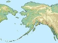
Mount Jarvis from the northeastElevation 13,421 ft (4,091 m) [1] Prominence 4,721 ft (1,439 m) [1] Location Wrangell – St. Elias National Park and Preserve, Alaska,  United States
Range Wrangell Mountains Coordinates 62°01′24″N 143°36′59″W / 62.0233333°N 143.6163889°WCoordinates: 62°01′24″N 143°36′59″W / 62.0233333°N 143.6163889°W[2] Topo map USGS Nabesna A-6 Geology Type Eroded shield volcano Age of rock 1.7 – 1.0 million years Last eruption Dacite flow, 1.0 million years ago Climbing Easiest route Glacier climb Mount Jarvis is an eroded shield volcano in the Wrangell Mountains of eastern Alaska. It is located in Wrangell-Saint Elias National Park about 10 miles (16 km) east of the summit of Mount Wrangell. The mountain sits at the northeastern edge of the massive ice-covered shield of Wrangell, rising nearly 5,000 feet (1,500 m) above it in a spectacular series of cliffs and icefalls.
When seen from above, Mount Jarvis is distinctly dumbbell-shaped, with two prominent peaks connected by a narrower ridge. The mountain's main summit is 13,421 feet (4,091 m), making it one of numerous thirteeners (peaks between 13,000 and 13,999 feet in elevation) in Alaska. The second summit is located about 3 miles (5 km) to the north-northwest, reaching 13,025 feet (3,970 m) with over 725 feet (221 m) of prominence above the connecting saddle,[3] thus qualifying it as an independent peak on the list of thirteeners as well. The entire summit area including both peaks and the ridge is covered in glacial ice. The steep, rocky eastern and western faces of Mount Jarvis form headwalls above the cirques of the Jacksina Glacier and Copper Glacier, which flow northward out of the Wrangell Mountains.
Mount Jarvis was named in 1903 by F. C. Schrader, a USGS geologist, for Lt. David H. Jarvis of the U. S. Revenue Cutter Service,[2] who led the Overland Relief Expedition to aid a whaling fleet trapped in Arctic Ocean ice off Point Barrow in 1897–98.
References
- ^ a b "Mount Jarvis, Alaska". Peakbagger.com. http://www.peakbagger.com/peak.aspx?pid=432. Retrieved 2009-01-22.
- ^ a b "Mount Jarvis". Geographic Names Information System, U.S. Geological Survey. http://geonames.usgs.gov/pls/gnispublic/f?p=gnispq:3:::NO::P3_FID:1404083. Retrieved 2009-01-22.
- ^ "Mount Jarvis-North Peak, Alaska". Peakbagger.com. http://www.peakbagger.com/peak.aspx?pid=21310. Retrieved 2009-01-22.
- Richter, Donald H.; Danny S. Rosenkrans and Margaret J. Steigerwald (1995). Guide to the Volcanoes of the Western Wrangell Mountains, Alaska. USGS Bulletin 2072. http://www.nps.gov/wrst/naturescience/guide-to-the-wrangell-volcanoes.htm.
- Winkler, Gary R. (2000). A Geologic Guide to Wrangell—Saint Elias National Park and Preserve, Alaska: A Tectonic Collage of Northbound Terranes. USGS Professional Paper 1616. ISBN 0-607-92676-7. http://pubs.usgs.gov/pp/p1616/.
- Richter, Donald H.; Cindi C. Preller, Keith A. Labay, and Nora B. Shew (2006). Geologic Map of the Wrangell-Saint Elias National Park and Preserve, Alaska. USGS Scientific Investigations Map 2877. http://pubs.usgs.gov/sim/2006/2877/.
Categories:- Shield volcanoes
- Subduction volcanoes
- Volcanoes of Alaska
- Mountains of Alaska
- Landforms of Valdez–Cordova Census Area, Alaska
Wikimedia Foundation. 2010.

