- City of London
-
Not to be confused with London.
City of London
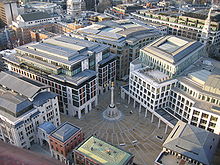
The City • Square MileAerial view of the City of London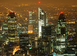

Flag
Coat of armsMotto: Domine Dirige Nos
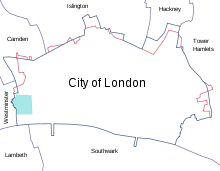
("O Lord Direct us", motto of City of London Corporation)Shown within Greater London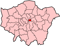
Coordinates: 51°30′56″N 0°05′32″W / 51.5155°N 0.0922°WCoordinates: 51°30′56″N 0°05′32″W / 51.5155°N 0.0922°W Sovereign state United Kingdom Constituent country England Region London Status Sui generis; City and ceremonial county Admin HQ Guildhall Roman settlement c. 47 AD
(Londinium)Wessex resettlement 886 AD
(Lundenburh)Subdivisions Government – Local authority City of London Corporation – Lord Mayor David Wootton – Member of Parliament Mark Field (Cities of London and Westminster) – London Assembly John Biggs (City and East) – Town Clerk Chris Duffield Area – Total 1.1 sq mi (2.90 km2) Highest elevation 69 ft (21 m) Lowest elevation 0 ft (0 m) Population (2010 est.)[1] – Total 11,700 – Density 10,449.3/sq mi (4,034.5/km2) – Ethnicity 84.4% White
(68.3% British
12.8% non-British
3.3% Irish)
6.8% South Asian
2.6% African-Caribbean
2.0% Chinese– ONS code 00AA Population Ranked 325/326 Time zone GMT (UTC0) – Summer (DST) BST (UTC+1) Postcodes EC, WC & E1 Area code(s) 020 Patron saint St Paul Police force City of London Police Transport for London zones Fare zone 1 & congestion charge zone Website cityoflondon.gov.uk The City of London is a small area within Greater London, England. It is the historic core of London around which the modern conurbation grew and has held city status since time immemorial.[2] The City’s boundaries have remained almost unchanged since the Middle Ages, and it is now only a tiny part of the metropolis of London, though it remains a notable part of central London. It is often referred to as the City (often written on maps as "City") or the Square Mile, as it is just over one square mile (1.12 sq mi/2.90 km2)[3] in area. These terms are also often used as metonyms for the United Kingdom's financial services industry, which continues a notable history of being based in the City.[4]
In the medieval period, the City was the full extent of London. The term London now refers to a much larger conurbation roughly corresponding to Greater London, a local government area which includes 32 London boroughs including the City of Westminster as well as the City of London. The local authority for the City, the City of London Corporation, is unique in the United Kingdom, and has some unusual responsibilities for a local authority in Britain, such as being the police authority for the City. It also has responsibilities and ownerships beyond the City's boundaries. The Corporation is headed by the Lord Mayor of the City of London, an office separate from (and much older than) the Mayor of London.
The City is today a major business and financial centre, ranking above New York City as the leading centre of global finance;[5] throughout the 19th century, the City served as the world's primary business centre, and continues to be a major meeting point for businesses to this day.[6] London came top in the Worldwide Centres of Commerce Index, published in 2008. The other major financial district in London is Canary Wharf, 2.5 miles (4.0 km) to the east.
The City has a resident population of a little over 11,000, but around 330,000 people work there, mainly in the financial services sector. The legal profession forms a major component of the western side of the City, especially in the Temple and Chancery Lane areas; these are where the Inns of Court are located, of which two — Inner Temple and Middle Temple — fall within the City of London boundary.
Contents
History
Main article: History of LondonToponymy
The name "London" is now used for a wider area than just the City of London, which is often known simply as 'the City'. This usage is documented as far back as the 16th century. 'The City' also denotes the trading and financial community based there. In this context it is also colloquially known as the 'Square Mile'.[7]
Roman origins
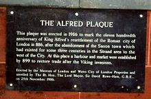 Plaque near Southwark Bridge noting the activities around the time of King Alfred.
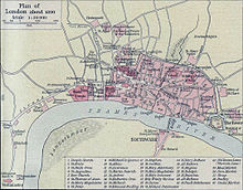 Map of London in about 1300.
It is believed that Roman London was established as a trading port by merchants on the tidal Thames around 47 AD. The new settlement and port was centred where the shallow valley of the Walbrook meets the Thames. However in AD 60 or 61, little more than ten years after Londinium was founded, it was sacked by the Iceni, led by their queen Boudica. Londinium was rebuilt as a planned settlement (a civitas) soon after and the new town was prosperous and grew to become the largest settlement in Roman Britain by the end of the 1st century. By the beginning of the 2nd century, Londinium had replaced Colchester as the capital of Roman Britain ("Britannia").
At its height, the Roman city had a population of approximately 45,000–60,000 inhabitants. The Romans built the London Wall some time between 190 and 225. The boundaries of the Roman city were similar to those of the City of London today, though Londinium did not extend further west than Ludgate/the River Fleet and the Thames was considerably wider than it is today, thus the shoreline of the city was north of its present position. The Romans built a bridge across the river, as early as 50 AD, near to where London Bridge stands.
A number of Roman sites and artefacts can be seen in the City of London today, including the Temple of Mithras, sections of the London Wall (at the Barbican and near the Tower of London), the London Stone and remains of the amphitheatre beneath the Guildhall. The Museum of London, located in the City, holds many of the Roman finds and has permanent Roman exhibitions, as well as being a source of information on Roman London generally.
Decline
By the time of the construction of the London Wall, the city's fortunes were in decline, with problems of plague and fire. The Roman Empire entered a long period of instability and decline, including for example the Carausian Revolt in Britain. In the 3rd and 4th centuries, the city was under attack from Picts, Scots and Saxon raiders. The decline continued, both for Londinium and the Empire, and in 410 AD the Romans withdrew entirely from Britain. Many of the Roman public buildings in Londinium by this time had fallen into decay and disuse, and gradually after the formal withdrawal the city became almost (if not, at times, entirely) uninhabited. The centre of trade and population moved away from the walled Londinium to Lundenwic ("London market"), a settlement to the west, roughly in the modern day Strand/Aldwych/Covent Garden area.
Anglo-Saxon restoration
Main article: Anglo-Saxon LondonDuring the Anglo-Saxon Heptarchy, the London area came under the Kingdoms of Mercia and then later Wessex, though was frequently under the control or threat of the Vikings and Danes.
Alfred the Great, King of Wessex and arguably the first king of the 'English', occupied and began the resettlement of the old Roman walled area, in 886, and appointed his son-in-law Earl Æthelred of Mercia over it as part of their reconquest of the Viking occupied parts of England. The refortified Anglo-Saxon settlement was known as Lundenburh ("London Fort", a borough). The historian Asser stated that "Alfred, king of the Anglo-Saxons, restored the city of London splendidly ... and made it habitable once more."[8] Alfred's "restoration" entailed reoccupying and refurbishing the nearly deserted Roman walled city, building quays along the Thames, and laying a new city street plan.[9]
Alfred's taking of London and the rebuilding of the old Roman city was a marking point in history, not only as the permanent establishment of the City of London, but also as part of a unifying moment in early English history, with Wessex becoming the dominant English kingdom and the repealing (to some degree) of the Viking occupation and raids. Whilst London, and indeed England, afterwards would continue to come under further periods of Viking and Dane raids and occupation, the establishment of the City of London and the Kingdom of England prevailed.[10]
In the 10th century, Athelstan permitted eight mints to be established, compared with six in his capital, Winchester, indicating the wealth of the city. London Bridge, which had fallen into ruin following the Roman evacuation and abandonment of Londinium, was rebuilt by the Saxons, but was periodically destroyed by Viking raids and storms.
As the focus of trade and population was moved back to within the old Roman walls, the older Saxon settlement of Lundenwic was largely abandoned and gained the name of Ealdwic (the "old settlement"). The name survives today as Aldwych (the "old market-place"), now a name given to a street and an area which lies in the City of Westminster between Westminster and the City of London.
Medieval and early modern periods
See also: Norman and Medieval London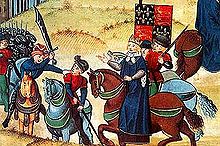 The end of the Peasant's Revolt 1381: their leader Wat Tyler is killed by William Walworth, Lord Mayor
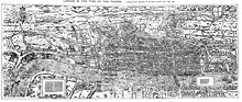 Civitas Londinium; Agas' Map of London, (1570-1605?)
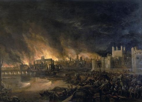
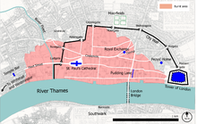 Map showing the extent of the Great Fire of London.
 The 1666 Great Fire destroyed nearly 80% of the City.
Following the Battle of Hastings, William the Conqueror marched on London, to Southwark and failed to get across London Bridge or to defeat the Londoners. He eventually crossed the River Thames at Wallingford, pillaging the land as he went. Rather than continuing the war, Edgar Ætheling, Edwin of Mercia and Morcar of Northumbria surrendered at Berkhamsted. William rewarded London in granting the citizens a charter in 1075; the City of London was one of the few institutions where the English retained some authority. The City was not covered by the Domesday Book.
William ensured against attack by building three castles nearby, to keep the Londoners subdued:
In 1132, Henry I recognised full County status for the City, and by 1141 the whole body of the citizenry was considered to constitute a single community. This 'commune' was the origin of the City of London Corporation and the citizens gained the right to appoint, with the king's consent, a Mayor in 1189 and to directly elect the Mayor from 1215.
The City continues to be composed of 25 ancient wards, each headed by an Alderman, who chair the Wardmotes. There was a Folkmoot for the whole of the city held at the outdoor cross of St Paul's Cathedral. Many of the medieval positions and traditions continue to the present day, demonstrating the unique institution which the City, and its Corporation, is.
The City was burned severely on a number of occasions, the worst being in 1123 and then again (and more famously) in the Great Fire of London in 1666. Both of these fires were referred to as the Great Fire. After the fire of 1666, a number of plans were drawn up to remodel the City and its street pattern into a renaissance-style city with planned urban blocks, squares and boulevards. These plans were almost entirely not taken up, and the medieval street pattern re-emerged almost intact.
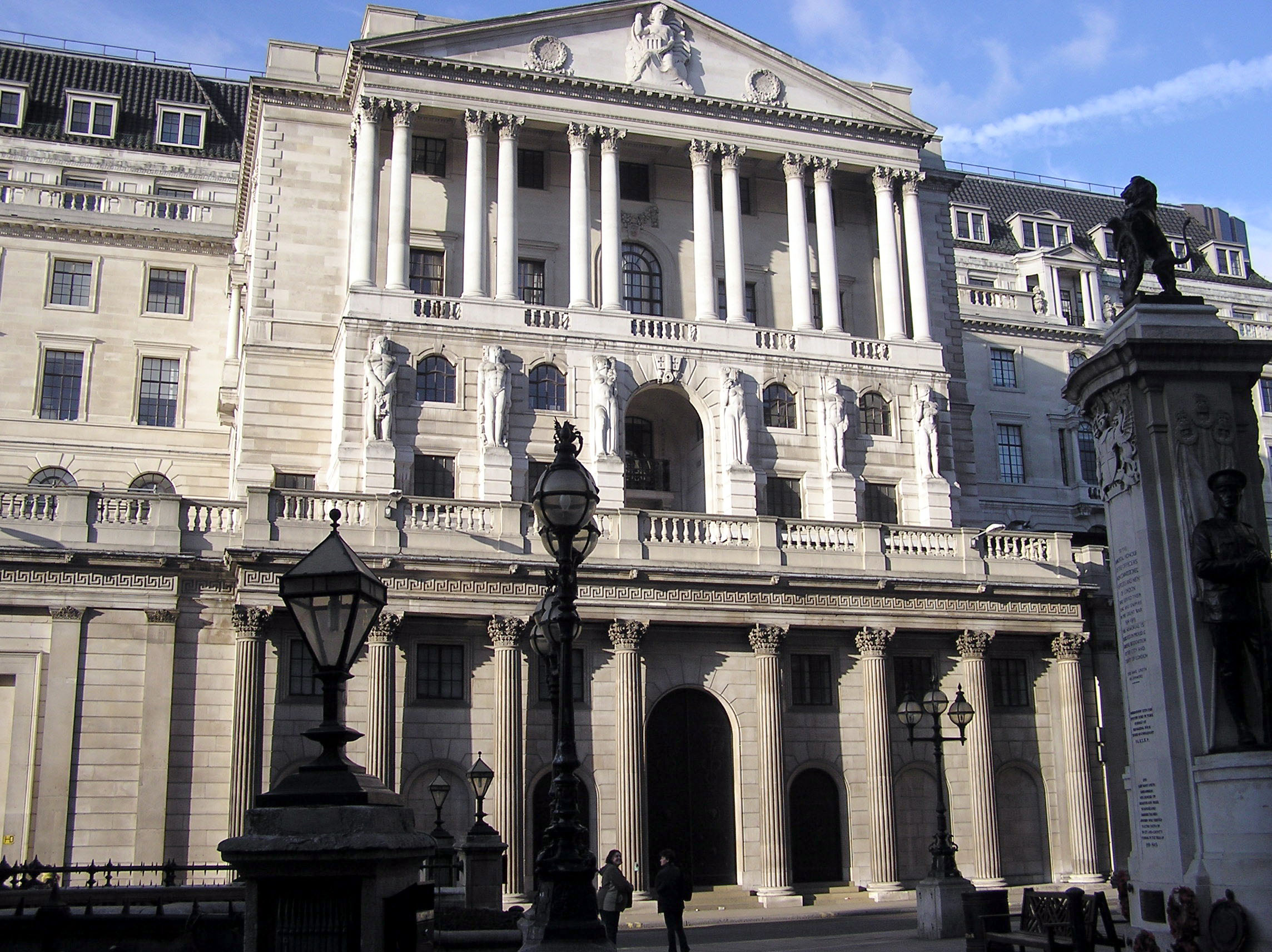
By the late 16th century London increasingly became a major centre for banking and international trade and commerce. The Royal Exchange was founded in 1565 by Sir Thomas Gresham to act as a centre of commerce for London's merchants and gained Royal patronage in 1571. Although no longer used for its original purpose, its location at the corner of Cornhill and Threadneedle Street continues to be the geographical centre for the City's core of banking and financial services, with the Bank of England moving to its present site in 1734, opposite the Royal Exchange on Threadneedle Street.
Growth of London
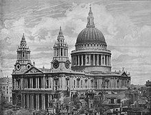 St Paul's Cathedral, 1896.
The 18th century was a period of rapid growth for London, reflecting an increasing national population, the early stirrings of the Industrial Revolution, and London's role at the centre of the evolving British Empire. The urban area expanded beyond the borders of the City of London, most notably during this period towards the West End and Westminster.
In 1708 Christopher Wren's masterpiece, St. Paul's Cathedral, was completed on his birthday. However, the first service had been held on 2 December 1697; more than 10 years earlier. This Cathedral replaced the original St. Paul's which had been completely destroyed in the Great Fire of London and is considered to be one of the finest in Britain and a fine example of Baroque architecture.
Expansion continued and became more rapid by the beginning of the 19th century, with London growing in all directions. To the East the Port of London grew rapidly during the century, with the construction of many docks, needed as the Thames at the City could not cope with the volume of trade. The arrival of the railways and the Tube meant that London could expand over a much greater area. By the mid-19th century, with London still rapidly expanding in population and area, the City had already become only a small part of the wider metropolis.
19th & 20th centuries
An attempt was made in 1894 to amalgamate the City and the surrounding County of London, but it did not succeed. The City of London therefore survived, and does so to this day, despite its situation within the London conurbation and numerous local government reforms. Regarding representation to Parliament, the City elected four members to the unreformed House of Commons, which it retained after the Reform Act 1832 and into the 20th century. Today it is included wholly in the Cities of London and Westminster constituency, and statute requires that it not be divided between two neighbouring areas.
The City's population fell rapidly in the 19th century and through most of the 20th century as people moved outwards to London's vast suburbs and many houses were demolished to make way for modern office blocks. The largest residential section of the City today is the Barbican Estate, constructed between 1965 and 1976. Here a major proportion of the City's population now live. The Museum of London is located here, as are a number of other services provided by the Corporation.
The City, like many areas of London and other British cities, fell victim to large scale and highly destructive aerial bombing during World War II, in what is known as The Blitz. Whilst St Paul's Cathedral survived the onslaught, large swathes of the City did not and the particularly heavy raids of late December 1940 led to a firestorm called the Second Great Fire of London. A major rebuilding programme therefore occurred in the decades following the war, in some parts (such as at the Barbican) dramatically altering the City's urban landscape. The destruction of the City's older historic fabric however allowed, and continues to allow, the construction of modern and larger-scale developments in parts of the City, whereas in those parts not so badly affected by bomb damage, the City retains its older character of smaller buildings. The street pattern, which is still largely medieval, was altered slightly in certain places, although there is a more recent trend of reversing some of the post-war modernist changes made, such as at Paternoster Square.
The 1970s saw the construction of tall office buildings including the 600-foot, 42-storey Natwest Tower, which became the first skyscraper in the UK. Office space development has intensified especially in the central, northern and eastern parts of the City, with further skyscrapers being built including 30 St Mary Axe, Broadgate Tower and the Heron Tower, the tallest in the City. A fifth, the Bishopsgate Tower is set to begin rising in late 2010, and will overtake the Heron Tower to become the tallest building in the City of London, and the second tallest in Britain after the under-construction Shard of Glass at London Bridge Station.
Arms, motto and flag
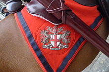 City of London arms on a saddle blanket, as seen outside the Royal Courts of Justice during the Lord Mayor's Show November 2011.
The Corporation of the City of London has a full achievement of armorial bearings consisting of a shield on which the arms are displayed, a crest displayed on a helm above the shield, supporters on either side and a motto displayed on a scroll beneath the arms.[11][12][13]
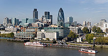 The Tower of London, Tower Millennium Pier and the City's financial core, as seen from City Hall in 2008.
The blazon of the arms is as follows:[13][11][12]
Arms: Argent a cross gules, in the first quarter a sword in pale point upwards of the last.
Crest: On a wreath argent and gules a dragon's sinister wing argent charged on the underside with a cross throughout gules.
Supporters: On either side a dragon argent charged on the undersides of the wings with a cross throughout gules.The coat of arms of the City is "anciently recorded" at the College of Arms. They were in use in 1381, as they formed part of the design of a new mayoralty seal taken into use on the 17 April of that year. These arms consist of a white shield bearing a red cross with a red upright sword in the first quarter. The design combines the emblems of the patron saints of England and London: the Cross of St George with the symbol of the martyrdom of Saint Paul. The 1381 arms replaced an earlier shield, found on a charter of 1319, that depicted St Paul holding a sword.[12][13] The sword is often erroneously supposed to commemorate the killing of Peasants' Revolt leader Wat Tyler by the Lord Mayor of London William Walworth. However the arms were in use some months before Tyler's death, and the tradition that Walworth's dagger is depicted may date from the late 17th century.[14][15][12][16]
The crest and supporters came into use in the 17th century but were used without authority until 30 April 1957 when they were confirmed and granted by letters patent from the College of Arms.[11][12][13]
The crest is a dragon's wing bearing the cross of St George, borne upon a peer's helm. A primitive form of the crest first appeared in 1539 on the reverse of a new common seal. This showed a fan-like object bearing a cross. Over time this evolved into a dragon's wing, and was shown as such in 1633 when it appeared above the city's coat of arms in the frontispiece to the fourth edition of John Stow's Survey of London. It has been speculated that the use of a peer's helmet (rather than that of a gentleman, used in other civic arms) relates to the use of the honorific prefix "The Right Honourable" by the Lord Mayor.[15] The helm was confirmed in 1957.[11]
On the seal of 1381 two lions were shown supporting the arms. However, by 1609 the present supporters, two white dragons bearing red crosses upon their wings, had been adopted.[13][15] The dragons were probably suggested by the legend of St George and the Dragon.[12][14]
The Latin motto of the City of London is "Domine dirige nos", which translates as "Lord, direct (guide) us". It appears to have been adopted in the 17th century, as the earliest record of it is was first recorded in 1633.[13][15]
A banner of the arms (the design on the shield) is flown as a flag.
Governance
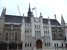 The Guildhall - the ceremonial and administrative centre of the City
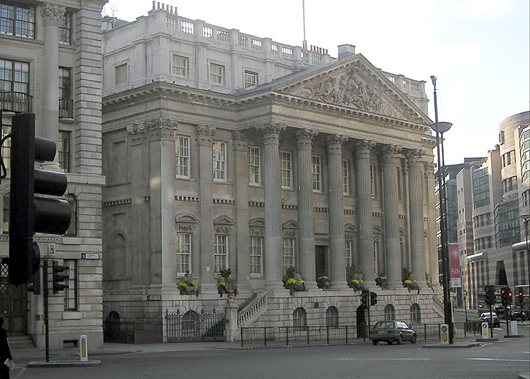
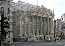 Mansion House - the official residence of the Lord Mayor
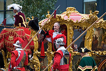 Former Lord Mayor of London John Stuttard during the Lord Mayor's parade of 2006
The City of London has a unique political status, a legacy of its uninterrupted integrity as a corporate city since the Anglo-Saxon period and its singular relationship with the Crown. Historically its system of government was not unusual, but it was not reformed by the Municipal Reform Act 1835 and little changed by later reforms.
It is administered by the City of London Corporation, headed by the Lord Mayor of London (not the same as the more recently created position of Mayor of London), which is responsible for a number of functions and owns a number of locations beyond the City's boundaries. Unlike other modern-day English local authorities, the Corporation has two council bodies: the now largely ceremonial Court of Aldermen and the Court of Common Council. The Court of Aldermen represents the wards, with each ward (irrespective of their size) returning one Alderman. The Chief Executive of the administrative side of the Corporation holds the ancient office of Town Clerk of London.
The City is a ceremonial county, although it has a Commission of Lieutenancy, headed by the Lord Mayor, instead of a Lord-Lieutenant. The City also has (instead of a High Sheriff) two Sheriffs (see list of Sheriffs of London), which are quasi-judicial offices and who are appointed by the Livery Companies, another ancient political system (based on the representation and protection of trades) still extant in the City. Senior members of the Livery Companies are known as Liverymen and form a special electorate called the Common Hall — this body chooses the Lord Mayor of the City, the Sheriffs and certain other officers.
Wards
Main article: Wards of the City of LondonThe City is made up of 25 wards, which had their boundaries changed in 2003, though the number of wards and their names did not change. They are survivors of the mediaeval governmental system that allowed a very local area to exist as a self governing enclave within the wider city.[17] They can be described as being both electoral/political divisions and permanent ceremonial, geographic and administrative entities within/sub-divisions of the City. Each ward has an Alderman, who traditionally held office for life but in the modern era put themselves up for re-election at least every 6 years. Wards continue to have Beadles, ancient functionary offices that are largely ceremonial in the modern era, the main remaining function being the running of the Wardmote, an annual meeting in each ward of electors, representatives and officials.[18] At the Wardmote the ward's Alderman appoints at least one Deputy for the year ahead. Each ward also has a Ward Club, which is similar to a residents' association found elsewhere in the country.[19]
The wards are ancient and their number has only changed three times since time immemorial: in 1394 Farringdon was divided into Farringdon Within and Farringdon Without; in 1550 the creation of Bridge Without, south of the river, with the ward of Bridge becoming Bridge Within;[20] and the merger of Bridge wards Within and Without, in 1978, into the present-day Bridge ward.[21]
Following changes to the City of London's boundary in 1994 and later reform of the business vote in the City, a major boundary and electoral representation revision took place to the wards in 2003. The ward boundaries and electoral representation were reviewed again in 2010 for change in 2013, though not to such a dramatic extent. The review was conducted by senior officers of the Corporation and senior judges of the Old Bailey;[22] the wards are not reviewed by the Electoral Commission under the Parliamentary Constituencies Act 1986 and (unlike with other local government electoral reviews in the country) the number and the names of the wards do not change. Particular churches, livery company halls and other historic buildings and structures are associated with specific wards, such as St Paul's Cathedral with Castle Baynard, or London Bridge with Bridge. Boundary changes in 2003 did remove some of these connected places from their wards, but that boundary review and the current review do take into account of these historic/traditional connections.
Current arrangements are that each ward elects an Alderman, to the Court of Aldermen and Commoners (the City equivalent of a Councillor) to the Court of Common Council of the Corporation. Only electors who are Freeman of the City of London are eligible to stand. The number of Commoners a ward sends to the Common Council varies (from 2 to 10) and depends on the size of the ward, in terms of the number of eligible votes. Since the 2003 review it is agreed that the four residential wards send 20 of the 100 Commoners, with the business-dominated wards returning the remaining allocation of 80 Commoners. Four of the wards are today regarded as being primarily residential, and recent boundary changes have reinforced this. They are: Portsoken, Queenhithe, Aldersgate and Cripplegate.
Elections
The City has a unique electoral system. Most of its voters are representatives of businesses and other bodies that occupy premises in the City. Its ancient wards have very unequal numbers of voters. In elections, both the businesses based in the City and the residents of the City vote.
The principal justification for the non-resident vote is that about 330,000 non-residents constitute the city's day-time population and use most of its services, far outnumbering the City's residents, who number around 11,000. Nevertheless, the system has long been the cause of controversy. The business vote was abolished in all other UK local authority elections in 1969.
A private act of Parliament in 2002[23] reformed the voting system for electing Members to the Corporation of London and received the Royal Assent on 7 November 2002. Under the new system, the number of non-resident voters has doubled from 16,000 to 32,000. Previously disfranchised firms (and other organizations) are entitled to nominate voters, in addition to those already represented, and all such bodies are now required to choose their voters in a representative fashion.
Bodies employing fewer than ten people may appoint one voter; those employing ten to 50 people may appoint one voter for every five employees; those employing more than 50 people may appoint ten voters and one additional voter for each 50 employees beyond the first 50.
The Act also removed other anomalies that had developed within the City's system, which had been unchanged since the 1850s.
The Temple
Inner Temple and Middle Temple (which neighbour each other) are two of the few remaining liberties, an old name for a geographic division. They are independent extra-parochial areas,[24] historically not governed by the City of London Corporation[25] (and are today regarded as local authorities for most purposes[26]) and equally outside the ecclesiastical jurisdiction of the Bishop of London. They geographically fall within the boundaries and liberties of the City, but can be thought of as independent enclaves. They are both part of the Farringdon Without ward of the City.
Other functions
Within the City, the Corporation owns and runs both the Smithfield Market and Leadenhall Market. The Corporation owns and is responsible for a number of locations beyond the boundaries of the City. These include various open spaces (parks, forests and commons) in and around greater London, including most of Epping Forest, Hampstead Heath and many public spaces in Northern Ireland through The Honourable The Irish Society. It also owns Old Spitalfields Market and Billingsgate Fish Market, both of which are within the neighbouring London Borough of Tower Hamlets. The Corporation also owns and helps fund the Old Bailey, the Central Criminal Court for England and Wales, as a gift to the nation, it having begun as the City and Middlesex Sessions.
The City has its own independent police force, the City of London Police - the Common Council (the main body of the Corporation) is the police authority.[27] The rest of Greater London is policed by the Metropolitan Police Service, based at New Scotland Yard.
The City of London has one hospital, St Bartholomew's Hospital. Founded in 1123 and commonly known as 'Barts', the hospital is at Smithfield, and is undergoing a long-awaited regeneration after many doubts as to it continuing in use during the 1990s.
The City is the third largest UK funding-patron of the arts. It oversees the Barbican Centre and subsidises several important performing arts companies.
The Port of London's health authority is also the responsibility of the Corporation, which includes the handling of imported cargo at London Heathrow airport.[28] The Corporation oversees the running of the Bridge House Trust, which maintains five key bridges in central London, London Bridge, Blackfriars Bridge, Southwark Bridge, Tower Bridge and the Millennium Bridge. The City's flag flies over Tower Bridge, although neither footing is in the City.[29]
Changes to boundary
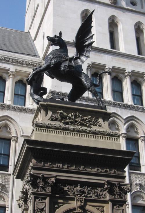
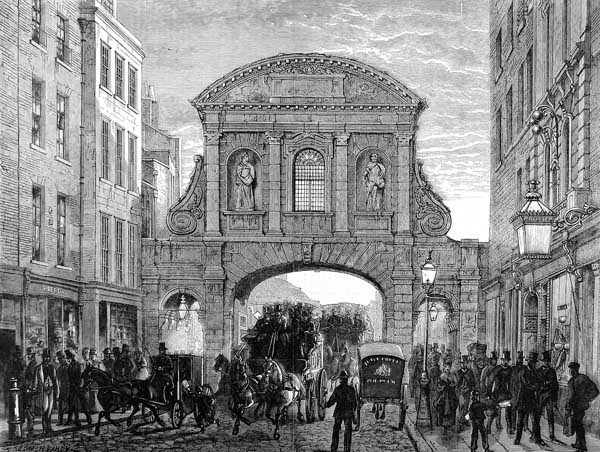
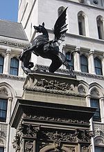 Dragon statue atop the Temple Bar monument, which marks the boundary between the City and Westminster.
The size of the City was constrained by a defensive perimeter wall, known as London Wall, which was built by the Romans in the late 2nd century to protect their strategic port city. However the boundaries of the City of London no longer coincide with the old city wall, as the City expanded its jurisdiction slightly over time. During the medieval era, the City's jurisdiction expanded westwards, crossing the historic western border of the original settlement - the River Fleet - along Fleet Street to Temple Bar. The City also took in the other "City bars" which were situated just beyond the old walled area, such as at Holborn, Aldersgate, Bishopsgate and Aldgate. These were the important entrances to the City and their control was vital in maintaining the City's special privileges over certain trades.
The walls have almost entirely disappeared, although several sections remain visible. A section near the Museum of London was revealed after the devastation of an air raid on 29 December 1940 at the height of the Blitz. Other visible sections are at St Alphage, and there are two sections near the Tower of London. The River Fleet was canalised after the Great Fire of 1666 and then in stages was bricked up and has been since the 18th century one of London's "lost rivers", today running entirely underground as a storm drain.
The boundary of the City then remained fixed until minor boundary changes in 1994, when it expanded slightly to the west, north and east, taking small parcels of land from the London Boroughs of Westminster, Camden, Islington, Hackney and Tower Hamlets. The main purpose of these changes was to tidy up the boundary in places where its course had been rendered obsolete by changes in the urban landscape. In the process the City lost small parcels of land, though there was an overall net gain of land (the City grew from 1.05 to 1.12 square miles). Most notably, the changes placed the (then recently developed) Broadgate estate entirely in the City.[30]
Southwark, to the south of the City on the other side of the Thames, came within the City between 1550 and 1899 as the Ward of Bridge Without, a situation connected with the Guildable Manor. The City's administrative responsibility there, however, had in practice disappeared by the mid-Victorian period as various aspects of metropolitan government were extended into the neighbouring areas. Today it forms part of the London Borough of Southwark. The Tower of London has always been outside the City and today comes under the London Borough of Tower Hamlets.
Geography
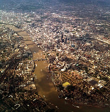 The City and its immediate environs, 2011.
The City of London is England's smallest ceremonial county by area and population, and the fourth most densely populated. Of the 326 English districts, it is the second smallest by population, after the Isles of Scilly, and the smallest by area. It can also be regarded as the second smallest British city in population, after St David's in Wales.
The elevation of the City ranges from sea level at the Thames to 21.6 metres (71 ft) at the junction of High Holborn and Chancery Lane.[31] Two small but notable hills exist within the historic core: Ludgate Hill to the west and Cornhill to the east; between them ran the Walbrook, one of the many "lost" rivers of London — another such river in the City is the Fleet.
Boundary
 Borders of the City of London, showing surrounding London boroughs and the pre-1994 boundary (where changed) in red. The area covered by the Inner and Middle Temple is marked.
Beginning in the west, where the City borders Westminster, the boundary crosses the Victoria Embankment from the Thames, passes to the west of Middle Temple, then turns for a short distance along Strand and then north up Chancery Lane, where it borders Camden. It turns east along Holborn to Holborn Circus, and then goes north east to Charterhouse Street. As it crosses Farringdon Road it becomes the boundary with Islington. It continues to Aldersgate, goes north, and turns east into some back streets soon after Aldersgate becomes Goswell Road, since 1994 embracing all of the Corporation's Golden Lane Estate. Here, at Baltic Street West, is the most northerly extent of the City. The boundary includes all of the Barbican Estate and continues east along Ropemaker Street and its continuation on the other side of Moorgate, becomes South Place. It goes north, reaching the border with Hackney, then east, north, east on back streets, with Worship Street forming a northern boundary, so as to include the Broadgate estate. The boundary then turns south at Norton Folgate and becomes the border with Tower Hamlets. It continues south into Bishopsgate, and takes some backstreets to Middlesex Street (Petticoat Lane) where it continues south-east then south. It then turns south-west, crossing the Minories, so as to exclude the Tower of London from the City, and then reaches the river. The City's boundary then runs up the centre of the Thames, with the exception that the entire span of Blackfriars Bridge falls within the City; additionally the City controls the full span of London Bridge (as part of Bridge ward) but only half of the river underneath it, a feature which is unique in British local administration.
The boundaries of the City are marked by black bollards bearing the City's emblem, and at major entrances, such as at Temple Bar on Fleet Street, a grander monument, with a dragon facing outwards, marks the boundary.
Official boundary map, with wards.
In some places the financial district extends slightly beyond the political boundaries of the City, notably to the north and east, into the London Boroughs of Tower Hamlets, Hackney and Islington, and informally these locations are seen as part of the "Square Mile". Since the 1990s the eastern fringe of the City, extending into Hackney and Tower Hamlets, has increasingly been a focus for large office developments due to the availability of large sites there compared to within the City.
Gardens and public art
See also: List of public art in the City of London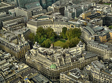 Finsbury Circus, the largest public open space in the City, as seen from Tower 42
The City has no sizeable parks within its boundary, but does have a network of a large number of gardens and small open spaces, many of which are maintained by the Corporation. These range from formal gardens such as the one in Finsbury Circus, containing a bowling green and bandstand, to churchyards such as one belonging to the church of St. Olave Hart Street, to water features and artwork found in some of the courtyards and pedestrianised lanes.[32]
Gardens include:
- Barber-Surgeon's Hall Garden, London Wall
- Cleary Garden, Queen Victoria Street
- Finsbury Circus, Blomfield Street/London Wall/Moorgate
- Jubilee Garden, Houndsditch
- Portsoken Street Garden, Portsoken Street/Goodman's Yard
- Postman's Park, Little Britain/Aldersgate
- Seething Lane Garden, Seething Lane
- St. Dunstan-in-the-East, St. Dunstan's Hill/Idol Lane
- St. Mary Aldermanbury, Aldermanbury
- St. Olave Hart Street churchyard, Seething Lane
- St. Paul's churchyard, St Paul's Cathedral
- West Smithfield Garden, West Smithfield
- Whittington Gardens, College Street/Upper Thames Street
Additionally there are a number of private gardens and open spaces, found often within courtyards of the larger commercial developments. Two of the largest private gardens are those of the Inner Temple and Middle Temple Inns of Court, in the far southwest of the City.
The Thames and its riverside walks are increasingly being valued as open space for the City and in recent years efforts have been made to increase the ability for pedestrians to access and walk along the river.
Climate
The nearest weather station has historically been the London Weather Centre, located at Kingsway/Holborn, although observations ceased in 2010. Now St James Park provides the nearest official readings.
The City has a oceanic climate (Köppen "Cfb") modified somewhat by the Urban Heat Island which persists in the centre of London. This generally causes higher nighttime minima than outlying areas. For example, the August Mean minimum[33] of 14.7 °C (58.5 °F) compares to a figure of 13.3 °C (55.9 °F) for both Greenwich[34] and Heathrow[35] and just 11.6 °C (52.9 °F) at Wisley[36] on the edge of the urban area beside the M25. All figures refer to the observation period 1971-2000.
Not surprisingly, the weather station holds the record for the UK's warmest overnight minimum temperature, 24.0 °C (75.2 °F), recorded on the 4th of August 1990.[37] The absolute maximum temperature stands at 37.6 °C (99.7 °F), set on the 10th August 2003.[38] The absolute minimum[39] for the weather station is a mere −8.2 °C (17.2 °F), compared to readings around −15 °C (5.0 °F) towards the edges of London. Unusually, this temperature was set during a windy and snowy cold spell (Mid January 1987), rather than a cold clear night - cold air drainage is arrested due to the vast urban area surrounding the city.
The station also holds the record for the highest British mean monthly temperature,[40] 22.9 °C (73.2 °F) (mean maximum 27.9 °C (82.2 °F), mean minimum 17.8 °C (64.0 °F) during July 2006. However, in terms of daytime maximum temperature's only, Cambridge NIAB[41] and Botanical Gardens[42] with a mean maximum of 28.3 °C (82.9 °F), and Heathrow[43] with 28.2 °C (82.8 °F) all exceeded this.
Some have questioned the comparability of the LWC records due to the weather stations rooftop location (rather than a conventional ground/grass located screen).
Climate data for London Weather Centre 1971-2000, 43m asl Month Jan Feb Mar Apr May Jun Jul Aug Sep Oct Nov Dec Year Average high °C (°F) 8.3
(46.9)8.5
(47.3)11.1
(52.0)13.5
(56.3)17.1
(62.8)20.0
(68.0)22.6
(72.7)22.5
(72.5)19.3
(66.7)15.3
(59.5)11.2
(52.2)9.1
(48.4)14.88
(58.78)Average low °C (°F) 3.7
(38.7)3.4
(38.1)5.0
(41.0)6.4
(43.5)9.4
(48.9)12.3
(54.1)14.6
(58.3)14.7
(58.5)12.5
(54.5)9.6
(49.3)6.2
(43.2)4.7
(40.5)8.54
(47.38)Source: YR.NO[44] Public services
Police and security
The City is a police area and has its own territorial police force, the City of London Police, which is a separate organisation to the Metropolitan Police Service which covers the remainder of Greater London. The City Police have three police stations, located at Snow Hill, Wood Street and Bishopsgate, and has 813 police officers, 85 Special Constables and 48 PCSOs. Covering just the City of London, it is the smallest territorial police force in England and Wales, both in terms of geographic area and the number of police officers.
Where the majority of British police forces have silver-coloured badges, those of the City Police are black and gold featuring the City crest. The force also have a unique red and white chequered cap bands and red and white striped duty arm bands on the sleeve of the tunics of constables and sergeants (red and white being the colours of the City of London), which in most other British police forces are black and white. City police sergeants and constables wear crested helmets whilst on foot patrol. These helmets do not feature the Brunswick Star, which is used on most other police helmets in England and Wales.
The City's position as the United Kingdom's financial centre and a critical part of the country's economy, contributing about 2.5% of the UK's gross national product,[45] has resulted in it becoming a target for political violence. The Provisional IRA exploded several bombs in the City in the early 1990s, including the 1993 Bishopsgate bombing.
The area is also spoken of as a possible target for al-Qaeda. For instance, when in May 2004 the BBC's Panorama programme examined the preparedness of Britain's emergency services for a terrorist attack on the scale of September 11, 2001 attacks, they simulated a chemical explosion on Bishopsgate in the east of the City.
The "Ring of Steel" is a particularly notable measure, established in the wake of the IRA bombings, that has been taken against terrorist threats.
Fire brigade
Main article: London Fire BrigadeThe City has fire risks in many places, including St. Paul's Cathedral, The Old Bailey, Mansion House, Smithfield Market, the Guildhall, and the numerous high-rise buildings. There is one London Fire Brigade station within the City, at Dowgate, with one pumping appliance.[46] The City relies upon stations in the surrounding London boroughs to support it at some incidents. Within the City the first fire engine is in attendance in roughly five minutes on average, the second when required in a little over five and a half minutes.[46] There were 1,814 incidents attended in the City in 2006/2007 - the lowest in Greater London amongst the 32 London boroughs. No one has died in an event arising from a fire in the City in the last four years prior to 2007.[46]
Demography
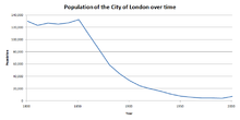 Population between 1800 and 2000
The Office for National Statistics has estimated that the City of London's population for mid-2010 was 11,700;[1] which was 4,515 more people than that of the last census from 2001.[47] At the time of the 2001 UK census, the ethnic composition of the City was 84.6% White, 6.8% South Asian, 2.6% Black, 2.3% Mixed, 2.0% Chinese and 1.7% were listed as "other".[47] To the right is a graph showing the change in population of the City since 1801 based decadal censuses. The first half of the 19th century shows a population staying between 120,000-140,000 people, however the population decreases dramatically from 1851 to 1991, with a small increase in population between 1991 and 2001. The only notable boundary changes to the City since the first census in 1801 occurred in 1994.
The City of London's full-time working residents have much higher gross weekly pay compared to London and Great Britain (England, Wales and Scotland): £773.30 compared to £598.60 and £491.00 respectively.[48] It is worth noting, however, that there is a large inequality between genders (£1,085.90 in men compared to £653.50 in women).[48] The 2001 Census showed the City of London as a unique district amongst 376 districts surveyed in England and Wales.[47] The City had the highest proportional population increase, households without a car or van, one-person households, people with qualifications at degree level or higher and the highest indications of overcrowding.[47] It recorded the lowest proportion of households with cars or vans, married couple households, people who travel to work by car and the lowest average household size: just 1.58 people.[47] It also ranked highest within the Greater London area for the percentage of people with no religion and people who are employed.[47]
Economy
See also: Economy of London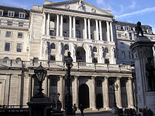
The City vies with New York City as the financial capital of the world and many banking and insurance institutions have their headquarters there. The London Stock Exchange (shares and bonds), Lloyd's of London (insurance) and the Bank of England are all based in the City. Over 500 banks have offices in the City, and the City is an established leader in trading in Eurobonds, foreign exchange, energy futures and global insurance. The Alternative Investment Market, a market for trades in equities of smaller firms, is a recent development. In 2008, the City of London accounted for 4% of UK GDP.[citation needed]
London is the world's greatest foreign exchange market, with much of the trade conducted in the City of London. Of the $3.98 trillion daily global turnover, as measured in 2007, trading in London accounted for around $1.36 trillion, or 34.1% of the total.[49] The Pound Sterling, the currency of the United Kingdom, is globally the fourth most traded currency and the third most held reserve currency.
Since 1991 Canary Wharf, a few miles east of the City in Tower Hamlets, has become a second centre for London's financial services industry and houses many banks and other institutions formerly located in the Square Mile. Although growth has continued in both locations, the Corporation has come to realise that obstructive planning policies were causing financial firms to increasingly choose Canary Wharf as a location.
Headquarters
Many major global companies have their headquarters in the City, including Aviva,[50] BT Group,[51] Lloyds Banking Group,[52] Old Mutual,[53] Prudential,[54] Standard Chartered,[55] and Unilever.[56]
A number of the world's largest law firms are headquartered in the City, including Allen & Overy, Clifford Chance, Freshfields Bruckhaus Deringer, DLA Piper, Hogan Lovells, Linklaters, Eversheds and Slaughter and May.
Non-financial diversification
The trend for purely office development is beginning to reverse as the Corporation encourages residential use, albeit with development occurring when it arises on windfall sites. The City has a target of 90 additional dwellings per year.[57] Some of the extra accommodation is in small pre-World War II listed buildings, which are not suitable for occupation by the large companies which now provide much of the City's employment.
Since the 1990s, the City has diversified away from near exclusive office use in other ways. For example, several hotels and the City's first department store opened in the 2000s. A shopping centre was opened at One New Change, Cheapside (near St Paul's Cathedral) in October 2010. However, large sections of the City remain very quiet at weekends, especially those areas in the eastern section of the City, and it is quite common to find shops, pubs and cafes closed on these days. The new centre at One New Change however is open 7 days a week.
Other sectors
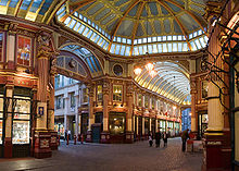
Whilst the financial sector, and related businesses and institutions, continue to dominate the City, the City's economy is not limited to that sector. The legal profession has a strong presence in the City, especially in the western half (i.e. towards the Inns of Court). Retail businesses were once important in the City, but have gradually moved to the West End of London, though it is now Corporation policy to encourage retailing in some locations, for example at Cheapside near St Paul's. The City has a number of visitor attractions, mainly based on its historic heritage as well as the Barbican Centre and adjacent Museum of London, though tourism is not at present a major contributor to the City's economy or character. The City has many pubs, bars and restaurants, and the "night-time" economy does feature in the Bishopsgate area, towards Shoreditch. The meat market at Smithfield, wholly within the City's boundaries, continues to be one of London's main markets (the only one remaining in central London) and the country's largest meat market. In the east of the City is Leadenhall Market, a fresh food market that is also a visitor attraction.
Landmarks
Historic buildings
Fire, bombing and post-War redevelopment has meant that the City, despite its history, has relatively few intact notable historic structures remaining. Those that are present today include the Monument to the Great Fire of London ("the Monument"), St Paul's Cathedral, the Guildhall, the Royal Exchange, Dr. Johnson's House, Mansion House and a great many churches, many designed by Sir Christopher Wren, who also designed St Paul's. 2 King's Bench Walk and Prince Henry's Room are notable historic survivors of heavy bombing of the Temple area, which has largely been rebuilt to its historic form. Another example of a bomb-damaged place having been restored is Staple Inn on Holborn. A few small sections of the Roman London Wall exist, for example near the Tower of London and also in the Barbican area. Among the twentieth century listed buildings are Bracken House, the first post WWII buildings in the country to be given statutory protection, and the whole of the Barbican and Golden Lane Estate.
The Tower of London is not within the City, but is a notable visitor attraction which brings tourists to the southeast of the City. Other landmark buildings include a number of the modern high-rise buildings (see section below) as well as the Bank of England, the Old Bailey, Smithfield Market and the Lloyd's building.
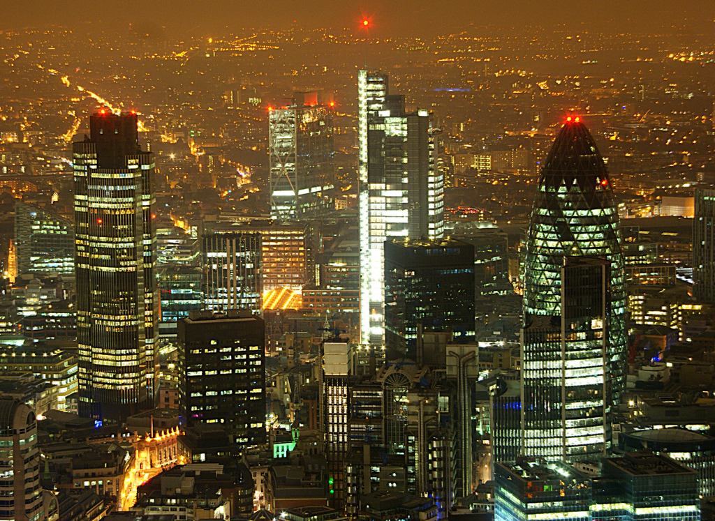
Skyscrapers
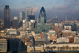 The City of London's core skyline, as seen from the south, in December 2009. The Heron Tower is seen under construction
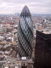
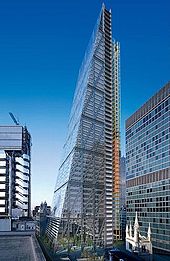 One of a number of skyscrapers at present under construction in the City is The Leadenhall Building (nicknamed the "Cheesegrater")
Completed
A growing number of tall buildings and skyscrapers exist in the City, principally for use by the financial sector. Almost all are situated in the eastern side of the Square Mile, in what is the City's financial core. In the north of the City there is a smaller cluster comprising the Barbican Estate's three tall residential towers and the commercial CityPoint tower — another residential tower at Milton Court is under construction adjacent to CityPoint. In 2007, the 100 m (328 ft) tall Drapers' Gardens building was demolished and replaced by a shorter tower. The thirteen tallest buildings (those taller than 100m) at present in the City are:
Rank Name Built Use Height Floors Location metres feet 1 Heron Tower 2010 Office 202 753 46 110 Bishopsgate 2 Tower 42 1980 Office 183 600 47 25 Old Broad Street 3 30 St Mary Axe ("The Gherkin") 2003 Office 180 590 40 30 St Mary Axe 4 Broadgate Tower 2008 Office 164 538 35 201 Bishopsgate 5 CityPoint 1967 Office 127 417 36 Ropemaker Street 6 Willis Building 2007 Office 125 410 26 51 Lime Street =7 Cromwell Tower 1973 Residential 123 404 42 Barbican Estate =7 Lauderdale Tower 1974 Residential 123 404 42 Barbican Estate =7 Shakespeare Tower 1976 Residential 123 404 42 Barbican Estate 10 St Helen's ("Aviva Tower") 1969 Office 118 387 28 Undershaft, St Mary Axe 11 St Paul's Cathedral 1710 Cathedral 111 365 n/a Ludgate Hill 12 99 Bishopsgate 1976 Office 104 340 26 99 Bishopsgate 13 Stock Exchange Tower 1970, reconstructed 2009 Office 100 328 27 125 Old Broad Street Under construction
Buildings over 100 metres either under construction or approved to be built:
Name Height Floors Location Use Status metres feet The Pinnacle ("Helter Skelter") 288 945 63 22-24 Bishopsgate Office Under construction The Leadenhall Building ("Cheesegrater") 225 737 48 122 Leadenhall Street Office Under construction[58] 100 Bishopsgate 172 564 40 100 Bishopsgate Office Site preparation[59] 20 Fenchurch Street ("Walkie Talkie") 160 525 39 20 Fenchurch Street Office Under construction Heron Plaza 135 443 44 128-140 Bishopsgate Hotel/Residential Site preparation[60] "The Heron"[61] 112 367 35 Milton Court, Barbican Residential Under construction Timeline
This is the timeline of the tallest building in the City of London. The White Tower and Southwark Cathedral lie immediately outside the City's official boundary; the Pinnacle is under construction.
Name Years as Tallest Metres Feet Floors The Pinnacle U/C 288 945 63 Heron Tower 2010 202 663 46 Tower 42 1980–2010 183 600 47 CityPoint 1967–1980 122 400 35 St Paul's Cathedral 1710–1962 111 365 n/a St Mary-le-Bow 1683–1710 72 236 n/a Monument to the Great Fire of London 1677–1683 62 202 n/a Southwark Cathedral 1666-1677 50 163 n/a Old St Paul's Cathedral 1310-1666 150 493 n/a White Tower 1098-1310 27 90 n/a Transport
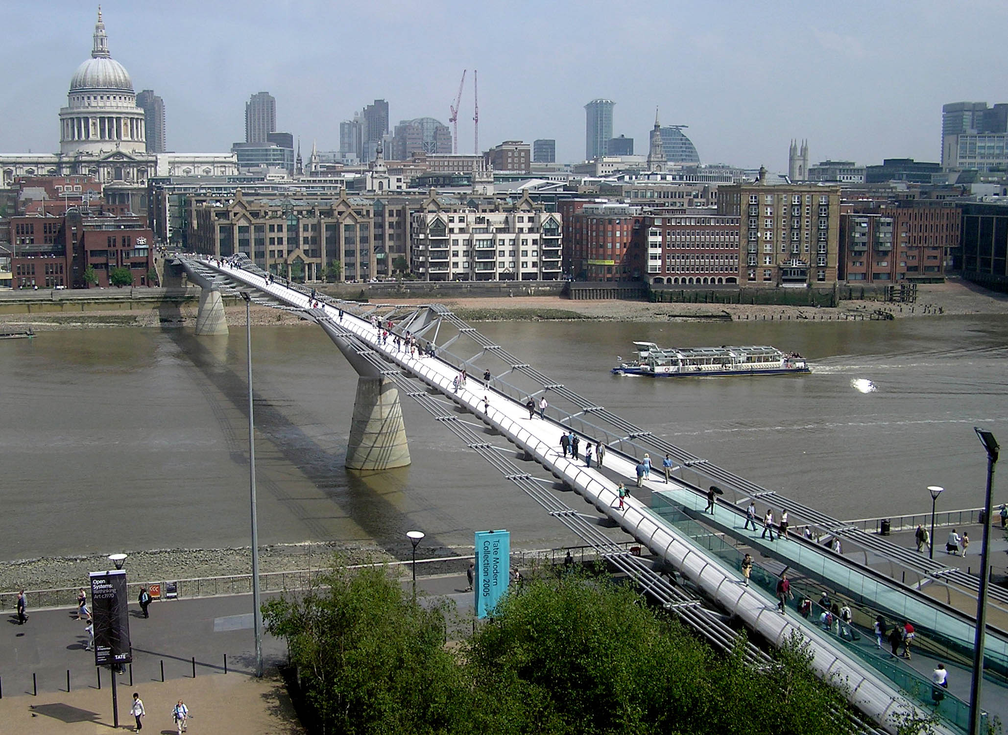
See also: Transport in London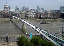 The Millennium Bridge, looking north towards St. Paul's Cathedral and the City.
Rail
The City is well served by the London Underground network, as well as the Docklands Light Railway (DLR), with 12 tube stations (counting Bank and Monument stations separately) and 2 DLR stations within its boundary. Three National Rail termini stations are located in the City, at Liverpool Street, Fenchurch Street and Cannon Street, and London Bridge station is on the other end of London Bridge in Southwark. The Thameslink mainline runs north-south through the western half of the City, with two stations within the City boundary: City Thameslink and Blackfriars. As well as being an Underground station, Moorgate is the terminus of the Northern City Line. The whole of the City of London lies in Travelcard Zone 1.
The high capacity west-east Crossrail railway line, which is scheduled to be completed by 2017, will run underground across the north of the City, with two stations at Farringdon (linked also to Barbican) and Liverpool Street (linked also to Moorgate).
Road
The national A1, A10 A3, A4, and A40 road routes begin in the City of London. The entirety of the City lies within the London congestion charge zone, with the small exception on the eastern boundary of the parts of the A1210/A1211 routes which form part of the inner ring road. The following bridges, listed west to east (heading downstream), cross the River Thames from the City of London to the southern bank: Blackfriars Bridge, Blackfriars Railway Bridge, Millennium Bridge (footbridge), Southwark Bridge, Cannon Street Railway Bridge and London Bridge. The famous landmark, the Tower Bridge, is not in the City of London. The City, like most of central London, is well served by buses, including night buses. Two bus stations are located in the City, at Aldgate on the eastern border with Tower Hamlets, and at Liverpool Street by the railway station there. There are approximately 28 Barclays Cycle Hire docking stations in the City.[62] A number of existing and proposed cycle routes criss-cross the City, as part of the London Cycle Network.[63]
River
One London River Services pier exists on the Thames along the City of London shore, the Blackfriars Millennium Pier, though the Tower Millennium Pier lies adjacent to the City's boundary, near the Tower of London. One of the Port of London's 25 safeguarded wharves in central London, Walbrook Wharf, is located on the City of London's shore, adjacent to Cannon Street station, and is used by the Corporation of London to transfer waste via the river. Swan Lane Pier, just upstream of London Bridge on the City shore, is proposed to be replaced and upgraded for regular passenger services. This work is planned to take place in 2012-2015. Before then, Tower Pier is to be extended.[64]
There is a public riverside walk along the entire shoreline of the City; it was opened in stages in recent years. The only remaining section not running along the river is a short stretch at Queenhithe. The walk runs along Walbrook Wharf and is only closed to pedestrians at this point when waste is being transferred onto barges.
Education
The City has only one directly maintained primary school,[65] Sir John Cass's Foundation Primary School at Aldgate[66] (ages 4 to 11). It is a Voluntary-Aided (VA) Church of England school, maintained by the Education Service of the City of London.
City residents may send their children to schools in neighbouring Local Education Authorities, such as Islington, Tower Hamlets, Westminster and Southwark.
The City controls three independent schools, City of London School (a boys school) and City of London School for Girls (girls) which are in the City itself, and the City of London Freemen's School (co-educational day and boarding) which is in Ashtead, Surrey. The City of London School for Girls has its own preparatory department for entrance at age seven. It is also the principal sponsor of the City of London Academy which is based in Southwark.
The City is also home to the renowned Cass Business School, the Guildhall School of Music and Drama and parts of three of the universities in London: The Maughan Library of King's College London's Strand Campus, and the business school of London Metropolitan University. A third business school in the City is a campus of the University of Chicago Graduate School of Business at Ropemaker Place. The College of Law has its London campus in Moorgate; part of Barts and The London School of Medicine and Dentistry is in the City, on the Barts hospital site at West Smithfield.
Public libraries
Libraries operated by the City of London Corporation include Barbican Library, Camomile Street Library, City Business Library, Guildhall Library, and Shoe Lane Library.[67]
Criticism
The City of London has been granted various special privileges since the Norman Conquest such as the right to run its own affairs[68][69] partly due to the power of its financial capital. These are also mentioned by the Statute of William and Mary in 1690.[70] Today, voting rights for the City of London’s municipal authority are granted to its 32,000 businesses in addition to residents which now number fewer than 12,000. This unique patronage system ensures that business interests usually take priority. Despite this, multiple attempts to reform the City have been thwarted, and maintaining these privileges is the role of an unelected official lobbyist in Parliament called the Remembrancer.[71]
The power and influence of the City over government policy has enraged democratically elected leaders down the ages. For example the former British Prime Minister Clement Attlee wrote “Over and over again we have seen that there is in this country another power than that which has its seat at Westminster. The City of London, a convenient term for a collection of financial interests, is able to assert itself against the Government of the country. Those who control money can pursue a policy at home and abroad contrary to that which has been decided by the people."[72]
More recently, following the financial crises of the late 2000s, the City came in for criticism due to an apparent lack of control and regulation. It is also claimed that many of the recent financial catastrophes which were partly caused by a lack of such controls, can be traced to companies who work in the City, or London based offices.[73]
English secretive trust laws and strong libel laws are two factors that make the City an attractive offshore haven for the assets of foreign business. Eva Joly states “The City of London that state within a state’ has never transmitted even the smallest piece of usable evidence to a foreign magistrate."[74] This provides a lucrative environment for money laundering and assets to be sheltered from tax, free from examination by law enforcement agencies by maintaining plausible deniability. Rich private clients also benefit through the domicile rules.[75] Although the City of London’s headline tax rate is the same as the rest of the UK, by influencing and using the legal system and laws of disclosure it has the means to allow clients to avoid or reputedly evade tax.
Although there is no agreed definition of a tax haven, many authors have accused the City of London of being one.[76][77] The Tax Justice Network, goes further and accuses the City of London as being “the biggest tax haven in the world” as well as ‘a state within a state’.[78] Ian Doyle and Jem Bendell, summarise these claims with the following statement: the City “is the most powerful lobby in Britain and possibly the world, and as a result . . . exerts enormous political influence to resist regulation and extract tax exemption. It has fostered criminality by ensuring that the City ranks amongst the least accountable of financial centres on the face of the Earth”.[79] The novel Golden Handcuffs by Polly Courtney draws on the author's experiences of working in investment banking.[80]
It should be noted that many criticisms of the 'City of London' also apply to the UK financial services industry. However, these activities still tend to be centered on London and the City of London in particular.
References
- ^ a b "Table 8a Mid-2010 Population Estimates: Selected age groups for local authorities in the United Kingdom; estimated resident population.". Population Estimates for UK, England and Wales, Scotland and Northern Ireland, Mid-2010. Office for National Statistics. 3 June 2011. http://www.ons.gov.uk/ons/publications/re-reference-tables.html?edition=tcm%3A77-231847. Retrieved 1 October 2011.
- ^ Beckett, J V (2005). City status in the British Isles, 1830–2002. Historical urban studies. Aldershot: Ashgate. p. 12. ISBN 0-7546-5067-7.
- ^ "City of London Resident Population Census 2001" (PDF). Corporation of London. July 2005. http://www.cityoflondon.gov.uk/nr/rdonlyres/10feeb0b-3ded-4c2d-93d1-8534fcb28cc5/0/Census%202001.pdf. Retrieved 2009-04-10.
- ^ "City of London still tops finance league". This is Money. 2011-03-25. http://www.thisismoney.co.uk/money/markets/article-1716751/City-of-London-still-tops-finance-league.html. Retrieved 2011-10-30.
- ^ "Global Financial Centres 7". Z/Yen. 2010. http://www.zyen.com/PDF/GFC%207.pdf#page=30. Retrieved 2010-04-21.
- ^ Dunton, Larkin (1896). The World and Its People. Silver, Burdett. p. 24.
- ^ Mills, AD (2001). Dictionary of London Place Names. Oxford.
- ^ Asser's Life of King Alfred, ch. 83, trans. Simon Keynes and Michael Lapidge, Alfred the Great: Asser's Life of King Alfred & Other Contemporary Sources (Penguin Classics) (1984), pp. 97-8.
- ^ Vince, Alan, Saxon London: An Archaeological Investigation, The Archaeology of London series (1990).
- ^ London: The Biography, 2000, Peter Ackroyd, p. 33-35
- ^ a b c d Briggs, Geoffrey (1971). Civic and Corporate Heraldry: A Dictionary of Impersonal Arms of England, Wales and Northern Ireland. London: Heraldry Today. p. 240. ISBN 0900455217.
- ^ a b c d e f Beningfield, Thomas James (1964). London, 1900-1964: Armorial bearings and regalia of the London County Council, the Corporation of London and the Metropolitan Boroughs. Cheltenham and London: J Burrow & Co Ltd. pp. 21–23.
- ^ a b c d e f "The City Arms". Corporation of London Records Office. http://www.cityoflondon.gov.uk/NR/rdonlyres/65DC8039-12C4-4AC4-8DAD-16F1608E99B7/0/cityarms.PDF. Retrieved 17 April 2011.
- ^ a b Scott-Giles, C Wilfrid (1953). Civic Heraldry of England and Wales, 2nd edition. London: J M Dent & Sons. pp. 245–246.
- ^ a b c d Fox-Davies, A C (1915). The Book of Public Arms, (2 ed.). London: T C & E C Jack. pp. 456–458.
- ^ Crosley, Richard (1928). London's Coats Of Arms And The Stories They Tell. London: Robert Scott. pp. 14–21.
- ^ The City of London - a history Borer, M.I.C. : New York,D.McKay Co, 1978 ISBN 0094618801 p112
- ^ City of London Corporation Ward Motes
- ^ City of London Corporation Ward Boundaries, Beadles and Clubs
- ^ Guildhall Library Manuscripts Section City of London wards
- ^ Bridge Ward Club History of the Bridge wards
- ^ Corporation of London Ward Boundary Review (2010)
- ^ "HMSO ''City of London (Ward Elections) Act 2002 (2002 Chapter vi)''". Opsi.gov.uk. 2011-10-21. http://www.opsi.gov.uk/acts/locact02/20020006.htm. Retrieved 2011-10-30.
- ^ Association for Geographic Information What place is that then? (PDF)
- ^ City of London (Approved Premises for Marriage) Act 1996 "By ancient custom the Honourable Society of the Inner Temple and the Honourable Society of the Middle Temple exercise powers within the areas of the Inner Temple and the Middle Temple respectively ("the Temples") concerning (inter alia) the regulation and governance of the Temples"
- ^ Middle Temple as a local authority
- ^ "Police Reform and Social Responsibility Act 2011". Legislation.gov.uk. 2011-10-26. http://www.legislation.gov.uk/ukpga/2011/13/contents/enacted/data.htm. Retrieved 2011-10-30.
- ^ Port Health Authority[dead link]
- ^ "City of London". britishflags.net. http://www.britishflags.net/cityoflondon.html. Retrieved 2011-10-30.
- ^ "The City and London Borough Boundaries Order 1993". Opsi.gov.uk. 2011-07-04. http://www.opsi.gov.uk/SI/si1993/Uksi_19931445_en_1.htm. Retrieved 2011-10-30.
- ^ Ordnance Survey data
- ^ "Gardens of the City of London". Gardens of the City of London. http://www.gardensofthecityoflondon.co.uk. Retrieved 2011-10-30.
- ^ "Aug Min". YR.NO. http://www.yr.no/place/United_Kingdom/England/Old_Bailey/statistics.html.
- ^ "Aug Min". MetOffice. http://www.metoffice.gov.uk/climate/uk/averages/19712000/sites/greenwich.html.
- ^ "Aug Min". MetOffice. http://www.yr.no/place/United_Kingdom/England/Heathrow/statistics.html.
- ^ "Aug Min". MetOffice. http://www.metoffice.gov.uk/climate/uk/averages/19712000/sites/wisley.html.
- ^ "Aug 1990 Min". Tutiempo. http://www.tutiempo.net/en/Climate/LONDON_WEA_CENTER/04-08-1990/37780.htm.
- ^ "Aug 2003 Max". Tutiempo. http://www.tutiempo.net/en/Climate/London_Weather_Centre/10-08-2003/37790.htm.
- ^ "Jan 1987 Min". Tutiempo. http://www.tutiempo.net/en/Climate/LONDON_WEA_CENTER/12-01-1987/37780.htm.
- ^ "Jul 2006 Mean". Tutiempo. http://www.tutiempo.net/en/Climate/London_Weather_Centre/07-2006/37790.htm.
- ^ "Jul 2006 Mean". MetOffice. http://www.metoffice.gov.uk/climate/uk/stationdata/cambridgedata.txt.
- ^ "Jul 2006 Mean". KNMI. http://eca.knmi.nl/utils/monitordetail.php?seasonid=13&year=2006&indexid=TX&stationid=1639.
- ^ "Jul 2006 Mean". MetOffice. http://www.metoffice.gov.uk/climate/uk/stationdata/heathrowdata.txt.
- ^ "LWC 1971-00 averages". YR.NO. http://www.yr.no/place/United_Kingdom/England/Old_Bailey/statistics.html. Retrieved 16 sep 2011.
- ^ "Key facts". Cityoflondon.gov.uk. http://www.cityoflondon.gov.uk/Corporation/media_centre/keyfacts.htm. Retrieved 2011-10-30.
- ^ a b c "London Fire Brigade - City of London Profile". London-fire.gov.uk. http://www.london-fire.gov.uk/about_us/media/City_of_London.pdf. Retrieved 2011-10-30.
- ^ a b c d e f "City of London Census 2001 profile". Census 2001. The Office for National Statistics. http://www.statistics.gov.uk/census2001/profiles/00aa.asp. Retrieved 2010-10-23.
- ^ a b "Labour Market Profile: City of London". nomis. The Office for National Statistics. https://www.nomisweb.co.uk/reports/lmp/la/2038431860/report.aspx?town=city%20of%20london#tabrespop. Retrieved 2010-10-24.
- ^ "Triennial Central Bank Survey 2007 - BIS - December 2007" (PDF). http://www.bis.org/publ/rpfxf07t.pdf. Retrieved 2011-10-30.
- ^ "Contact us". Aviva. http://www.aviva.com/about-us/contact-us/. Retrieved 15 August 2010.
- ^ "Contact BT". BT Group. http://www.btplc.com/thegroup/contactbt/index.cfm. Retrieved 15 August 2010.
- ^ "Company Contacts". Lloyds Banking Group. http://www.lloydsbankinggroup.com/about_us/company_contacts.asp. Retrieved 15 August 2010.
- ^ "Investor Relations Contacts". Old Mutual. http://www.oldmutual.com/ir/contacts.jsp. Retrieved 15 August 2010.
- ^ "Contact". Prudential. http://www.prudential.co.uk/prudential-plc/siteservices/directory/plccontact/. Retrieved 15 August 2010.
- ^ "Contact Us". Standard Chartered. http://www.standardchartered.com/uk/contact-us/en/. Retrieved 15 August 2010.
- ^ Unilever registered offices[dead link]
- ^ City of London Corporation Core Strategy
- ^ British Land The Leadenhall Building, London
- ^ Leytonstonia Great Portland Estates aims for 100 Bishopsgate construction start in 2011
- ^ Skyscrapernews.com City of London Approves Heron Plaza
- ^ Skyscrapernews.com Milton Court
- ^ Barclays Cycle Hire Scheme map of docking station locations
- ^ London Cycle Network City of London cycle map
- ^ "River Thames Pier Plan". Lda.gov.uk. http://www.lda.gov.uk/upload/pdf/River_Thames_Pier_Plan_Diagram_9_1.pdf. Retrieved 2011-10-30.
- ^ Schools[dead link]
- ^ Primary schools[dead link]
- ^ "City of London libraries
- ^ "Development of local government". Cityoflondon.gov.uk. http://www.cityoflondon.gov.uk/Corporation/LGNL_Services/Leisure_and_culture/Local_history_and_heritage/development.htm. Retrieved 2011-10-30.
- ^ "The Corporation of London, it's right and privileges". Wattpad.com. 2007-01-06. http://www.wattpad.com/9747-the-corporation-of-london-its-rights-and?p=1. Retrieved 2011-10-30.
- ^ Statute of William and Mary, confirming the Privileges of the Corporation, A New History of London: Including Westminster and Southwark (1773)
- ^ New Statesman, The tax haven in the heart of Britain, Nicholas Shaxson, 24 February 2011
- ^ Clement Attlee The Labour Party in Perspective, p179
- ^ Nicholas Shaxson - Treasure Islands – Tax havens and the men who stole the world – P.249 Chapter 12 Griffin The City of London Corporation
- ^ "Eva Joly, Notre affaire à tous, page 243". Amazon.fr. http://www.amazon.fr/dp/207042376X. Retrieved 2011-10-30.
- ^ Nicholas Shaxson - Treasure Islands – Tax havens and the men who stole the world – p250 & p276 Chapter 12 Griffin The City of London Corporation
- ^ "Markets in vice, markets in virtue". En.mercopress.com. 2009-11-03. http://en.mercopress.com/2009/11/03/delaware-cayman-islands-and-london-city-among-most-secretive-tax-havens%20. Retrieved 2011-10-30.
- ^ Nick Mathiason. "Welcome to London, the onshore tax haven". Guardian. http://www.guardian.co.uk/money/2007/jul/08/tax.business1%20. Retrieved 2011-10-30.
- ^ "Corporation of London: State within a state". Taxjustice.blogspot.com. 2009-02-07. http://taxjustice.blogspot.com/2009/02/corporation-of-london-state-within.html. Retrieved 2011-10-30.
- ^ World Review, Ian Doyle and Jem Bendell, The Journal of Corporate Citizenship 35, Autumn 2009
- ^ "Quiz our panel of experts". The Times (London). 2007-03-20. http://business.timesonline.co.uk/tol/business/career_and_jobs/graduate_management/article1536889.ece. Retrieved September 16, 2011. "Polly Courtney is the author of Golden Handcuffs, the City-based novel that exposes the truth about life as a "high flyer" in London's Square Mile. She joined the graduate scheme of a large US investment bank in 2002, having graduated from Cambridge with a first class degree in mechanical engineering. Much of her writing is based on her own experience"
External links
- Official websites
-
- City of London Corporation - the City's local government website
- Visit the City - the City's visitor website
- Museum of London
- Geographical information
-
- City of London Corporation: Ward boundary maps
- City of London Police: Alternative ward map
- MAPCO : Map And Plan Collection Online - High resolution historic maps of London c. 1560-1925
- Local information
Categories:- City of London
- Districts of London
- Local government in London
- Financial districts
- Economy of London
- Cities in London
- Local authorities adjoining the River Thames
- Central business districts
- Central business districts in the United Kingdom


Wikimedia Foundation. 2010.