- Chilmark Quarries
-
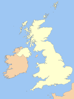
Chilmark Quarries Site of Special Scientific Interest Country England Region South West Ceremonial county Wiltshire Location Chilmark - coordinates 51°4′48″N 2°2′11″W / 51.08°N 2.03639°WCoordinates: 51°4′48″N 2°2′11″W / 51.08°N 2.03639°W Area 9.65 ha (23.85 acres) Notification 1977 Managed by Natural England Area of Search Wiltshire Interest Biological and Geological Website : Map of Site Chilmark Quarries (grid reference ST974312) is a 9.65 hectare biological and geological Site of Special Scientific Interest, in the ravine south of the village of Chilmark in Wiltshire, notified in 1977.
Chilmark stone, a form of limestone, is still mined at the site, subject to restrictions intended to protect the bats and other wildlife. The operator Chicksgrove Quarry Ltd also extracts Chilmark stone from Chicksgrove Quarry, a site 1.5 miles away.
Contents
Biological Interest
Within the disused quarries on the western side of the valley, there is a system of caves in which up to 150 bats, of several species, roost in winter. The largest British wintering roost of Bechstein's Bat is here. Other species which utilise the site include Greater and Lesser Horseshoe Bats, Daubenton's Bat, Natterer's Bat and Brandt's Bat.
Geological Interest
The quarry has exposures of Jurassic rocks, part of the Purbeckian beds. It is a fine building stone used for the main structure of Salisbury Cathedral and many other local buildings. Purbeckian limestones, possibly from Chilmark, were used for packing around one at least of the upright stones of Stonehenge, for houses on an Iron Age site at Fifield Bavant, and for Rockbourne Roman Villa and other Roman sites.[1] Chilmark stone is easy to work, but long-lived in use. Fossils are uncommon in the stone presently being extracted, but include ammonites and other shells.
References
External links
- Chicksgrove Quarry operates the stone mine and cutting yard in Chilmark Quarries
- Wiltshire Community Histories
- English Nature citation sheet for the site (accessed 25 July 2006)
- English Nature website (SSSI information)
- SSSI boundary at English Nature's "Nature on the Map" website
- Aerial photo of the site at Multimap.com
- Building Research Establishment report on Chilmark stone
- Joint Nature Conservation Committee for Chilmark quarries
- John Palmer's study of Roman Purbeck quarry industries
Bratton Downs • Charnage Down Chalk Pit • Chilmark Quarries • Corsham Railway Cutting • Dead Maid Quarry • Dinton Quarry • Dinton Railway Cutting • Fyfield Down • Great Quarry, Swindon • Gripwood Quarry • Kellaways - West Tytherton, River Avon • Lady Down Quarry • The New Forest • Okus Quarry • Old Town Railway Cutting, Swindon • Piggledene • Seend Cleeve Quarry • Seend Ironstone Quarry and Road Cutting • Stanton St. Quintin Quarry & Motorway Cutting • Steeple Ashton • Stert Brook Exposure • Teffont Evias Quarry / Lane Cutting • Upper Chicksgrove Quarry • West Harnham Chalk Pit • Westbury Ironstone Quarry • Wootton Bassett Mud SpringNeighbouring areas: Avon • Berkshire • Dorset • Gloucestershire • Hampshire • Oxfordshire • Somerset Categories:- Sites of Special Scientific Interest in Wiltshire
- Sites of Special Scientific Interest notified in 1977
- Special Areas of Conservation in England
- Bat roosts in England
Wikimedia Foundation. 2010.

