- Marcy Avenue (BMT Jamaica Line)
-
Marcy Avenue


New York City Subway rapid transit station 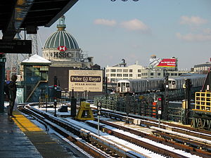
View from the northbound platform, looking westStation statistics Address Marcy Avenue & Broadway
Brooklyn, NY 11211Borough Brooklyn Locale Williamsburg Coordinates 40°42′30″N 73°57′29″W / 40.708361°N 73.957944°WCoordinates: 40°42′30″N 73°57′29″W / 40.708361°N 73.957944°W Division B (BMT) Line BMT Jamaica Line Services J  (all times)
M (weekdays at all hours except late nights)
Z (rush hours, peak direction)
Connection - New York City Bus: B24, B44 B44LTD, B46 B46LTD, B60, B62, Q54, Q59
Structure Elevated Platforms 2 side platforms Tracks 3 (2 in revenue service) Other information Opened June 25, 1888[citation needed] Accessible 
Traffic Passengers (2010) 3,276,009[1]  8.9%
8.9%Rank 140 out of 422 Station succession Next north Hewes Street (local): J 
Myrtle Avenue (express): J Z
Essex Street: MNext south Essex Street: J Z
Hewes Street: M
Driggs Avenue (demolished)Next northFlushing Avenue: J M
West Fourth Street – Washington Square: MNext southnone Station service legend Symbol Description 
Stops in station at all times 
Stops all times except late nights 
Stops late nights only 
Stops late nights and weekends only 
Stops weekdays only 
Stops all times except rush hours in the peak direction Stops all times except weekdays 
Stops rush hours only 
Stops rush hours in the peak direction only 
Station is closed (Details about time periods) Marcy Avenue is a station on the BMT Jamaica Line of the New York City Subway. Located at the intersection of Marcy Avenue and Broadway in Brooklyn, it is served by the J train at all times, the M train on weekdays, and the Z train during rush hours in the peak direction.
Contents
History
Marcy Avenue opened on 25 June 1888 a part of the Broadway Elevated, one of the first elevated lines in New York City. Trains traveled westbound to the Broadway Ferry terminal on the East River in Brooklyn and eastbound services ran to Canarsie (this routing is no longer used due to the later building of the Canarsie Line) and a connection over the Williamsburg Bridge to Delancey Street/Essex Street in Manhattan opened in 1908.[2] In 1913, trains were extended further down the newly opened Nassau Street Line to Chambers Street. A year later, a connection was built to allow Myrtle Avenue to run on the Broadway Elevated.
The Dual Contracts expansion projects radically changed operations at Marcy Avenue. A third track was added, allowing trains to run express, although the track remains as a stub-end at Marcy Avenue for storage and turn-arounds. The Contracts also provided for the merger of the Jamaica Line from Broadway Junction to 168th Street with the Broadway Elevated, in turn making the Broadway Elevated part of the Jamaica Line and giving trains three eastern terminals.
The BMT gave its train routes numbers in 1924 and denoted Myrtle Avenue trains as "10," Canarsie trains as "14," and Jamaica trains as "15," all of which stopped at Marcy Avenue at all times. Four years later, the 14th Street–Eastern District Line merged with the Canarsie Line and the connection between the latter and the Jamaica Line was discontinued, cutting the 14 back to Eastern Parkway in the process. After the completion of the Nassau Street Line, the 15 was extended to Broad Street and the 14 ended at Canal Street. When the BMT lines were renamed alphabetically in the 1960s, the 10 became the M, the 14 became the KK, and the 15 became the J (express) and JJ (local).
Service remained constant until the Chrystie Street Connection opened on 26 November 1967, causing a number of service changes and additions. The JJ absorbed the KK and ran to both Canal Street and Broad Street and then further extended to Atlantic Avenue – Pacific Street. The J was then extended down to the Brighton Line via the Montague Street Tunnel and merged with the QT to form the QJ to Brighton Beach. The KK was re-introduced in 1968 to travel up the IND Sixth Avenue Line to 57th Street, replacing JJ service. Most of these services were eliminated in the 1970s because of financial issues; the first major cutback occurred when the QJ was reduced to Broad Street and relabeled as the J. The KK was renamed the K and stopped running entirely in 1976. The M was truncated to Chambers Street. The Z was established in 1988 for rush hour trains in a skip-stop pattern along with the J, a pattern that does not affect Marcy Avenue.
When the Williamsburg Bridge was closed for reconstruction in 1999, a temporary platform was placed over the middle track as this was the terminal for M trains during that time.
Station layout
This station has two side platforms on three tracks and is the westernmost station on the Jamaica Line. The center track dead ends at the west (railroad north) end and is thus, unusable for service. Both platforms have beige windscreens and red canopies with green frames that run along the entire length except for a section at the southeast (railroad south), where they have waist-high black steel fences.
All four fare control areas of the station are on platform level. As a result, there is no free transfer between directions. The primary ones, elevated station houses adjacent to the platforms. Each station house has doors leading to the stairs and platform, turnstile bank, token booth, and two stairs and one ADA-compliant elevator to the streets. The stairs on the Manhattan-bound station house go down to either northern corners of Marcy Avenue and Broadway while the stairs on the Queens-bound station house go down to either southern corners.
Both platforms have a HEET entrance/exit at their extreme west end added during a 1990s renovation. A single full height turnstile leads to a canopied staircase that goes down to either side of Broadway near Havemeyer Street.
The 2005 artwork here is called A Space Odyssey by Ellsworth Ausby. It consists of stained glass windows depicting space travel on the platform windscreens.
Just west of this station, there is a short section of track continuing straight which once led to the Broadway Ferry Spur. As now configured, westbound trains run over the Williamsburg Bridge, connecting to the BMT Nassau Street Line in Manhattan. To the east, there are switches that are used by the J and Z trains when they run express to Myrtle Avenue weekdays in peak direction.
Gallery
-

Williamsburg Bridge Bus Terminal
-

Remains of the Broadway Ferry spur
References
- ^ "Facts and Figures: 2010 Subway Ridership". New York Metropolitan Transportation Authority. http://www.mta.info/nyct/facts/ridership/ridership_sub_annual.htm. Retrieved 2012-06-01.
- ^ 1912 BMT system map NYCSubway Retrieved 2009-08-10
External links
 Media related to Marcy Avenue (BMT Jamaica Line) at Wikimedia Commons
- nycsubway.org — BMT Jamaica Line: Marcy Avenue
- Station Reporter — J Train
- Station Reporter — M Train
- The Subway Nut — Marcy Avenue Pictures
- The Official Subway and Rail Art Guide
- MTA's Arts For Transit — Marcy Avenue (BMT Jamaica Line)
- Marcy Avenue entrance from Google Maps Street View
- Havemeyer Street entrance from Google Maps Street View
Categories:- BMT Jamaica Line stations
- New York City Subway stations in Brooklyn
- Railway stations opened in 1888


Wikimedia Foundation. 2010.