- London Wall
-

This article is part of the series on:
Military of ancient Rome (portal)
753 BC – AD 476Structural history Roman army (unit types and ranks, legions, auxiliaries, generals) Roman navy (fleets, admirals) Campaign history Lists of wars and battles Decorations and punishments Technological history Military engineering (castra, siege engines, arches, roads) Political history Strategy and tactics Infantry tactics Frontiers and fortifications (limes, Hadrian's Wall)  Statue of Trajan in front of a section of the Roman wall, Tower Hill.
 13th-century bastion on the London Wall, Barbican Estate.
 Fragment of the wall at Cooper's Row.
London Wall was the defensive wall first built by the Romans around Londinium, their strategically important port town on the River Thames in what is now the United Kingdom, and subsequently maintained until the 18th century. It is now the name of a road in the City of London running along part of the course of the wall. Until the later Middle Ages the wall defined the boundaries of the City of London.
Contents
Construction of the Roman wall
The wall appears to have been built in the late 2nd or early 3rd century, certainly between 190 and 225, and probably between 200 and 220.[1] This was around 80 years after the construction in 120 of the city's fort, whose north and west walls were thickened and doubled in height to form part of the new city wall. It continued to be developed until at least the end of the 4th century, making it among the last major building projects undertaken by the Romans before the Roman departure from Britain in 410.
Although the exact reason for the wall's construction is unknown, it may have been connected to the invasion of northern Britain by Picts who overran Hadrian's Wall in the 180s.[2] Alternatively, many historians link the building of London Wall with the political crisis that had emerged in the 190s when two men—Septimius Severus, and the governor of Britain Clodius Albinus—both claimed the right to succession as Emperor. The wall may have been constructed on the orders of Albinus in the 190s, who, in a power struggle with his rival, may have felt the need to protect his capital. Septimius eventually defeated his rival in 197.
Along with Hadrian's Wall and the road network, the London Wall was one of the largest construction projects carried out in Roman Britain. The wall was constructed largely from Kentish ragstone brought by water from Maidstone. It has been calculated that some 1,300 barge journeys would have been required to transport the 85,000 tons of stone from Kent. Once built, the wall was nearly 3 miles (5 kilometres) long, enclosed an area of about 330 acres (130 ha), and was 6 to 9 feet (2 to 3 m) wide and about 20 feet (6 m) high.[3] It had a ditch or fossa in front of the outer wall, measuring some 6 feet (2 m) deep by between 9 and 15 feet (3 to 5 m) wide. It included a number of bastions (at least twenty-two) spaced about 70 yards (64 m) apart, on the eastern section of the wall.[4]
The economic stimulus provided by the wall and Septimius's campaigns of conquest in Scotland appear to have revived Londinium's fortunes somewhat in the early third century.
Gates
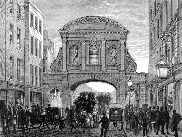
The wall had a number of gates around the outside that led to important Roman roads, leading to other towns in the country. The gates on the wall going clockwise from Ludgate in the west to Aldgate in the east were: Ludgate, Newgate, Cripplegate, Bishopsgate and Aldgate. Aldersgate, between Newgate and Cripplegate, was added c. 350,[5] and Moorgate, between Cripplegate and Bishopsgate, was built later still, in the medieval period. These bring the number of gates up to the canonical seven, commemorated in London tradition and literature. Some of the gates, though now long gone, are remembered by the areas or roads where the gates stood being named after them. Due to the rapid growth of the city, the number of gates was increased to cope with the extra traffic in the medieval period, and the walls were also strengthened and built upon.
The boundaries of the City of London ceased to coincide with the old city wall as the City expanded its jurisdiction slightly during the medieval era. The City's jurisdiction expanded westwards, crossing the historic western border of the original settlement - the River Fleet - along Fleet Street to Temple Bar. The City also took in the other "City bars" which were situated just beyond the old walled area, such as at Holborn, Aldersgate, Bishopsgate and Aldgate. These were the important entrances to the City and their control was vital in maintaining the City's special privileges over certain trades.
Riverside Wall
In the late third century, Londinium was raided on several occasions by Saxon pirates. This led, from around 280 onwards,[6] to the construction of an additional riverside wall.
Later use and remains
The wall remained in active use as a fortification for over 1,000 years afterwards. It was used to defend London against raiding Saxons in 457, and was redeveloped in the medieval period with the addition of crenellations, more gates and further bastions. It was not until as late as the 18th and 19th centuries that the wall underwent substantial demolition, though even then large portions of it survived by being incorporated into other structures. Amid the devastation of the Blitz, some of the tallest ruins in the bomb-damaged City were remnants of the Roman wall.
The wall's moat has also left its mark on London; it forms the line of the street of Houndsditch. This was once London's main rubbish disposal site and was notorious for its appalling odour; its name, according to the 16th century historian John Stow, was derived "from that in old time, when the same lay open, much filth (conveyed forth of the City) especially dead dogges were there laid or cast." The moat was finally covered over and filled in at the end of the 16th century, becoming the present street.
Today all that remains of the wall are a few (albeit substantial) fragments, some of which can be seen in the grounds of the Museum of London, in the Barbican Estate and around Tower Hill. A section near the Museum of London was revealed at Noble Street, after the devastation of an air raid on 29 December 1940 at the height of the Blitz. Another visible section is at St Alphage Gardens, and other sections form part of the walls or foundations of modern buildings and are only visible from inside those buildings. One of the largest and most readily accessed fragments of the wall stands just outside Tower Hill tube station, with a replica statue of the Emperor Trajan standing in front of it.
In 1984 the Museum of London set up a Wall Walk from the Tower of London to the Museum, using 23 tiled panels.[7] A number of these have been destroyed in subsequent years.[8] At Noble Street, the panels were replaced by etched glass panels. These were intended as a prototype for new panels along the entire walk, but no further replacements have been made.
The modern road
 The modern (post 1976) road named London Wall
Part of the route originally taken by the northern wall is commemorated, although now only loosely followed,[9] by the road also named London Wall, on which the Museum of London is located. The modern road starts in the west with a roundabout at Aldersgate, then passes east past Moorgate, from which point it runs parallel to the line of the City Wall, and eventually becomes Wormwood Street before it reaches Bishopsgate. This alignment, however, is the result of rebuilding between 1957 and 1976.[10] Prior to this, London Wall was less wide, and ran behind the line of the City Wall for its entire length, from Wormwood Street to Wood Street.[11] The western section is now St Alphage Garden.
Location Coordinates Museum of London 51°31′03″N 0°05′49″W / 51.5175°N 0.09694°W Barbican 51°31′08″N 0°05′35″W / 51.51889°N 0.09306°W London Wall 51°31′04″N 0°05′43″W / 51.51778°N 0.09528°W St Alphage Garden 51°31′05″N 0°05′33″W / 51.51806°N 0.0925°W Cooper's Row 51°30′38″N 0°04′34″W / 51.51056°N 0.07611°W Tower Hill 51°30′36″N 0°04′33″W / 51.51°N 0.07583°W Within and Without the Wall
The suffix words "Without" and "Within" denote whether an area of the City — and usually applied to the wards — fell outside or within the London Wall, though only Farringdon and (formerly) Bridge have been split into separate wards this way (Bridge Without falling beyond the gates on London Bridge). Some wards — Aldersgate, Bishopsgate and Cripplegate — cover an area that was both within and outwith the Wall and, although not split into separate wards, often the part (or "division") within the Wall is denoted (on maps, in documents, etc) as being "Within" and the part outside the Wall as being "Without". Archaically "Infra" (within) and "Extra" (without) were also used[12] and the terms "intramural" and "extramural"[13][14] are also used to describe being within or outside the walled part of the City.
See also
- Roman London
- Fortifications of London
- List of cities with defensive walls
- List of town walls in England and Wales
- York city walls
- Chester city walls
Notes
- ^ Ross & Clark 2008, p. 47.
- ^ Channel4.com Timeline of Romans in Britain
- ^ http://www.museumoflondon.org.uk/English/Collections/OnlineResources/Londinium/Today/vizrom/01+wall.htm. Retrieved 30 May 2010.
- ^ Those on the western section, such as the well-preserved example that can be seen at the Barbican Estate, next to the church of St Giles-without-Cripplegate, were added in the 13th century (Chapman, Hall & Marsh 1986, nos. 15-17).
- ^ Ross & Clark 2008, p.47.
- ^ Ross & Clark 2008, p.47.
- ^ http://www.museumoflondon.org.uk/English/Collections/OnlineResources/Londinium/Today/LondonWallWalk/. Retrieved 21 May 2010.
- ^ For the status of the panels in January 2006, see http://www.london-footprints.co.uk/wklondonwallroute.htm. Retrieved 21 May 2010.
- ^ Smith 1970.
- ^ http://postwarbuildings.com/buildings/roman-house. Retrieved 30 May 2010.
- ^ http://www.a-zmaps.co.uk/?nid=383. Retrieved 30 May 2010.
- ^ British History Online & HRI Online (examples of infra and extra being used)
- ^ Wiktionary: mural
- ^ Mapping London: Making Sense of the City, Simon Foxell, p 17
References
- Chapman, Hugh, Hall, Jenny, and Marsh, Geoffrey (1986), The London Wall Walk. London: Museum of London. Updated version downloadbale from here: http://www.museumoflondon.org.uk/English/Collections/OnlineResources/Londinium/Today/LondonWallWalk/. Retrieved 30 May 2010.
- Ross, Cathy, & Clark, John, eds. (2008), London: The Illustrated History. London: Allen Lane.
- Smith, A. (1970), Dictionary of City of London Street Names. London: David & Charles.
External links
- Map of present day street named 'London Wall'
- http://www.museumoflondon.org.uk
- PhotoEssay on London Walls with markers
- London Wall Walk photos geocoded on Flickr
- London Wall Walk Narrated Video Tour
Gates and Bars of the City of London Former gates of London Wall and City bars
Temple Bar · Ludgate† · Holborn Bar · Newgate† · Aldersgate† · Cripplegate† · Moorgate · Bishopsgate† Bars · Aldgate† · (Tower) Posterngate
Listed clockwise from the West
Water-gates: Billingsgate and Dowgate
Bridge-gates: Great Stone Gateway and New Stone Gate
†The six Roman gates Categories:
- History of the City of London
- Streets in the City of London
- English Heritage sites in London
- London Wall and its gates
- Roman London
- Roman fortifications
- Walls in England
- Fortifications of London
- City walls
- Grade I listed buildings in London
- Ruins in London


Wikimedia Foundation. 2010.