- National Register of Historic Places listings in Kings County, New York
-
 Location of Kings County in New York
List of the National Register of Historic Places listings in Kings County, New York
This is intended to be a complete list of properties and districts listed on the National Register of Historic Places in Brooklyn (Kings County), New York. The locations of National Register properties and districts (at least for all showing latitude and longitude coordinates below) may be seen in a Google map by clicking on "Map of all coordinates".[1]
-
- This National Park Service list is complete through NPS recent listings posted November 18, 2011.[2]
Contents: Counties in New York Albany (Albany) – Allegany – Bronx – Broome – Cattaraugus – Cayuga – Chautauqua – Chemung – Chenango – Clinton – Columbia – Cortland – Delaware – Dutchess – Erie (Buffalo) – Essex – Franklin – Fulton – Genesee – Greene – Hamilton – Herkimer – Jefferson – Kings (Brooklyn) – Lewis – Livingston – Madison – Monroe (Rochester) – Montgomery – Nassau – New York (Manhattan – Below 14th Street, 14th to 59th Streets, 59th to 110th Streets, Above 110th Street, Islands) – Niagara – Oneida – Onondaga (Syracuse) – Ontario – Orange – Orleans – Oswego – Otsego – Putnam – Queens – Rensselaer – Richmond (Staten Island) – Rockland – Saratoga – Schenectady – Schoharie – Schuyler – Seneca – St. Lawrence – Steuben – Suffolk – Sullivan – Tioga – Tompkins – Ulster – Warren – Washington – Wayne – Westchester (New Rochelle, Peekskill, Yonkers) – Wyoming – Yates Current listings
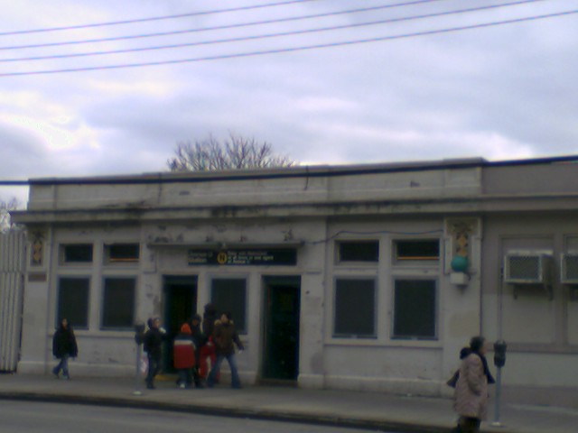
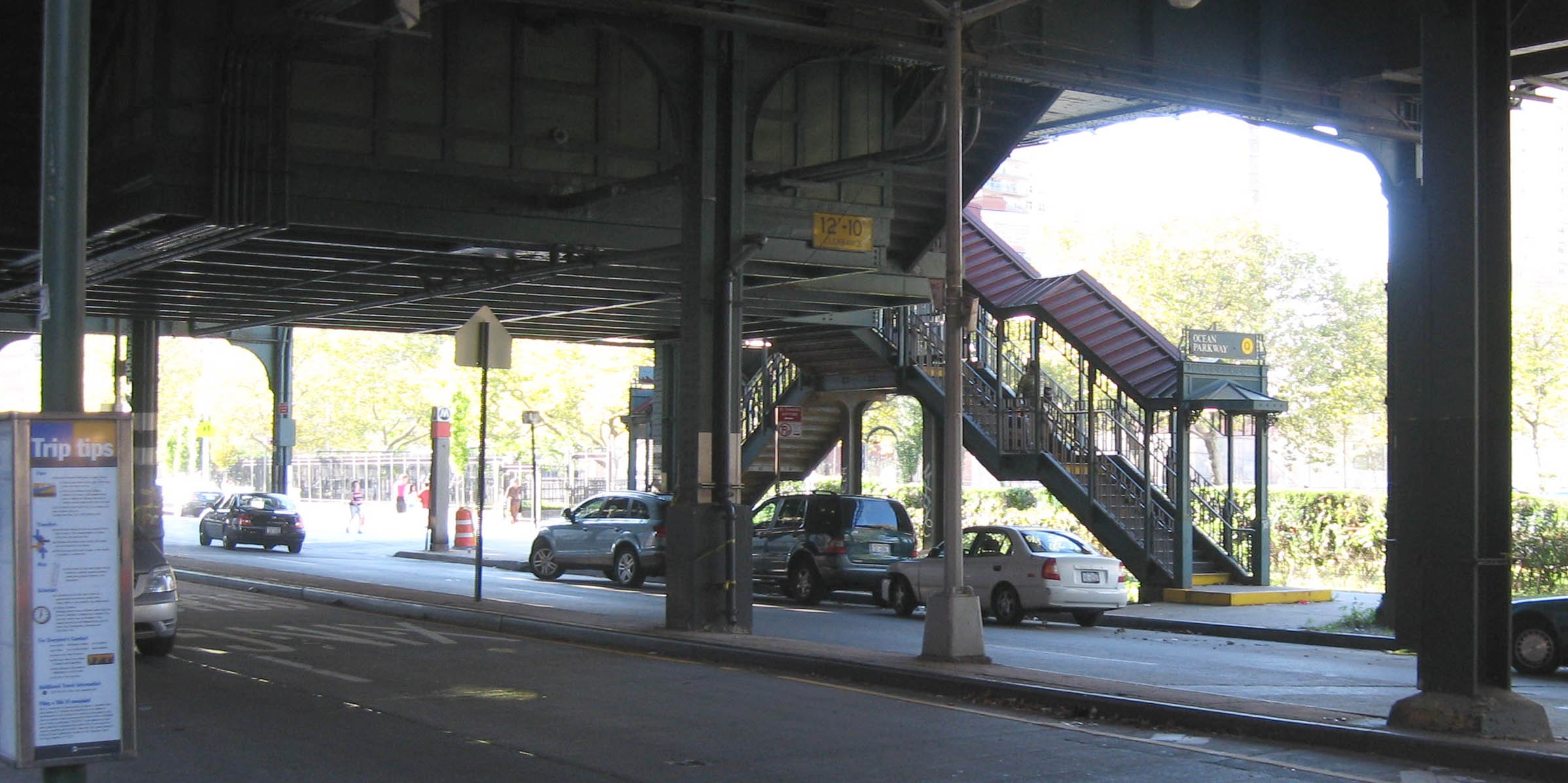
# Landmark name Image Date listed Location City or Town Summary 1 15th Street – Prospect Park Subway station (F G trains) 
July 27, 2005 15th St./Prospect Park W and SW
40°39′37″N 73°58′49″W / 40.66028°N 73.98028°WBrooklyn 2 Fourth Avenue Subway station (F G trains) 
July 6, 2005 Bet. 3rd and 4th Aves., and 10th and 11th Sts.
40°40′13″N 73°59′24″W / 40.67028°N 73.99°WBrooklyn 3 68th Police Precinct Station House and Stable 
June 3, 1982 4302 4th Ave.
40°39′1″N 74°0′34″W / 40.65028°N 74.00944°WSunset Park, Brooklyn 4 75th Police Precinct Station House September 10, 2007 484 Liberty Ave.
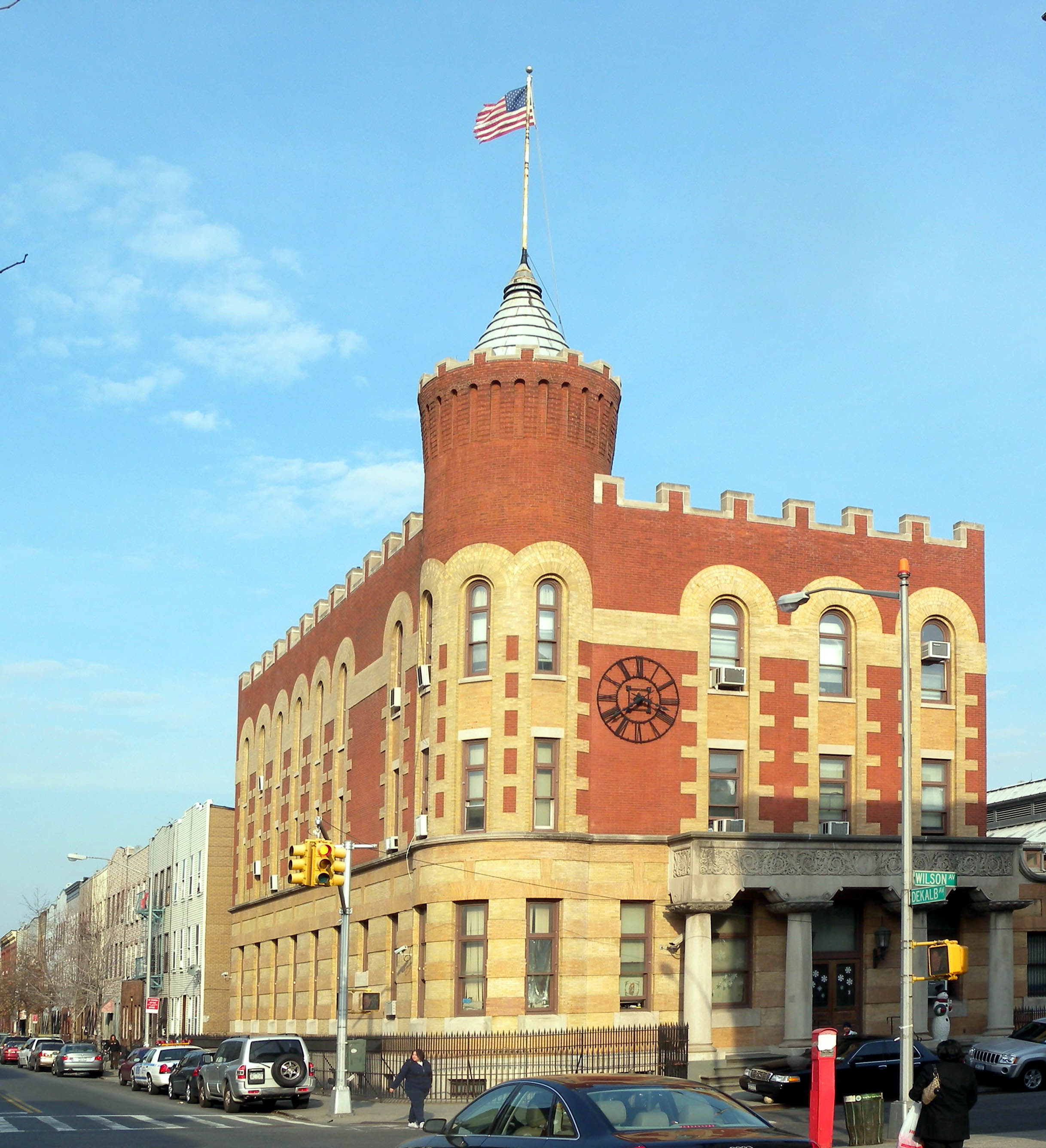
40°40′29″N 73°53′33″W / 40.67472°N 73.8925°WBrooklyn 5 83rd Precinct Police Station and Stable 
April 14, 1982 179 Wilson Ave.
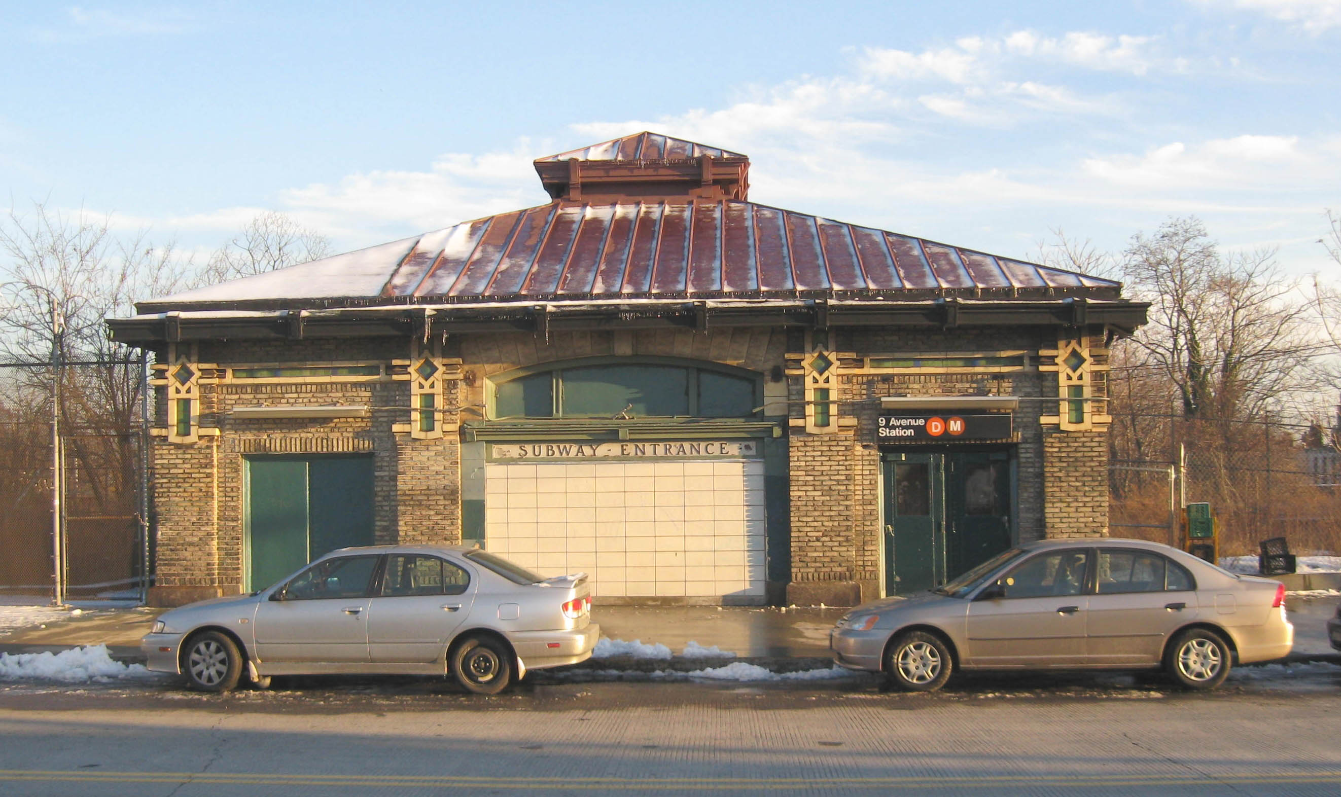
40°42′6″N 73°55′25″W / 40.70167°N 73.92361°WNew York 6 Ninth Avenue Subway station (D train) 
July 6, 2005 38th St. and 9th Ave. near the jct. of New Utrecht Ave.
40°38′47″N 73°59′41″W / 40.64639°N 73.99472°WSunset Park 7 Albemarle-Kenmore Terraces Historic District June 30, 1983 Albemarle Terrace, Kenmore Terrace , and E. 21st St.
40°39′3″N 73°57′33″W / 40.65083°N 73.95917°WFlatbush 8 Andrews United Methodist Church January 22, 1992 95 Richmond St.
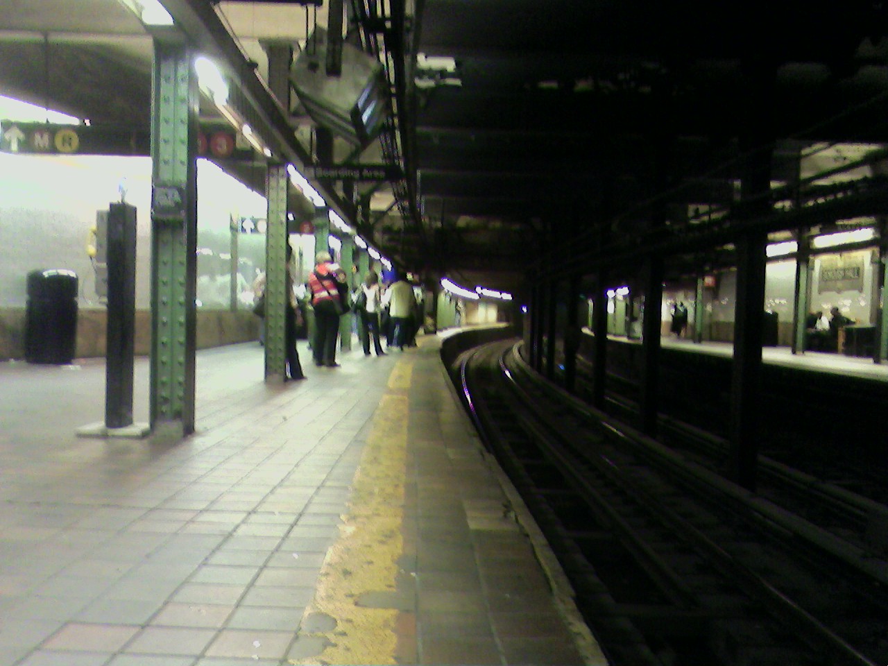
40°41′7″N 73°52′38″W / 40.68528°N 73.87722°WEast New York (misfiled by NRIS in New York county, but belongs here) 9 Astral Apartments 
October 29, 1982 184 Franklin St.
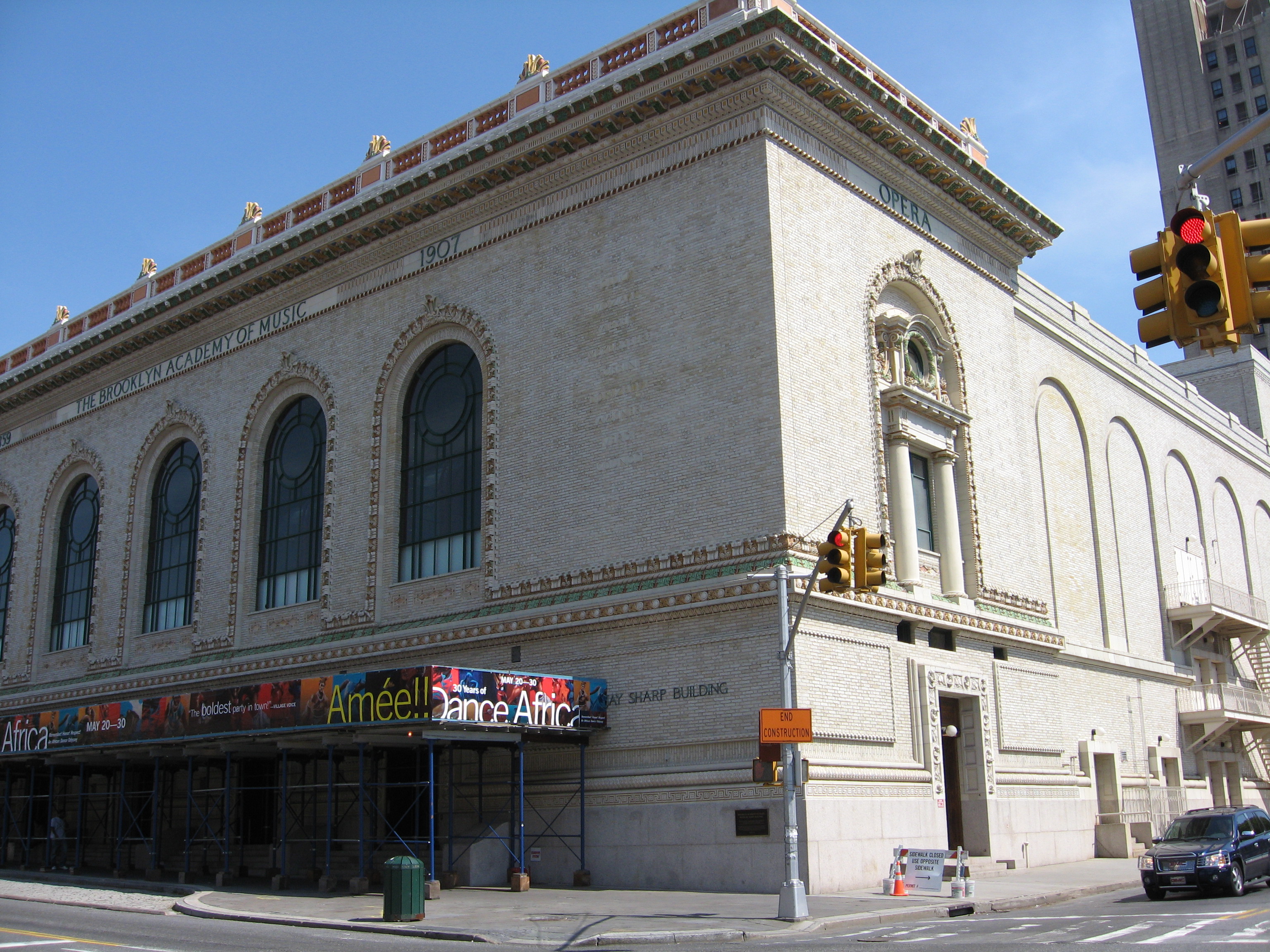
40°43′54″N 73°57′28″W / 40.73167°N 73.95778°WGreenpoint 10 Atlantic Avenue Control House 
May 6, 1980 Flatbush and Atlantic Aves.
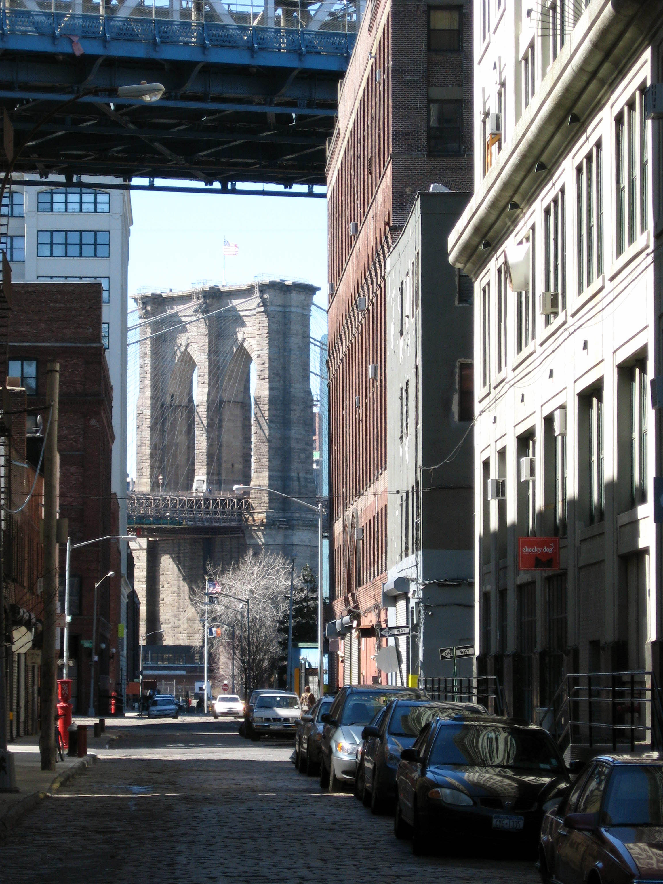
40°41′4″N 73°58′42″W / 40.68444°N 73.97833°WDowntown Brooklyn 11 Atlantic Avenue Subway station (2 3 4 5 B D N Q R trains) September 17, 2004 Jct. of Flatbush Ave. at Atlantic and 4th Aves.
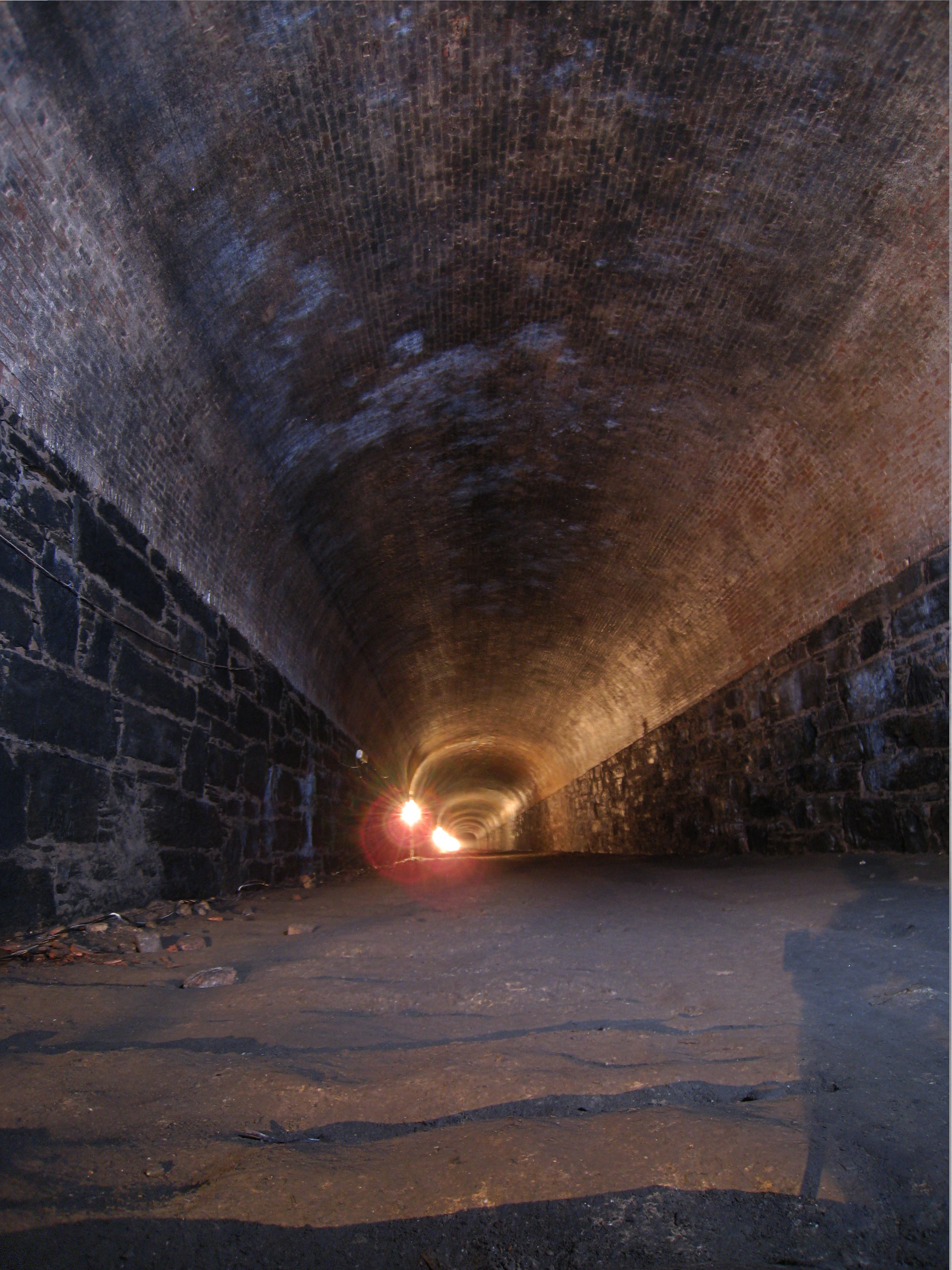
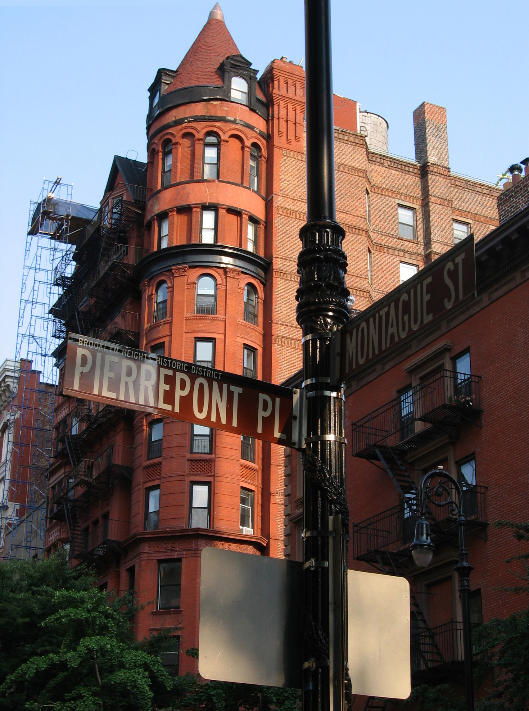
40°41′5″N 73°58′42″W / 40.68472°N 73.97833°WDowntown Brooklyn 12 Atlantic Avenue Tunnel 
September 7, 1989 Below Atlantic Ave. between Boerum Pl. and Columbia St.
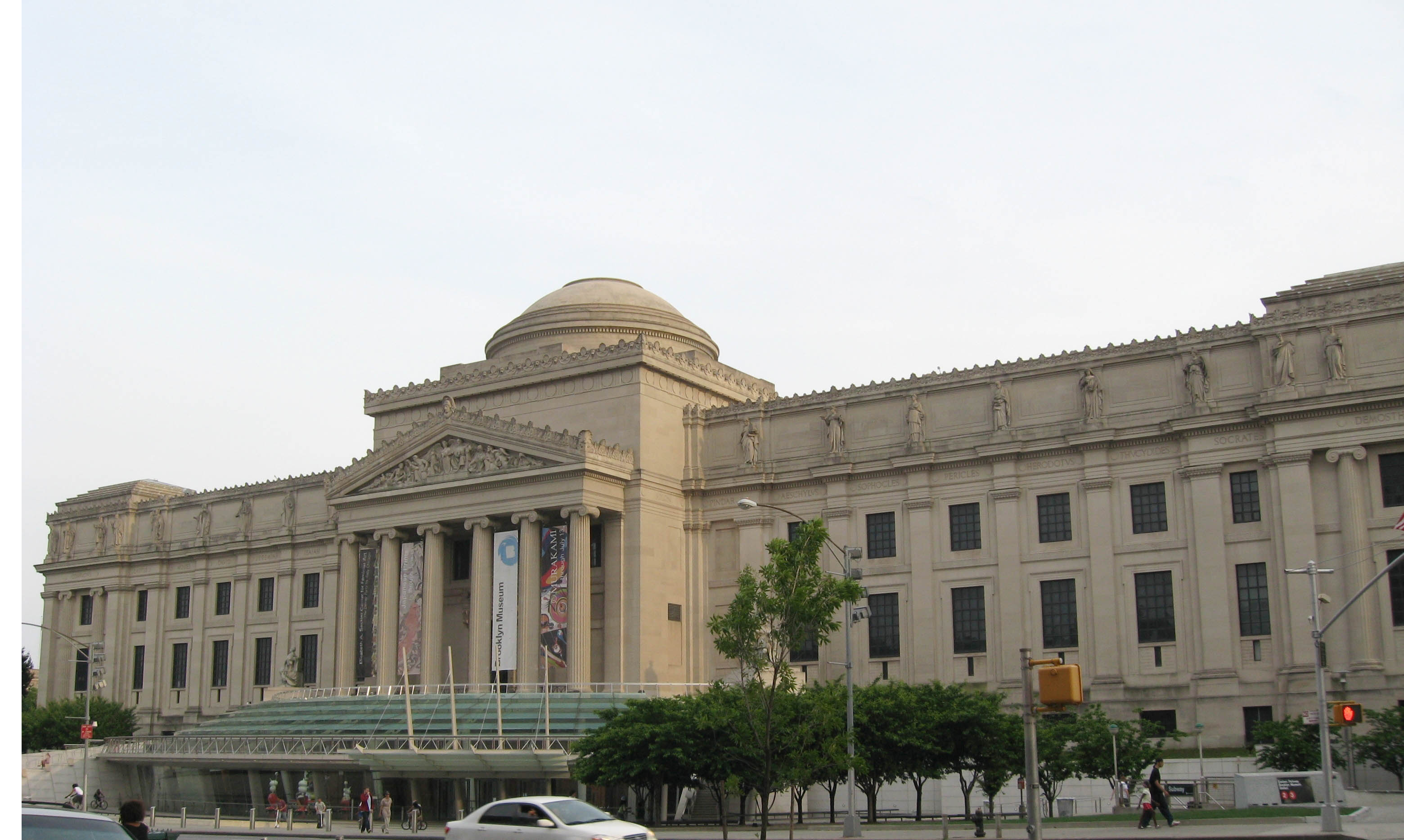
40°41′30″N 74°0′0″W / 40.69167°N 74°WCobble Hill 13 Austin, Nichols and Company Warehouse June 28, 2007 184 Kent Ave.
40°43′7″N 73°57′54″W / 40.71861°N 73.965°WWilliamsburg 14 Avenue U Subway station (N train) 
July 6, 2005 Bet. Ave. U and Ave. T and 7th and 8th Sts.
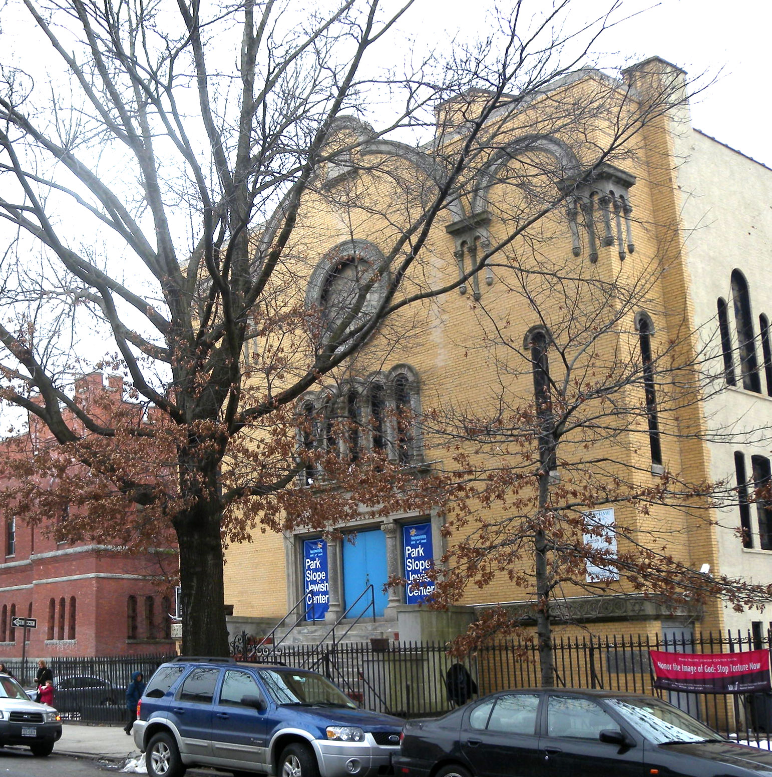
40°35′50″N 73°58′46″W / 40.59722°N 73.97944°WBrooklyn 15 Baptist Temple (Brooklyn, New York) 
November 20, 1995 360 Schermerhorn St.
40°41′11″N 73°58′50″W / 40.68639°N 73.98056°WDowntown Brooklyn 16 Bay Parkway Subway station (D train) 
July 6, 2005 Above Bay Parkway at 86th St.
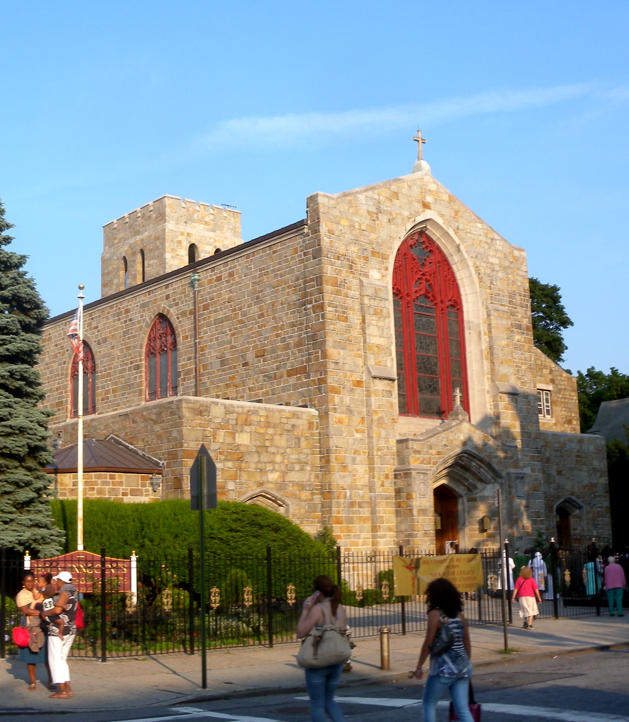
40°36′6″N 73°59′40″W / 40.60167°N 73.99444°WBrooklyn 17 Bay Ridge United Methodist Church September 9, 1999 7002 Fourth St.
40°38′1″N 74°1′29″W / 40.63361°N 74.02472°WBay Ridge Razed October 21, 2008[3] 18 Beth El Jewish Center of Flatbush May 29, 2009 1981 Homecrest Ave.
40°36′3.63″N 73°57′34.66″W / 40.6010083°N 73.9596278°WFlatbush New listing; refnum# 09000377 19 Beverley Road Subway station (Q trains) 
September 17, 2004 Beverley Rd. at Marlborough Rd.
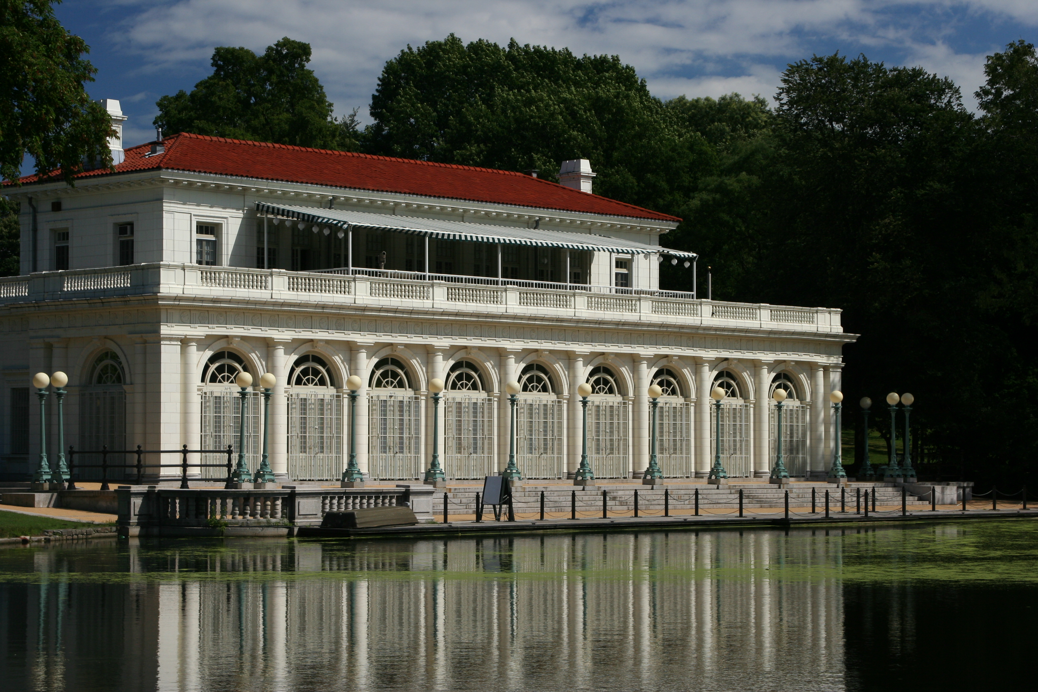
40°38′39″N 73°57′53″W / 40.64417°N 73.96472°WFlatbush 20 Boathouse on the Lullwater of the Lake in Prospect Park 
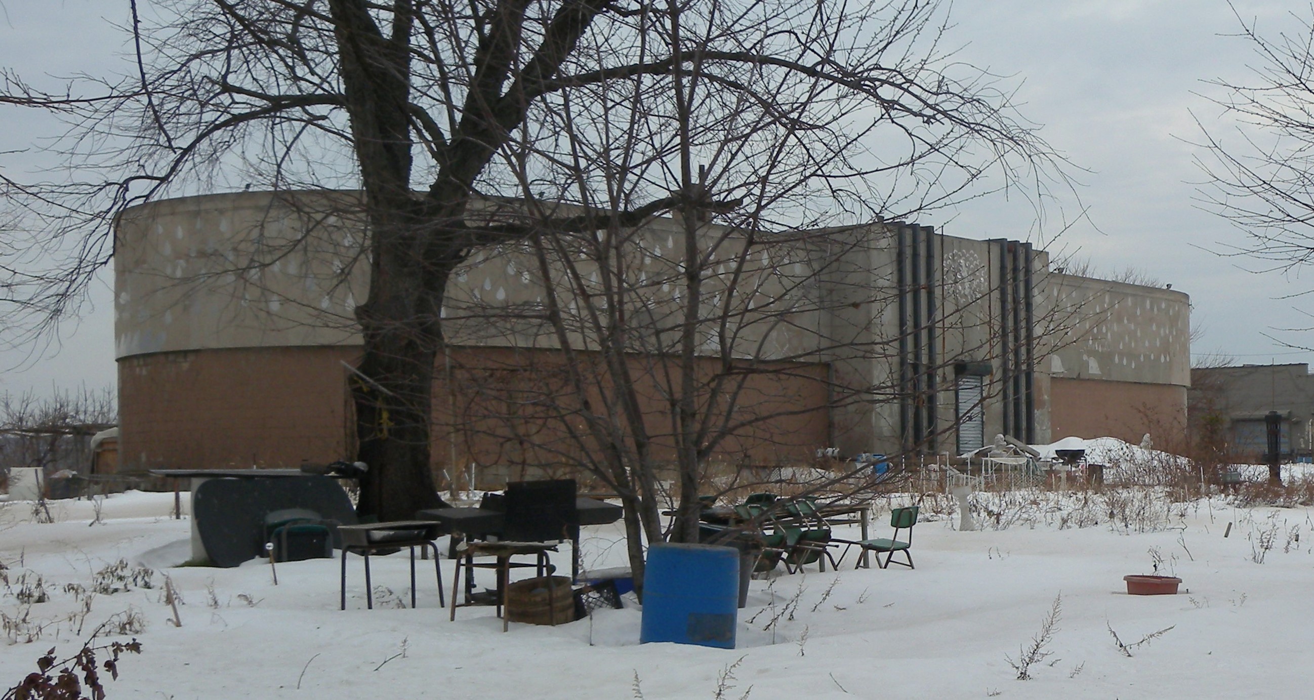
January 7, 1972 Prospect Park
40°39′39″N 73°57′55″W / 40.66083°N 73.96528°WProspect Park (Brooklyn) 21 Boerum Hill Historic District September 26, 1983 Roughly bounded by Pacific, Wyckoff, Bergen, Nevins, Bond and Hoyt Sts.
40°41′7″N 73°59′13″W / 40.68528°N 73.98694°WBoerum Hill 22 Borough Hall Subway station (4 5 trains) 
September 17, 2004 Jct. of Joralemon, Court and Adams Sts.
40°41′32″N 73°59′27″W / 40.69222°N 73.99083°WDowntown Brooklyn 23 Boy's High School 
February 25, 1982 832 Marcy Ave.
40°41′4″N 73°56′54″W / 40.68444°N 73.94833°WBedford-Stuyvesant 24 Brooklyn Academy of Music 
May 2, 2006 30 Lafayette Ave.
40°41′11″N 73°58′41″W / 40.68639°N 73.97806°WFort Greene 25 Brooklyn Borough Hall 
January 10, 1980 209 Joralemon St.
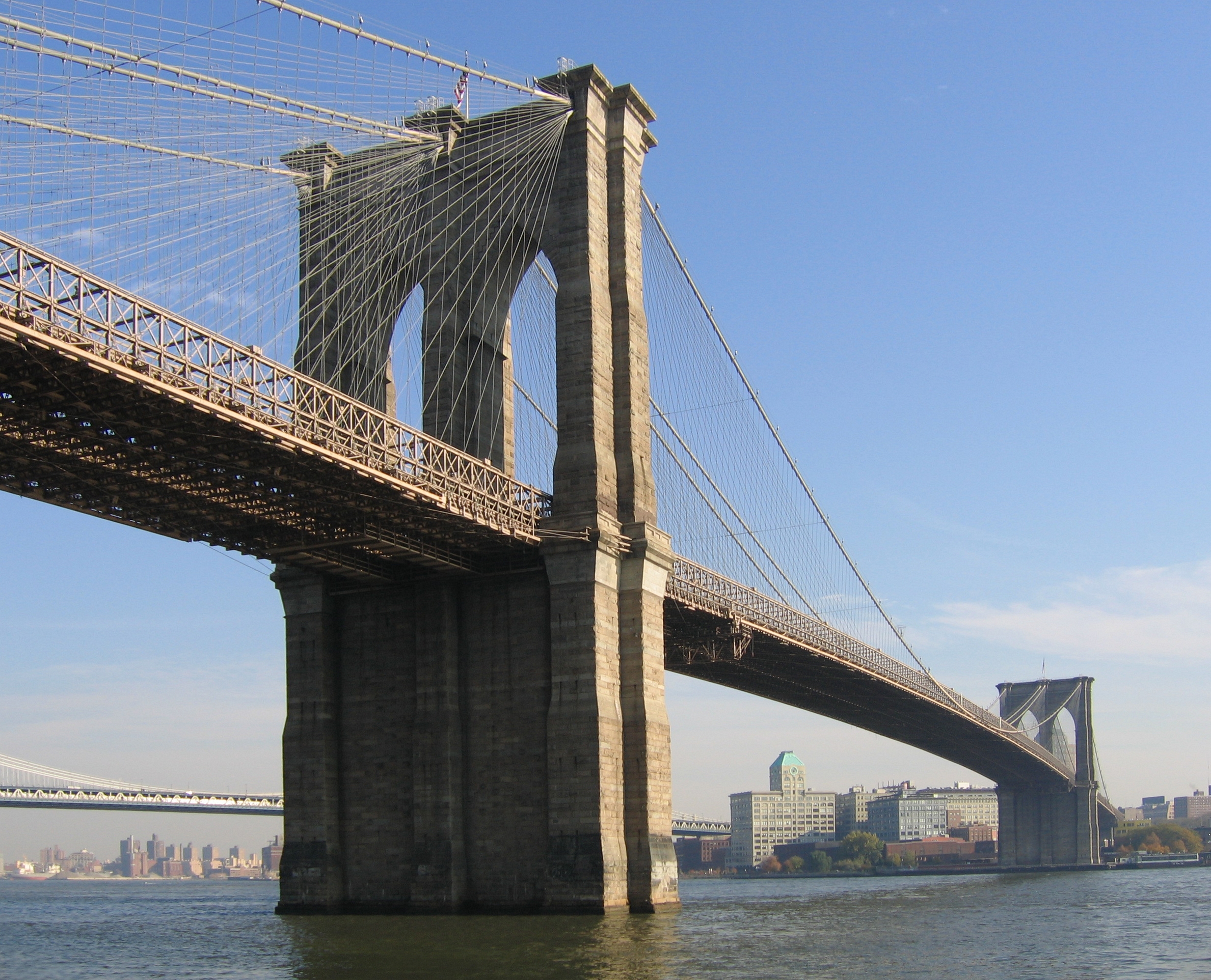
40°41′34″N 73°59′27″W / 40.69278°N 73.99083°WDowntown Brooklyn 26 Brooklyn Bridge 
October 15, 1966 Across the East River from Brooklyn to Manhattan
40°42′23″N 73°59′51″W / 40.70639°N 73.9975°WBrooklyn 27 Brooklyn Heights Historic District 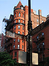
October 15, 1966 Borough of Brooklyn, bounded by Atlantic Ave., Court and Fulton Sts. and the East River
40°41′48″N 73°59′48″W / 40.69667°N 73.99667°WBrooklyn Heights 28 Brooklyn Historical Society 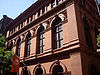
July 17, 1991 128 Pierrepont St.
40°41′41″N 73°59′34″W / 40.69472°N 73.99278°WBrooklyn Heights 29 Brooklyn Museum 
August 22, 1977 Eastern Parkway and Washington Ave.
40°40′14″N 73°57′51″W / 40.67056°N 73.96417°WProspect Heights, Brooklyn 30 Brooklyn Public Library-Central Building 
January 11, 2002 Grand Army Plaza
40°40′20″N 73°58′7″W / 40.67222°N 73.96861°WBrooklyn 31 Brooklyn Trust Company Building 
August 20, 2009 177 Montague St.
40°41′39.43″N 73°59′32.64″W / 40.6942861°N 73.9924°WBrooklyn Heights New listing; refnum 09000632 32 Buildings at 375-379 Flatbush Avenue and 185-187 Sterling Place September 7, 1984 375-379 Flatbush Ave. and 185-187 Sterling Pl.
40°40′36″N 73°58′19″W / 40.67667°N 73.97194°WBrooklyn 33 Carroll Gardens Historic District September 26, 1983 Carroll and President Sts. between Smith and Hoyt Sts.
40°40′47″N 73°59′25″W / 40.67972°N 73.99028°WCarroll Gardens 34 Casemate Fort, Whiting Quadrangle 
August 7, 1974 Fort Hamilton, off NY 27
40°36′31″N 74°1′58″W / 40.60861°N 74.03278°WBrooklyn 35 Christ Evangelical English Lutheran Church 
August 30, 2007 1084 Lafayette Ave.
40°41′32″N 73°55′45″W / 40.69222°N 73.92917°WBrooklyn 36 Church of the Holy Innocents 
June 16, 2005 279 E. 17th St.
40°38′39″N 73°57′46″W / 40.64417°N 73.96278°WFlatbush 37 Clinton Hill Historic District June 19, 1985 Roughly bounded by Willoughby and Grand Aves., Fulton St. and Vanderbilt Ave.
40°41′14″N 73°57′55″W / 40.68722°N 73.96528°WClinton Hill 38 Clinton Hill South Historic District July 17, 1986 Roughly Lefferts and Brevoort Pl. between Washington Ave. and Bedford Pl.
40°40′50″N 73°57′32″W / 40.68056°N 73.95889°WClinton Hill 39 Cobble Hill Historic District 
June 11, 1976 Roughly bounded by Atlantic Ave., Court, Degraw and Hicks Sts.
40°41′21″N 73°59′47″W / 40.68917°N 73.99639°WCobble Hill 40 Coney Island Fire Station Pumping Station 
December 8, 1981 2301 Neptune Ave.
40°34′43″N 73°59′31″W / 40.57861°N 73.99194°WConey Island 41 Coney Island Yard Electric Motor Repair Shop February 9, 2006 SW corner of Avenue X and Shell Rd.
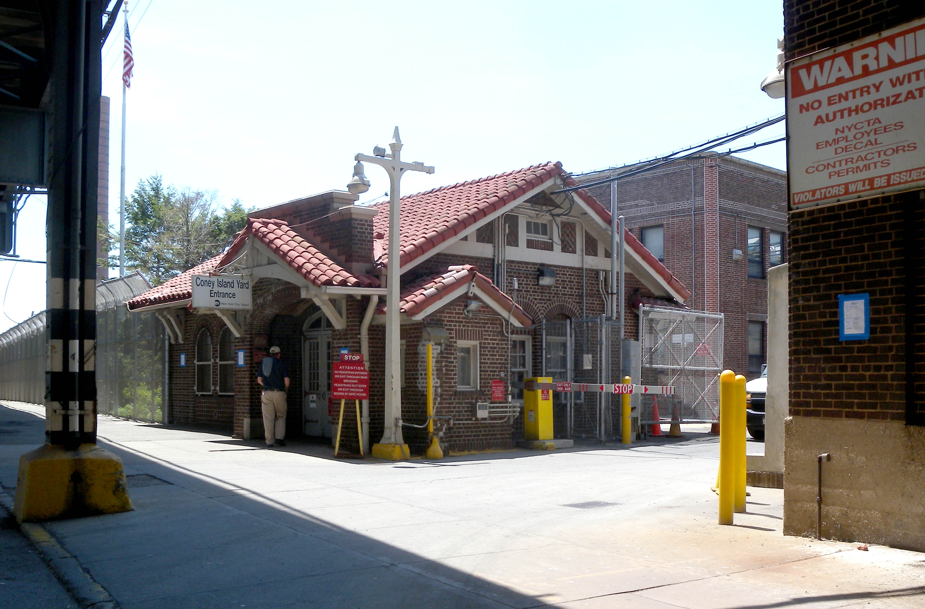
40°35′23″N 73°58′31″W / 40.58972°N 73.97528°WBrooklyn 42 Coney Island Yard Gatehouse 
February 9, 2006 SW corner of Shell Rd. and Avenue X
40°35′22″N 73°58′30″W / 40.58944°N 73.975°WBrooklyn 43 Congregation Beth Israel April 30, 2009 203 E. 37th St.
40°39′8.07″N 73°56′34.52″W / 40.6522417°N 73.9429222°WBrooklyn 44 Congregational Church of the Evangel December 11, 2009 1950 Bedford Ave.
40°39′26.74″N 73°57′23.67″W / 40.6574278°N 73.956575°WBrooklyn New listing; refnum 09001081 45 Congregation Tifereth Israel 
January 11, 2002 1320 Eight Ave.
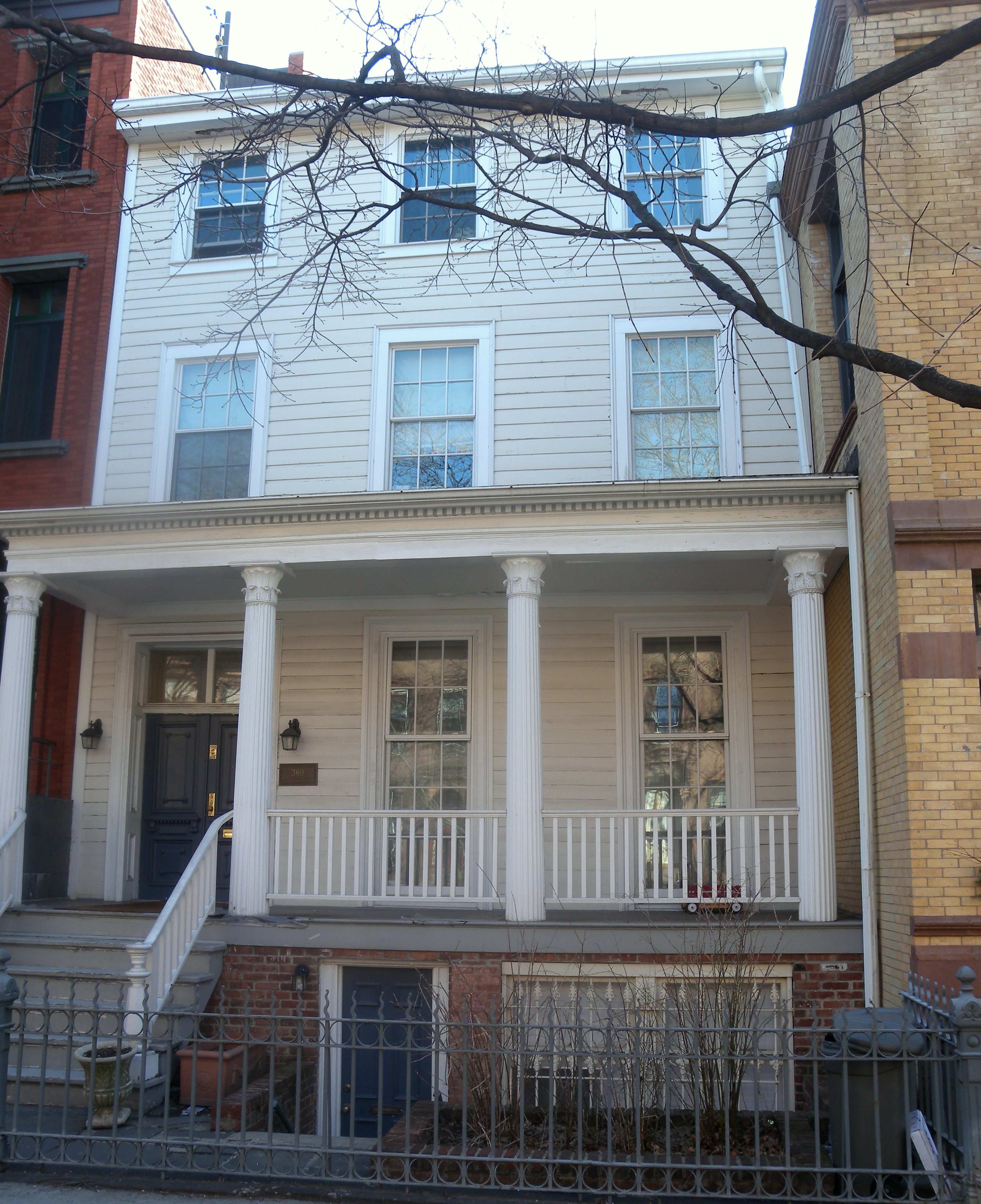
40°39′47″N 73°58′56″W / 40.66306°N 73.98222°WBrooklyn 46 William B. Cronyn House 
June 3, 1982 271 9th St.
40°40′11″N 73°59′16″W / 40.66972°N 73.98778°WNew York 47 Cuyler Presbyterian Church 
March 23, 2001 358-360 Pacific St.
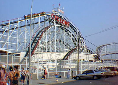
40°41′12″N 73°59′13″W / 40.68667°N 73.98694°WBrooklyn 48 Cyclone Roller Coaster 
June 25, 1991 834 Surf Ave. at W. 10th St.
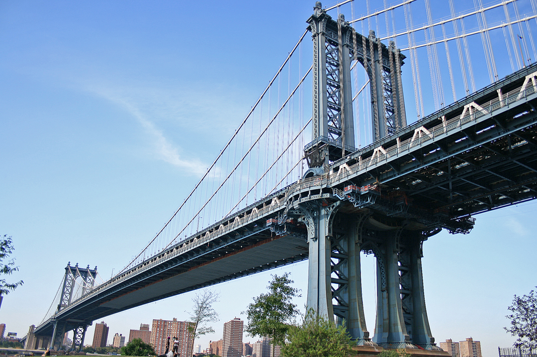
40°34′30″N 73°58′44″W / 40.575°N 73.97889°WConey Island 49 Cypress Avenue West Historic District September 30, 1983 Roughly bounded by St. Nicholas and Seneca Aves., Linden and Stockholm Sts.
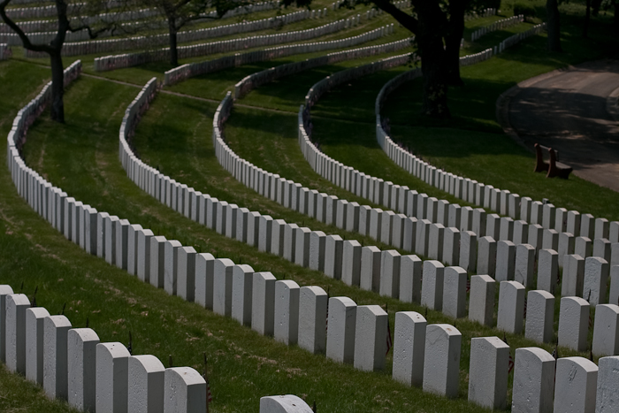
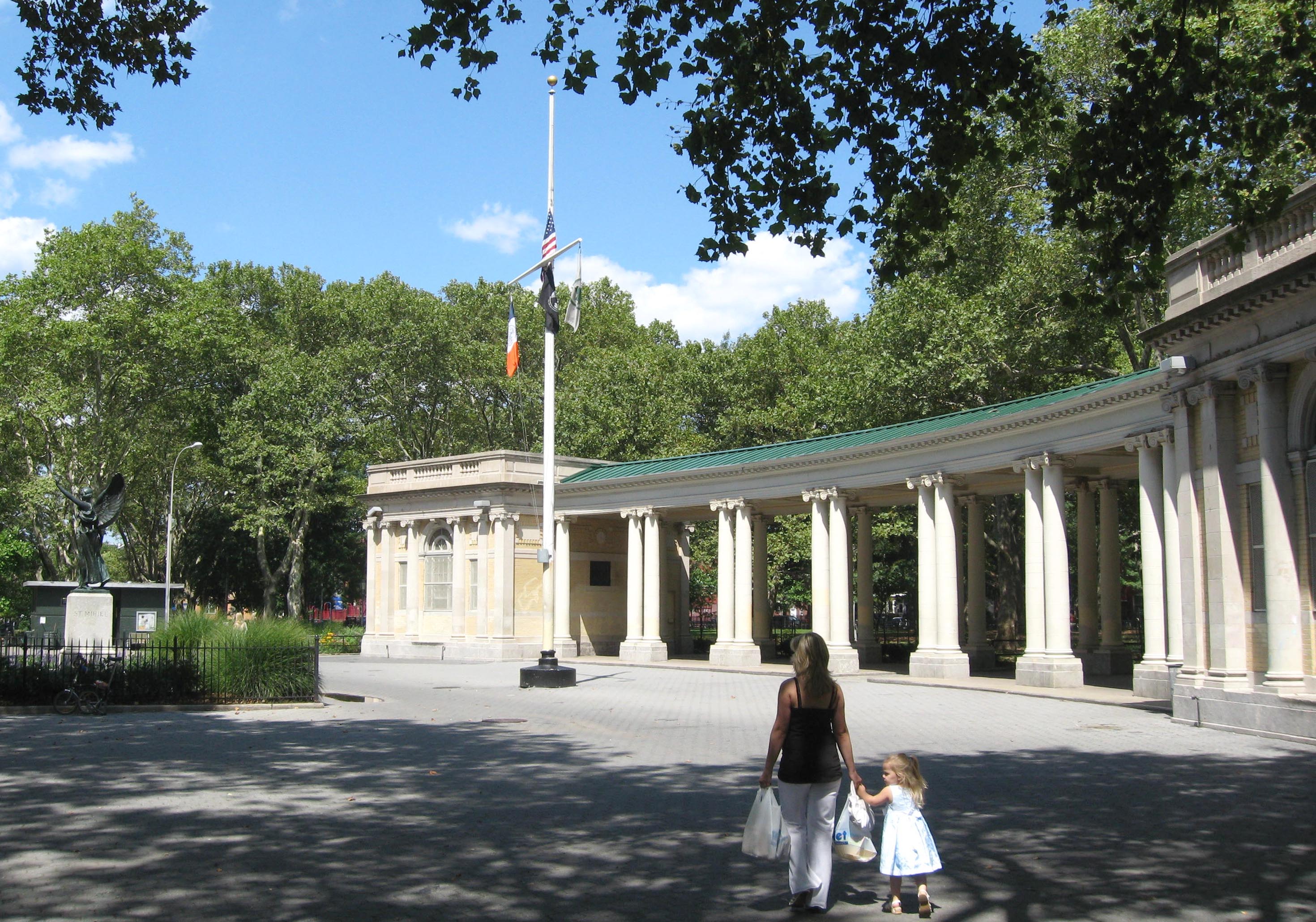
40°42′14.75″N 73°54′46.46″W / 40.7040972°N 73.9129056°WNew York 50 Cypress Hills National Cemetery 
November 13, 1997 625 Jamaica Ave.
40°41′13.91″N 73°52′55.49″W / 40.6871972°N 73.8820806°WBrooklyn 51 Ditmas Park Historic District September 30, 1983 Bounded by Marlborough Rd., Dorchester, Ocean, and Newkirk Aves.
40°38′19″N 73°57′40″W / 40.63861°N 73.96111°WDitmas Park 52 DUMBO Industrial District 
September 22, 2000 Roughly bounded by Main and Washington Sts, East River, John St., Bridge and Jay Sts., and Front and York Sts.
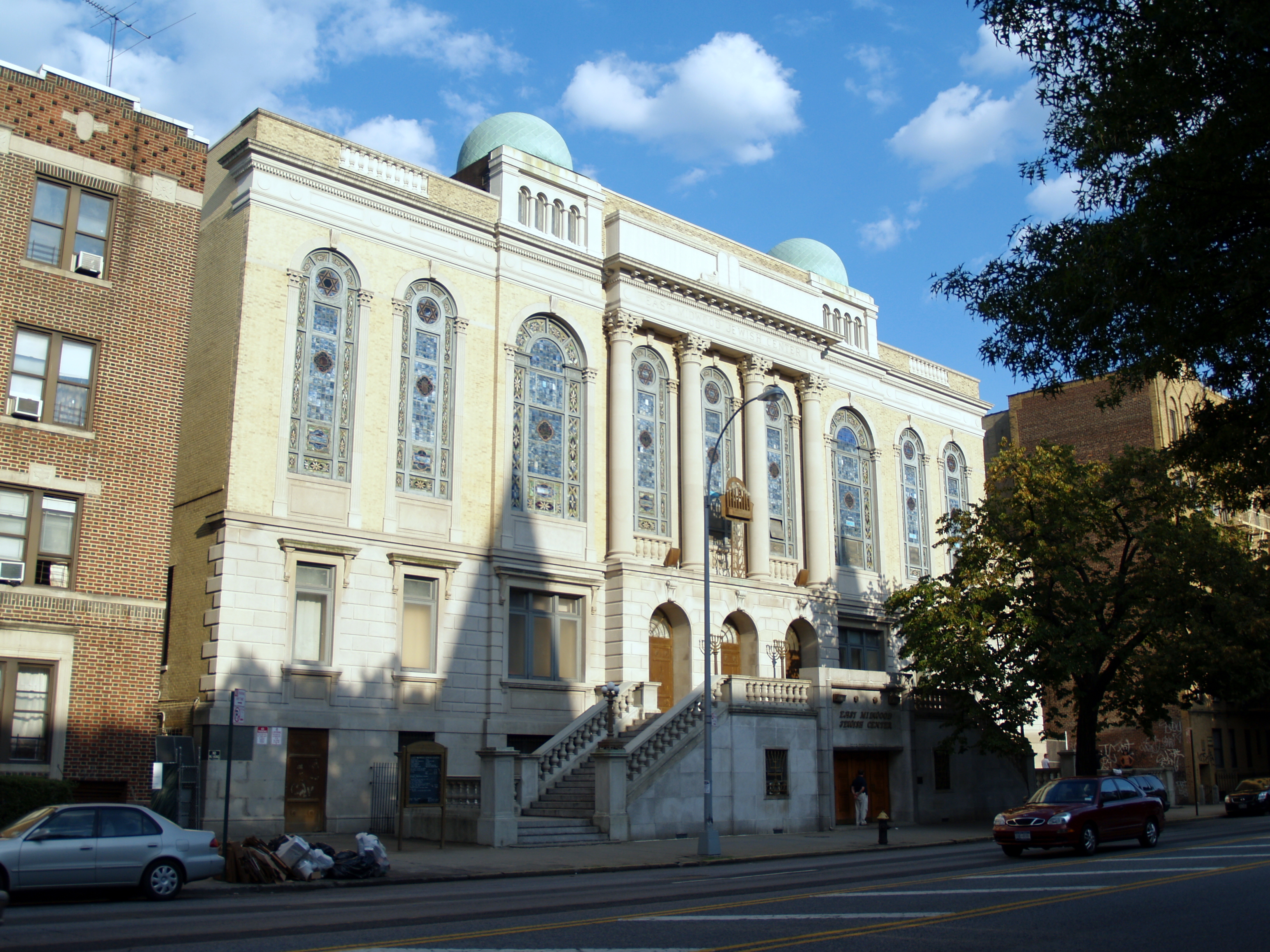
40°42′11″N 73°59′17″W / 40.70306°N 73.98806°WDUMBO 53 East Midwood Jewish Center 
June 7, 2006 1625 Ocean Ave.
40°37′20″N 73°57′20″W / 40.62222°N 73.95556°WMidwood 54 Eastern Parkway 
September 26, 1983 Eastern Pkwy from Grand Army Plaza to Ralph Ave.
40°40′14″N 73°58′8″W / 40.67056°N 73.96889°WBrooklyn 55 Eighth Avenue (14th Brooklyn Regiment) Armory 
April 14, 1994 1402 Eighth Ave.
40°39′46″N 73°59′0″W / 40.66278°N 73.983333°WPark Slope Former home of 14th Brooklyn Regiment. 56 Emmanuel Baptist Church 
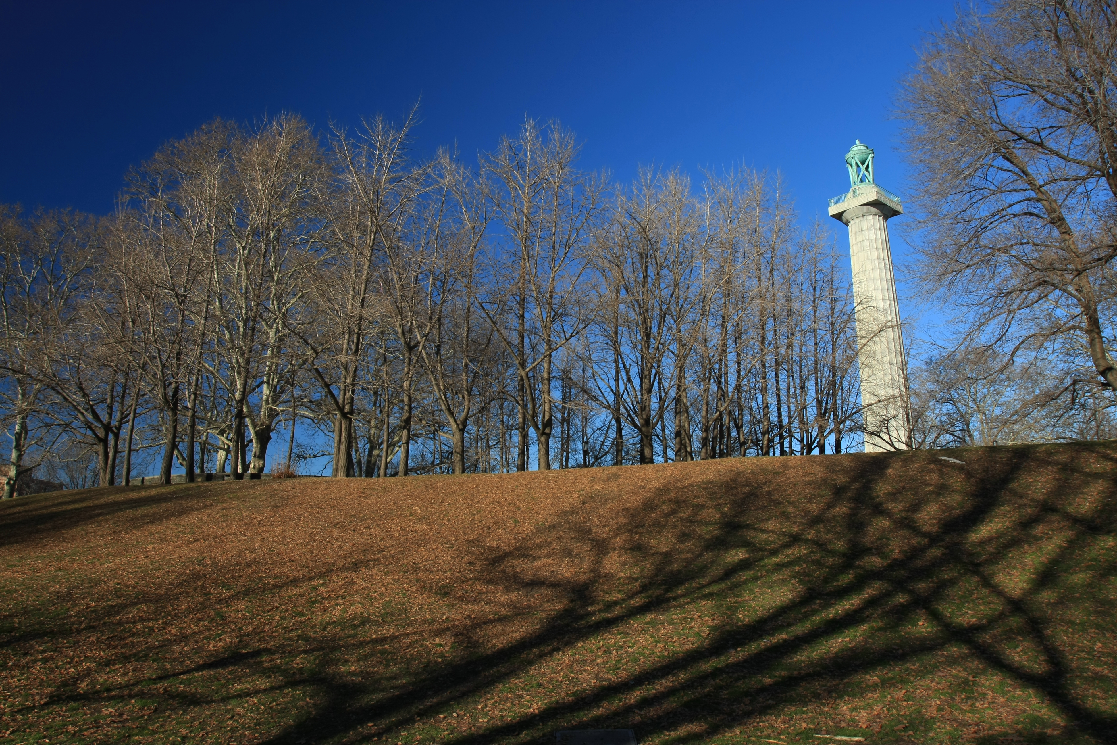
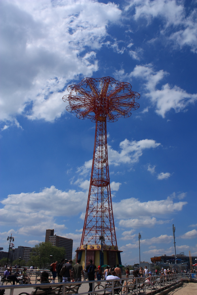
December 16, 1977 279 LaFayette Ave.
40°41′17″N 73°58′10″W / 40.68806°N 73.96944°WBrooklyn 57 Erasmus Hall Academy 
November 11, 1975 Between Flatbush, Bedford, Church, and Snyder Aves.
40°38′58″N 73°57′28″W / 40.64944°N 73.95778°WFlatbush 58 Evergreens Cemetery 
November 15, 2007 1629 Bushwick Ave.
40°41′4.3122″N 73°54′4.3122″W / 40.684531167°N 73.901197833°WBrooklyn 59 Federal Building and Post Office 
October 9, 1974 271 Cadman Plaza, E.
40°41′44″N 73°59′24″W / 40.69556°N 73.99°WDowntown Brooklyn 60 Feuchtwanger Stable March 20, 1986 159 Carlton Ave.
40°41′34″N 73°58′22″W / 40.69278°N 73.97278°WBrooklyn 61 Flatbush Dutch Reformed Church Complex 
September 8, 1983 890 Flatbush Ave. and 2101-2103 Kenmore Terr.
40°39′0″N 73°57′33″W / 40.65°N 73.95917°WFlatbush 62 Flatbush Town Hall 
July 24, 1972 35 Snyder Ave.
40°38′56″N 73°57′26″W / 40.64889°N 73.95722°WFlatbush 63 Flatlands Dutch Reformed Church 
August 30, 1979 Kings Hwy. and E. 40th St.
40°37′26″N 73°56′13″W / 40.62389°N 73.93694°WFlatlands 64 Floyd Bennett Field Historic District 
April 11, 1980 Flatbush Ave.
40°35′17″N 73°53′32″W / 40.58806°N 73.89222°WBrooklyn 65 Fort Greene Historic District 
September 26, 1983; boundary increase September 7, 1984 Roughly bounded by Ft. Greene Pl., Fulton St., Vanderbilt and Myrtle Aves.
40°41′19″N 73°58′19″W / 40.68861°N 73.97194°WFort Greene, Brooklyn 66 Friends Meetinghouse and School 
November 4, 1982 110 Schermerhorn St.
40°41′23″N 73°59′24″W / 40.68972°N 73.99°WDowntown Brooklyn 67 Fulton Ferry District June 28, 1974 Roughly bounded by the East River and Washington, Water, Front, and Doughty Sts.
40°42′12″N 73°59′35″W / 40.70333°N 73.99306°WFulton Ferry, Brooklyn 68 Gage and Tollner Restaurant 
June 3, 1982 372 Fulton St.
40°41′28″N 73°59′17″W / 40.69111°N 73.98806°WDowntown Brooklyn 69 Grecian Shelter 
January 20, 1972 Prospect Park near Parkside Ave.
40°39′13″N 73°58′3″W / 40.65361°N 73.9675°WProspect Park 70 Green-Wood Cemetery 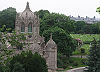
March 8, 1997 500 25th Street
40°39′8″N 73°59′26″W / 40.65222°N 73.99056°WBrooklyn 71 Greenpoint Historic District 
September 26, 1983 Roughly bounded by Kent, Calyer, Noble, and Franklin Sts., Clifford Pl. and Manhattan Ave.
40°43′43″N 73°57′20″W / 40.72861°N 73.95556°WGreenpoint 72 Hanson Place Seventh Day Adventist Church 
April 23, 1980 88 Hanson Pl.
40°41′7″N 73°58′28″W / 40.68528°N 73.97444°WNew York 73 Holy Trinity Church (Protestant Episcopal) 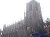
December 23, 1987 157 Montague St.
40°41′40″N 73°59′35″W / 40.69444°N 73.99306°WBrooklyn Heights 74 Houses at 216-264 Ovington Ave. June 5, 2007 216-264 Ovington Ave.
40°38′5″N 74°1′42″W / 40.63472°N 74.02833°WBrooklyn 75 Hubbard House June 2, 2000 2138 McDonald Ave.
40°36′0″N 73°58′25″W / 40.6°N 73.97361°WBrooklyn 76 Hunterfly Road Historic District 
December 5, 1972 1698, 1700, 1702, 1704, 1706, 1708 Bergen St.
40°40′28″N 73°55′35″W / 40.67444°N 73.92639°WWeeksville, Brooklyn 77 Immanuel Congregational Church June 7, 2006 461 Decatur St.
40°40′57″N 73°55′30″W / 40.6825°N 73.925°WBedford–Stuyvesant 78 Industrial Complex at 221 McKibbin Street May 12, 2009 221 McKibbin St.
40°42′19.5″N 73°56′19.09″W / 40.705417°N 73.9386361°WBrooklyn 79 Jewish Center of Kings Highway February 12, 2010 1202-1218 Ave. P
40°36′36.46″N 73°57′39.45″W / 40.6101278°N 73.9609583°WBrooklyn New listing; refnum 10000009 80 Kings County Savings Bank 
April 16, 1980 135 Broadway
40°42′37″N 73°57′51″W / 40.71028°N 73.96417°WWilliamsburg 81 Kingsway Jewish Center February 12, 2010 2810 Nostrand Ave.
40°36′57.12″N 73°56′41.21″W / 40.6158667°N 73.9447806°WBrooklyn New listing; refnum 10000010 82 Knickerbocker Field Club October 29, 1982 114 E. 18th St.
40°38′52″N 73°57′49″W / 40.64778°N 73.96361°WNew York 83 Kol Israel Synagogue December 2, 2009 603 St. John's Place
40°40′22.23″N 73°57′29.47″W / 40.6728417°N 73.9581861°WBrooklyn New listing; refnum 09000966 84 Lefferts Manor Historic District May 18, 1992 Roughly bounded by Lincoln Rd., Fenimore St., Rogers Ave. and Flatbush Ave.
40°39′26″N 73°57′26″W / 40.65722°N 73.95722°WProspect Lefferts Gardens 85 Lefferts-Laidlaw House September 12, 1985 136 Clinton St.
40°41′37″N 73°58′10″W / 40.69361°N 73.96944°WBrooklyn Heights 86 Lincoln Club 
January 27, 1983 65 Putnam Ave.
40°40′59″N 73°57′35″W / 40.68306°N 73.95972°WBrooklyn 87 Litchfield Villa 
September 14, 1977 Prospect Park W. and 5th St.
40°40′8″N 73°58′26″W / 40.66889°N 73.97389°WProspect Park 88 Hendrick I. Lott House 
March 3, 1994 1940 E. 36th St.
40°36′37″N 73°55′58″W / 40.61028°N 73.93278°WMarine Park 89 Magen David Synagogue April 15, 2004 2017 67th St.
40°36′54″N 73°59′12″W / 40.615°N 73.98667°WBensonhurst 90 Manhattan Bridge 
August 30, 1983 Spans East River between Front and Canal St.
40°42′36″N 73°59′18″W / 40.71°N 73.98833°WDowntown Brooklyn 91 Msgnr McGolrick Park and Shelter Pavilion 
May 6, 1980 Bounded by Nassau and Driggs Aves., Russell and Monitor Sts.
40°43′28″N 73°56′38″W / 40.72444°N 73.94389°WGreenpoint 92 New England Congregational Church and Rectory 
September 15, 1983 177-179 S. 9th St.
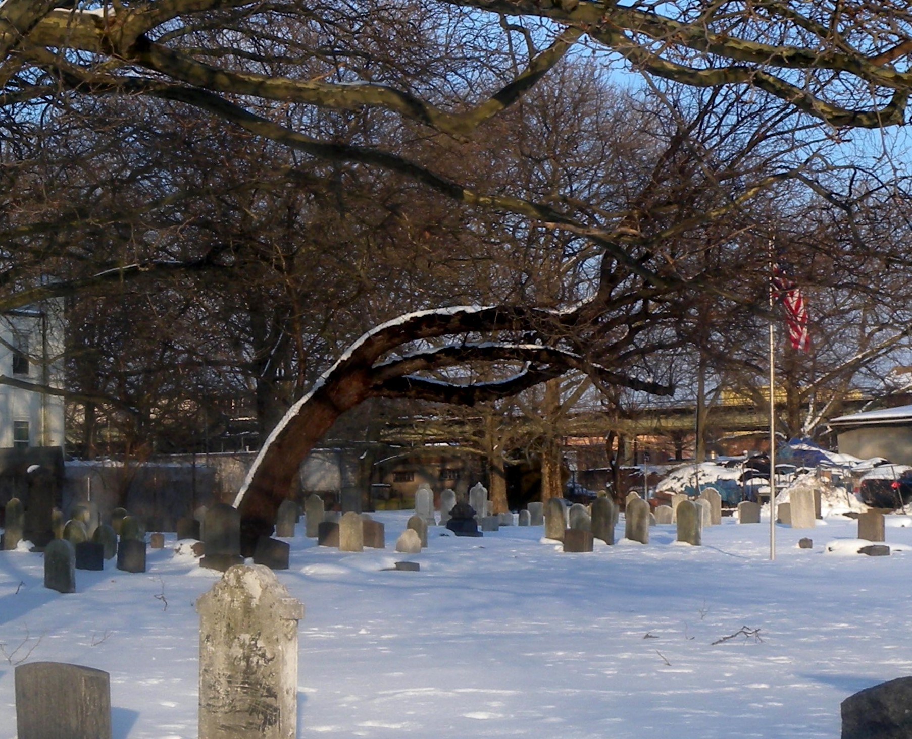
40°42′31″N 73°57′45″W / 40.70861°N 73.9625°WWilliamsburg 93 New Lots Reformed Church and Cemetery 
May 19, 1983 630 New Lots Ave.
40°39′53″N 73°53′8″W / 40.66472°N 73.88556°WNew Lots 94 New Utrecht Avenue Subway station (N train) 
July 6, 2005 Beneath the jct. of New Utrecht Ave. with 15th Ave. and 62nd St.
40°37′29″N 73°59′48″W / 40.62472°N 73.99667°WBrooklyn 95 New Utrecht Reformed Church and Buildings 
April 9, 1980 18th Ave. and 83rd St.
40°36′30″N 74°0′3″W / 40.60833°N 74.00083°WNew Utrecht 96 New York Congregational Home for the Aged November 5, 2008 123 Linden Blvd.
40°39′8.73″N 73°57′15.03″W / 40.652425°N 73.954175°WBrooklyn New listing: refnum #08001033 97 Ocean Parkway 
September 8, 1983 From Church Ave. to Seabreeze Ave.
40°36′19″N 73°58′11″W / 40.60528°N 73.96972°WBrooklyn 98 Ocean Parkway Jewish Center December 11, 2009 550 Ocean Pkwy.
40°38′4.24″N 73°58′23.01″W / 40.6345111°N 73.9730583°WBrooklyn New listing; refnum 09001082 99 Ocean Parkway Subway station (Q train) 
July 29, 2005 Above jct. of Brighton Beach Ave. and Ocean Pkwy
40°34′35″N 73°58′8″W / 40.57639°N 73.96889°WBrighton Beach 100 Old Brooklyn Fire Headquarters 
January 20, 1972 365-367 Jay St.
40°41′34″N 73°59′15″W / 40.69278°N 73.9875°WDowntown Brooklyn 101 Old First Reformed Church (Brooklyn, New York) 
April 1, 1998 729 Carroll St.
40°40′24″N 73°58′37″W / 40.67333°N 73.97694°WPark Slope 102 Old Gravesend Cemetery 
September 17, 1980 Gravesend Neck Rd. and MacDonald Ave.
40°35′41″N 73°58′30″W / 40.59472°N 73.975°WGravesend 103 Parachute Jump 
September 2, 1980 Coney Island
40°34′21″N 73°59′6″W / 40.5725°N 73.985°WConey Island 104 Park Slope Historic District 
November 21, 1980 Roughly bounded by Prospect Park West, Berkeley Pl., 15th St., 6th, 7th and Flatbush Aves.
40°40′8″N 73°58′35″W / 40.66889°N 73.97639°WPark Slope 105 Parkway Theatre March 31, 2010 1768 St. John's Pl.
40°40′11.55″N 73°55′7.58″W / 40.669875°N 73.9187722°WBrooklyn New listing; refnum 10000136 106 Plymouth Church of the Pilgrims 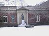
October 15, 1966 75 Hicks St.
40°41′57″N 73°59′37″W / 40.69917°N 73.99361°WBrooklyn Heights 107 Pratt Institute Historic District 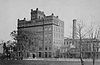
March 23, 2005 Roughly bounded by Hall St., Dekalb Ave., Willoughby St. and Emerson Pl.
40°41′28″N 73°57′50″W / 40.69111°N 73.96389°WClinton Hill 108 Prospect Hall 
April 15, 1999 263 Prospect Ave.
40°39′49″N 73°59′24″W / 40.66361°N 73.99°WProspect Heights 109 Prospect Heights Historic District 
September 15, 1983 Roughly bounded by Pacific and Bergen Sts., Flatbush and Vanderbilt Aves., and Park Pl.
40°40′44″N 73°58′20″W / 40.67889°N 73.97222°WBrooklyn 110 Prospect Park 
September 17, 1980 Bounded by Parkside, Ocean and Flatbush Aves., Prospect Park W. and Prospect SW.
40°39′34″N 73°58′14″W / 40.65944°N 73.97056°WBrooklyn 111 Prospect Park South Historic District 
July 21, 1983 Roughly bounded by BMT RR Tracks, Beverly Rd., and Coney Island and Church Aves.
40°38′46″N 73°58′1″W / 40.64611°N 73.96694°WFlatbush 112 Public Bath No. 7 
September 12, 1985 227-231 Fourth Ave.
40°40′36″N 73°59′0″W / 40.67667°N 73.983333°WPark Slope 113 Public School 108 December 10, 1982 200 Lindwood St.
40°40′52″N 73°53′5″W / 40.68111°N 73.88472°WNew York 114 Public School 111 and Public School 9 Annex 
December 14, 1981 249 Sterling Place and 251 Sterling Place
40°40′35″N 73°58′11″W / 40.67639°N 73.96972°WFort Greene 115 Public School 39 April 17, 1980 417 6th Ave.
40°40′7″N 73°59′2″W / 40.66861°N 73.98389°WPark Slope 116 Public School 65K December 10, 1981 158 Richmond St.
40°40′59″N 73°52′40″W / 40.68306°N 73.87778°WBrooklyn 117 Public School 7 November 3, 1983 131-143 York St.
40°42′6″N 73°59′9″W / 40.70167°N 73.98583°WNew York 118 Public School 71K 
November 4, 1982 119 Heyward St.
40°42′6″N 73°57′24″W / 40.70167°N 73.95667°WNew York 119 Quarters A 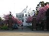
May 30, 1974 U.S. Naval Facility
40°42′8.57″N 73°58′49.19″W / 40.7023806°N 73.9803306°WBrooklyn Navy Yard 120 John Rankin House 
November 16, 1978 440 Clinton St.
40°40′53″N 73°59′56″W / 40.68139°N 73.99889°WCarroll Gardens 121 Renaissance Apartments August 22, 1995 480 Nostrand Ave.
40°40′56″N 73°57′2″W / 40.68222°N 73.95056°WBrooklyn 122 John Roosevelt "Jackie" Robinson House 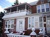
May 11, 1976 5224 Tilden St.
40°38′54″N 73°54′54″W / 40.64833°N 73.915°WEast Flatbush, Brooklyn 123 Rockwood Chocolate Factory Historic District October 6, 1983 54-88 Washington, 13-53 Waverly, and 255-275 Park Aves.
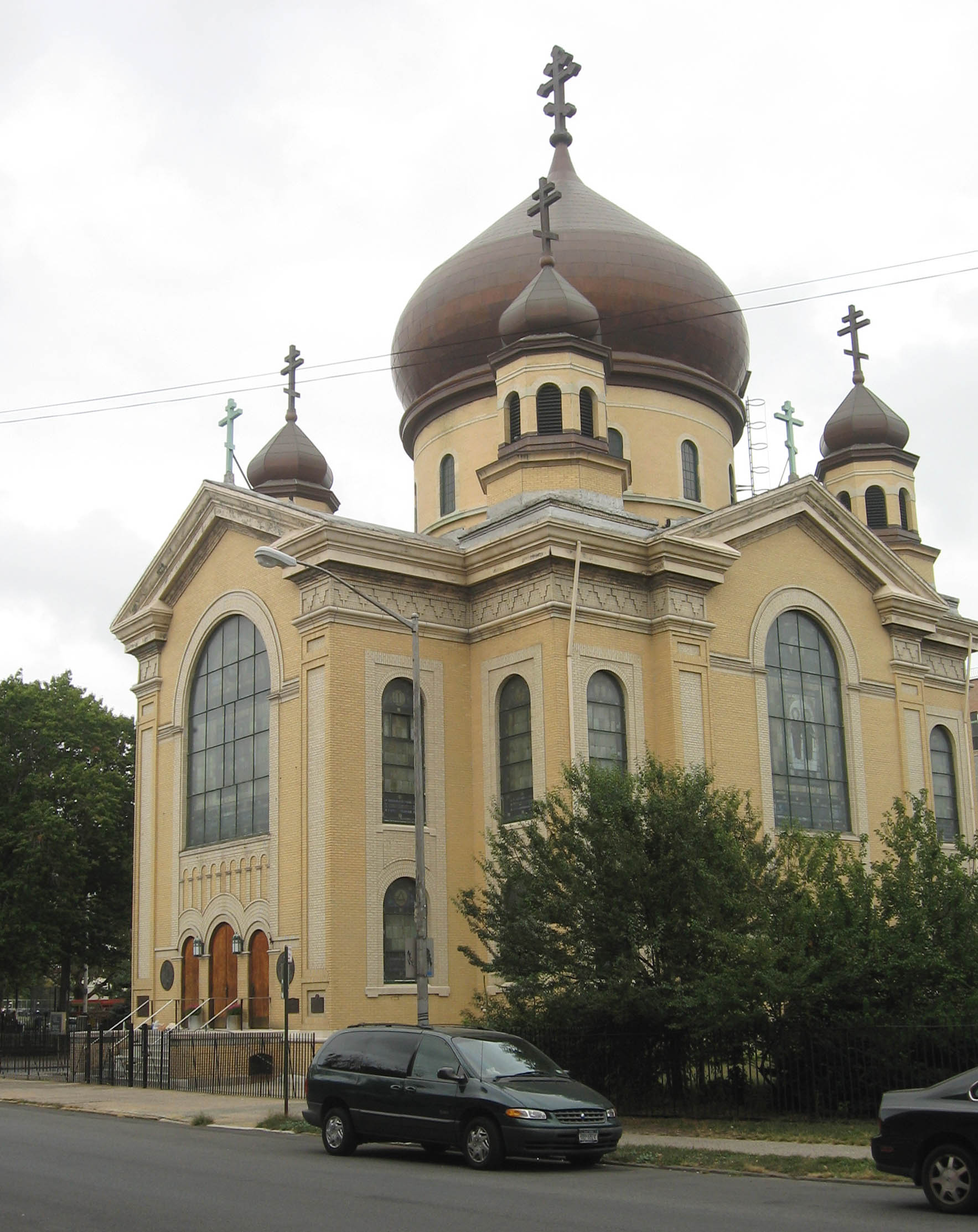
40°41′47″N 73°58′6″W / 40.69639°N 73.96833°WFort Greene 124 Russian Orthodox Cathedral of the Transfiguration of Our Lord 
April 16, 1980 228 N. 12th St.
40°43′10″N 73°57′14″W / 40.71944°N 73.95389°WGreenpoint 125 Saitta House 
May 30, 2007 1135 84th St.
40°37′2″N 74°0′59″W / 40.61722°N 74.01639°WDyker Heights 126 Senator Street Historic District October 10, 2002 318-370 and 317-347 Senator St.
40°37′50″N 74°1′30″W / 40.63056°N 74.025°WBrooklyn 127 Shaari Zedek Synagogue December 4, 2009 767 Putnam Ave.
40°41′11.19″N 73°55′51.24″W / 40.6864417°N 73.9309°WBrooklyn New listing; refnum 09000968 128 South Bushwick Reformed Protestant Dutch Church Complex 
November 4, 1982 855-857 Bushwick Ave.
40°41′39″N 73°55′34″W / 40.69417°N 73.92611°WSouth Bushwick 129 South Congregational Church 
November 4, 1982 President and Court Sts.
40°40′55″N 73°59′48″W / 40.68194°N 73.99667°WSouth Brooklyn 130 St. Bartholomew's Protestant Episcopal Church and Rectory April 23, 1980 1227 Pacific St.
40°40′41″N 73°57′9″W / 40.67806°N 73.9525°WCrown Heights 131 St. George's Protestant Episcopal Church 
September 8, 1983 800 Marcy Ave.
40°41′10″N 73°56′54″W / 40.68611°N 73.94833°WBedford-Stuyvesant 132 St. Luke's Protestant Episcopal Church September 16, 1982 520 Clinton Ave.
40°40′57″N 73°58′4″W / 40.6825°N 73.96778°WClinton Hill 133 St. Mary's Episcopal Church 
July 21, 1983 230 Classon Ave.
40°41′34″N 73°57′42″W / 40.69278°N 73.96167°WClinton Hill 134 St. Paul's Protestant Episcopal Church 
December 21, 1989 199 Carroll St.
40°40′55″N 73°58′25″W / 40.68194°N 73.97361°WSouth Brooklyn 135 State Street Houses January 17, 1980 291-299, 290-324 State St.
40°41′19″N 73°59′16″W / 40.68861°N 73.98778°WDowntown 136 Stoothoff-Baxter-Kouwenhaven House 
November 14, 1982 1640 E. 48th St.
40°37′12″N 73°55′44″W / 40.62°N 73.92889°WFlatlands 137 Stuyvesant Heights Historic District December 4, 1975; expansion November 15, 1996 Roughly bounded by Macon, Tompkins, Decatur, Lewis, Chauncey, and Stuyvesant
40°40′52″N 73°56′14″W / 40.68111°N 73.93722°WBedford-Stuyvesant 138 Substation 401 July 6, 2005 3046 Fulton St. bet. Essex St. and Shepherd Ave.
40°40′49″N 73°52′59″W / 40.68028°N 73.88306°WEast New York 139 Sunset Park Historic District 
September 15, 1988 Roughly bounded by Fourth Ave., Thirty-eighth St., Seventh Ave. and Sixty-fourth St.
40°38′38″N 74°0′28″W / 40.64389°N 74.00778°WSunset Park 140 Temple Beth El of Borough Park April 27, 2010 4802 15th Ave.
40°37′58.59″N 73°59′13.71″W / 40.6329417°N 73.9871417°WBorough Park New listing, refnum 10000224 141 Twenty third Regiment Armory 
May 6, 1980 1322 Bedford Ave.
40°40′43″N 73°57′16″W / 40.67861°N 73.95444°WBrooklyn 142 U.S. Army Military Ocean Terminal 
September 23, 1983 58th-65th St. and 2nd Ave.
40°38′41″N 74°1′40″W / 40.64472°N 74.02778°WSunset Park 143 US Post Office-Flatbush Station 
November 17, 1988 2273 Church Ave.
40°39′2″N 73°57′24″W / 40.65056°N 73.95667°WFlatbush 144 US Post Office-Kensington 
November 17, 1988 421 McDonald Ave.
40°38′37″N 73°58′47″W / 40.64361°N 73.97972°WKensington 145 US Post Office-Metropolitan Station November 17, 1988 47 Debevoise St.
40°42′6″N 73°56′30″W / 40.70167°N 73.94167°WWilliamsburg 146 US Post Office-Parkville Station 
November 17, 1988 6618 20th Ave.
40°36′56″N 73°59′15″W / 40.61556°N 73.9875°WBensonhurst 147 Joost Van Nuyse House June 9, 2006 1128 E. 34th St.
40°37′41″N 73°56′38″W / 40.62806°N 73.94389°WFlatlands 148 Wallabout Historic District April 27, 2011 73-83 & 123-141 Cleremont Ave.; 74-148 & 75-143 Clinton Ave.; 381-387, 403-421 & 455-461 Myrtle Ave.; 74-132 & 69-149 Vanderbilt Ave.
40°41′40″N 73°58′12″W / 40.69444°N 73.97°WWallabout Surviving frame houses from 17th century; one of oldest areas of borough. 149 Weir Greenhouse May 10, 1984 750-751-5th Ave.
40°39′32″N 73°59′47″W / 40.65889°N 73.99639°WSunset Park 150 Williamsburgh Savings Bank 
April 9, 1980 175 Broadway
40°42′36″N 73°57′42″W / 40.71°N 73.96167°WWilliamsburg 151 Willoughby-Suydam Historic District September 30, 1983 Suydam St., Willoughby, St. Nicholas, and Wyckoff Aves.
40°42′21″N 73°55′14″W / 40.70583°N 73.92056°WBrooklyn 152 Wilson Avenue Subway station (L train) 
July 6, 2005 Chauncey St. at Wilson Ave.
40°41′19″N 73°54′17″W / 40.68861°N 73.90472°WBushwick 153 Pieter Wyckoff House 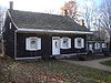
December 24, 1967 5902 Canarsie Lane
40°38′40″N 73°55′16″W / 40.64444°N 73.92111°WFlatbush 154 Wyckoff-Bennett Homestead 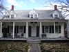
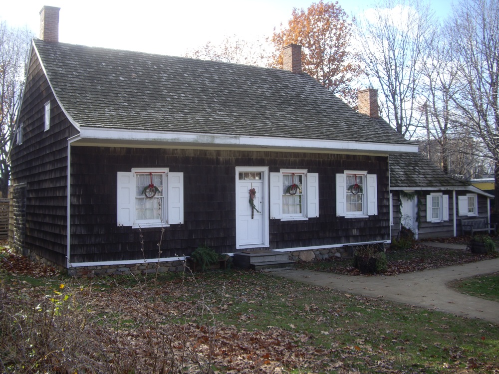
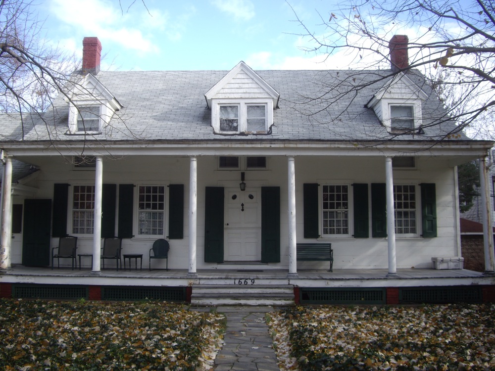
December 24, 1974 1669 E. 22nd St.
40°36′39″N 73°57′7″W / 40.61083°N 73.95194°WBrooklyn 155 Young Israel of Flatbush February 12, 2010 1012 Avenue I
40°37′36.93″N 73°57′57.35″W / 40.626925°N 73.9659306°WFlatbush New listing; refnum 10000011 See also
- Statewide: National Register of Historic Places listings in New York
- Citywide: Manhattan, Queens, Staten Island, Bronx
- List of New York City Designated Landmarks in Brooklyn
References
- ^ The latitude and longitude information provided in this table was derived originally from the National Register Information System, which has been found to be fairly accurate for about 99% of listings. For about 1% of NRIS original coordinates, experience has shown that one or both coordinates are typos or otherwise extremely far off; some corrections may have been made. A more subtle problem causes many locations to be off by up to 150 yards, depending on location in the country: most NRIS coordinates were derived from tracing out latitude and longitudes off of USGS topographical quadrant maps created under the North American Datum of 1927, which differs from the current, highly accurate WGS84 GPS system used by Google maps. Chicago is about right, but NRIS longitudes in Washington are higher by about 4.5 seconds, and are lower by about 2.0 seconds in Maine. Latitudes differ by about 1.0 second in Florida. Some locations in this table may have been corrected to current GPS standards.
- ^ "National Register of Historic Places: Weekly List Actions". National Park Service, United States Department of the Interior. Retrieved on November 18, 2011.
- ^ Pogrebin, Robin (2008-11-30). "Houses of Worship Choosing to Avoid Landmark Status". The New York Times Company. http://www.nytimes.com/2008/12/01/arts/design/01landmarks.html?ref=design. Retrieved 2 December 2008.
External links
Neighborhoods in the New York City Borough of Brooklyn ATURA · Barren Island · Bath Beach · Bay Ridge · Bedford · Bedford-Stuyvesant · Bensonhurst · Bergen Beach · BoCoCa · Boerum Hill · Borough Park · Brighton Beach · Brooklyn Chinatown · Brooklyn Heights · Brownsville · Bushwick · Canarsie · Carroll Gardens · City Line · Clinton Hill · Cobble Hill · Coney Island · Crown Heights · Cypress Hills · Ditmas Park · Downtown · Dumbo · Dyker Heights · East Flatbush · East New York · East Williamsburg · Farragut · Fiske Terrace · Flatbush · Flatlands · Fort Greene · Fort Hamilton · Fulton Ferry · Georgetown · Gerritsen Beach · Gowanus · Gravesend · Greenpoint · Greenwood Heights · Highland Park · Homecrest · Kensington · Little Poland · Lapskaus Boulevard · Madison · Manhattan Beach · Mapleton · Marine Park · Midwood · Mill Basin · Navy Yard · New Lots · New Utrecht · Ocean Hill · Ocean Parkway · Park Slope · Pigtown · Plum Beach · Prospect Heights · Prospect Lefferts Gardens · Prospect Park South · RAMBO · Red Hook · Sea Gate · Sheepshead Bay · South Park Slope · Starrett City · Stuyvesant Heights · Sunset Park · Vinegar Hill · Weeksville · White Sands · Williamsburg · Windsor Terrace · Wingate · Wyckoff Heights
 Categories:
- History of Brooklyn
- National Register of Historic Places in New York by county
- National Register of Historic Places in New York City
- National Register of Historic Places in Brooklyn, New York City
-


Wikimedia Foundation. 2010.