- National Register of Historic Places listings in Arlington County, Virginia
-
This list includes properties and districts listed on the National Register of Historic Places in Arlington County, Virginia. Click the "Map of all coordinates" link to the right to view a Google map of all properties and districts with latitude and longitude coordinates in the table below.[1]
-
- This National Park Service list is complete through NPS recent listings posted November 10, 2011.[2]
[3] Landmark name [4] Image Date listed Location City or town Summary 1 Al's Motors 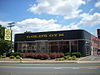
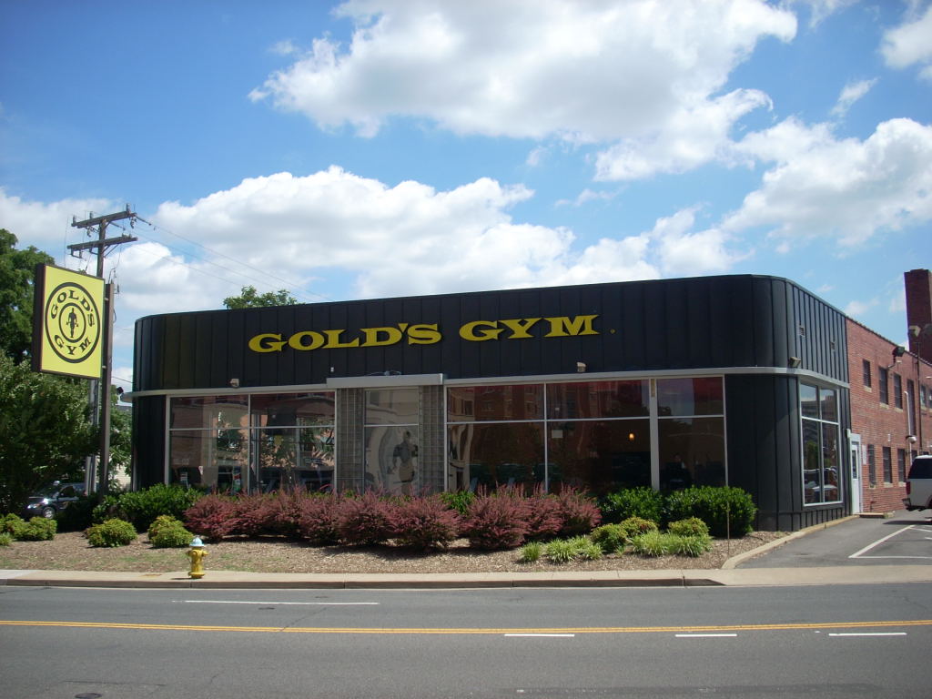
July 5, 2003 3910 Wilson Blvd.
38°52′45″N 77°06′27″W / 38.879167°N 77.1075°WArlington Currently a Gold's Gym 2 Arlington Forest Historic District December 2, 2005 Bounded by Carlin Springs Rd., George Mason Dr., Henderson Rd., Aberdeen St., Columbus St., Granada, Galveston and 2nd
38°52′14″N 77°07′08″W / 38.870556°N 77.118889°WArlington 3 Arlington Heights Historic District February 21, 2008 Bounded by Arlington Blvd., S. Fillmore St., S. Walter Reed Dr., Columbia Pk., & S. Glebe Rd.
38°52′02″N 77°05′27″W / 38.86735°N 77.090764°WArlington 4 Arlington House, The Robert E. Lee Memorial 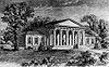
October 15, 1966 Arlington National Cemetery
38°52′54″N 77°4′29″W / 38.88167°N 77.07472°WArlington 5 Arlington Ridge Park September 4, 2009 Northwest corner of N. Meade St. and Marshall Dr.
38°53′15″N 77°04′18″W / 38.887636°N 77.071722°WArlington 6 Arlington Village Historic District April 11, 2003 S. 13th St., S. 13 Rd., S. 16th St., S. Barton S., S. Cleveland St. and Edgewood St.
38°51′33″N 77°05′02″W / 38.859167°N 77.083889°WArlington 7 Ashton Heights Historic District June 23, 2003 Roughly bounded by Wilson Blvd., N. Irving St., Arlington Blvd., N. Oxford St., N. Piedmont & N. Oakland Sts.
38°52′38″N 77°06′04″W / 38.877222°N 77.101111°WArlington 8 Aurora Highlands Historic District October 22, 2008 Bounded by 16th St. S., S. Eads St., 26th St. S., and S. Joyce St.
38°51′16″N 77°03′28″W / 38.85445°N 77.057733°WArlington 9 Ball-Sellers House July 17, 1975 5620 S. 3rd St.
38°51′49″N 77°07′31″W / 38.863611°N 77.125278°WArlington 10 Barcroft Community House July 28, 1995 800 S. Buchanan St.
38°50′30″N 77°05′53″W / 38.841667°N 77.098056°WArlington 11 Benjamin Banneker: SW-9 Intermediate Boundary Stone 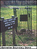
May 11, 1976 18th and Van Buren Sts.
38°53′31″N 77°09′34″W / 38.891944°N 77.159444°WArlington 12 Buckingham Historic District 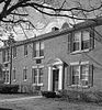
January 21, 1999 Roughly bounded by N. 5th, N. Oxford, and N. 2nd Sts., and N. Glebe Rd.
38°52′30″N 77°06′20″W / 38.875°N 77.105556°WArlington Boundary increase (listed February 11, 2004): Bounded by N. Oxford St., Fifth St. N, N. Henderson Rd., First St. N., N. Pershing, N. Thomas St., and Second St. N.
Boundary increase II (listed March 23, 2010): Bounded by and including N. Thomas St., 4th St. N. , N. Pershing Dr., and N. George Mason Dr.13 Calvert Manor December 15, 1997 1925-1927 N. Calvert St.
38°53′42″N 77°05′32″W / 38.895°N 77.092222°WArlington 14 Carlin Hall August 12, 1993 5711 4th St., S.
38°51′47″N 77°07′35″W / 38.863056°N 77.126389°WArlington 15 Cherrydale Historic District May 22, 2003 Roughly bounded by Lorcom Ln., N. Utah and N. Taylor Sts., and I-66
38°53′41″N 77°06′32″W / 38.894722°N 77.108889°WArlington 16 Cherrydale Volunteer Fire House 
July 28, 1995 3900 N. Lee Hwy.
38°53′14″N 77°06′26″W / 38.887222°N 77.107222°WArlington 17 Claremont Historic District August 31, 2006 Bounded by S. Dinwiddie St., S. Chesterfield Rd., S. Buchanan St., 25th St. S, 24th St. S, 23rd St. S and 22nd St. S
38°50′47″N 77°06′20″W / 38.846389°N 77.105556°WArlington 18 Clarendon School 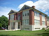
December 9, 1999 3550 Wilson Blvd.
38°52′54″N 77°06′08″W / 38.881667°N 77.102222°WArlington Currently the Arlington Arts Center 19 Colonial Village December 9, 1980 Roughly bounded by Wilson Blvd., Lee Hwy., N. Veitch St. and Queens Lane
38°53′39″N 77°04′59″W / 38.894167°N 77.083056°WArlington 20 Columbia Forest Historic District February 11, 2004 Bounded by 11th, S. Edison, S. Dinwiddie, S. Columbus, S. George Mason, and S. Frederick St.
38°51′09″N 77°06′41″W / 38.8525°N 77.111389°WArlington 21 George Crossman House May 22, 2003 2501 N. Underwood St.
38°53′31″N 77°09′40″W / 38.891944°N 77.161111°WArlington 22 Charles Richard Drew House May 11, 1976 2505 1st St., S.
38°52′22″N 77°05′14″W / 38.872778°N 77.087222°WArlington 23 Fairlington Historic District March 29, 1999 Roughly bounded by Quaker Lane, King St., I-395, S. Walter Reed Dr., and S. Abingdon St.
38°50′11″N 77°05′40″W / 38.836389°N 77.094444°WArlington 24 Fort C. F. Smith Historic District February 1, 2000 2411 24th St.
38°54′06″N 77°05′25″W / 38.901667°N 77.090278°WArlington 25 Fort Ethan Allen 
February 11, 2004 Address Restricted
38°55′25″N 77°07′26″W / 38.923611°N 77.123889°WArlington 26 Fort Myer Historic District 
November 28, 1972 Arlington Blvd. (U.S. 50)
38°52′59″N 77°04′54″W / 38.883056°N 77.081667°WArlington 27 George Washington Memorial Parkway 
June 2, 1995 Roughly, south side of the Potomac River from American Legion to Memorial Bridge and north side from Brickyard Rd. to Chain Bridge
38°56′19″N 77°08′07″W / 38.938611°N 77.135278°WArlington 28 Glebe Center February 11, 2004 71-89 N. Glebe Rd.
38°52′18″N 77°06′08″W / 38.871794°N 77.102214°WArlington 29 The Glebe 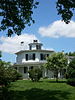
February 23, 1972 4527 17th St., N.
38°53′30″N 77°07′04″W / 38.891667°N 77.117778°WArlington Has octagon wing 30 Glebewood Village Historic District February 11, 2004 N. Brandywine St. between Lee Highway and 10th Place N., 21St Rd. between N. Brandywine St. and N. Glebe Rd.
38°53′44″N 77°07′26″W / 38.895556°N 77.123889°WArlington 31 Glencarlyn Historic District September 18, 2008 Bounded by S. Carlin Springs Rd., Arlington Blvd., 5th Rd. S., Glencarlyn Park
38°51′49″N 77°07′35″W / 38.863544°N 77.126394°WArlington 32 Harry W. Gray House February 11, 2004 1005 S. Quinn St.
38°51′53″N 77°04′30″W / 38.864722°N 77.075°WArlington 33 Highland Park-Overlee Knolls August 18, 2011 Roughly bounded by 22nd St. N., N. Lexington St., 16th St. N., N. Longfellow St., McKinley Rd., I-66 & N. Quantico St.
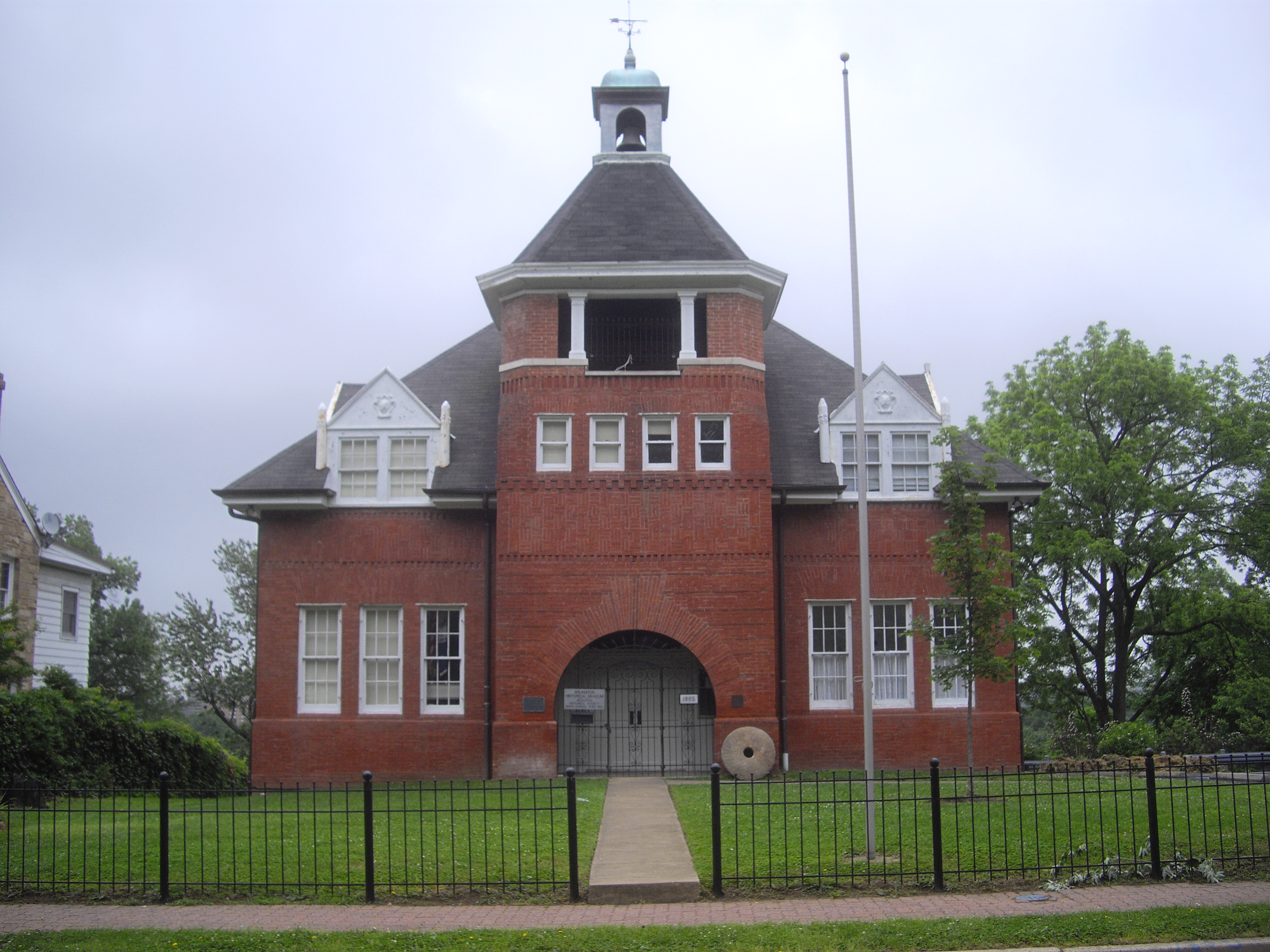
38°53′12″N 77°08′49″W / 38.886667°N 77.146944°WArlington Historic Residential Suburbs in the United States, 1830-1960 MPS 34 Hume School 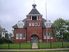
June 18, 1979 1805 S. Arlington Ridge Rd.
38°51′31″N 77°04′05″W / 38.858611°N 77.068056°WArlington 35 Francis Scott Key Bridge 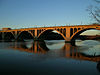
March 1, 1996 US 29 over the Potomac River
38°54′08″N 77°04′13″W / 38.902222°N 77.070278°WArlington 36 Lee Gardens North Historic District February 26, 2004 2300-2341 N. 11th St.
38°53′08″N 77°05′12″W / 38.885556°N 77.086667°WArlington 37 Lomax African Methodist Episcopal Zion Church February 11, 2004 2704 24th Rd. S.
38°50′51″N 77°04′57″W / 38.8475°N 77.0825°WArlington 38 Lyon Park Historic District November 12, 2003 Roughly bounded by 10th St. N, Arlington Blvd., and N. Irving St.
38°52′45″N 77°05′26″W / 38.879167°N 77.090556°WArlington 39 Lyon Village Historic District May 10, 2002 Roughly bounded by Lee Highway, N. Veitch St., N. Franklin Rd., N. Highland St., N. Fillmore St., and N. Kirkwood Rd.
38°53′29″N 77°05′42″W / 38.891389°N 77.095°WArlington 40 Maywood Historic District May 22, 2003 Roughly bounded by Lorcom Ln., Spout Run Parkway, I-66, Lee Highway, N. Oakland St., N. Nelson St., and N. Lincoln St.
38°53′53″N 77°06′05″W / 38.898056°N 77.101389°WArlington 41 Monroe Courts Historic District 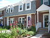
February 21, 2008 1041-1067 N. Nelson and 1036-1062 & 1033-1055 N. Monroe Sts.
38°53′08″N 77°06′18″W / 38.885569°N 77.104936°WArlington 42 Mount Vernon Memorial Highway May 18, 1981 Washington St. and George Washington Memorial Parkway
38°46′35″N 77°03′13″W / 38.776389°N 77.053611°WArlington 43 Northwest No. 1 Boundary Marker of the Original District of Columbia 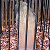
February 1, 1991 3607 Powhatan St.
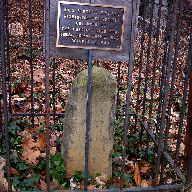
38°54′11″N 77°09′34″W / 38.903056°N 77.159444°WArlington 44 Northwest No. 2 Boundary Marker of the Original District of Columbia 
February 1, 1991 5145 N. 38th St.
38°54′49″N 77°08′46″W / 38.913611°N 77.146111°WArlington 45 Northwest No. 3 Boundary Marker of the Original District of Columbia February 1, 1991 4013 N. Tazewell St.
38°55′29″N 77°07′59″W / 38.924722°N 77.133056°WArlington 46 Penrose Historic District November 15, 2004 Roughly bounded by Arlington Blvd., S. Courthouse Rd., S. Fillmore St., S. Barton St. S, and Columbia Pike
38°52′07″N 77°05′08″W / 38.868736°N 77.085442°WArlington 47 Pentagon Office Building Complex 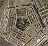
July 27, 1989 Jefferson Davis Highway/VA 110 at I-395
38°52′16″N 77°03′23″W / 38.871111°N 77.056389°WArlington 48 Quarters 1, Fort Myer November 28, 1972 Grant Ave.
38°52′58″N 77°04′53″W / 38.882778°N 77.081389°WArlington 49 Saegmuller House May 22, 2003 5101 Little Falls Rd.
38°54′21″N 77°08′25″W / 38.905833°N 77.140278°WArlington 50 Southwest No. 4 Boundary Marker of the Original District of Columbia 
February 1, 1991 King St. north of the junction with Wakefield St.
38°49′54″N 77°05′32″W / 38.831667°N 77.092222°WAlexandria 51 Southwest No. 5 Boundary Marker of the Original District of Columbia 
February 1, 1991 Northeast of the junction of King St. and Walter Reed Dr.
38°50′31″N 77°06′22″W / 38.841944°N 77.106111°WArlington 52 Southwest No. 6 Boundary Marker of the Original District of Columbia February 1, 1991 S. Jefferson St. south of the junction with Columbia Pike, in median strip
38°51′06″N 77°07′06″W / 38.851667°N 77.118333°WBailey's Crossroads 53 Southwest No. 7 Boundary Marker of the Original District of Columbia February 1, 1991 Behind 3101 S. Manchester St.
38°51′44″N 77°08′00″W / 38.862222°N 77.133333°WFairfax 54 Southwest No. 8 Boundary Marker of the Original District of Columbia February 1, 1991 Junction of Wilson Blvd. and John Marshall Dr., behind apartment building
38°52′24″N 77°08′50″W / 38.873353°N 77.147122°WArlington 55 Stratford Junior High School February 26, 2004 4100 Vacation Ln.
38°54′00″N 77°06′44″W / 38.9°N 77.112222°WArlington 56 US Post Office-Arlington February 7, 1986 3118 N. Washington Blvd.
38°53′08″N 77°05′44″W / 38.885556°N 77.095556°WArlington 57 Virginia Heights Historic District February 21, 2008 Bounded by 10th Pl. S., S. Frederick St. & S. George Mason Dr.
38°51′02″N 77°06′52″W / 38.850439°N 77.114569°WArlington 58 Walter Reed Gardens Historic District May 22, 2003 2900-2906 13th St. S., 2900-2914 13th Rd. S., 1301-1319 S. Walter Reed Dr.
38°51′33″N 77°05′13″W / 38.859167°N 77.086944°WArlington 59 Washington National Airport Terminal and South Hangar Line 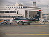
September 12, 1997 Thomas Ave.
38°50′50″N 77°02′41″W / 38.847222°N 77.044722°WArlington 60 Waverly Hills Historic District 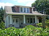
February 26, 2004 Roughly bounded by 20th Rd. N., N. Utah St, I-66, N. Glebe Rd. and N. Vermont St.
38°53′31″N 77°07′02″W / 38.891944°N 77.117222°WArlington 61 West Cornerstone 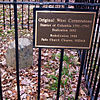
February 1, 1991 West side of Meridian St., south of the junction with Williamsburg Blvd.
38°53′33″N 77°10′21″W / 38.8925°N 77.1725°WFalls Church 62 Westover Historic District May 2, 2006 Bounded by McKinley Rd., N. Washington Blvd., N. 16th St., N. Jefferson St., N. 11th St. and N. Fairfax Dr.
38°52′58″N 77°08′11″W / 38.882775°N 77.136525°WArlington 63 Earle Micajah Winslow House February 22, 2011 2333 N. Vernon St.
38°54′06″N 77°07′09″W / 38.901667°N 77.119167°WArlington Streamline Modern Houses in Arlington County, Va 1936-1945 MPS See also
- National Register of Historic Places listings in Virginia
- National Register of Historic Places listings in Falls Church, Virginia
- List of National Historic Landmarks in Virginia
References
- ^ The latitude and longitude information provided in this table was derived originally from the National Register Information System, which has been found to be fairly accurate for about 99% of listings. For about 1% of NRIS original coordinates, experience has shown that one or both coordinates are typos or otherwise extremely far off; some corrections may have been made. A more subtle problem causes many locations to be off by up to 150 yards, depending on location in the country: most NRIS coordinates were derived from tracing out latitude and longitudes off of USGS topographical quadrant maps created under North American Datum of 1927, which differs from the current, highly accurate GPS system used by Google maps. Chicago is about right, but NRIS longitudes in Washington are higher by about 4.5 seconds, and are lower by about 2.0 seconds in Maine. Latitudes differ by about 1.0 second in Florida. Some locations in this table may have been corrected to current GPS standards.
- ^ "National Register of Historic Places: Weekly List Actions". National Park Service, United States Department of the Interior. Retrieved on November 10, 2011.
- ^ Numbers represent an ordering by significant words. Various colorings, defined here, differentiate National Historic Landmark sites and National Register of Historic Places Districts from other NRHP buildings, structures, sites or objects.
- ^ "National Register Information System". National Register of Historic Places. National Park Service. . http://nrhp.focus.nps.gov/natreg/docs/All_Data.html.
U.S. National Register of Historic Places Topics Lists by states Alabama • Alaska • Arizona • Arkansas • California • Colorado • Connecticut • Delaware • Florida • Georgia • Hawaii • Idaho • Illinois • Indiana • Iowa • Kansas • Kentucky • Louisiana • Maine • Maryland • Massachusetts • Michigan • Minnesota • Mississippi • Missouri • Montana • Nebraska • Nevada • New Hampshire • New Jersey • New Mexico • New York • North Carolina • North Dakota • Ohio • Oklahoma • Oregon • Pennsylvania • Rhode Island • South Carolina • South Dakota • Tennessee • Texas • Utah • Vermont • Virginia • Washington • West Virginia • Wisconsin • WyomingLists by territories Lists by associated states Other  Category:National Register of Historic Places •
  Portal:National Register of Historic Places
Municipalities and communities of Arlington County, Virginia County seat: Arlington Unincorporated
communitiesArlington Ridge | Ballston | Cherrydale | Clarendon | Courthouse | Crystal City | Fairlington | Glencarlyn | Lyon Village | Pentagon City | Rosslyn | Shirlington | Virginia Square | Westover
 Categories:
- Arlington County, Virginia
- National Register of Historic Places in Virginia
- Virginia-related lists
-


Wikimedia Foundation. 2010.