- Miles City Waterworks Building and Pumping Plant Park
-
Miles City Waterworks Building and Pumping Plant Park
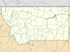

Location: West of Miles City on Pumping Plant Rd.. Coordinates: 46°24′22″N 105°52′5″W / 46.40611°N 105.86806°WCoordinates: 46°24′22″N 105°52′5″W / 46.40611°N 105.86806°W Governing body: State NRHP Reference#: 79003723 Added to NRHP: September 26, 1979[1] The Miles City Waterworks Building and Pumping Plant Park is a National Registered Historic Place located in Miles City, Montana. It was added to the Register on September 26, 1979.
The building is currently being used as the Custer County Art and Heritage Center.[2]
The placard reads:
Incorporated in 1887, eleven-year-old Miles City had grown to serve first the Tongue River Cantonment (established just after the Battle of the Little Bighorn) and then Fort Keogh. Wells within the town were the original water source and, later, water was drawn from the Tongue River. By 1909, this supply proved inadequate, and the City Council voted to fund and secure an additional water plant. A bond issue passed the next year, but it took an Act of Congress in 1911 to allow Miles City to locate, construct, maintain, and operate a pumping station upon Fort Keogh property, supplying the city with water from the Yellowstone River. From December 1911 until 1974, this plant operated. The original 1911 equipment is still in place, from filter regulatory consoles to marble-topped oak cabinets. In 1974, the Custer County Art and Heritage Center leased the building and the tanks to the east, remodeling the tanks into art gallery and office and workshop spaces. The surrounding park long has been a popular picnic and performance area.
References
- ^ "National Register Information System". National Register of Historic Places. National Park Service. 2010-07-09. http://nrhp.focus.nps.gov/natreg/docs/All_Data.html.
- ^ Visit MT. "Custer County Art and Heritage Center". http://custer.visitmt.com/categories/moreinfo.asp?siteid=129&IDRRecordID=138. Retrieved 13 September 2011.
U.S. National Register of Historic Places Topics Lists by states Alabama • Alaska • Arizona • Arkansas • California • Colorado • Connecticut • Delaware • Florida • Georgia • Hawaii • Idaho • Illinois • Indiana • Iowa • Kansas • Kentucky • Louisiana • Maine • Maryland • Massachusetts • Michigan • Minnesota • Mississippi • Missouri • Montana • Nebraska • Nevada • New Hampshire • New Jersey • New Mexico • New York • North Carolina • North Dakota • Ohio • Oklahoma • Oregon • Pennsylvania • Rhode Island • South Carolina • South Dakota • Tennessee • Texas • Utah • Vermont • Virginia • Washington • West Virginia • Wisconsin • WyomingLists by territories Lists by associated states Other  Category:National Register of Historic Places •
  Portal:National Register of Historic PlacesCategories:
- National Register of Historic Places in Montana
- Geography of Custer County, Montana

Wikimedia Foundation. 2010.