- Dettah
-
Dettah
Detah— Yellowknives Dene First Nation (Dettah) — 
 Dettah
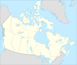
Coordinates: 62°24′41″N 114°18′27″W / 62.41139°N 114.3075°WCoordinates: 62°24′41″N 114°18′27″W / 62.41139°N 114.3075°W Country  Canada
Territory  Northwest Territories
Region North Slave Region Constituency Weledeh Census division Fort Smith Region, Northwest Territories Government – Chief Edward Sangris – Chief Executive Officer John Carter – MLA Bob Bromley Area – Land 1.34 km2 (0.5 sq mi) Elevation 179 m (587 ft) Population – Total 247 – Density 184.9/km2 (478.9/sq mi) Time zone Mountain (MST) (UTC-7) – Summer (DST) MDT (UTC-6) Canadian Postal code X1A Area code(s) 867 Telephone exchanges 444 445 446 669 765 766 873 920 Sources:Community Governance Data List[1],
2006 Canada Census[2],
Prince of Wales Northern Heritage Centre[3],
Canada Flight Supplement[4]Dettah or Detah is a First Nations[5] community in the North Slave Region of the Northwest Territories, Canada. Located just outside the capital of Yellowknife, it is a 6.5 km (4.0 mi) drive from that town by ice road in winter or a 27 km (17 mi) drive via the Ingraham Trail. The name means 'Burnt Point' in the Tli Cho language, and refers to a traditional fishing camp, used by the Dene for hundreds of years.
According to the 2006 Census, Dettah had a population of 247 people, consisting almost entirely of First Nations.[2] In 2009 the Government of the Northwest Territories reported that the population was 257 with an average yearly growth rate of 2.2 from 1996.[6]
Both it and N'Dilo are the communities of the Yellowknives. Dettah is represented by the Yellowknives Dene First Nation (Dettah) and are part of the Akaitcho Territory Government.[7]
References
 Dettah government building
- ^ Community Governance Data List
- ^ a b 2006 Census
- ^ Prince of Wales Northern Heritage Centre - official names
- ^ Canada Flight Supplement. Effective 0901Z 20 October 2011 to 0901Z 15 December 2011
- ^ Differences in Community Government Structures
- ^ Detah - Statistical Profile at the GNWT
- ^ Indian and Northern Affairs Canada
Further reading
- Northwest Territories, and BHP Billiton Diamonds Inc. Communities and Diamonds Socio-Economic Impacts in the Communities of: Behchoko, Gameti, Whati, Wekweeti, Detah, Ndilo, Lutsel K'e, and Yellowknife : 2005 Annual Report of the Government of the Northwest Territories Under the BHP Billiton, Diavik and De Beers Socio-Economic Agreements. [Yellowknife]: Govt. of the Northwest Territories, 2006.
External links
 Subdivisions of the Northwest Territories
Census divisions Dehcho Region Inuvik Region Aklavik · Fort McPherson · Inuvik · Paulatuk · Sachs Harbour · Tsiigehtchic · Tuktoyaktuk · UlukhaktokNorth Slave Region Sahtu Region South Slave Region Enterprise · Fort Providence · Fort Resolution · Fort Smith · Hay River Reserve · Hay River · KakisaCategories:- Communities in the North Slave Region
- Dene communities
- Northwest Territories geography stubs


Wikimedia Foundation. 2010.