Mount Rosseau

Mount Rosseau
Mount Rosseau
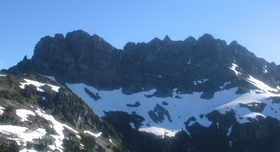
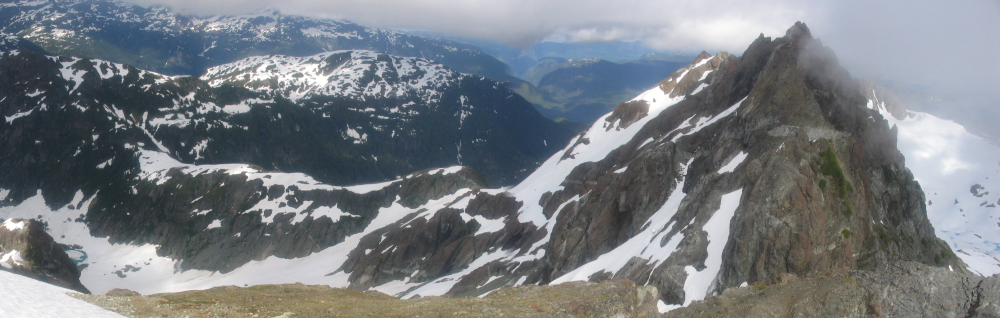
Elevation 1,958 m (6,424 ft)
Prominence 613 m (2,011 ft)
Location
Location Vancouver Island, British Columbia, Canada
Range Vancouver Island Ranges
Coordinates 49°28′44.0″N 125°30′22.0″W / 49.47889°N 125.50611°W / 49.47889; -125.50611
Topo map NTS 92/F05

Mount Rosseau is a mountain on Vancouver Island, British Columbia, Canada, located 43 km (27 mi) southwest of Courtenay and 23 km (14 mi) south of Mount Albert Edward. It is the highest summit of the Septimus-Rosseau massif. The most western summit of the massif is Mount Septimus.

Mount Rosseau is part of the Vancouver Island Ranges which in turn form part of the Insular Mountains.[1]

Contents

History

The BC Geographical Names Information System records the origin of Mt Rosseau's name:[2]

[Mount Rosseau is named after] Ralph Rosseau, a widely-known and respected elementary school principal in Port Alberni and a noted mountaineer; killed in a climbing accident on Mount Septimus 3 July 1954. (obituary & photograph in West Coast Advocate, 8 July 1954, file T.1.43) Source: BC place name cards, or correspondence to/from BC's Chief Geographer or BC Geographical Names Office

Access

Flower Ridge (left), Price Pass (center) and Mt Rosseau (right)

Mount Septimus has three established access routes:

1. From Cream Lake, the south aspect can be accessed by ascending the wide couloir to the shoulder west of Mount Septimus' summit. Cream Lake can be accessed from:

- Bedwell Lake Trail, the traverse west to Cream Lake. Accesses west aspect. Quickest & easiest approach.

- Price Creek Trail to Cream Lake. Accesses west aspect. The Price Creek Trail is not maintained and is overgrown.

2. Della Falls Trail to Love Lake. Bushwack west up to a ridge, then head north on the ridge to the mountains flanks. Accesses south aspect.

3. Flower Ridge Trail to Price Pass. Scramble off of Flower Ridge to the pass between Green and Margret Lakes. Route finding difficulties from the pass onto the mountains flanks. Accesses north aspect.

See also

References

  1. ^ Mount Rosseau in the Canadian Mountain Encyclopedia
  2. ^ BC Geographical Names Information System, Mount Rosseau


Wikimedia Foundation. 2010.

Игры ⚽ Нужна курсовая?

Look at other dictionaries:

  • Mount Septimus — Elevation 1,948 m (6,391 ft) …   Wikipedia

  • Della Falls — ▪ waterfalls, British Columbia, Canada       series of three cascades from Della Lake to the valley of Drinkwater Creek on Vancouver Island, B.C., Can. They are located approximately 37 miles (60 km) northwest of the mill town of Port Alberni and …   Universalium

  • Big Interior Mountain — Infobox Mountain Name = Big Interior Mountain Photo = Caption = Elevation = Unit m|1857|0 Location = Vancouver Island, British Columbia, Canada Range = Vancouver Island Ranges Prominence = Unit m|572|0 Coordinates =… …   Wikipedia

  • List of boarding schools — This list includes boarding schools offering a curriculum in English and other languages:AfricaZambia*Canisius Secondary School *Chengelo School *Musikili Primary SchoolGhana*Opoku Ware School *Prempeh College *Wesley Girls High School *presby… …   Wikipedia

  • Projet:Médecine/Index — Articles 0 9 1,2 dibromo 3 chloropropane · 112 (numéro d urgence européen) · 1935 en santé et médecine · 1941 en santé et médecine · 1er régiment médical · 2 iodothyronine déiodinase · 2,4,6 trichlorophénol · 2005 en santé et médecine · 2006 en… …   Wikipédia en Français

  • Picnic at Hanging Rock — infobox Book | name = Picnic at Hanging Rock title orig = translator = image caption = Picnic at Hanging Rock novel cover author = Joan Lindsay illustrator = cover artist = country = flagicon|AUS Australia language = English series = genre =… …   Wikipedia

  • Panama Canal Zone — Coordinates: 9°07′03.61″N 79°43′12.60″W / 9.1176694°N 79.720167°W / 9.1176694; 79.720167 …   Wikipedia

  • Kinmount, Ontario — Kinmount is a village with a population of approximately 500, located on the Burnt River in Ontario, Canada. The village is now part of the City of Kawartha Lakes. The village s hinterland covers large sections of both Haliburton and Peterborough …   Wikipedia

  • NORTH Network — was a telehealth organization serving communities in Northern and Central Ontario. NORTH s head office was located in Toronto and its clinical headquarters in Timmins. NORTH was a program of Sunnybrook Health Sciences Centre, and received funding …   Wikipedia

  • Debate camp — For the episode of The West Wing, see Debate Camp (West Wing). Part of the series Policy Debate Organization Policy debate competitions Inter Collegiate policy debate Format Structure of policy de …   Wikipedia

Share the article and excerpts

Direct link
Do a right-click on the link above
and select “Copy Link”