- Nipissing 10, Ontario
-
Coordinates: 46°20′34″N 79°49′18″W / 46.342645°N 79.821626°W
 Community centre in Garden Village
 Waterfront on Lake Nipissing in Garden Village
Nipissing 10 is a First Nations reserve in northeastern Ontario, Canada located on the north shores of Lake Nipissing in Nipissing District, serving as the land base for the Nipissing First Nation. The 21,007.3 hectares (51,910 acres) reserve is located west of North Bay and east of West Nipissing.
The reserve comprises the communities of Beaucage and Garden Village. Beaucage is located directly on Highway 17, while Garden Village is accessible by municipal streets in Sturgeon Falls.
Garden Village was depicted in the comic strip For Better or for Worse, as the community where Elizabeth Patterson did her practice teaching while studying education at North Bay's Nipissing University.
Demographics
According to the Canada 2006 Census[1]:
- Population: 1,413
- % Change (2001-2006): 2.5
- Dwellings: 652
- Area (km²): 61.22
- Density (persons per km²): 23.1
References
External links

West Nipissing, Unorg. North Nipissing District West Nipissing 
North Bay  Nipissing 10

Lake Nipissing /
Unorg. Centre Parry Sound District, Nipissing Twp.Cities 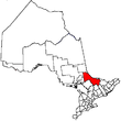
Towns Mattawa • Temagami • West NipissingTownships First Nations reserves Bear Island 1 • Nipissing 10Unorganized territories See also: Communities in Nipissing District • Census divisions of Ontario Categories:- Municipalities in Nipissing District, Ontario
- Anishinaabe reserves in Ontario
- Ojibwe
- Northern Ontario geography stubs


Wikimedia Foundation. 2010.